
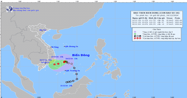
Storm No. 10 (international name Pabuk) has weakened into a tropical depression in the offshore waters from Khanh Hoa to Binh Thuan.
According to the National Center for Hydro-Meteorological Forecasting, this morning (December 25), storm No. 10 (storm Pubuk) weakened into a tropical depression.
At 10am, the center of the tropical depression was located offshore from Khanh Hoa to Binh Thuan. The strongest wind near the center of the tropical depression was level 7 (50-61km/h), gusting to level 9; moving in a West Southwest direction at a speed of 10-15km/h.
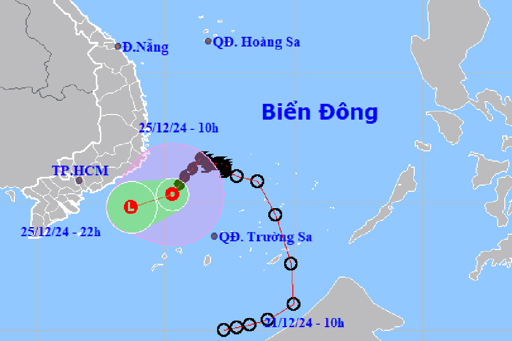
In the next 12 hours, the tropical depression will continue to move West Southwest, about 15km/h and gradually weaken into a low pressure area over the sea from Binh Thuan to Bac Lieu.
Impact of tropical depression, the southwestern sea area of the Central East Sea, the sea area from Khanh Hoa to Ba Ria - Vung Tau (including Phu Quy island district) has strong winds of level 6-7, gusts of level 9, waves 2-4m high; rough seas.
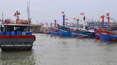
Ships operating in the above-mentioned dangerous areas are susceptible to the effects of storms, whirlwinds, strong winds, and large waves.
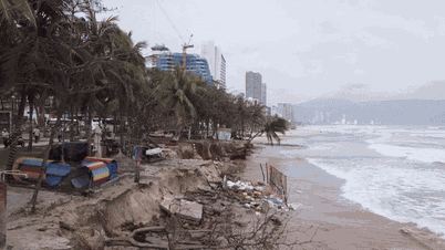
In addition, in the area from Quang Tri to Phu Yen, there was rain, locally moderate rain, heavy rain and thunderstorms. The rainfall from 7:00 p.m. on December 24 to 8:00 a.m. this morning, locally over 40mm in some places such as: Sa Huynh (Quang Ngai) 41.8mm, Dai Lanh (Khanh Hoa) 43.8mm, ...
It is forecasted that today and tonight, in the Central and South Central regions, there will continue to be rain, moderate rain, locally heavy rain and thunderstorms with rainfall from 10-30mm, locally over 60mm.
During thunderstorms, there is a possibility of tornadoes, lightning and strong gusts of wind. Localized heavy rain can cause flooding in low-lying areas; flash floods on small rivers and streams, and landslides on steep slopes.
Storm No. 10 has moved little in the past 6 hours, thunderstorms appear in Ho Chi Minh City

Hanoi weather for the next 3 days: Cold air shifts to the east, coldest night 13 degrees

Cold air is active, there is a possibility of many severe cold spells in the first month of the year.
Source: https://vietnamnet.vn/bao-so-10-suy-yeu-thanh-ap-thap-nhiet-doi-o-vung-bien-khanh-hoa-binh-thuan-2356201.html


![[Photo] Prime Minister Pham Minh Chinh receives Swedish Minister of International Development Cooperation and Foreign Trade](https://vphoto.vietnam.vn/thumb/1200x675/vietnam/resource/IMAGE/2025/5/12/ae50d0bb57584fd1bbe1cd77d9ad6d97)


![[Photo] Prime Minister Pham Minh Chinh works with the Standing Committee of Thai Binh Provincial Party Committee](https://vphoto.vietnam.vn/thumb/1200x675/vietnam/resource/IMAGE/2025/5/12/f514ab990c544e05a446f77bba59c7d1)


Comment (0)