The current efforts to revive the river city of Ho Chi Minh City recall that golden age.
Historical witness from the origin of Saigon - Ho Chi Minh City
Last weekend, Bach Dang Wharf in the center of Ho Chi Minh City attracted thousands of people to attend the groundbreaking ceremony of the pedestrian bridge across the Saigon River. Ho Chi Minh City leaders explained that the Saigon River is a part of the city's historical memory of more than 300 years and continues to be a testament over time, affirming the strong development and the constant aspiration to rise of Saigon - Ho Chi Minh City.
Therefore, for the people of Ho Chi Minh City, every new project, tourism product, or waterway product deployed on the Saigon River brings indescribable feelings of joy.
Looking back at history, Associate Professor Dr. Nguyen Hong Thuc (Hanoi National University) pointed out that from the 17th to 20th centuries, Saigon transformed from an unknown place into a river city, a port city, leading in national and international trade. The Ben Nghe - Tau Hu canal, connecting with the Cho Gao canal (Tien Giang) used to be the "rice road" from the West to the rice mills in Cho Lon, then to Khanh Hoi port for export around the world. Along this canal, the French built a modern road with the first bus station connecting Saigon - Cho Lon. In the 1920s - 1930s, in the Cau Mong and Cau Quay areas, a financial - banking district was clearly formed, symbolized by the powerful headquarters - the Indochina Bank, now the State Bank. Cau Ong Lanh and Cau Muoi markets are agricultural hubs, connecting with Chinese streets (Calmette, Pho Duc Chinh...), Indian streets (Ton That Dam, Pasteur...).
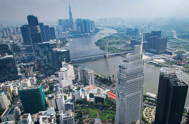
The potential of rivers and sea-oriented economy will be an important driving force for Ho Chi Minh City to rise up.
PHOTO: NHAT THINH
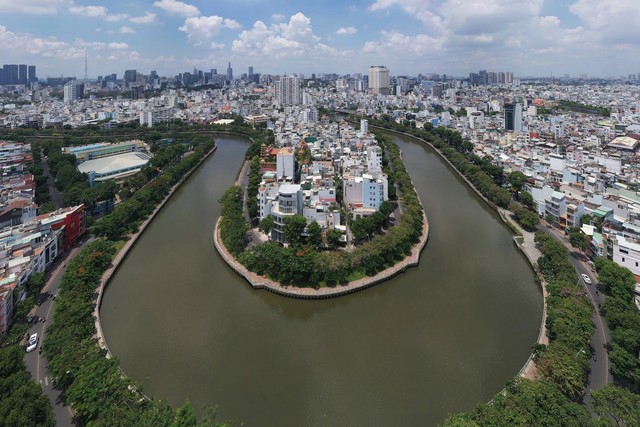
Connecting both the old and new Cho Lon, Cho Lon deserves to be a "heritage special zone" including many Chinese, Vietnamese, Khmer vestiges of commerce, culture, religion... In fact, the history of the canals in the heart of the city, especially the two major routes including Ben Nghe - Tau Hu (about 22 km) and Nhieu Loc - Thi Nghe (about 10 km) still retains its value from the beginning of the 20th century until now.
"The land of Saigon has grown up with its own river identity, creating a heritage of water urban landscape: wetlands, mangrove forests, canals, lakes, shipyards, ports... with countless activities on the water, which is the cultural origin of the city until now. Along with the requirements of trade development between the "Pearl of the Far East" and neighboring countries in the whole Southeast Asia region, small canals have been gradually built, repaired, expanded and extended into large canals to facilitate water transportation", Ms. Hong Thuc pointed out.
In-depth research on archaeology, Dr. Nguyen Thi Hau commented: In the context of natural geography, the first characteristic of Saigon - Ho Chi Minh City is that it is a river city. From prehistoric times, to the Oc Eo culture, to the period of urban establishment, it was the rivers that brought ethnic communities here, starting from the sea along the Dong Nai River and the Saigon River. After that, the central area of the city (Bach Dang wharf) to Cho Lon - a very bustling commercial center of the Chinese - was connected by the Ben Nghe canal and many other canals. From Cho Lon, you can go to the Western provinces via the Cho Dem and Vam Co rivers. Then from Saigon, you can also go up to Dong Nai by river to spread out to the Eastern regions, to the Central Highlands rich in products.
However, with the speed of economic development and urbanization, the Saigon River has begun to lose its position and become a regret for many people.
Reviving river cities, gaining momentum towards the sea
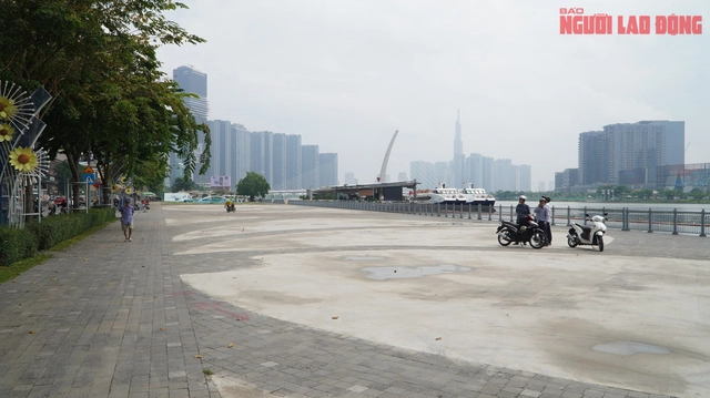
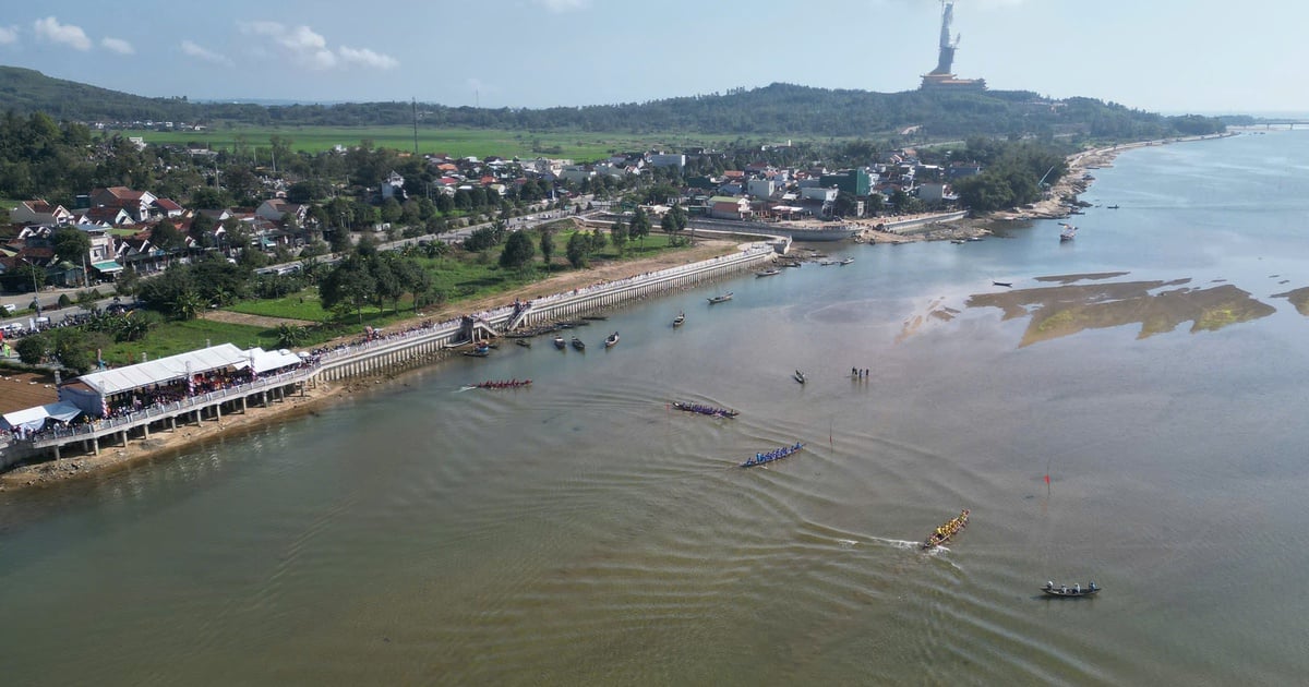
But the advantage of the river has been revived when Ho Chi Minh City identified the Saigon River as a sustainable and ecological development axis, towards Can Gio to form a marine economic axis to create a driving force for economic breakthrough. From this policy, Ho Chi Minh City has gradually put on a new, modern, airy and much more beautiful coat for both banks of the Saigon River in the central area of the city. Bach Dang wharf park, the square around the statue of Saint Tran Hung Dao, the brilliant sunflower field in the middle of the park along the riverbank in Thu Thiem, river tours from day to night, river festivals creating a unique mark for the city... the first items as a premise for the work of renovating the landscape and exploiting the space along the riverbank have been urgently deployed by Ho Chi Minh City.
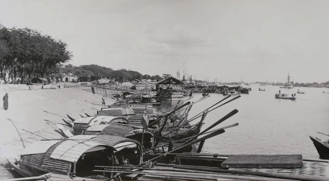
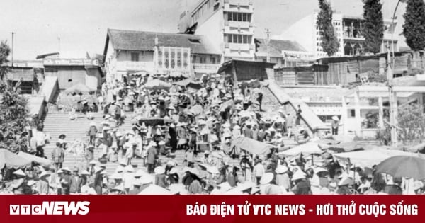
Ferry terminal of residents on Saigon River in 1896
PHOTO: NATIONAL ARCHIVES CENTER II
Along with that, the City has approved the project "Developing river embankments and riverside economic services in Ho Chi Minh City in the period of 2020 - 2045" with the orientation of gradually completing the multi-functional infrastructure system along the Saigon River, organizing landscape architecture space connecting public utilities, creating conditions for the development of economic activities, services related to rivers and green infrastructure. In parallel, the strategy of building ports, opening roads, connecting railways and waterways from the city center to Can Gio is continuously initiated and added to the planning.
Associate Professor, Dr. Nguyen Hong Thuc affirmed that the Ho Chi Minh City area has a strategic position on the international maritime map with the potential to become a gateway to the entire Southern, Central Highlands and South Central regions. The Southern key economic region almost forms a diamond octagon, embracing the natural core of the Can Gio World Biosphere Reserve of more than 42,000 hectares. This international urban - seaport area will become a marine economic pole when connecting the international coastal urban chain from the vision of rapidly developing the coastal urban chain facing Vung Tau - Can Gio - Go Cong.
"Developing a chain of urban areas "fronting" the sea of Can Gio Bay will create opportunities for the "international position" of the city area and remove bottlenecks in labor quality and growth rate. With the driving force of the maritime economy, the two eastern and western arms of the city are: Industry and the Cai Mep - Thi Vai port system and Agriculture - eco-tourism, processing clean agricultural products in Go Cong Dong, Tien Giang, Hiep Phuoc port will develop new functions, changing the social face of the region, multi-centered in spatial distribution and dynamic", he emphasized.
Ho Chi Minh City is aiming to revive the river city.
PHOTO: NHAT THINH
Dr. Nguyen Thi Hau noted that the dynamic factor is something that must definitely be preserved and maintained when Ho Chi Minh City discusses the story of developing economic exploitation from river resources and restoring river urban areas in Ho Chi Minh City.
According to Dr. Hau, during the war, people did not dare to travel on the Saigon River for fear of insecurity. Now, after 50 years of peace, the city must create the impression that the Saigon River is a peaceful river, so that people can easily travel on the river. It is necessary to embellish the Red Light Cape area to become a natural symbol for the Saigon River. Because this is the Nha Be intersection area, which has long been considered the starting point of the Gia Dinh - Saigon place name. The Saigon River begins to flow into the sea here. Migrants from the sea when coming here also began to recognize the fertile land and chose to settle here, establishing Gia Dinh - Saigon.
"Only when people have convenience in all activities on and by the river can the river city of Ho Chi Minh City be revived. At this time, new projects, new products, and new techniques can be applied to maximize their capacity to exploit economic values more deeply and widely," Dr. Hau emphasized.
The Soul of Saigon
The river element is movement. Ho Chi Minh City always moves like rivers. That is the soul of Saigon. Despite going through the development process from the so-called "above the dock, below the boat", to the colonial trading ports, until now, the rivers of Ho Chi Minh City still flow as they have since ancient times.
Dr. Nguyen Thi Hau
Thanhnien.vn
Source: https://thanhnien.vn/50-nam-dat-nuoc-thong-nhat-tphcm-chuyen-minh-tu-dong-chay-song-sai-gon-185250331232226608.htm


![[Photo] Prime Minister Pham Minh Chinh chairs meeting after US announces reciprocal tariffs](https://vstatic.vietnam.vn/vietnam/resource/IMAGE/2025/4/3/ee90a2786c0a45d7868de039cef4a712)
![[Photo] A brief moment of rest for the rescue force of the Vietnam People's Army](https://vstatic.vietnam.vn/vietnam/resource/IMAGE/2025/4/3/a2c91fa05dc04293a4b64cfd27ed4dbe)
![[Photo] General Secretary To Lam receives Japanese Ambassador to Vietnam Ito Naoki](https://vstatic.vietnam.vn/vietnam/resource/IMAGE/2025/4/3/3a5d233bc09d4928ac9bfed97674be98)
![[Photo] Moment of love: Myanmar people are moved to thank Vietnamese soldiers](https://vstatic.vietnam.vn/vietnam/resource/IMAGE/2025/4/3/9b2e07196eb14aa5aacb1bc9e067ae6f)
![[Photo] Special relics at the Vietnam Military History Museum associated with the heroic April 30th](https://vstatic.vietnam.vn/vietnam/resource/IMAGE/2025/4/3/a49d65b17b804e398de42bc2caba8368)



























Comment (0)