
TPO – The Meteorological Agency forecasts that this week, rain will increase in Ho Chi Minh City and the Southern region. During thunderstorms, there is a possibility of tornadoes, lightning and strong gusts of wind. Be on guard against the possibility of heavy rain causing localized flooding.
According to the National Center for Hydro-Meteorological Forecasting, the weather in the Southern region today (August 26) is cloudy, with showers and thunderstorms in some places during the day. The lowest temperature is from 24 - 27 degrees Celsius, the highest is from 31 - 34 degrees Celsius, some places are over 34 degrees Celsius.
It is forecasted that this evening and tonight, the Southern region will have scattered showers and thunderstorms, locally heavy to very heavy rain with rainfall from 15 - 30mm, locally over 80mm.
Meanwhile, the Southern Hydrometeorological Station said that the low pressure trough with an axis passing through the Northern region is currently maintained. The southwest monsoon that dominates the weather in the Southern region is operating with increasing intensity. Above, the subtropical high pressure with an axis passing through the Central region is gradually weakening. In the coming days, there is a tendency to form a low pressure trough with an axis passing through the South Central and Southern regions.
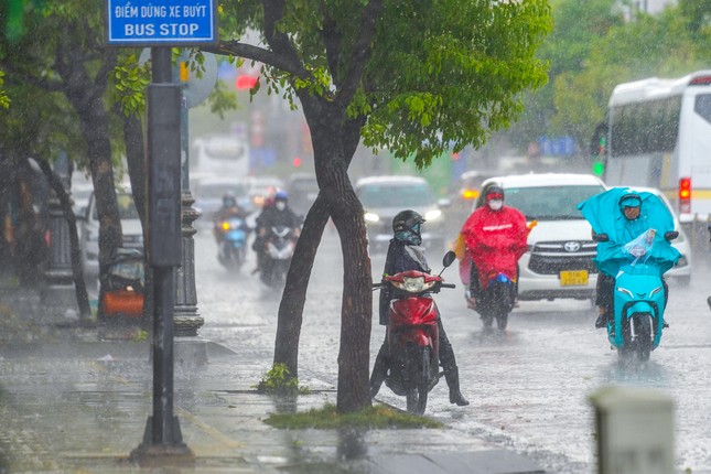 |
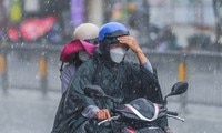
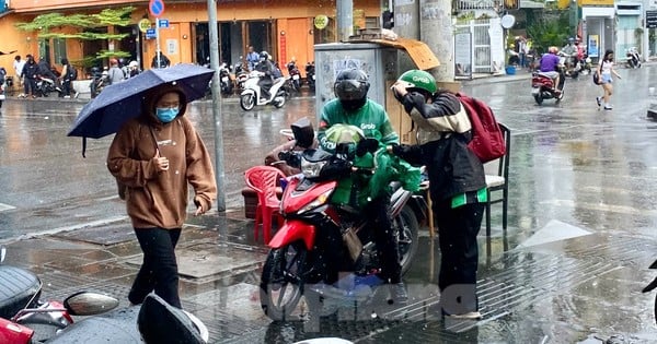
The meteorological agency forecasts that in the last week of August, rain will increase significantly in Ho Chi Minh City and the Southern region. (Illustration: Pham Nguyen) |
Based on the above main weather patterns, the Southern Hydrometeorological Station forecasts that Ho Chi Minh City will have showers and thunderstorms in the last week of August and the beginning of September, with moderate to heavy rain in some places. During thunderstorms, there is a possibility of tornadoes, lightning and strong gusts of wind. Beware of the possibility of heavy rain causing localized flooding.
Warning of thunderstorms, tornadoes, strong winds in the southern sea
The Southern Hydrometeorological Station said that currently (August 26), the central and southern East Sea (including the Truong Sa archipelago), the sea from Binh Thuan to Ca Mau, Ca Mau to Kien Giang and the Gulf of Thailand have showers and thunderstorms.
Forecast for the day and night of August 26, in the central and southern East Sea (including the waters of the Truong Sa archipelago), the waters from Binh Thuan to Ca Mau, Ca Mau to Kien Giang and the Gulf of Thailand, there will be showers and thunderstorms. During thunderstorms, there is a possibility of tornadoes and strong gusts of wind of level 7-8, beware of wave heights sometimes increasing over 2m.
“All vessels operating in the above areas are at high risk of being affected by tornadoes, strong gusts of wind and big waves,” the Southern Hydrometeorological Station warned.
Thunderstorms in Ho Chi Minh City at the end of August

Ho Chi Minh City and the South will have heavy rain in the new week.

Many districts in Ho Chi Minh City are about to have water cut off.

Details of bus routes in Ho Chi Minh City adjusted during the September 2nd holiday

Train driver training process for metro line 1 in Ho Chi Minh City
Source: https://tienphong.vn/tphcm-mua-dong-gia-tang-trong-tuan-moi-post1667011.tpo


Comment (0)