
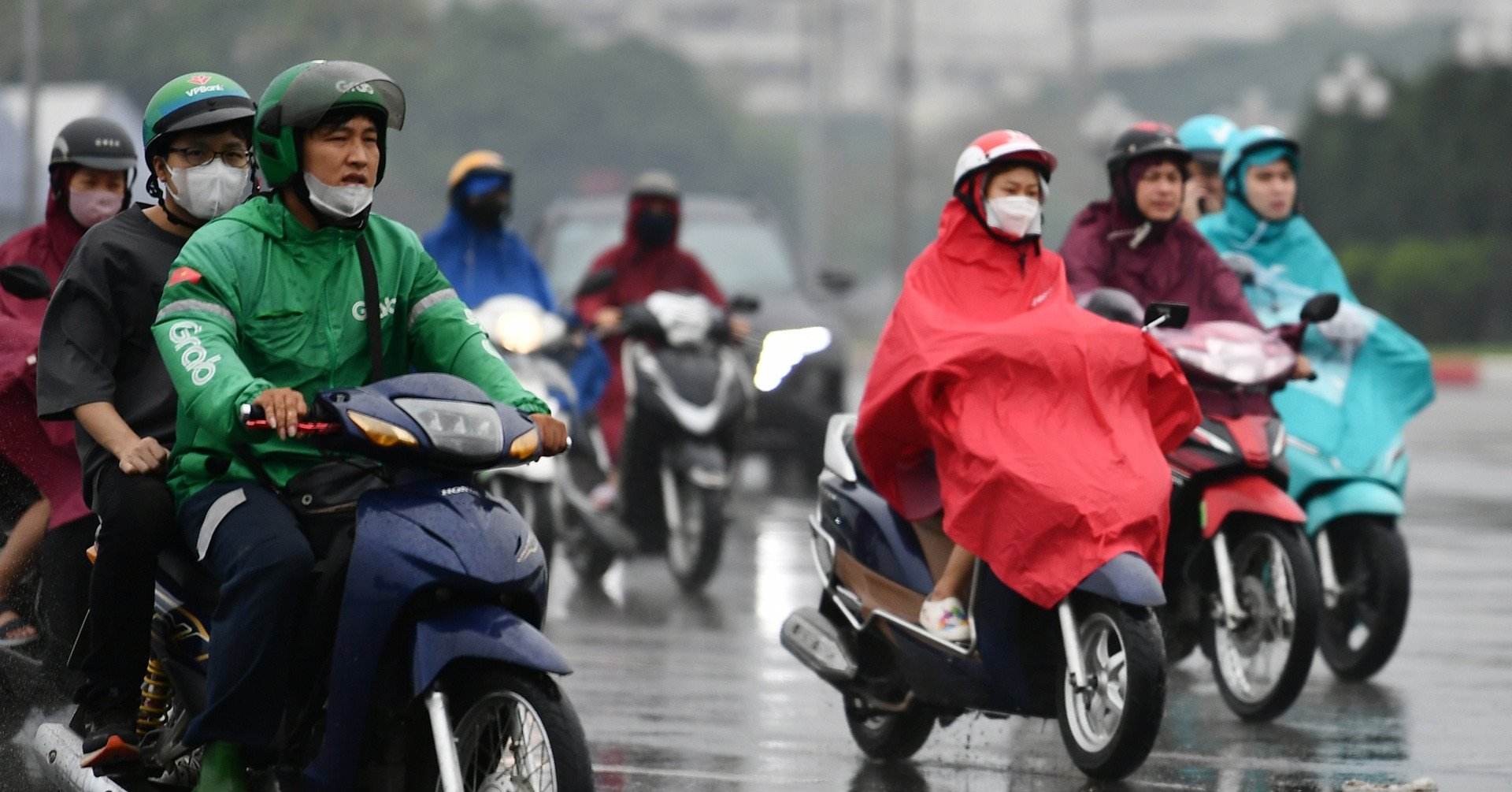
The North is likely to receive consecutive cold air, especially a strong strengthening period that will cause the weather to turn cold throughout the region. La Nina is starting to take effect, this winter may see many long, severe cold spells.
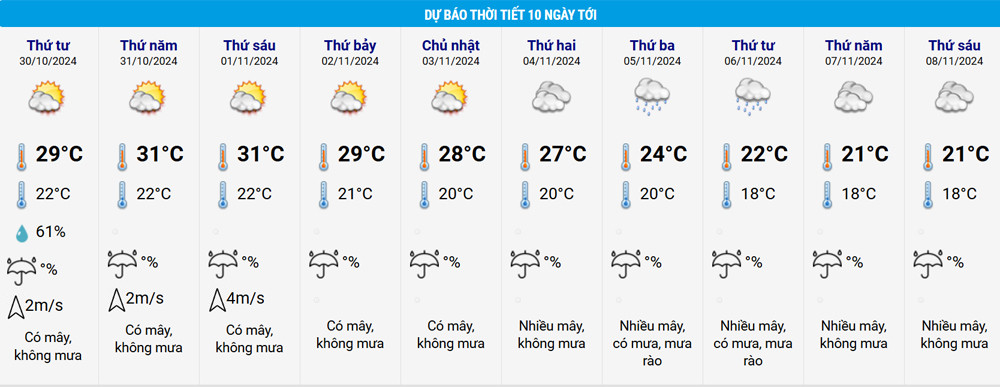
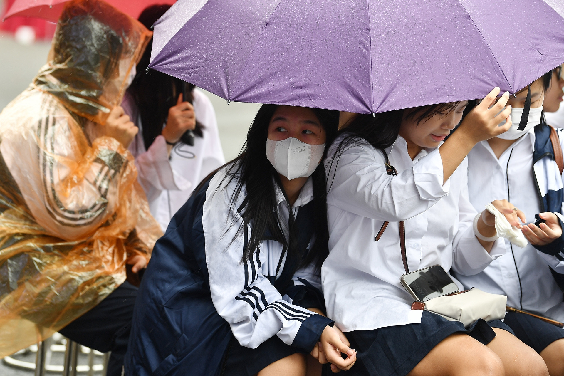
According to the National Center for Hydro-Meteorological Forecasting, in the next 1-2 days, the North and North Central regions will have rain in some places; in particular, the Northeast and the Northern Delta, North Central regions will have scattered rain and showers from the night of October 29 to the morning of October 30. The night and early morning will be cold, and the mountainous areas will be chilly.
From the night of October 31 to November 8, the North will continue to have rain in some places, with fog in some places in the early morning. The night and early morning will be cold, and the mountainous areas will be chilly. Notably, from around November 5, there will be showers in some areas and the weather will turn cold throughout the region.
Thus, from now until about November 5, the North will receive two consecutive cold spells, the latter of which will cause the temperature to drop and the weather to be cold. This is considered the first cold spell of this winter.
Forecasting the weather from now until November 8, the Southern Hydrometeorological Station said that around November 1-2, cold air will weaken and return to the north of our country, and will continue to strengthen strongly on November 4-5.
The National Center for Hydro-Meteorological Forecasting said that on November 5, the Lang Son area dropped 4-5 degrees with the highest level of 22 degrees, then dropped further to 19 degrees, narrowing the temperature difference compared to nighttime, to 17 degrees. At the same time, in Cao Bang, the temperature fluctuated between 20-24 degrees, then dropped to 17-21 degrees. In Hanoi, the temperature also dropped, on November 5 it was at 20-24 degrees, then dropped to 18-21 degrees.
Mr. Hoang Phuc Lam, Deputy Director of the National Center for Hydro-Meteorological Forecasting, said that from November 2024 to January 2025, ENSO is likely to transition to La Nina state with a probability of 60-70%.
Regarding the cold air of this winter, Mr. Lam said that severe cold is likely to be active in December 2024 - January 2025. It is necessary to be on guard against the possibility of prolonged severe cold spells, especially in the northern mountainous areas, accompanied by frost and ice during this time. Severe cold in the Northern region is likely to appear widely from the second half of December (equivalent to the average of many years).

Also during the period from November to January of the following year, the activity of tropical storms/depressions in the East Sea and their impact on the mainland of our country is likely to be at a level approximately equal to or higher than the average of many years (average of many years in the East Sea: 2.8 storms, landfall: 1.1 storms). Tropical storms/depressions making landfall are likely to be concentrated in the Central region and the southern provinces. Be on guard for the possibility of tropical storms/depressions forming right in the East Sea.
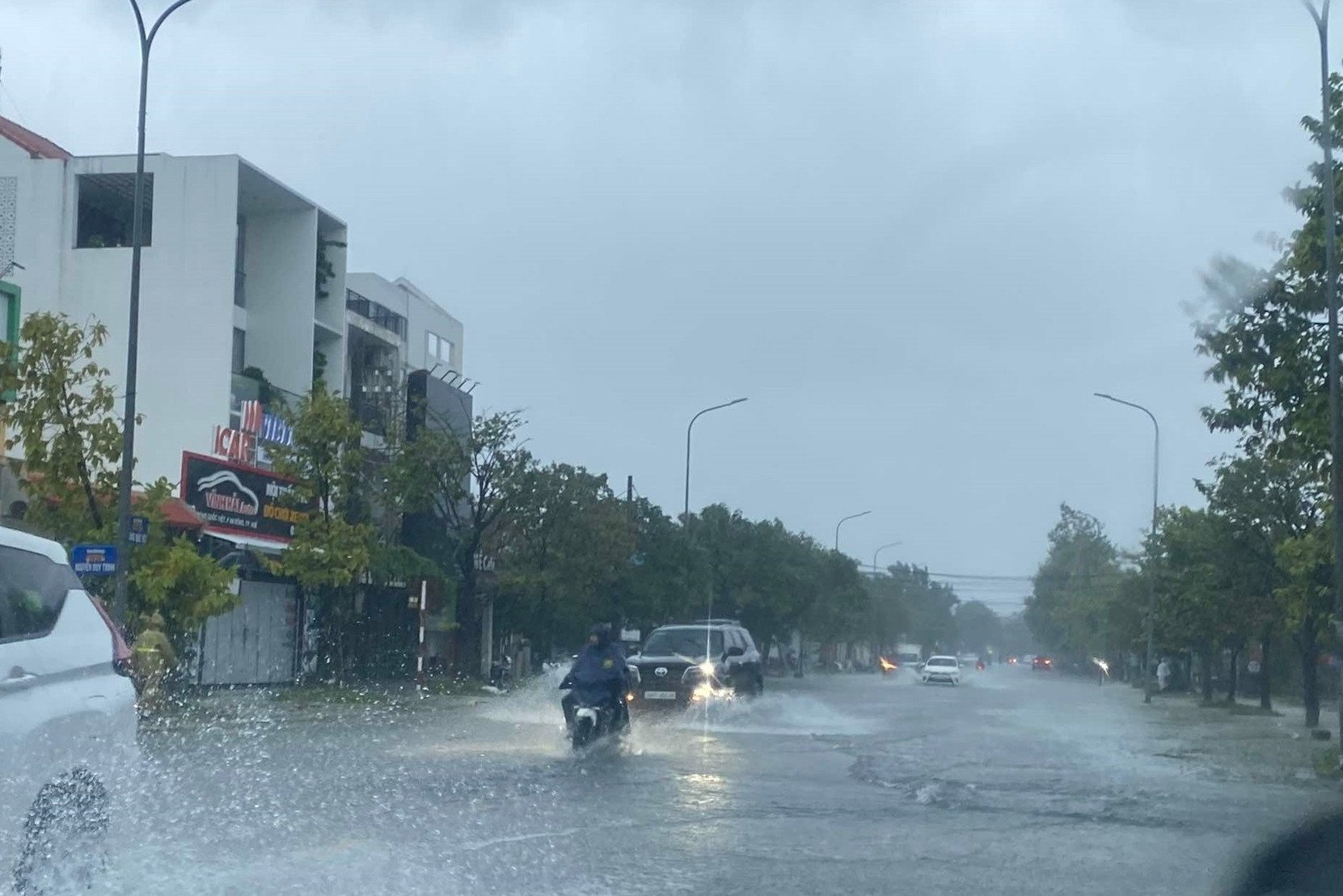
There is a possibility of dangerous weather phenomena such as thunderstorms, tornadoes, lightning and strong gusts of wind across the country. Heavy rains will continue to occur in the Central and South Central regions in November. The rainy season in the Central, Central Highlands and Southern regions may end later than usual (around the end of November in the Central Highlands and the South and the end of December in the Central and South Central regions).
La Nina lasts until about April 2025
In a further forecast, Mr. Lam said that the ENSO phenomenon will remain in a weak La Nina state until around March-April 2025 with a probability of about 50-60%. During February-April 2025, there is little chance of a storm/tropical depression appearing in the East Sea.
Cold air continues to be active in February 2025, causing widespread cold spells in the northern provinces. During cold spells, it is necessary to be on guard against the possibility of frost and ice, especially in the northern mountainous areas. In addition, during the dry season in the southern region, unseasonal rain may occur.
How long will the heavy rain in the Central region last?
Father and son electrocuted, hundreds of households in Dong Nai submerged in water
Hanoi weather for the next 3 days: Cold air spreads throughout the region, cold rain
Source: https://vietnamnet.vn/mien-bac-sap-don-dot-khong-khi-lanh-manh-troi-chuyen-ret-toan-vung-2333288.html

![[Photo] General Secretary To Lam receives French Ambassador to Vietnam Olivier Brochet](https://vstatic.vietnam.vn/vietnam/resource/IMAGE/2025/4/17/49224f0f12e84b66a73b17eb251f7278)
![[Photo] Promoting friendship, solidarity and cooperation between the armies and people of the two countries](https://vstatic.vietnam.vn/vietnam/resource/IMAGE/2025/4/17/0c4d087864f14092aed77252590b6bae)
![[Photo] Nhan Dan Newspaper announces the project "Love Vietnam so much"](https://vstatic.vietnam.vn/vietnam/resource/IMAGE/2025/4/17/362f882012d3432783fc92fab1b3e980)
![[Photo] Closing of the 4th Summit of the Partnership for Green Growth and the Global Goals](https://vstatic.vietnam.vn/vietnam/resource/IMAGE/2025/4/17/c0a0df9852c84e58be0a8b939189c85a)
![[Photo] National Assembly Chairman Tran Thanh Man meets with outstanding workers in the oil and gas industry](https://vstatic.vietnam.vn/vietnam/resource/IMAGE/2025/4/17/1d0de4026b75434ab34279624db7ee4a)


![[Photo] Welcoming ceremony for Chinese Defense Minister and delegation for friendship exchange](https://vstatic.vietnam.vn/vietnam/resource/IMAGE/2025/4/17/fadd533046594e5cacbb28de4c4d5655)


![[Video] Viettel officially puts into operation the largest submarine optical cable line in Vietnam](https://vstatic.vietnam.vn/vietnam/resource/IMAGE/2025/4/17/f19008c6010c4a538cc422cb791ca0a1)


Comment (0)