
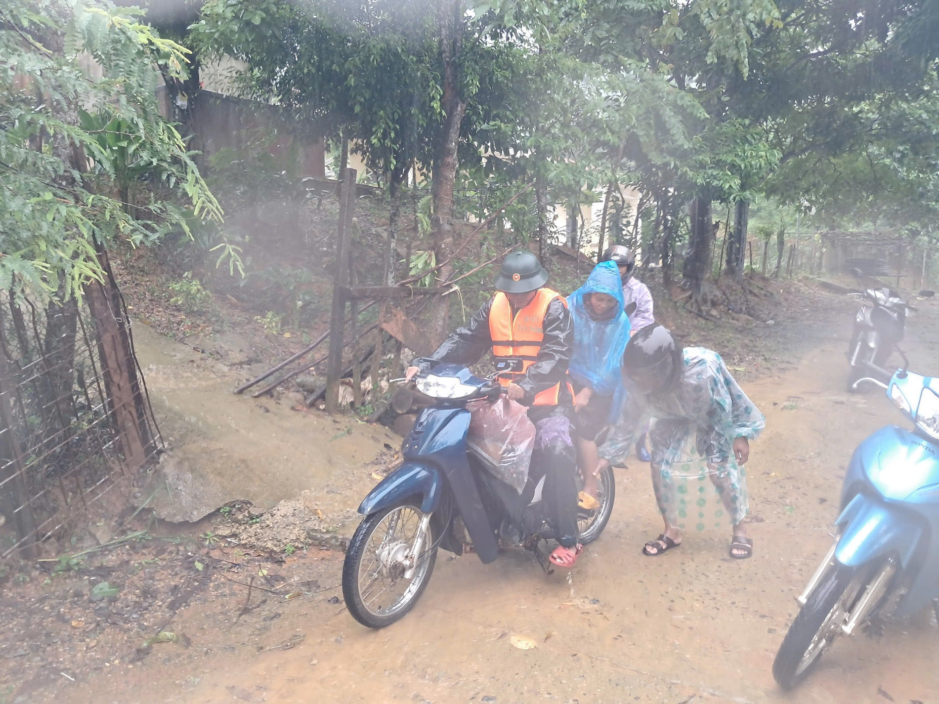
On the evening of September 19, the Steering Committee for Disaster Prevention and Search and Rescue of Huong Hoa district (Quang Tri province) said that due to the impact of storm No. 4, the district had moderate to heavy rain, causing flooding on national highways, inter-commune roads, and intra-village roads in some localities.
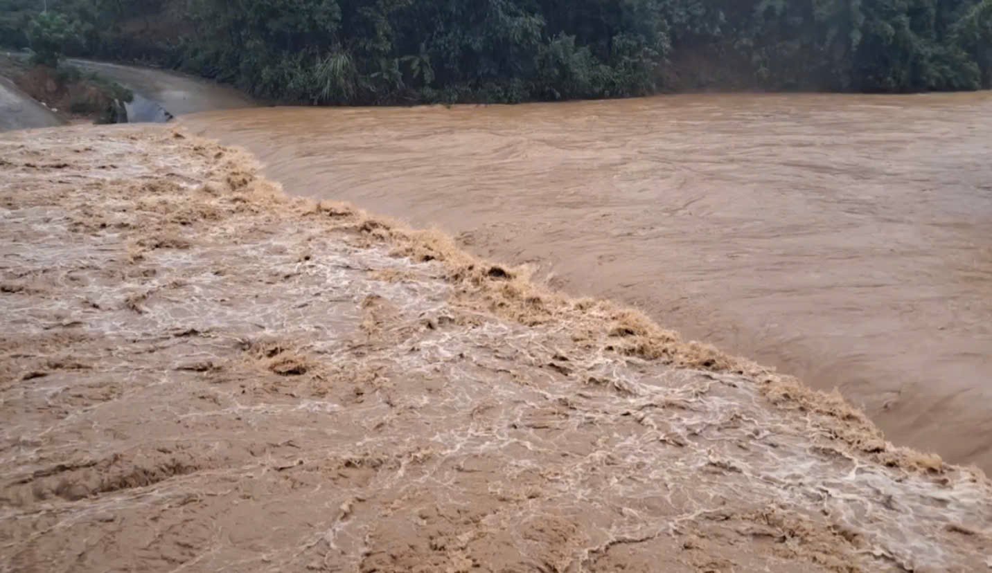
Specifically, at the spillways in the villages: Coóc (Huong Linh commune), Loa and Trum (Ba Tang commune), Bu village (Tan Lap commune); Lia commune to Xy commune; La La bridge at Km 1+700, DT.587 route to Huc commune... the water rose high, causing flooding from 0.5 - 1m, causing local isolation of some residential areas.
Road DT.586 and the inter-commune road to Huong Linh have some minor landslides. Notably, after making landfall, storm No. 4 weakened into a tropical depression, but its circulation continued to cause heavy rain and strong winds in the area.
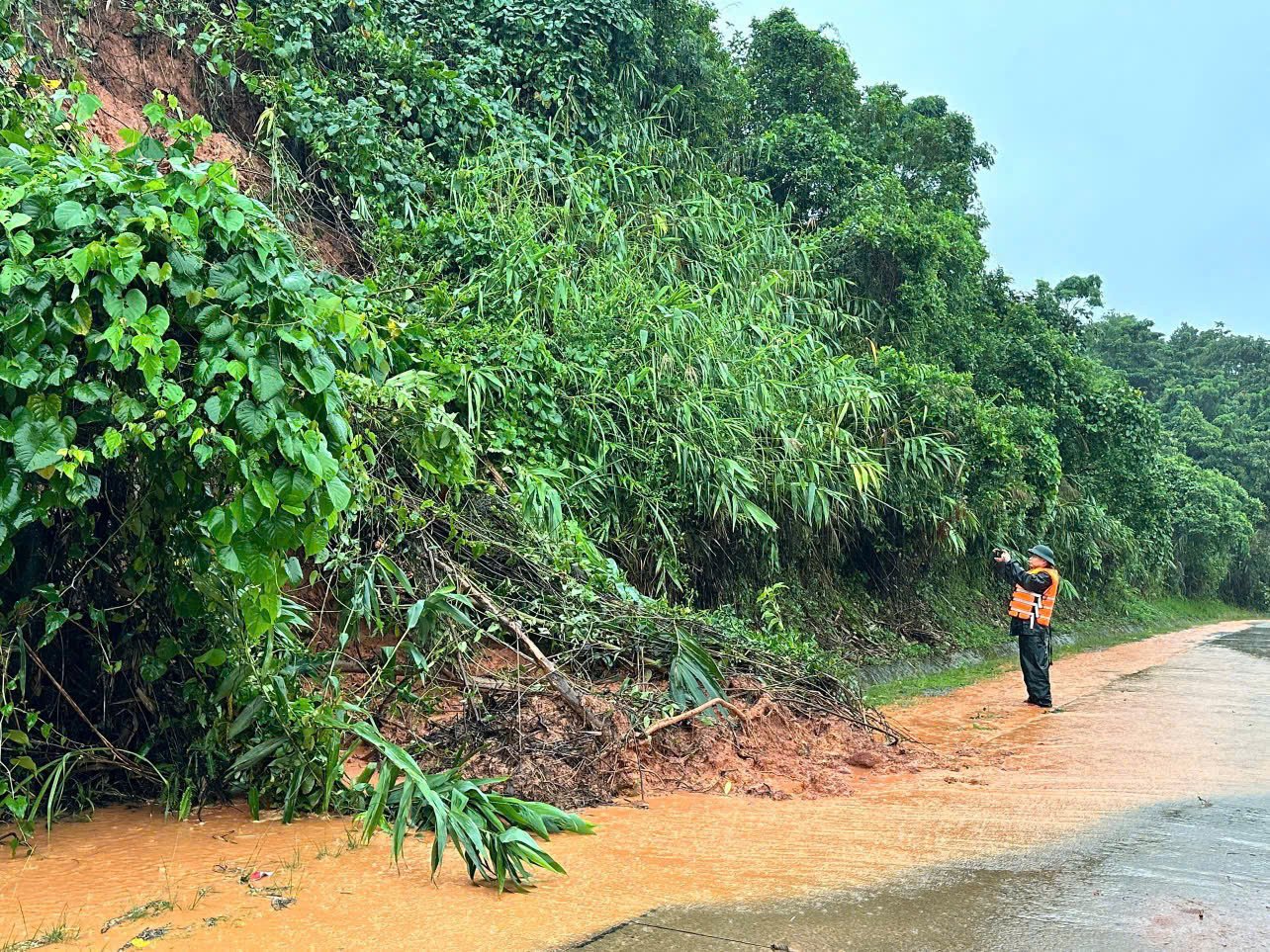
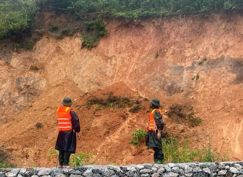
Through preliminary assessment, Huong Hoa district currently has 45 points at risk of landslides, of which 19 points are at high risk of landslides.
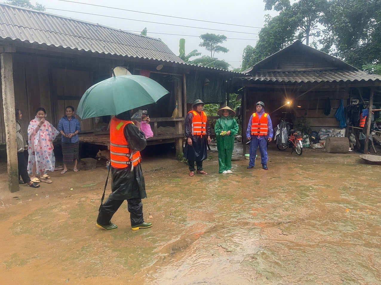
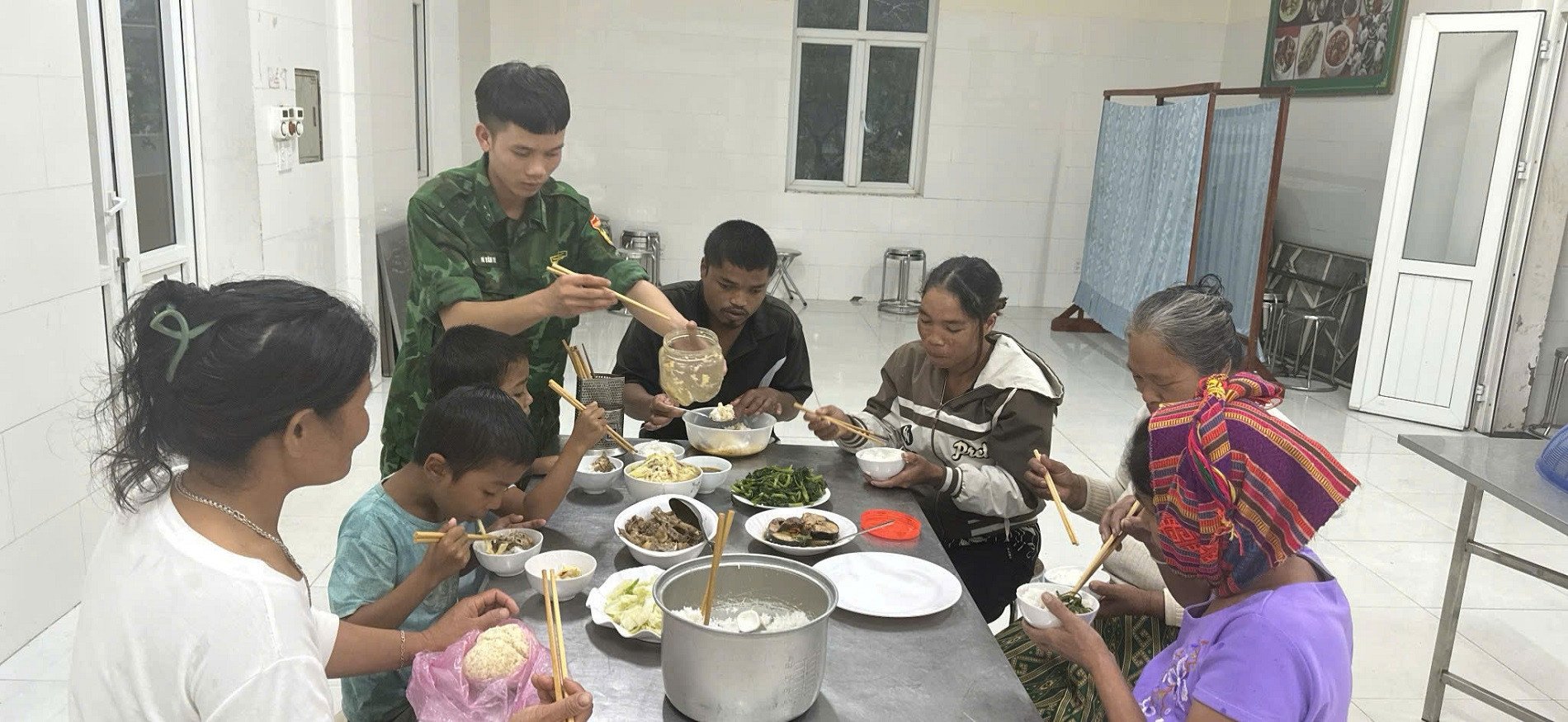
To ensure the safety, lives and property of the people, on the afternoon and evening of September 19, local authorities coordinated with armed forces to urgently evacuate 84 households at risk of landslides in Huc, Huong Lap and Huong Viet communes to safety.
According to the Standing Office of the Steering Committee for Flood and Storm Prevention and Control of Quang Tri province, from the afternoon and night of September 19 to September 20, floods on rivers continued to rise and peaked at alert levels 1 to 2; Thach Han river alone is likely to rise above alert level 2.
Currently, the water level on Ben Hai River, Hieu River and Thach Han River in the upstream is above alert level 1, in the downstream is below alert level 1 and rising.
Source: https://vietnamnet.vn/lo-so-lo-nui-trong-dem-quang-tri-di-doi-khan-cap-hon-80-ho-dan-2323989.html

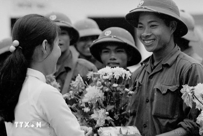
![[Photo] Promoting friendship, solidarity and cooperation between the armies and people of the two countries](https://vstatic.vietnam.vn/vietnam/resource/IMAGE/2025/4/17/0c4d087864f14092aed77252590b6bae)
![[Photo] General Secretary To Lam receives French Ambassador to Vietnam Olivier Brochet](https://vstatic.vietnam.vn/vietnam/resource/IMAGE/2025/4/17/49224f0f12e84b66a73b17eb251f7278)
![[Photo] Nhan Dan Newspaper announces the project "Love Vietnam so much"](https://vstatic.vietnam.vn/vietnam/resource/IMAGE/2025/4/17/362f882012d3432783fc92fab1b3e980)
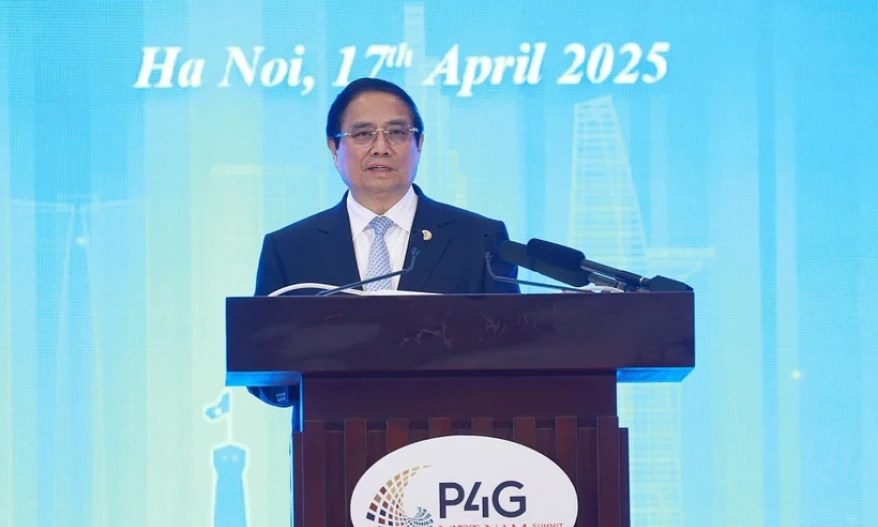
![[Photo] Closing of the 4th Summit of the Partnership for Green Growth and the Global Goals](https://vstatic.vietnam.vn/vietnam/resource/IMAGE/2025/4/17/c0a0df9852c84e58be0a8b939189c85a)
![[Photo] National Assembly Chairman Tran Thanh Man meets with outstanding workers in the oil and gas industry](https://vstatic.vietnam.vn/vietnam/resource/IMAGE/2025/4/17/1d0de4026b75434ab34279624db7ee4a)


![[Photo] Welcoming ceremony for Chinese Defense Minister and delegation for friendship exchange](https://vstatic.vietnam.vn/vietnam/resource/IMAGE/2025/4/17/fadd533046594e5cacbb28de4c4d5655)


![[Video] Viettel officially puts into operation the largest submarine optical cable line in Vietnam](https://vstatic.vietnam.vn/vietnam/resource/IMAGE/2025/4/17/f19008c6010c4a538cc422cb791ca0a1)


Comment (0)