
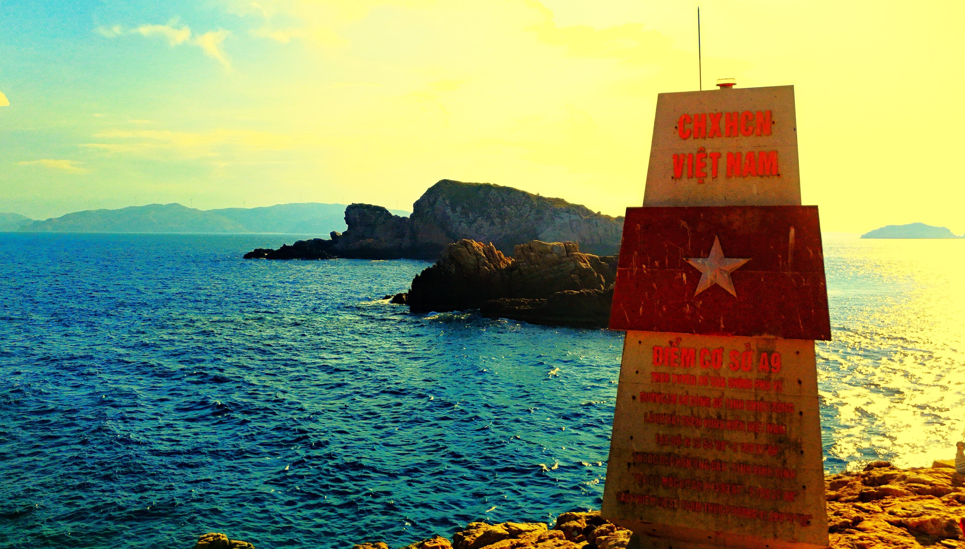
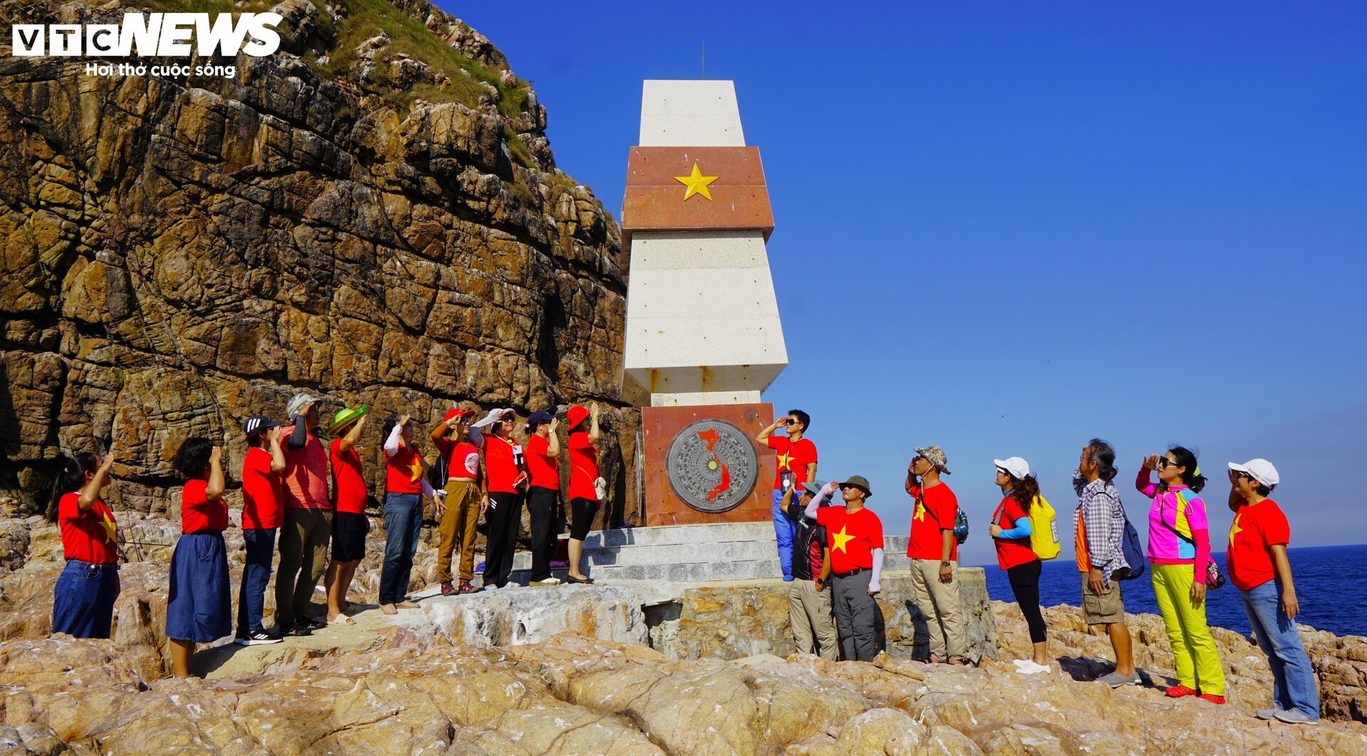
(VTC News) – In the middle of the vast sea and sky, the A9 milestones (Quy Nhon City, Binh Dinh) are the sovereignty markers in Vietnam's sea.
Video: Milestone A9 on the top of Hon Ong Can (Quy Nhon City, Binh Dinh)
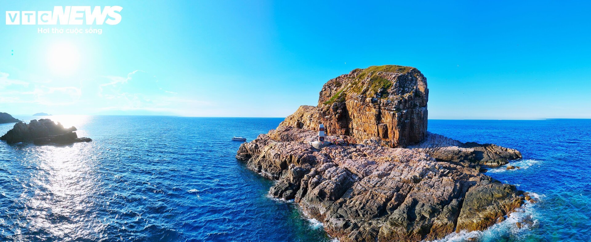
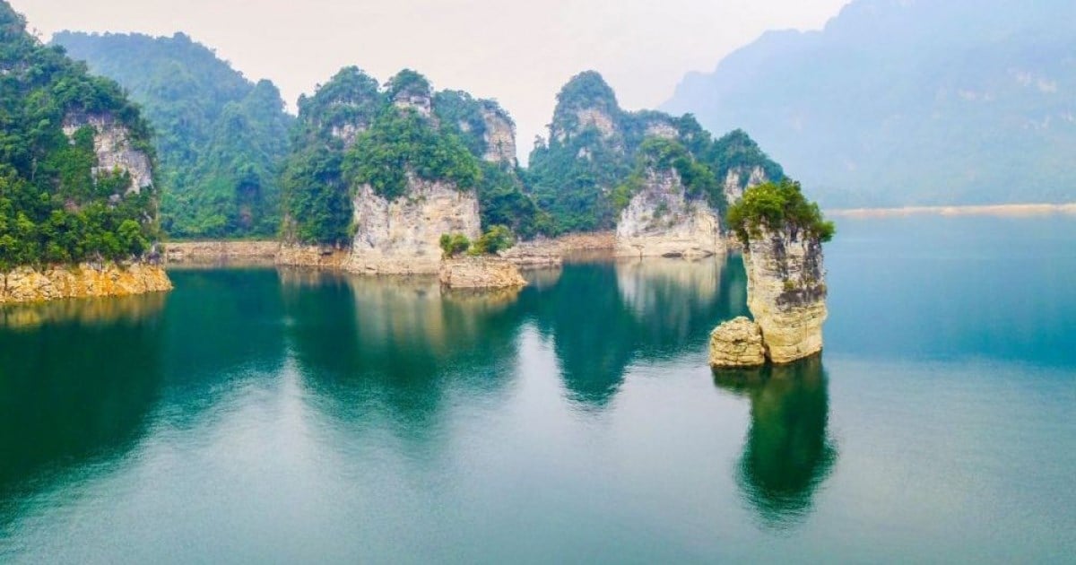
Landmark A9 is located on Hon Ong Can (in Nhon Ly commune, Quy Nhon city, Binh Dinh).
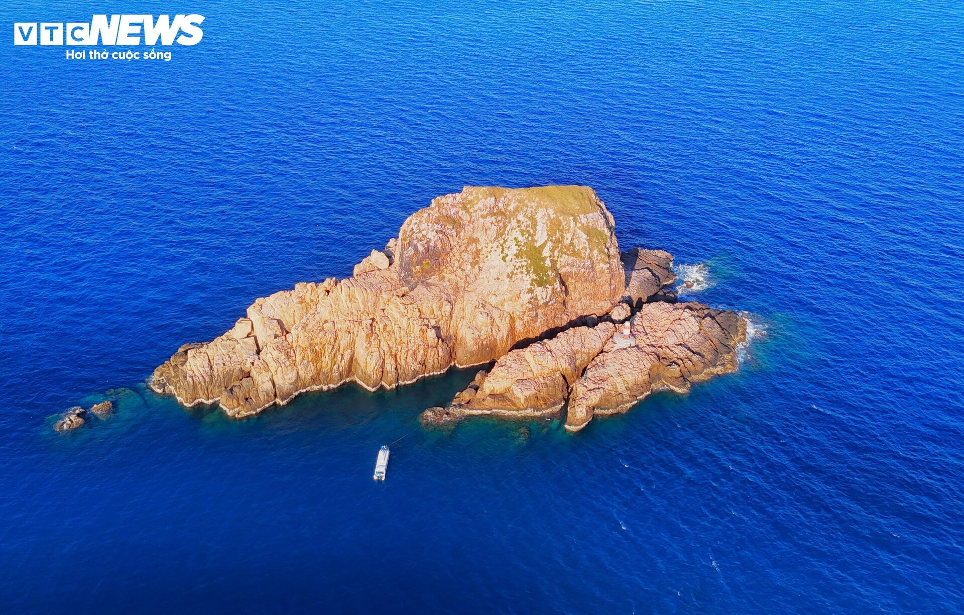
Hon Ong Can is located in the Hon Can island cluster. This is the farthest point in the triangle of three island clusters Hon Seo - Hon Co - Hon Can in the Nhon Ly sea. Seen from afar, the Hon Can island cluster is a continuous strip, like an animal lying prone on the sea, the head of which is Hon Ong Can.

Landmark A9 is about 140 km south of landmark A8 at Dai Lanh Cape (Phu Yen) and about 170 km north of landmark A10 on Ly Son Island (Quang Ngai).
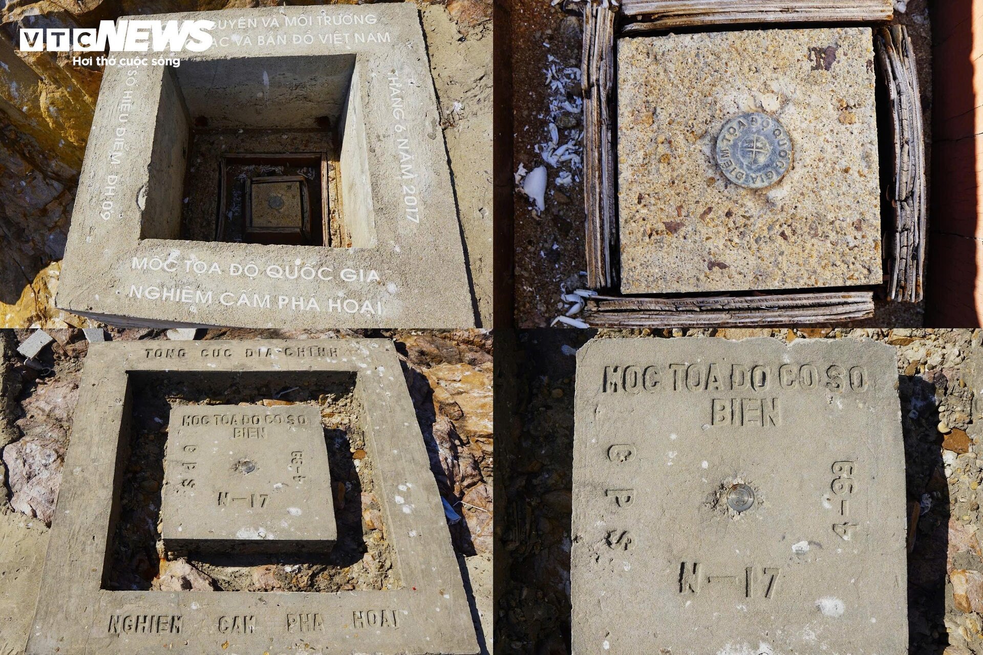
The two ends of landmark A9 are national coordinate points established by the Vietnam Survey and Mapping Department and the General Department of Land Administration (Ministry of Natural Resources and Environment) in June 2017, with code number DH09. Hon Ong Can is important in determining the width of Vietnam's territorial waters according to the 1982 United Nations Convention on the Law of the Sea (UNCLOS).
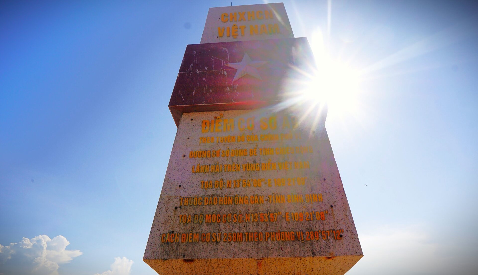
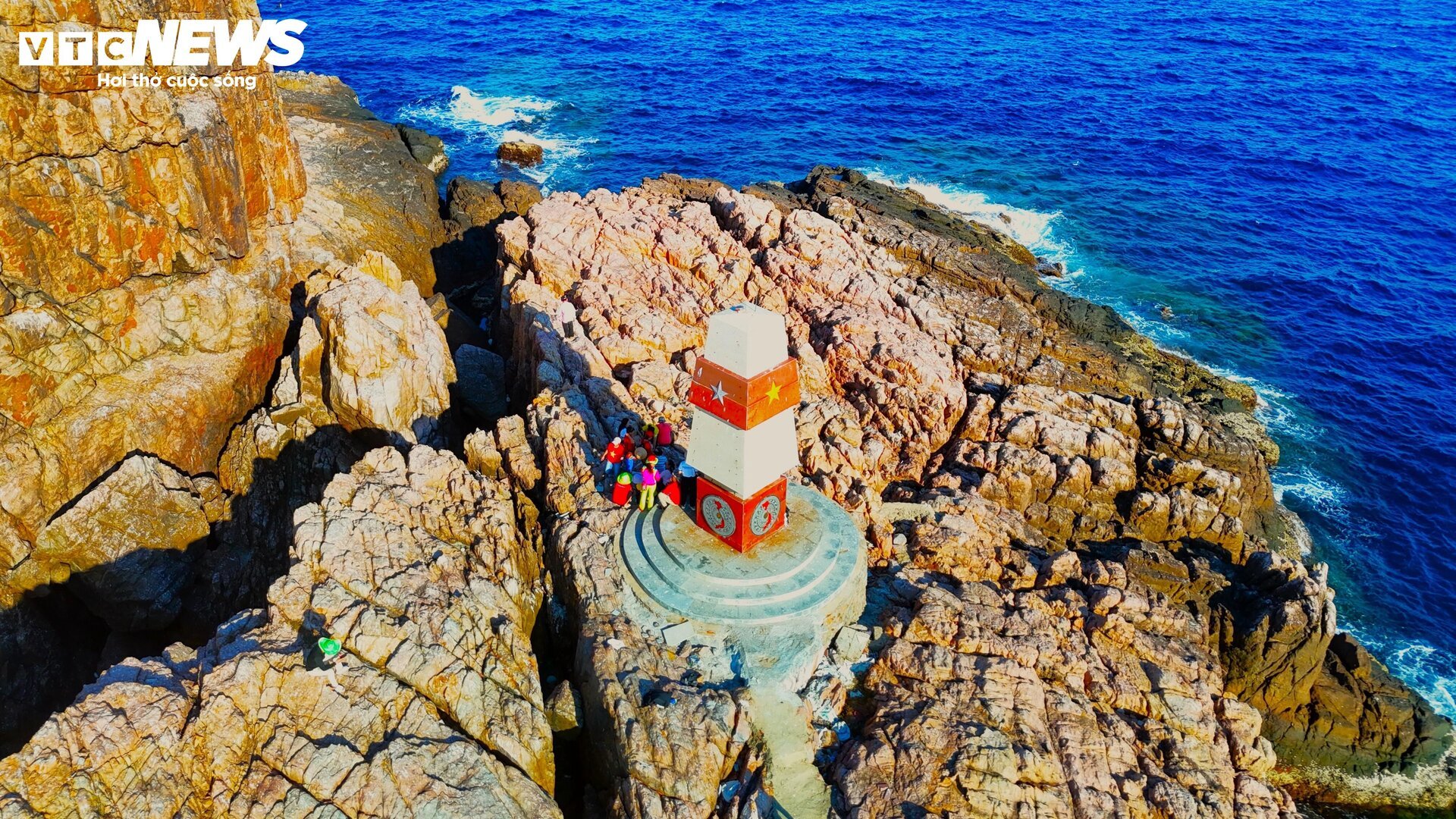
Above all 4 sides of the milestone is the national flag, below is the image of the country on a bronze drum background. The eastern side also has additional parameters about the base point A9.
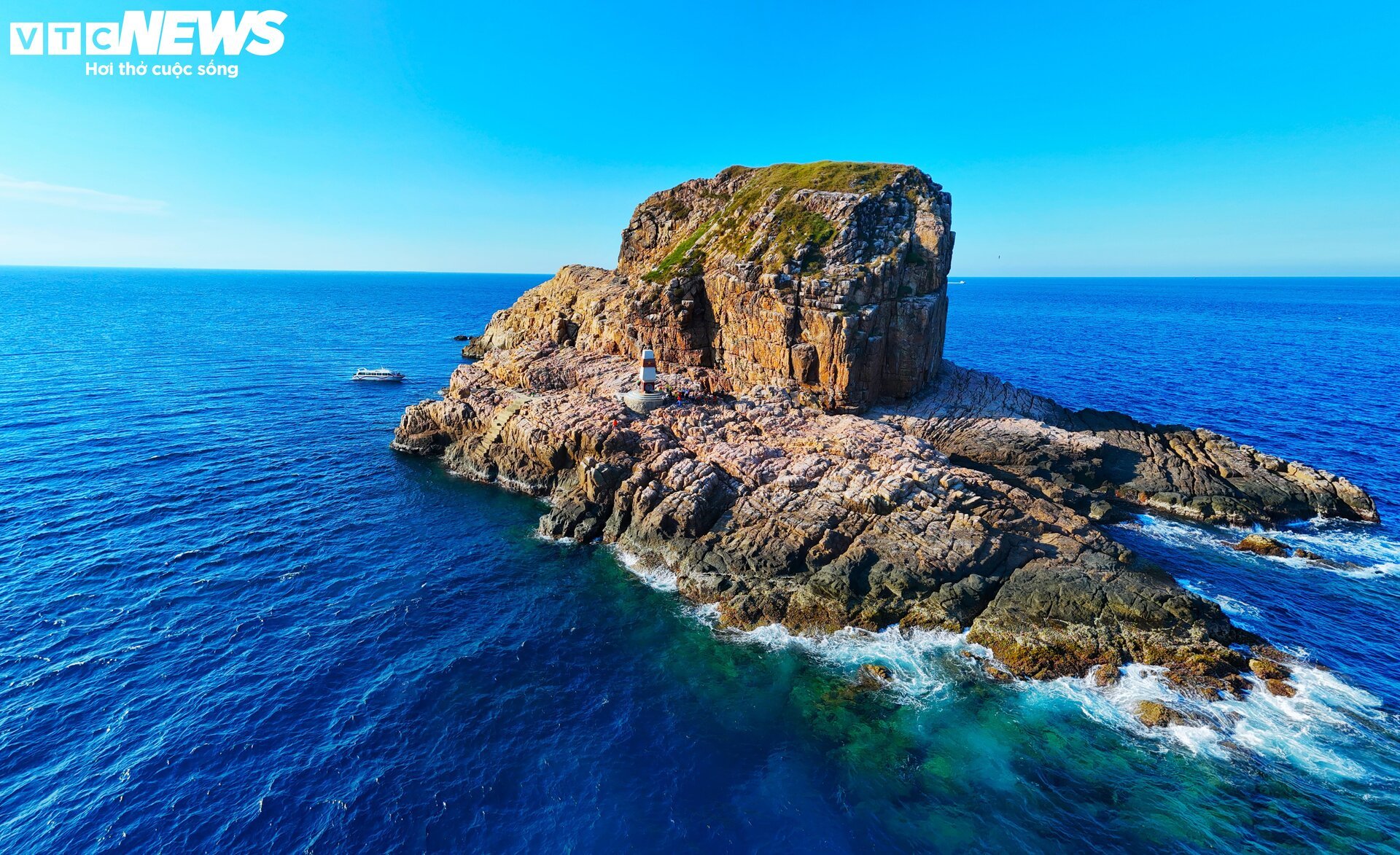
Around Hon Ong Can, there are many reefs, big waves and high cliffs. Locals and tourists can only reach the shore by canoe when the sea is calm. On days when the waves are big and the wind is strong, they have to go by boat, then use a basket boat to follow the big waves to reach the shore and must leave the island before 4pm.
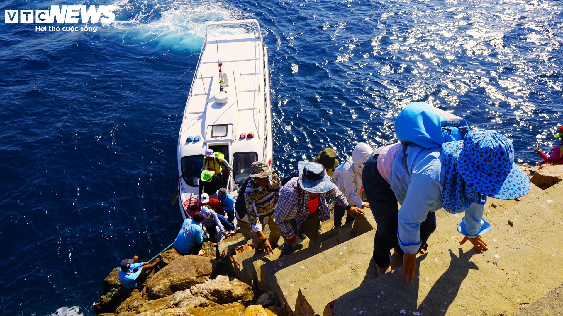
The path to the A9 landmark has waves crashing on four sides and steep cliffs, so it is difficult to approach without the support of experienced fishermen. The path to the landmark has been built into a three-step staircase with about 20 steps, each step is about 50 cm apart, some steps are up to 60 cm.
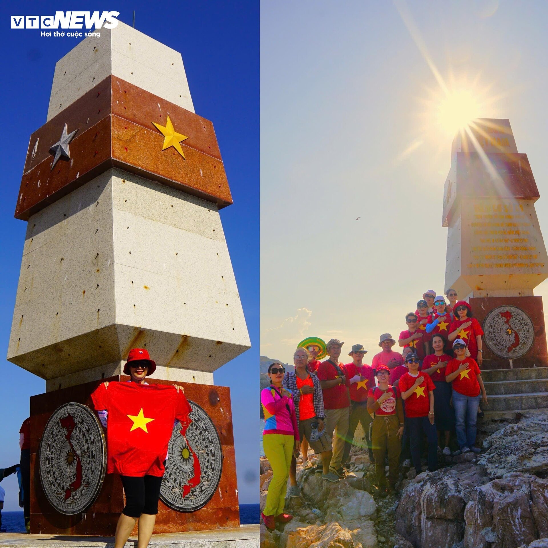
Binh Dinh people and tourists expressed their pride when seeing with their own eyes the sacred sovereignty landmark in the middle of the ocean.
Of the 12 points connecting along the S-curve towards the sea, except for the base point A8 at Dai Lanh Cape (Phu Yen province), the destinations are all located on islands. Therefore, to reach the base points, in addition to the necessary procedures, sometimes you also need luck with the weather.
![[Photo] Many practical activities of the 9th Vietnam-China border defense friendship exchange](https://vstatic.vietnam.vn/vietnam/resource/IMAGE/2025/4/16/3016ed3ef51049219574230056ddb741)
![[Photo] North-South Expressway construction component project, Bung - Van Ninh section before opening day](https://vstatic.vietnam.vn/vietnam/resource/IMAGE/2025/4/17/ad7c27119f3445cd8dce5907647419d1)
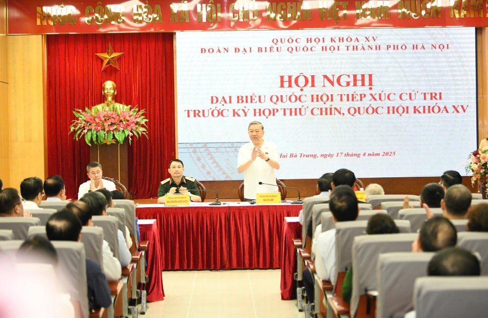
![[Photo] General Secretary To Lam attends conference to meet voters in Hanoi city](https://vstatic.vietnam.vn/vietnam/resource/IMAGE/2025/4/17/889ce3da77e04ccdb753878da71ded24)
![[Photo] President Luong Cuong receives Lao Prime Minister Sonexay Siphandone](https://vstatic.vietnam.vn/vietnam/resource/IMAGE/2025/4/17/337e313bae4b4961890fdf834d3fcdd5)


![[Photo] Opening of the 4th Summit of the Partnership for Green Growth and the Global Goals](https://vstatic.vietnam.vn/vietnam/resource/IMAGE/2025/4/16/488550ff07ce4cd9b68a2a9572a6e035)
![[Photo] National Assembly Chairman Tran Thanh Man meets with Ethiopian Prime Minister Abiy Ahmed Ali](https://vstatic.vietnam.vn/vietnam/resource/IMAGE/2025/4/16/c196dbc1755d46e4ae7b506c5c15be55)
![[Photo] President Luong Cuong receives Ethiopian Prime Minister Abiy Ahmed Ali](https://vstatic.vietnam.vn/vietnam/resource/IMAGE/2025/4/16/504685cac833417284c88a786739119c)


![[Video] Viettel officially puts into operation the largest submarine optical cable line in Vietnam](https://vstatic.vietnam.vn/vietnam/resource/IMAGE/2025/4/17/f19008c6010c4a538cc422cb791ca0a1)


Comment (0)