
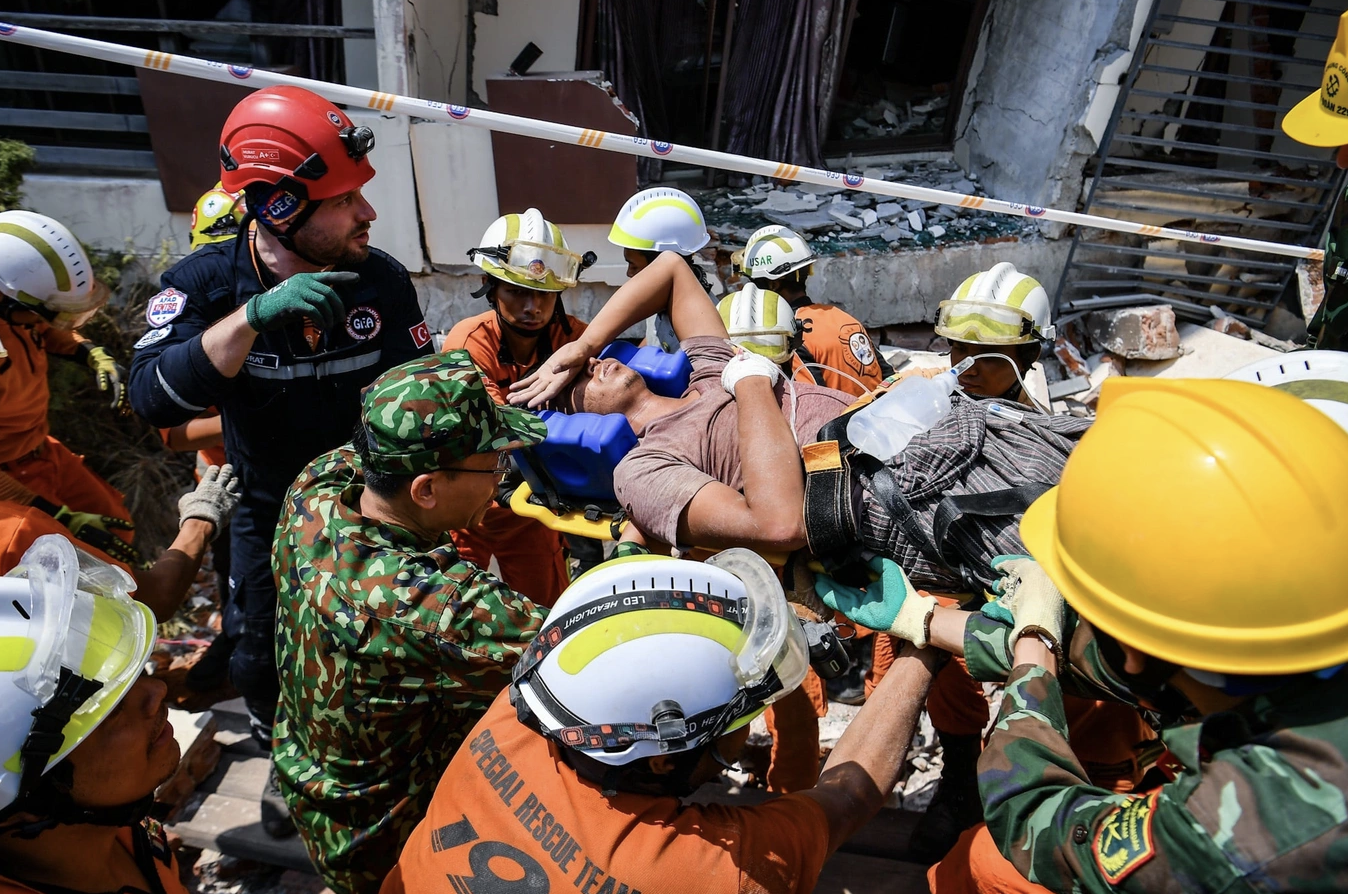
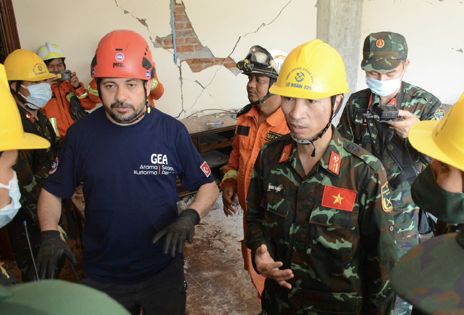
A 7.7-magnitude earthquake struck central Myanmar on the afternoon of March 28, causing casualties and damage to buildings in Myanmar and Thailand. The quake also caused earthquake waves and affected several cities in Vietnam.
 |
| Map of earthquake epicenter in Myanmar |
From the earthquakes and tsunamis that occurred in Sichuan (China) in 2008, 2022, Japan in 2011 and recently in Myanmar, to have more information about the important role of forecasting and mapping of dangerous areas due to earthquakes and tsunamis for key projects and economic areas, people's lives, reporters of Cong Thuong Newspaper had an interview with Professor Tran Tuan Anh - Vice President of the Vietnam Academy of Science and Technology, Director of the Institute of Earth Sciences.
- Sir, the recent earthquake in Myanmar affected several countries in the region, including Vietnam. So how did these earthquakes affect Vietnam?
Professor Tran Tuan Anh : The Myanmar region is located at the tectonic boundary of the Indian, Eurasian, and Sunda plates, so there are very strong earthquakes. In the last 100 years, this region has had 6 earthquakes larger than 7, the highest being in 1912 with a magnitude of 7.8. In general, distant earthquakes have little impact on Vietnam.
 |
| Professor Tran Tuan Anh - Vice President of Vietnam Academy of Science and Technology |
Recently, high-rise buildings in Hanoi and Ho Chi Minh City have been shaking due to the effects of earthquakes. This phenomenon has occurred in recent years when there have been large earthquakes in Laos, China, etc. The main effects are shaking in high-rise buildings in big cities. These effects are also small and unlikely to cause damage.
- Vietnam is a country with a long coastline and an economy closely linked to the sea. To prevent and mitigate damage caused by earthquakes and tsunamis, what recommendations do you have?
Professor Tran Tuan Anh : To prevent, combat and mitigate damage caused by earthquakes and tsunamis, Vietnam currently has a map assessing the risk of earthquakes and some scenarios for tsunamis. However, these maps need to be updated with additional data from recent years.
The earthquake hazard zoning map aims to identify earthquake-prone areas in Vietnam. Thanks to this map, it is possible to know the time of earthquake recurrence in 1,000 years, 500 years and 20 years. Or, in other words, scientists can predict earthquakes in Vietnam.
To build these maps, in addition to earthquake data, scientists must study faults, conduct seismic and tectonic surveys, recalculate parameters and interpret them in an easy-to-understand manner for convenient use by users.
According to international practice, data will be updated every 5-10 years. Vietnam's earthquake hazard zoning map has not been updated in the past 10-20 years.
- From the earthquakes and tsunamis in Sichuan (China), Japan and now Myanmar, from a scientific perspective, what recommendations do you have regarding the work of creating warning maps in conjunction with planning and standard building... for economic zones, key projects, and energy projects?
 |
| Dr. Nguyen Xuan Anh - Director of the Earthquake Information and Tsunami Warning Center - shares fault zones in Vietnam |
Professor Tran Tuan Anh : In addition to assessing earthquake hazards, it is necessary to update data for earthquake risk assessment maps in regions across the country. In the immediate future, it is necessary to assess the potential for damage when an earthquake occurs in some key areas such as large cities, densely populated areas, key projects, and areas at risk of strong earthquakes.
For the coastal economic zone, it is necessary to assess the impact of tsunamis. It is known that the earthquake risk assessment map is currently only made for a few small areas, and the data has not been updated for many years. If these maps are available, localities and management agencies can rely on them to come up with appropriate seismic resistance plans for constructions, serving the planning and socio-economic development of the country.
For example, in the capital city of Hanoi, construction works that have become old after 5-10 years, or newly built works, need to be evaluated, data updated, and which works are at risk of being affected, and to what extent if an earthquake occurs.
In areas with high risk of earthquakes, it is necessary to assess the impact on construction works and whether there is a risk of rocks rolling down the mountainside. Inspection and assessment are very important to help the government and people proactively prevent and mitigate damage caused by earthquakes.
Particularly for important projects and works such as nuclear power, high-speed trains, subways, hydroelectric power... it is necessary to conduct research to assess the impact of earthquakes and tsunamis (if the project is located on the coast) according to separate standards.
Normally, it is necessary to survey and monitor in advance, thereby assessing the danger and calculating the risks during operation to ensure absolute safety for these projects.
Thank you very much, professor!
According to the latest statistics from the Myanmar military government, at least 2,028 people were killed in the earthquake and 3,408 were injured by the end of March 30. The city of Mandalay - the hardest hit - is the center of the rescue operation in Myanmar. The earthquake severely damaged the important highway system connecting Yangon with Nay Pyi Taw and Mandalay. Meanwhile, in Thailand, rescue workers are trying to rescue dozens of workers trapped in a collapsed 33-storey tower in the capital Bangkok. The most serious impact was recorded at construction sites, especially the complete collapse of the State Audit Office (SAO) building in the Chatuchak district. Preliminary reports show that 169 other buildings in Thailand have cracks, but they do not affect the main structure. |
Source: https://congthuong.vn/cong-trinh-trong-diem-can-danh-gia-rui-ro-dong-dat-va-song-than-380644.html
![[Photo] Third meeting of the Organizing Subcommittee serving the 14th National Party Congress](https://vstatic.vietnam.vn/vietnam/resource/IMAGE/2025/4/2/3f342a185e714df58aad8c0fc08e4af2)
![[Photo] General Secretary To Lam receives Russian Ambassador to Vietnam](https://vstatic.vietnam.vn/vietnam/resource/IMAGE/2025/4/2/b486192404d54058b15165174ea36c4e)


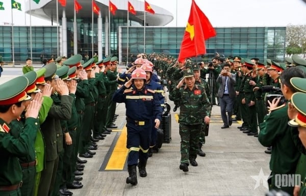


![[Photo] Relatives of victims of the earthquake in Myanmar were moved and grateful to the rescue team of the Vietnamese Ministry of National Defense.](https://vstatic.vietnam.vn/vietnam/resource/IMAGE/2025/4/2/aa6a37e9b59543dfb0ddc7f44162a7a7)


Comment (0)