
The tropical depression has strengthened into a storm, storm number 10, internationally named Pabuk; with wind gusts of level 10 in the sea northwest of Truong Sa archipelago. The storm is forecast to head towards the South Central and Southern seas.
According to the National Center for Hydro-Meteorological Forecasting, this afternoon (December 23), the tropical depression in the sea northwest of Truong Sa archipelago has strengthened into a storm, storm number 10 in 2024, internationally named Pabuk.
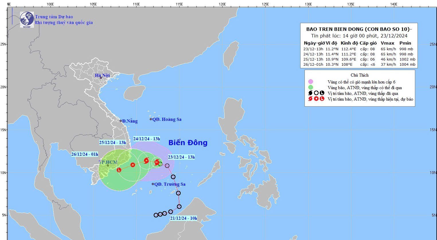
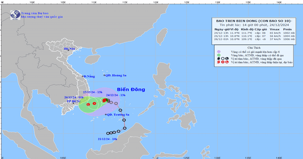
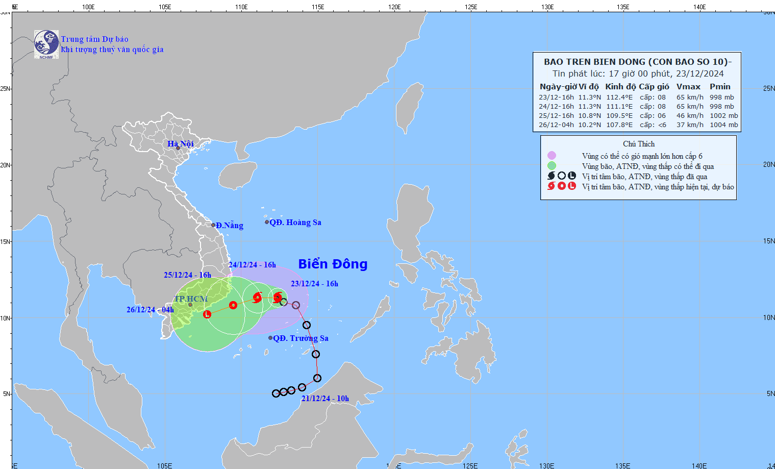
As of 1 p.m. today, the center of storm No. 10 is at approximately 11.2 degrees North latitude; 112.4 degrees East longitude, in the northwest area of Truong Sa archipelago. The strongest wind near the center of the storm is level 8 (62-74 km/h), gusting to level 10; moving in the West Northwest direction, speed of approximately 10 km/h.
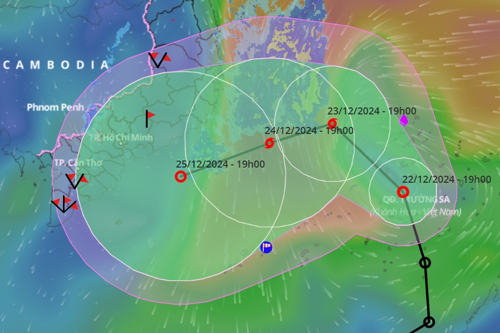
In the next 24 hours, the storm will continue to move slowly in the West-Northwest direction, at a speed of 5-10km/h. By 1pm tomorrow (December 24), the storm's eye will be in the southwestern sea area of the Central East Sea. The strongest wind near the storm's eye is level 8, gusting to level 10.
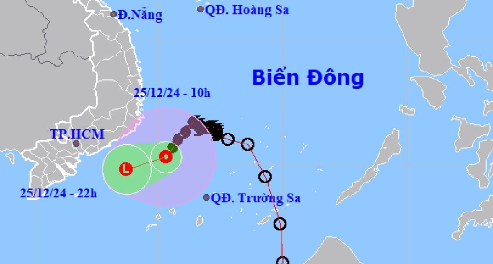
Forecast for the next 24 hours, the storm will change direction to West Southwest, speed about 5-10 km/h and gradually weaken into a tropical depression. At 13:00 on December 25, the center of the tropical depression over the sea from Phu Yen to Ba Ria - Vung Tau, the intensity will decrease to level 6, gust level 8.
About 12 hours later, the tropical depression continued to weaken into a low pressure area over the sea from Binh Thuan to Tra Vinh.
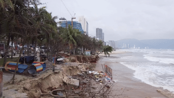
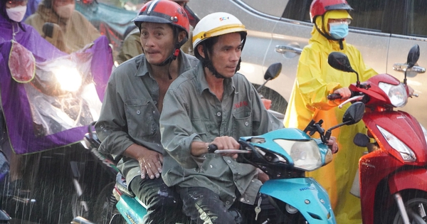
Due to the influence of storm No. 10, last night and this morning, in the Central Central region there was scattered rain and showers.
It is forecasted that from tonight to tomorrow night (December 24), in the area from Da Nang to Khanh Hoa, there will be moderate rain, heavy rain, locally very heavy rain and thunderstorms with common rainfall from 40-120mm, locally over 200mm.
From early morning to tomorrow night, in the Eastern Central Highlands, there will be moderate rain, heavy rain, locally very heavy rain and thunderstorms with rainfall from 30-60mm, locally over 100mm.
During the day and night of December 25, heavy rains continued to occur in the Central and South Central regions and the Eastern Central Highlands with rainfall of 40-80mm, locally over 150mm; in the Eastern Central Highlands, rainfall was generally 20-50mm, locally over 100mm. From December 26, heavy rains in these areas are likely to gradually decrease.
The meteorological agency warns that thunderstorms may cause tornadoes, lightning and strong gusts of wind. Heavy rains may cause flooding in low-lying areas; flash floods in small rivers and streams; and landslides on steep slopes.
Storm No. 10 also causes the northern sea area of the South East Sea (including the northern area of Truong Sa archipelago) and the southwestern sea area of the Central East Sea to have strong winds of level 6-7, the area near the storm's center has strong winds of level 8, gusts of level 10, waves 4-6m high; rough seas.
Ships operating in the above mentioned dangerous areas are likely to be affected by storms, whirlwinds, strong winds and large waves.
Tropical depression changes direction continuously, likely to become storm No. 10 on December 23

Hanoi weather for the next 3 days: Cold air shifts to the east, coldest night 13 degrees
Cold air is active, there is a possibility of many severe cold spells in the first month of the year.
Source: https://vietnamnet.vn/bao-so-10-hinh-thanh-tren-bien-dong-ten-quoc-te-la-pabuk-2355523.html


Comment (0)