
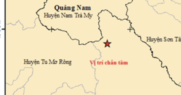
The Earthquake Information and Tsunami Warning Center (Institute of Geophysics, Vietnam Academy of Science and Technology) continuously broadcast 7 earthquake bulletins recorded in Kon Plong district, Kon Tum province. The earthquakes did not pose any natural disaster risk.
The largest earthquake recorded by the Institute of Geophysics occurred at 20:13'23'' on March 16 at the coordinates 15.008 degrees North latitude, 108.218 degrees East longitude, with a focal depth of about 8 km, in Kon Plong district, Kon Tum province.
Previously, 6 consecutive earthquakes with magnitudes of 2.6, 2.7, 3.3, 3.2, 3.7 and 3.8; focal depth of about 8.1 - 10 km were also recorded in Kon Plong district, Kon Tum province.
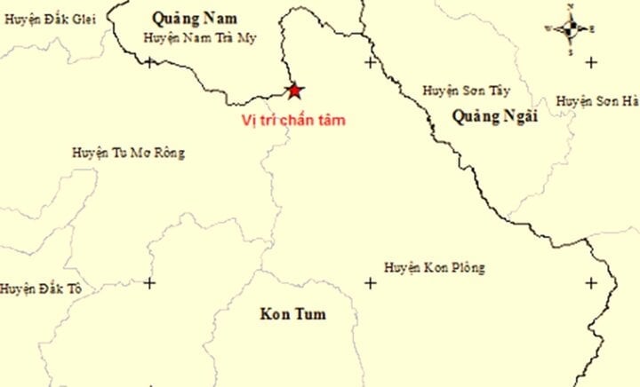
Kon Plong district recorded 7 earthquakes.
According to the Institute of Geophysics, since mid-2021, hundreds of earthquakes have occurred in Kon Plong district and neighboring districts of Kon Tum province, many of which caused widespread tremors, the largest of which was the earthquake that occurred on the afternoon of August 23, 2022 with a magnitude of 4.7.
Director of the Institute of Geophysics, Dr. Nguyen Xuan Anh said that the Earthquake Information and Tsunami Warning Center regularly informs the authorities and people in this area about earthquake activities; at the same time, the Institute's staff continues to monitor and process data of earthquakes in Kon Plong district.
According to Dr. Nguyen Xuan Anh, people need to stay calm, strictly follow the instructions of local authorities and functional agencies; at the same time, proactively reinforce their houses and equip themselves with knowledge about earthquake prevention and control.
Local authorities and functional agencies need to increase propaganda about these prevention and avoidance methods; at the same time, clearly inform people about the intensity and risk level of recent earthquakes.
Source
![[Photo] National Assembly Chairman Tran Thanh Man meets with King Philippe of Belgium](https://vstatic.vietnam.vn/vietnam/resource/IMAGE/2025/4/1/c6fb3ef1d4504726a738406fb7e6273f)

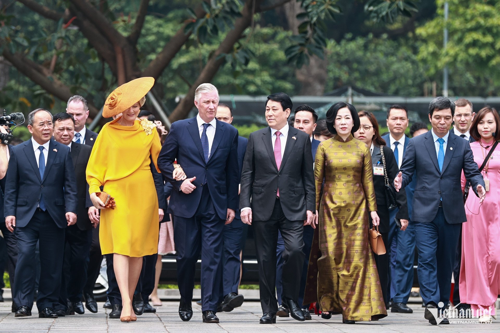
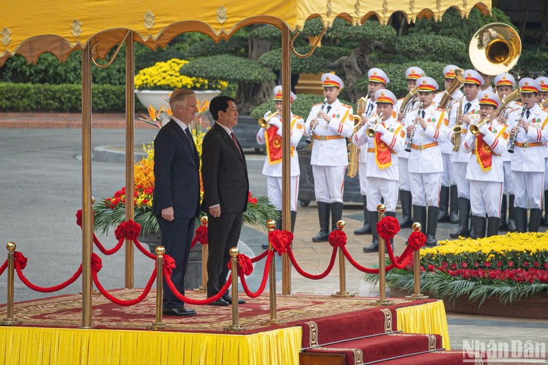
![[Photo] Official welcoming ceremony for the King and Queen of the Kingdom of Belgium](https://vstatic.vietnam.vn/vietnam/resource/IMAGE/2025/4/1/9e1e23e54fad482aa7680fa5d11a1480)
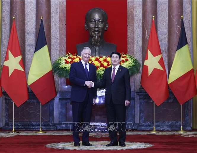
![[Photo] President Luong Cuong meets with King Philippe of Belgium](https://vstatic.vietnam.vn/vietnam/resource/IMAGE/2025/4/1/1ce6351a31734a1a833f595a89648faf)
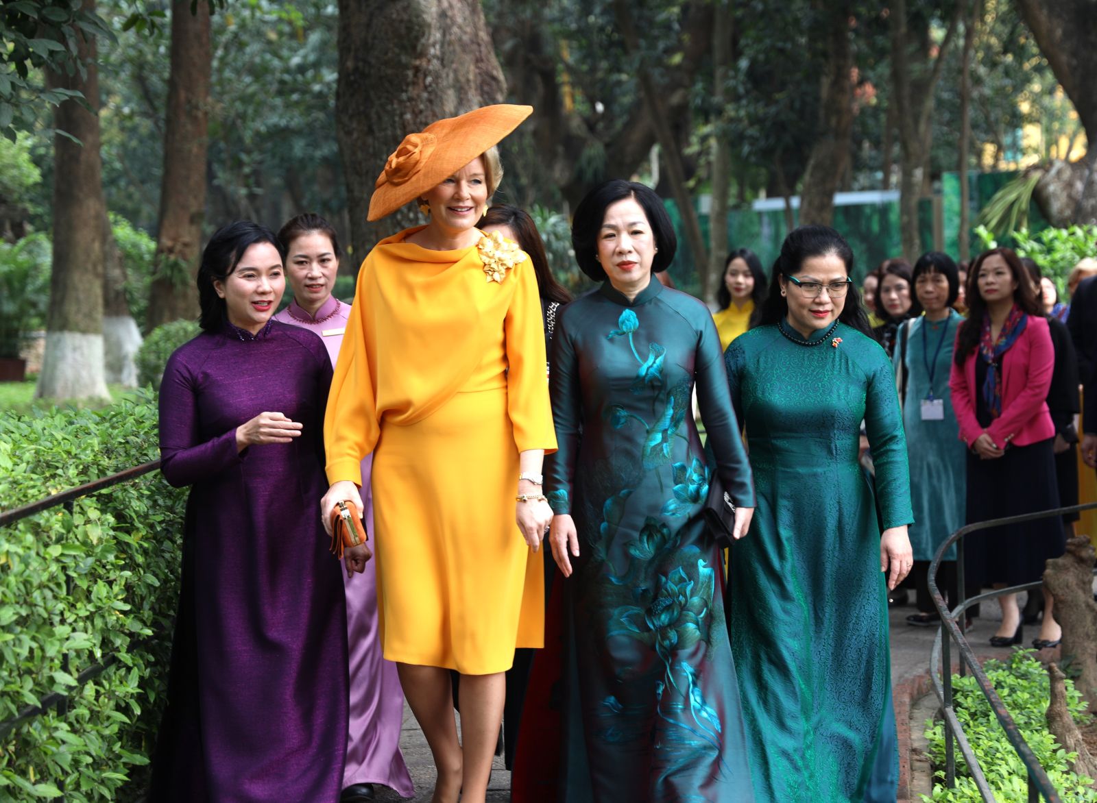
![[Photo] Queen of the Kingdom of Belgium and the wife of President Luong Cuong visit Uncle Ho's Stilt House](https://vstatic.vietnam.vn/vietnam/resource/IMAGE/2025/4/1/9752eee556e54ac481c172c1130520cd)
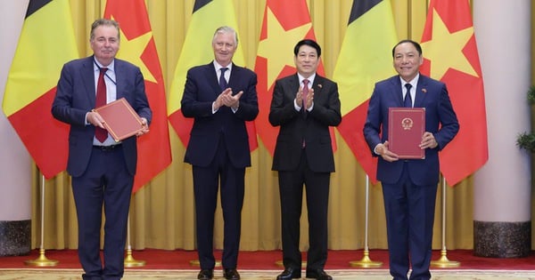
![[Photo] President Luong Cuong and the King of Belgium witness the Vietnam-Belgium document exchange ceremony](https://vstatic.vietnam.vn/vietnam/resource/IMAGE/2025/4/1/df43237b0d2d4f1997892fe485bd05a2)


Comment (0)