
 |
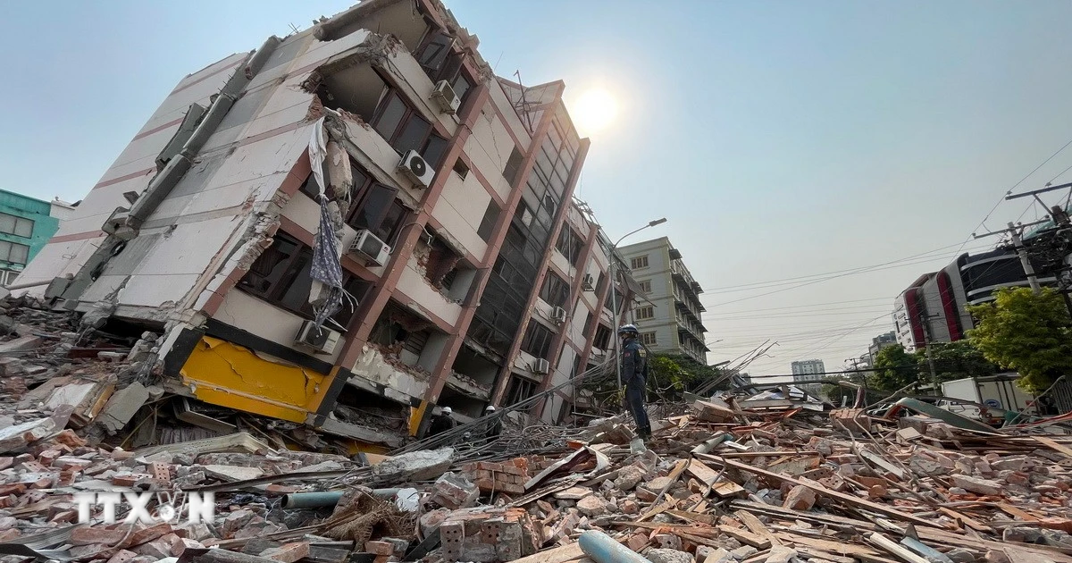
A collapsed building in Myanmar after an earthquake on March 28. Photo: Reuters . |
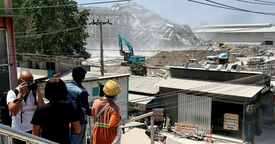
At 1 p.m. on March 28, a 7.7-magnitude earthquake struck west of Mandalay, Myanmar. The massive earthquake affected many Southeast Asian countries, including Vietnam.
According to the US Geological Survey (USGS), earthquakes with a magnitude of 7.0-7.9 are considered “major,” with the potential to cause widespread, severe damage, especially near densely populated areas. The agency also estimates the potential for a loss of life in the range of 1,000-10,000, and economic damage of $1-10 billion .
In Ho Chi Minh City and Hanoi, at around 1:30 p.m., many people living in apartment and office buildings felt their houses shaking, and felt dizzy as if their blood pressure had dropped.
Speaking with Tri Thuc - Znews , Mr. Nguyen Xuan Anh (Director of the Institute of Geophysics) said that the earthquake that occurred in Myanmar was very strong, so people in high-rise buildings in Hanoi and Ho Chi Minh City could easily feel it.
“The earthquake was so big that the impact range of hundreds of kilometers is normal,” Mr. Xuan Anh explained why tremors were felt in locations far from the epicenter like Ho Chi Minh City, and said that the Institute of Geophysics is continuing to monitor.
Big earthquake, far-reaching effects
The strength of an earthquake is measured in magnitude, a number that represents the amount of energy released at the source. Magnitude is different from intensity, which describes the amount of shaking at a particular location, depending on distance and geology.
Scientists use different scales for earthquakes to ensure accuracy. The Richter scale is used for small earthquakes, and the moment scale is used for large earthquakes.
 |
Several office buildings in Ho Chi Minh City shook at noon on March 28. Photo: Linh Huynh . |
The Richter scale, developed by Charles F. Richter in 1935, was originally used to measure local earthquakes in California. It is based on the amplitude (height) of the largest seismic wave recorded on the Wood-Anderson seismograph, after adjusting for distance from the epicenter.
The scale is logarithmic, meaning that each unit increase (for example, from 5 to 6) corresponds to a 10-fold increase in wave amplitude and approximately 31.6 times the energy released. However, the Richter scale is only accurate for small to moderate earthquakes (below magnitude 7) and is not suitable for large earthquakes due to saturation.
The moment magnitude scale (Mw) is now preferred, especially for large earthquakes, and is based on the seismic moment, calculated from the fault area and the amount of slip. It is not as saturated as the Richter scale, so it is more accurate for earthquakes of magnitude 8 and above. The moment scale is now the global standard, allowing for more accurate measurements of large events.
For example, the 1960 Chile earthquake, considered the strongest earthquake ever recorded by humans, had a Richter magnitude of 8.6, but a moment magnitude of 9.5.
Moment scales are also logarithmic. An earthquake of magnitude 7.7 will be more than five times as large as one of magnitude 7.
 |
Office workers in Phu My Hung area run out of their building due to the impact of the earthquake in Myanmar. Photo: Son Tran. |
To make a distinction, the strength of an earthquake on the Richter scale is often noted in units of ML, while the moment scale is often noted as M, Mw or Mwg.
Where to follow earthquake information?
Vietnam is not a country where large earthquakes often occur. Therefore, people do not have much experience in looking up information related to this phenomenon.
There are currently many free tools on the Internet that provide up-to-date, highly accurate information related to earthquakes that users can use.
For domestic users, the website http://igp-vast.vn/ of the Institute of Geophysics (under the Vietnam Academy of Science and Technology) provides complete information. The website provides complete data on domestic geological events, including aftershocks that many international sources do not update.
 |
For large or local earthquakes, when searching for the keyword "earthquake", Google will provide basic information. Photo: Xuan Sang. |
The USGS Earthquake Page is a resource used by technology companies and international media when reporting on this phenomenon. Users can access https://earthquake.usgs.gov/earthquakes/ to track recorded earthquakes in real time. The page arranges events in chronological order, with the most recent at the top. Additionally, the earthquake's magnitude on the Richter scale is noted next to it.
In addition, USGS also provides a visual map for users to follow. The colored dots represent the location of the earthquake. The size corresponds to the magnitude and area of influence.
In addition, domestic users can also quickly check earthquake information using the Google search engine. By using the keyword "earthquake", the platform will return information taken directly from the US Geological Survey. Events are listed in chronological order and have locations attached. The graphics provided by Google are also more intuitive with the epicenter location and the affected area described accurately.
Source: https://znews.vn/tran-dong-dat-o-myanmar-manh-den-dau-post1541513.html

![[Photo] Phuc Tho mulberry season – Sweet fruit from green agriculture](https://vstatic.vietnam.vn/vietnam/resource/IMAGE/2025/4/10/1710a51d63c84a5a92de1b9b4caaf3e5)
![[Photo] Prime Minister Pham Minh Chinh chairs meeting to discuss tax solutions for Vietnam's import and export goods](https://vstatic.vietnam.vn/vietnam/resource/IMAGE/2025/4/10/19b9ed81ca2940b79fb8a0b9ccef539a)


![[Photo] Unique folk games at Chuong Village Festival](https://vstatic.vietnam.vn/vietnam/resource/IMAGE/2025/4/10/cff805a06fdd443b9474c017f98075a4)


Comment (0)