How long will widespread thunderstorms in the North last?
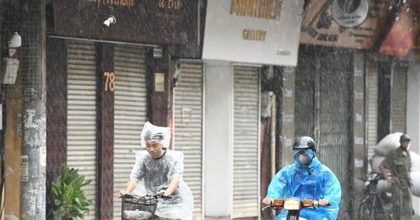
According to the National Center for Hydro-Meteorological Forecasting, last night (June 23) and early this morning (June 24), in the Northern, Central, Central Highlands and Southern regions, there were scattered showers and thunderstorms, locally heavy to very heavy rain with rainfall from 7:00 p.m. on June 23 to 8:00 a.m. on June 24, some places had over 80mm such as: Xuan Minh (Ha Giang) 285.2mm, Ha Lang (Tuyen Quang) 87.2mm, Thach Yen (Hoa Binh) 99.2mm, Quan Hoa (Hanoi) 91.8mm, Chau Cuong (Nghe An) 99mm,...
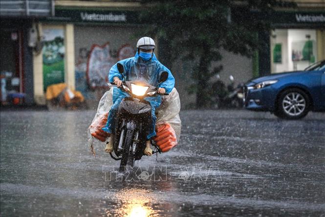
How long will the widespread thunderstorms, tornadoes and lightning in the North last?
From the evening of June 24 to the morning of June 26, in the Northern and North Central regions, there will be moderate rain, heavy rain and thunderstorms, some places will have very heavy rain with common rainfall in the Northern region from 50-120mm, some places over 200mm, in the North Central region 30-70mm, some places over 150mm.
In addition, on June 24, in the North and North Central regions, there will be scattered showers and thunderstorms, locally heavy rain with rainfall from 20-40mm, some places over 80mm. In the afternoon and evening of June 24, in the Central Central region, Central Highlands, and South, there will be scattered showers and thunderstorms, locally heavy rain with rainfall from 10-30mm, some places over 70mm. Warning: from the afternoon and night of June 26, heavy rain in the North is likely to gradually decrease.
Detailed forecast:
Area | Time of impact | Total volume (mm) |
North | From 4pm/6/24 to 1pm/6/26 | 50-120, some places over 200 |
North Central Coast | From 4pm/6/24 to 1pm/6/26 | 30-70, some places over 150 |
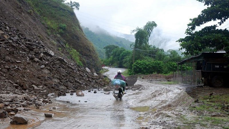
Beware of the risk of flash floods, landslides in mountainous areas and flooding in low-lying areas. Beware of heavy rain in a short period of time causing flooding in urban areas. During thunderstorms, there is a possibility of tornadoes, lightning, hail and strong gusts of wind.
At sea, at Phu Quy island station, there is currently strong southwest wind at level 6; Huyen Tran island station has gusts of level 9. In the Gulf of Tonkin and the sea from Quang Tri to Binh Dinh, Binh Thuan to Ca Mau, Ca Mau to Kien Giang, the Gulf of Thailand, the sea between the East Sea and the South East Sea, there are showers and thunderstorms. On June 24, the sea from Binh Dinh to Ca Mau, the area between the East Sea and the western sea of the South East Sea (including the sea of Truong Sa archipelago) has wind at level 5, sometimes level 6, gusts of level 7-8. Rough sea.
In addition, on the day and night of June 24, in the North East Sea, the Middle East Sea and the South East Sea (including the waters of the Hoang Sa and Truong Sa archipelagos), the Gulf of Tonkin, the waters from Quang Tri to Ca Mau, Ca Mau to Kien Giang and the Gulf of Thailand, there will be showers and strong thunderstorms. During thunderstorms, there is a possibility of tornadoes and strong gusts of wind of level 7-8, beware of wave heights sometimes increasing to over 2.5m.
All vessels operating in the above areas are at high risk of being affected by tornadoes, strong winds and large waves.
Coping with widespread thunderstorms across the North
According to the National Center for Hydro-Meteorological Forecasting, from the evening of June 24 to the morning of June 26, the North will have moderate rain, heavy rain, and in some places very heavy rain with common amounts from 50-120mm, in some places over 200mm; the North Central region from 30-70mm, in some places over 150mm. During thunderstorms, there is a possibility of tornadoes, lightning, hail and strong gusts of wind; there is a risk of flash floods, landslides in mountainous areas and flooding in low-lying areas, urban areas.
In order to proactively respond and minimize damage, the Standing Office of the National Steering Committee for Natural Disaster Prevention and Control requests the Steering Committees for Natural Disaster Prevention and Control and Search and Rescue of provinces and cities to:
1. Closely monitor warning and forecast bulletins; promptly and regularly notify and guide authorities at all levels and people to proactively prevent and minimize damage; prepare on-site forces to promptly support people in overcoming consequences (if any).
2. Deploy shock forces to inspect and review residential areas along rivers, streams, low-lying areas, and areas at high risk of flooding, flash floods, and landslides to proactively clear the flow, organize the relocation and evacuation of people when situations arise.
3. Direct specialized agencies to coordinate with provincial television stations and media agencies, especially at grassroots levels, to propagate, disseminate, and instruct people on how to recognize and respond to thunderstorms with tornadoes, lightning, hail, strong gusts of wind and heavy rain, flash floods, and landslides to minimize damage (some reference documents are posted on the website phongchongthientai.mard.gov.vn).
4. Organize a permanent presence, closely monitor weather and natural disaster developments, and regularly compile reports to the Standing Office of the National Steering Committee for Natural Disaster Prevention and Control.
Propose that the Provincial and Municipal Steering Committees for Disaster Prevention, Control and Search and Rescue pay attention and implement.
Source: https://danviet.vn/mua-dong-loc-set-o-mien-bac-keo-dai-den-bao-gio-20240624112609545.htm

![[Photo] Prime Minister Pham Minh Chinh receives CEO of Standard Chartered Group](https://vstatic.vietnam.vn/vietnam/resource/IMAGE/2025/4/2/125507ba412d4ebfb091fa7ddb936b3b)

![[Photo] Prime Minister Pham Minh Chinh receives Deputy Prime Minister of the Republic of Belarus Anatoly Sivak](https://vstatic.vietnam.vn/vietnam/resource/IMAGE/2025/4/2/79cdb685820a45868602e2fa576977a0)
![[Photo] Comrade Khamtay Siphandone - a leader who contributed to fostering Vietnam-Laos relations](https://vstatic.vietnam.vn/vietnam/resource/IMAGE/2025/4/3/3d83ed2d26e2426fabd41862661dfff2)
![[Photo] Special relics at the Vietnam Military History Museum associated with the heroic April 30th](https://vstatic.vietnam.vn/vietnam/resource/IMAGE/2025/4/3/a49d65b17b804e398de42bc2caba8368)






















Comment (0)