
Proactively releasing spillways and lowering water levels in dams before each heavy rain in Ha Tinh contributes to ensuring the safety of the works and minimizing damage to crops and livestock for people in downstream areas.

Video: Spillway to regulate water in Ke Go Lake.
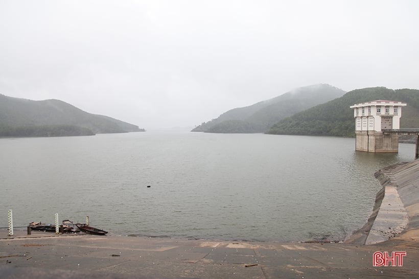
At 2:00 p.m. on November 14, Nam Ha Tinh Irrigation Company Limited regulated Ke Go Lake water through 2 Doc Mieu spillways with a flow rate of 10m3 /second. Along with the spillway discharge, the lake's water level was also lowered through the hydroelectric sluice with a flow rate of 15m3 /second.
Ke Go Lake is located in Cam My Commune (Cam Xuyen District) with an elevation of 32.5m, a capacity of 345 million m3 , and a spillway threshold elevation of 26.5m (the lake water level must be above 26.5m to operate and regulate water through the spillway). The downstream area of Ke Go Lake includes many communes, wards, and towns with tens of thousands of households in Thach Ha, Cam Xuyen districts and Ha Tinh City.
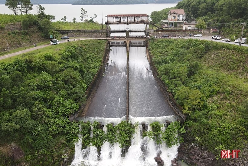
Ke Go Lake regulates water through Doc Mieu spillway from 2:00 p.m. on November 14 with a flow rate of 10m3 /second.
According to engineer Nguyen Van Khoa - an officer of the Ke Go Irrigation Works Exploitation Station (Nam Ha Tinh Irrigation Company Limited), before the water regulation, the elevation of Ke Go reservoir was 30.76m, equivalent to a capacity of 295 million m3 . In case the weather is not rainy or the rain is not too complicated, the reservoir can still hold water up to an elevation of 31.5m, equivalent to a capacity of 315 million m3 .
However, according to the forecast from the Ha Tinh Hydrometeorological Station, from the night of November 15 to 16, a strong air mass will increase, so there will be moderate to heavy rain in Ha Tinh, and very heavy rain on the southern coast. The Nam Ha Tinh Irrigation Company has proactively released water to lower the water level of Ke Go Lake since the afternoon of November 14.
Before the spillway, the elevation of Ke Go lake was 30.76m, with a capacity of 295 million m3 .
In addition to the forecast of widespread heavy rain in Ha Tinh, the spillway of Ke Go Lake is also based on the actual water level in the lake and the water operation and regulation process approved by the People's Committee of Ha Tinh province in Decision No. 1702/QD-UBND dated August 19, 2022 to ensure safety for the project and downstream areas.
Mr. Dang Hoa Binh - Head of Management and Exploitation Department of Nam Ha Tinh Irrigation Company Limited said: Before the time of spillway discharge to regulate water of Ke Go lake, the unit notified the People's Committees of Cam Xuyen, Thach Ha districts, Ha Tinh city and the downstream communes affected in the system, and notified and instructed the people to know and implement safety measures.
According to Mr. Binh, the spillway of Ke Go Lake is a normal regulatory activity to reduce the lake's water level to the correct operating procedure according to the approved plan and reduce the risk of unsafety during the rain on November 16. With the current water level of the lake and the actual water level situation in the downstream area, the spillway of Ke Go Lake is not a cause for concern.
With the current overflow flow and downstream water level, water regulation of Ke Go Lake is not a concern.
Nam Ha Tinh Irrigation Company Limited is managing and operating 33 large and small dams. Recently, due to the situation of continuous heavy rains in the province, the dams in the province are almost full of water, this unit has deployed many operations to release spillways to regulate water at large reservoirs such as: Thuong Song Tri, Kim Son, Da Han, Tau Voi, Song Rac, Boc Nguyen. The small capacity reservoirs, located mainly in Huong Khe district, Ky Anh district, Ky Anh town..., have been filled with water from previous heavy rains and then flow freely through the spillways whenever there is prolonged rain.
According to Mr. Dang Hoa Binh, in addition to Ke Go Lake, other large reservoirs in the area are also being released to lower water levels ahead of the forecast of heavy rain on November 16.
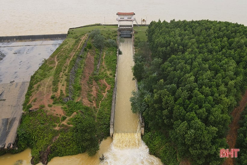
Boc Nguyen Lake is overflowing at a flow rate of 25m3 /second.
Specifically, Song Rac Lake (Cam Lac Commune, Cam Xuyen District), Boc Nguyen Lake (Nam Dien Commune, Thach Ha District), Kim Son Lake, Thuong Song Tri Lake (same commune as Ky Hoa, Ky Anh Town), Da Han Lake (Hoa Hai Commune, Huong Khe District), Tau Voi Lake (Ky Thinh Ward, Ky Anh Town) with discharge flow from 3 - 50 m3 /second.
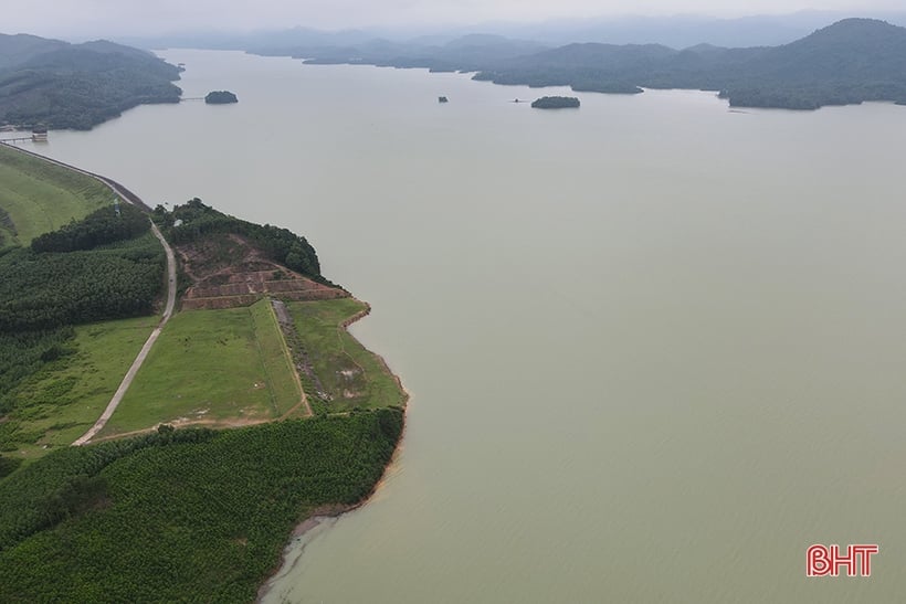
Meanwhile, as of the end of November 14, the water level of Ngan Truoi Lake (Vu Quang) - the largest reservoir in Ha Tinh - was at an elevation of 45.7/52m, equivalent to a capacity of 529.76/775 million m3 , the current water flow to the lake is 75.73m3 /second.
Ngan Truoi Lake located in Vu Quang district is currently a large reservoir in Ha Tinh.
According to Mr. Van Thang - Deputy Head of the Irrigation Investment and Construction Management Board 4 (Ministry of Agriculture and Rural Development), the water level of Ngan Truoi Lake is currently at 68.4% of its capacity. In case there is heavy rain in the coming days with a forecast flow of 50 - 150 mm and concentrated in the southern coastal plains, there is still no problem to worry about. However, the unit closely monitors the actual rain situation in the area, based on the water flow into the lake to have an appropriate response plan.
According to the forecast of Ha Tinh Hydrometeorological Station, on the night of November 15 and 16, the cold air will strengthen, so Ha Tinh will have moderate to heavy rain, the southern coast will have very heavy rain; Northeast wind level 3, coastal level 4, level 5, gusting to level 6, level 7; cold at night and in the morning. From November 17 to 19, the cold air is stable, after weakening slowly, the clouds will decrease, there will be no rain, there will be sunshine in some places during the day, the highest temperature is 22 - 24 degrees Celsius, the temperature will drop at night, in mountainous areas it can drop to 12 - 14 degrees Celsius, in coastal plains 14 - 16 degrees Celsius; Northeast wind level 3; coastal areas level 4, sometimes level 5, gusting to level 6; cold at night and morning. Rainfall forecast is 50 - 100 mm, especially in the southern coastal plain of the province 80 - 150 mm. Due to low temperatures at night, especially on November 17-19, there is a risk of negative impacts on production and life. Measures need to be taken to keep crops and livestock warm, especially in mountainous areas. The difference in day and night temperatures is large, so it is necessary to keep warm to avoid heat shock which can have a negative impact on health, especially for the elderly, children, and people with underlying diseases. At sea, strong winds and big waves can adversely affect fishing, farming and shipping activities. |
Precious Stone
Source


Comment (0)