
Latest tropical depression news: At 1 p.m., the center of the tropical depression was at about 12.3 degrees North latitude; 112.0 degrees East longitude, in the northwest area of Truong Sa archipelago. The strongest wind near the center of the tropical depression is level 6 (39-49 km/h), gusting to level 8; moving northwest at a speed of 5-10 km/h.
Latest tropical depression news
According to the latest news from the National Center for Hydro-Meteorological Forecasting, at 1:00 p.m. on February 12, the center of the tropical depression was determined to be at about 12.3 degrees North latitude, 112.0 degrees East longitude, in the northwest area of Truong Sa archipelago. The area near the center of the tropical depression has the strongest wind speed of level 6 (39-49 km/h), gusting to level 8. The tropical depression is moving northwest at a speed of 5-10 km/h.
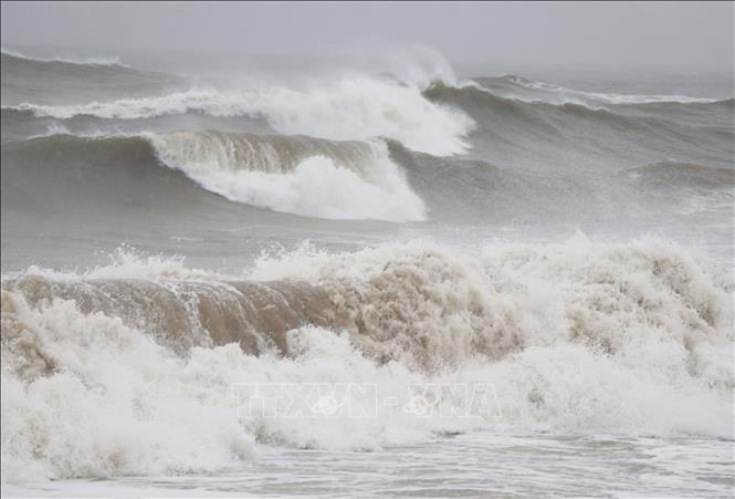
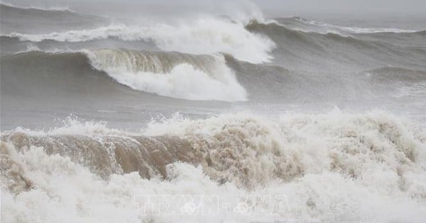
In early 2025, the East Sea welcomed a tropical depression. Illustration photo: VNA
It is forecasted that by 1:00 p.m. on February 13, the tropical depression will move northwest at a speed of about 5 km/h, with its center located at about 13.0 degrees North latitude and 111.3 degrees East longitude, in the western sea area of the central East Sea. Its intensity will remain at level 6, gusting to level 8.
The dangerous area at sea is determined between 11.0-14.5 degrees North latitude and 110.0-113.5 degrees East longitude. The natural disaster risk level is at level 3, affecting the western area between the East Sea and the offshore waters from Binh Dinh to Khanh Hoa.
At 1:00 p.m. on February 14, the tropical depression continued to move northwest at a speed of about 5 km/h, with its center located at about 14.0 degrees North latitude and 110.5 degrees East longitude, offshore from Quang Ngai to Phu Yen. Its intensity remained at level 6, gusting to level 8.
The danger zone has expanded from 11.5 to 15.5 degrees North latitude, west of the 112.5 degree East meridian. The disaster risk level remains at level 3, affecting the western region between the East Sea and offshore waters from Quang Ngai to Phu Yen.
During the next 48 to 72 hours, the tropical depression will move slowly in the Northwest direction and tend to weaken gradually.
At sea, the western area of the East Sea, the southwestern sea of the North East Sea and the offshore sea from Binh Dinh to Khanh Hoa will have showers and thunderstorms. Strong winds of level 6, gusting to level 8, causing rough seas.
In the western sea area between the East Sea and the southwestern sea area of the North East Sea, including the Hoang Sa archipelago, waves are forecast to be 2.0-3.5 m high. From February 14, the offshore sea area from Thua Thien Hue to Binh Dinh will have waves 2.0-3.0 m high.
Vessels operating in the danger zone are likely to be affected by storms, whirlwinds, strong winds and large waves. Weather forecasts should be closely monitored to take timely response measures.
Provinces and cities from Quang Ngai to Kien Giang proactively respond to tropical depression
On February 12, the Ministry of Agriculture and Rural Development issued Official Dispatch No. 949/CD-BNN-DD on responding to tropical depression in the East Sea.
To proactively respond to the tropical depression, the Minister of Agriculture and Rural Development requested ministries, branches, and Chairmen of People's Committees of coastal provinces and cities from Quang Ngai to Kien Giang to closely monitor the developments of the tropical depression; strictly manage means of transport going out to sea; organize counting and notify owners of means of transport, captains of ships and boats operating at sea of the location, direction of movement and developments of the tropical depression to proactively avoid, escape or not move into dangerous areas. Dangerous areas in the next 24 hours: From 10 - 14 degrees North latitude, 110 - 114 degrees East longitude (dangerous areas are adjusted in forecast bulletins).
Ministries and branches, according to their functions, state management tasks and assigned tasks, shall proactively direct and coordinate with localities in responding to tropical depressions; prepare forces and means for rescue when required, and at the same time organize serious on-duty shifts and regularly report to the Ministry of Agriculture and Rural Development (through the Department of Dyke Management and Disaster Prevention and Control).
Vietnam News Agency, Vietnam Television, Voice of Vietnam, the coastal information station system and mass media agencies from central to local levels should increase information on the developments of the tropical depression to authorities at all levels, owners of means of transport operating at sea and people to proactively prevent and respond.
According to the National Center for Hydro-Meteorological Forecasting, on the morning of February 12, the low pressure area in the central East Sea strengthened into a tropical depression. At 1 p.m., the center of the tropical depression was at about 12.3 degrees North latitude; 112 degrees East longitude, in the northwest area of Truong Sa. The strongest wind near the center of the tropical depression is level 6 (39 - 49 km/h), gusting to level 8. It is forecasted that in the next 24 hours, the tropical depression will move northwest at a speed of about 5 km/h. The strongest wind is level 6, gusting to level 8.
Source: https://danviet.vn/nong-cap-nhat-nhanh-nhat-duong-di-cua-ap-thap-nhet-doi-dau-tien-2025-dang-huong-thang-vao-nuoc-ta-20250212152142796.htm


Comment (0)