
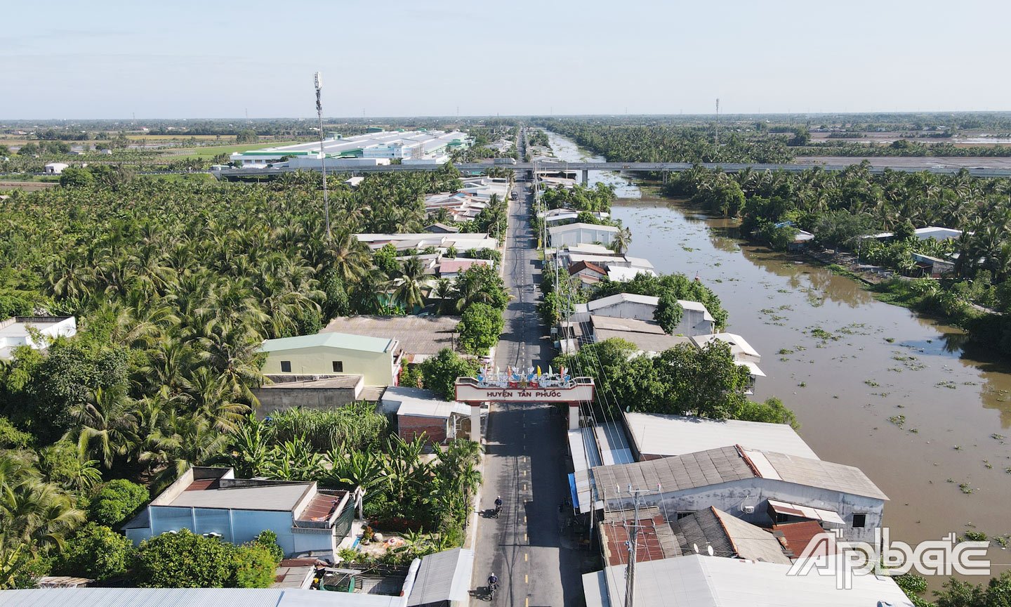
“One center, two multi-dimensional routes, two breakthroughs, three dynamic regions” is the development space orientation of Quang Ninh that the province has persistently implemented over the past 10 years. This orientation continues to be pursued by Quang Ninh, clarified in the Provincial Planning for the period 2021-2030, with a vision to 2050. Quang Ninh is prioritizing investment resources and creating development space.
Developing "heart" and "line" according to planning
Thoroughly implementing the spirit of the Resolution of the 13th National Party Congress on planning and organizing the national development space; closely following the Planning of Quang Ninh province for the period 2021-2030, with a vision to 2050... Quang Ninh has identified the potential and advantages of the locality, persistently implementing the development space of "one center, two multi-dimensional routes, two breakthroughs, three dynamic regions", creating traffic corridors associated with economic corridors, urban corridors, towards building a centrally-run city and promoting intra-regional linkages, regional linkages, territorial division and cooperation, ensuring potentials, strengths, comparative advantages, and competitive advantages.
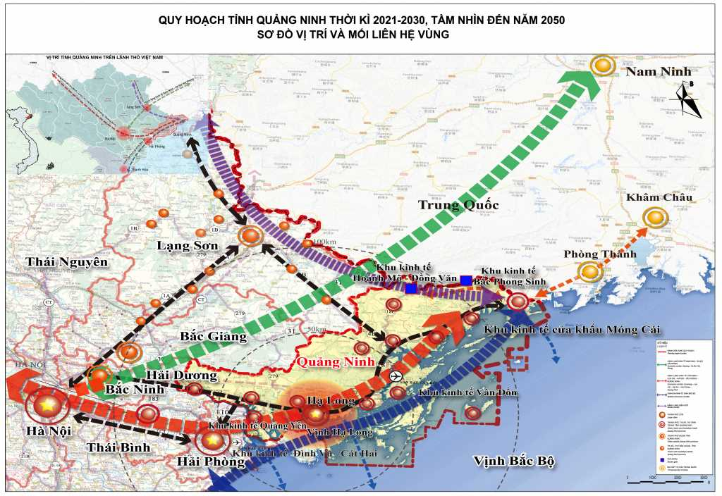
Accordingly, the "heart" is Ha Long City, the political - administrative - economic - cultural center of the province; urban development according to a multi-polar model, taking Cua Luc Bay as the center of connection, expanding the urban area to the North. Two routes include: The Western corridor route starts from Ha Long to Dong Trieu towards the Red River Delta and the capital Hanoi, oriented to develop a chain of green urban - industrial, clean industry, high technology and cultural, historical and spiritual tourism. In which, Quang Yen coastal economic zone is the "nucleus", the new growth engine of the Western route and of the province, developing according to the "Smart City" model with smart, modern industrial - service - urban - seaport zones, processing, manufacturing and high-tech industrial centers. The Eastern corridor route starts from Ha Long to Mong Cai and targets the Northeast Asian market; Develop a chain of ecological urban areas - high-end services, trade, tourism, clean agriculture - high technology and marine economy; take industrial development to lead agriculture.
To promote the early formation of "centers" and "routes" according to the planning, Quang Ninh creates traffic corridors associated with economic corridors, urban corridors, promoting intra-regional and regional linkages. At the same time, assigning and cooperating territories, ensuring that the potentials, strengths, comparative advantages, and competitive advantages of each locality of the province are placed in close relationship with the Northern dynamic triangle, the Northern key economic region, and the Red River Delta are maximized, complementing each other, and developing together. On that basis, strictly manage, reasonably and effectively use land resources, natural resources, minerals, forest resources, and marine resources for the goal of sustainable development, green growth, and adaptation to climate change. The province strives to become a centrally-run city by 2030 on the basis of forming an inner-city area including 7 cities: Ha Long, Cam Pha, Uong Bi, Mong Cai - Hai Ha, Dong Trieu, Quang Yen, Van Don and re-establishing Tien Yen town.
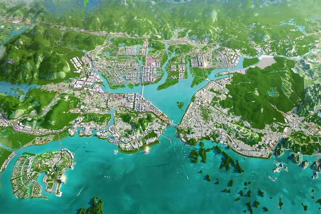
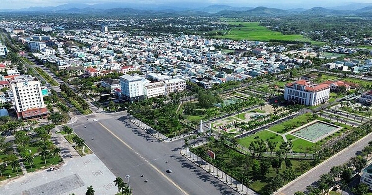
Ha Long City has a special economic geographical position, being the "heart" in the spatial development orientation of Quang Ninh. Also because of this particularly important role, in the Master Plan of Ha Long City until 2040 approved by the Prime Minister, Ha Long is oriented to develop according to the model of a smart urban area, sustainable development adapting to climate change, in accordance with the green growth requirements of the province...
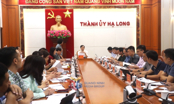
Comrade Nguyen Tien Dung, Chairman of Ha Long City People's Committee, said: Immediately upon receiving the Planning, the city will publicly announce the Planning project according to regulations, issue plans and decisions, establish and submit to the Provincial People's Committee for approval of zoning planning projects, urban development programs, architectural management regulations and promote investment in key traffic routes, connections to create development momentum.
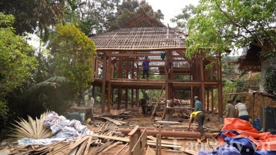
Since the beginning of the term, Ha Long City has prioritized resources to invest in over 60 projects and works with a total investment of over 4,000 billion VND to develop infrastructure, especially transportation, culture, education, clean water... in mountainous communes, highlands, remote areas. According to the plan, by 2025, there will be dozens of new projects and works deployed, aiming to create momentum and expand development space for Ha Long.

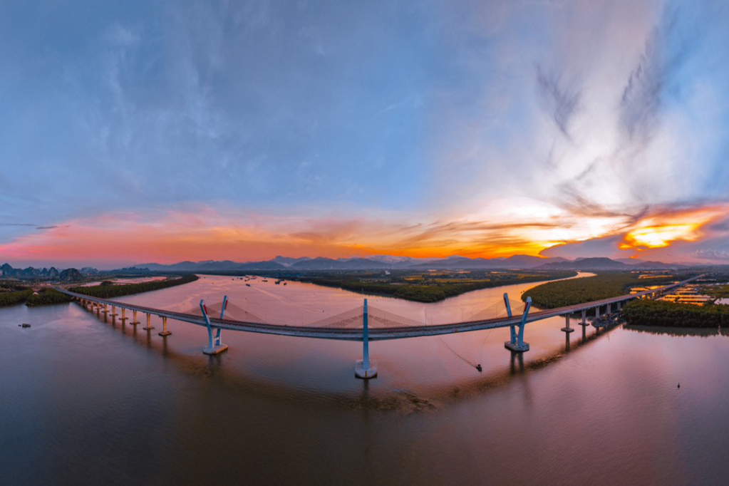
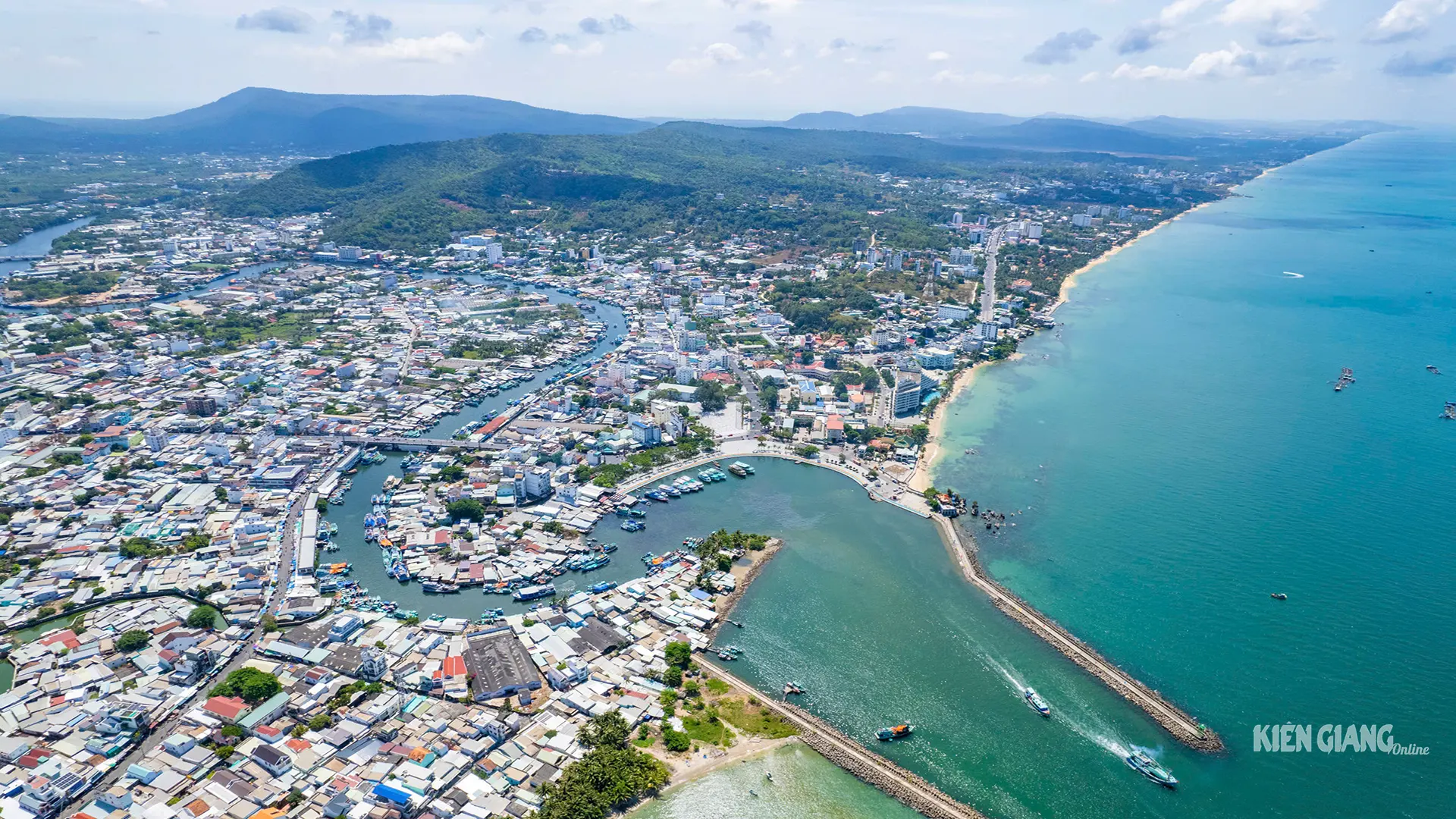
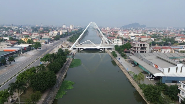
Ha Long today has a strong development of urban infrastructure, it is possible to imagine the space, the structural model in a multi-polar direction with the role of the connecting center of Cua Luc Bay. With the priority and attention of the province, the Love and Binh Minh bridges are the key connecting points, closing the space of Cua Luc Bay has been formed. The routes surrounding the bay are gradually being synchronized, invested thoroughly with the goal of creating new development space. The area around the bay is being urbanized, implementing many new investment projects to effectively exploit land funds in a direction suitable for green growth requirements and adapting to climate change.
Ha Long Bay area is gradually connecting space with Bai Tu Long Bay, Lan Ha Bay, Cat Ba Island. The Eastern region has formed administrative - political centers with important administrative headquarters of the province; the Western region is a new space for urban areas, international tourism and entertainment services... with a series of new urban projects worth billions of USD undertaken by leading Vietnamese corporations such as Vingroup, Sun Group, BIM Group and Tuan Chau Group that have been investing and constructing. From there, the Western region of Ha Long City becomes a modern, high-quality living space.
And finally, the northern mountainous region is oriented with the functions of ecological conservation, agricultural and forestry production, and community ecotourism, which is gradually taking shape when the city is focusing resources on prioritizing the simultaneous development of new connecting routes from lowland to highland areas such as the road connecting Son Duong to Dong Son, Dong Lam and preparing to deploy to Ky Thuong. This investment priority not only creates conditions for the northern region of Ha Long to develop, the people in the highlands to improve their lives, but also contributes significantly to attracting investment and promoting the land area that still has a lot of potential.
It can be seen that, with its own strategy for development and expansion of space, the role of the "Heart" of Ha Long City has been gradually formed. The Planning not only helps the city solve the problem of space allocation for development goals, but also removes the basic bottlenecks of land space, overloaded technical infrastructure and lack of synchronization of traffic infrastructure, which were bottlenecks of the two localities of Ha Long - Hoanh Bo before the merger.
New driving force for development in the West
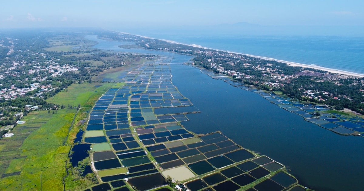
Looking back at previous years, the western region of the province had many "bottlenecks" that limited socio-economic development. Quang Yen Town has many potentials and advantages, being a regional and coastal urban connection center with over 200 years of construction and development, but development opportunities are limited because the main traffic route is National Highway 18, which is short and far from the center. The rudimentary traffic infrastructure connects the region with small, degraded provincial roads and an outdated ferry system that takes a long time to travel. This has hindered the development of the regional economy and lacks attractiveness in attracting investment.
Based on the practical requirements for the new development orientation, closely following the planning and organization of the province's territorial space, concretizing the planning to build the western region into a gateway, economic center, seaport center, cultural and spiritual tourism center... Quang Ninh has prioritized investment in this area with the expectation of creating a driving force for development, an economic locomotive, and growth of the province.
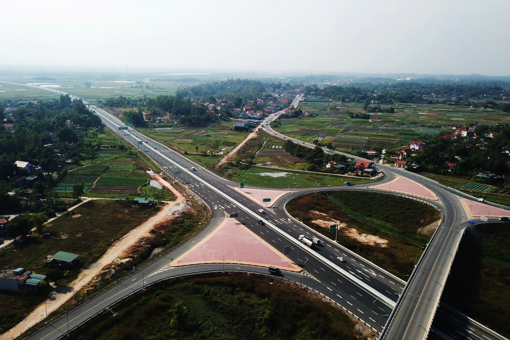
Accordingly, right after the Bach Dang bridge, the provincial highway axis was formed, choosing Quang Yen as the new gateway of the province, Quang Ninh prioritized resources to invest in a new transport infrastructure chain connecting the western region, such as: Dam Nha Mac and Ha Long Xanh intersections, the riverside road connecting Ha Long - Hai Phong highway with Dong Trieu town, accompanying Hai Phong city to build Ben Rung and Lai Xuan bridges to replace the previous ferry transportation method. These are projects of special significance, the driving force to create a breakthrough in attracting investment, increasing productivity, quality, efficiency and competitiveness of the economy.
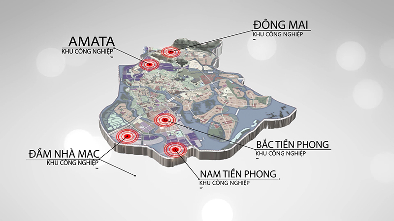
With strategic thinking, long-term vision, proactively grasping opportunities, potentials, and unique advantages... Quang Ninh's priority investment in the Western region has turned this large, potential-rich region into a strong development area, possessing synchronous and modern infrastructure. The investment in traffic infrastructure has turned the region into a regional connection center, traffic works have become the "backbone" and most vital routes leading investors to the area. This is also the region with the most industrial parks in the province up to this point, with more than 100 secondary investors from 13 countries operating in production and business. Currently, the "wave" of investment in the Western region of the province continues to increase with many million-dollar projects.
Along with possessing a central geographical location, located in the economic development corridor of Northern Vietnam when connecting economy, trade, services with coastal economic zones such as Van Don, Cat Hai, Thai Binh and processing and manufacturing industrial centers such as Bac Ninh, Bac Giang..., the attention, investment in infrastructure, and priority development for the Western route are also important conditions for the Prime Minister to approve and supplement the Quang Yen coastal economic zone with an area of 13,303 hectares, including complex urban areas, industry, high technology in Uong Bi City and Quang Yen Town to the coastal economic zones of Vietnam; the driving force for Dong Trieu Town to build into the 5th city of the province; become an important connection point of the Eastern expressway axis connecting a series of industrial parks, urban areas, centers connecting 3 international airports (Noi Bai, Cat Bi, Van Don) and the system of international seaports, creating a large economic zone.
Prioritizing investment and development of the western route of the province also contributes significantly to promoting land area, creating landscapes - architectural works bearing local identity to serve tourism development when connecting the relic and scenic complex of Yen Tu, Tran Dynasty, creating the basis for UNESCO to recognize the relic and scenic complex of Yen Tu as a world heritage, the second world heritage that Quang Ninh province owns...
With the strong shift from global value chains, the planning fully converges the province's intelligence, development aspirations, proactiveness, and foresight, clearly demonstrating its strategic vision..., the orientations in a long-term development plan from the Provincial Planning for the period 2021-2030, with a vision to 2050, are helping Quang Ninh eliminate fragmented and local approaches and create an important foundation for development and brand building, to become a comprehensive growth pole of the Northern region.
Source
![[Photo] Prime Minister Pham Minh Chinh chairs meeting to discuss tax solutions for Vietnam's import and export goods](https://vstatic.vietnam.vn/vietnam/resource/IMAGE/2025/4/10/19b9ed81ca2940b79fb8a0b9ccef539a)
![[Photo] Unique folk games at Chuong Village Festival](https://vstatic.vietnam.vn/vietnam/resource/IMAGE/2025/4/10/cff805a06fdd443b9474c017f98075a4)
![[Photo] Phuc Tho mulberry season – Sweet fruit from green agriculture](https://vstatic.vietnam.vn/vietnam/resource/IMAGE/2025/4/10/1710a51d63c84a5a92de1b9b4caaf3e5)


Comment (0)