
A strong cold front is moving towards our country and is starting to affect the northern provinces. It is forecasted that the cold front will have the strongest impact on February 7-8.
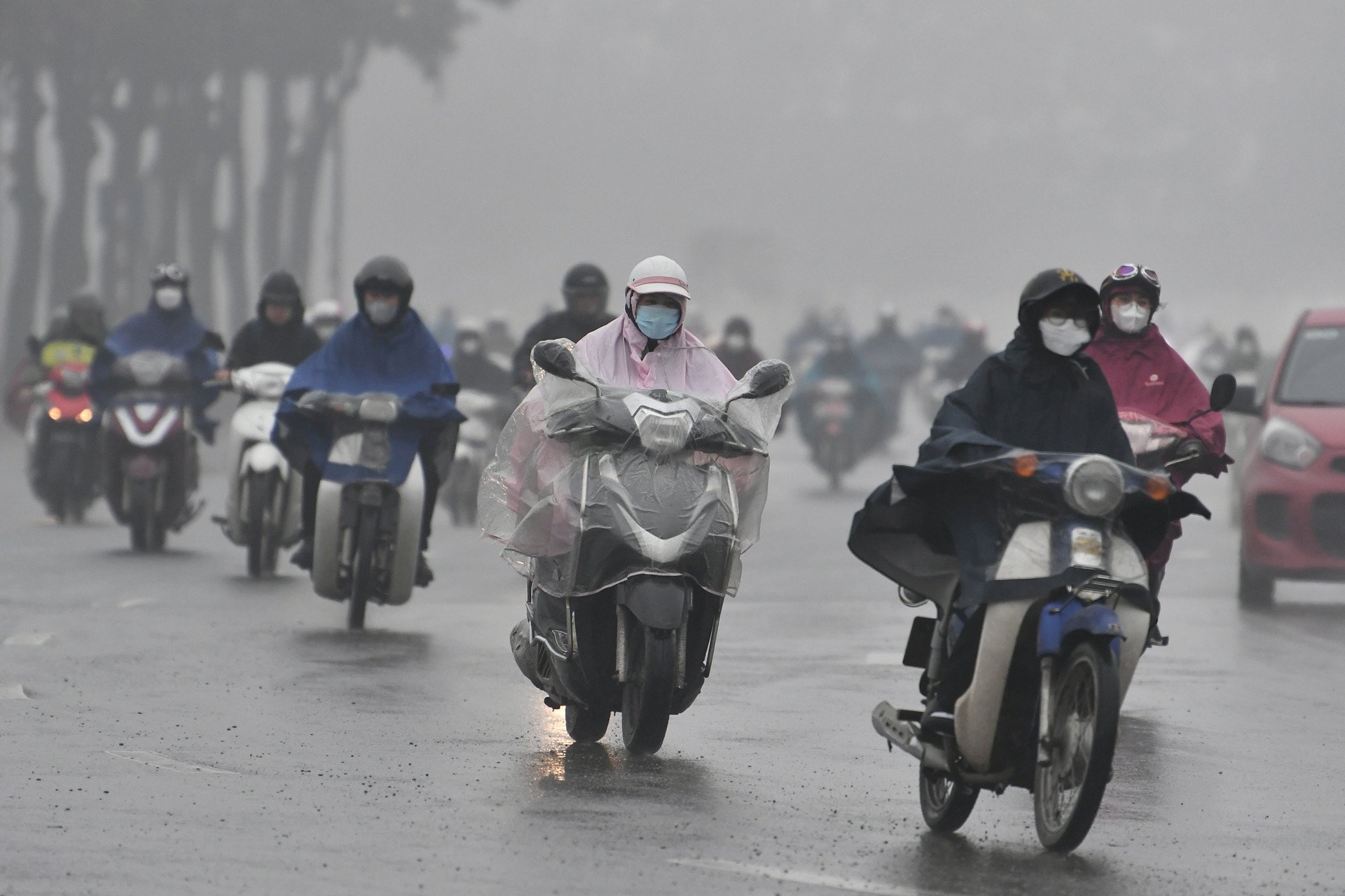
According to Mr. Nguyen Van Huong - Head of Weather Forecast Department, National Center for Hydro-Meteorological Forecasting, from today (February 7), a new monsoon and cold air will affect our country. The Northern provinces will continue to experience light rain in the Northern region until around the 8th, after which light rain, drizzle and fog will end.
"The time when the cold air has the strongest impact is on February 7-8," Mr. Huong commented.
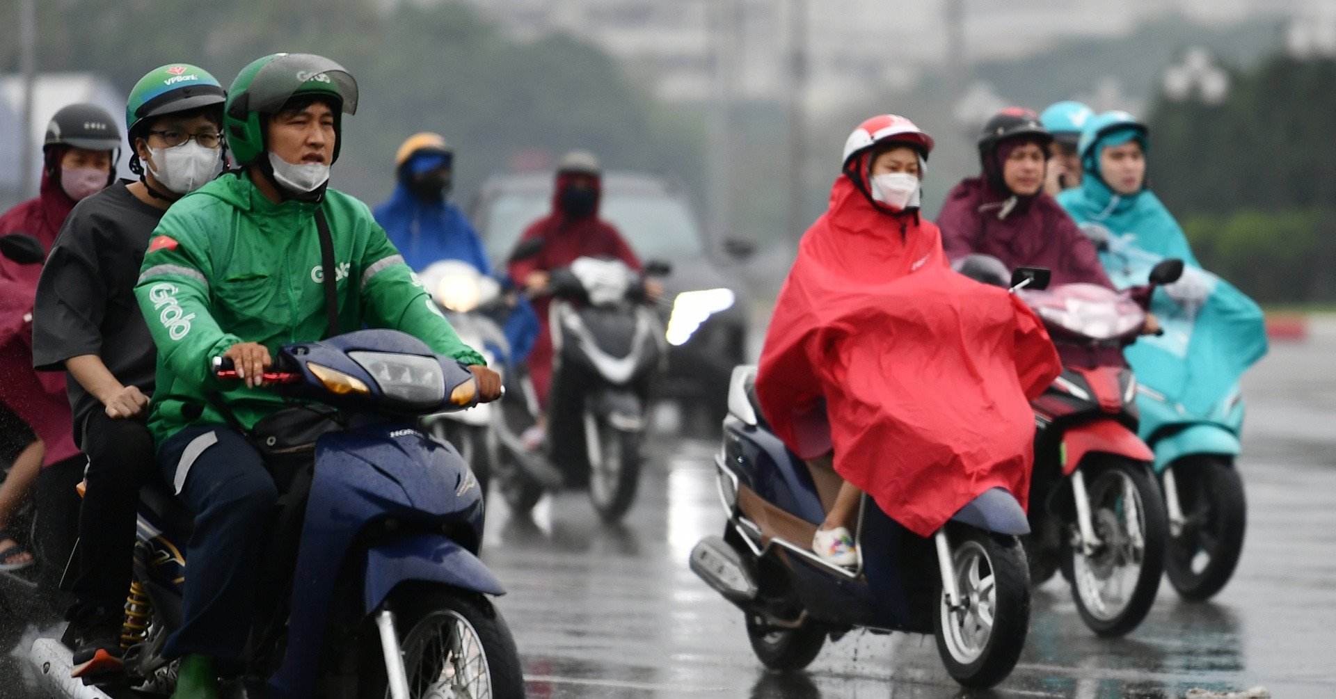
The National Center for Hydro-Meteorological Forecasting said that this morning, cold air has affected the entire Northeast region, some places in the Northwest and North Central regions. In the Gulf of Tonkin, there are strong Northeast winds of level 7, gusting to level 8.
Today and tonight, this cold air mass will continue to affect other places in the Northwest, North and Central Central regions, then affect some places in the South Central region. Northeast wind inland will strengthen to level 3, coastal areas level 3-4, some places will have gusts of level 6.
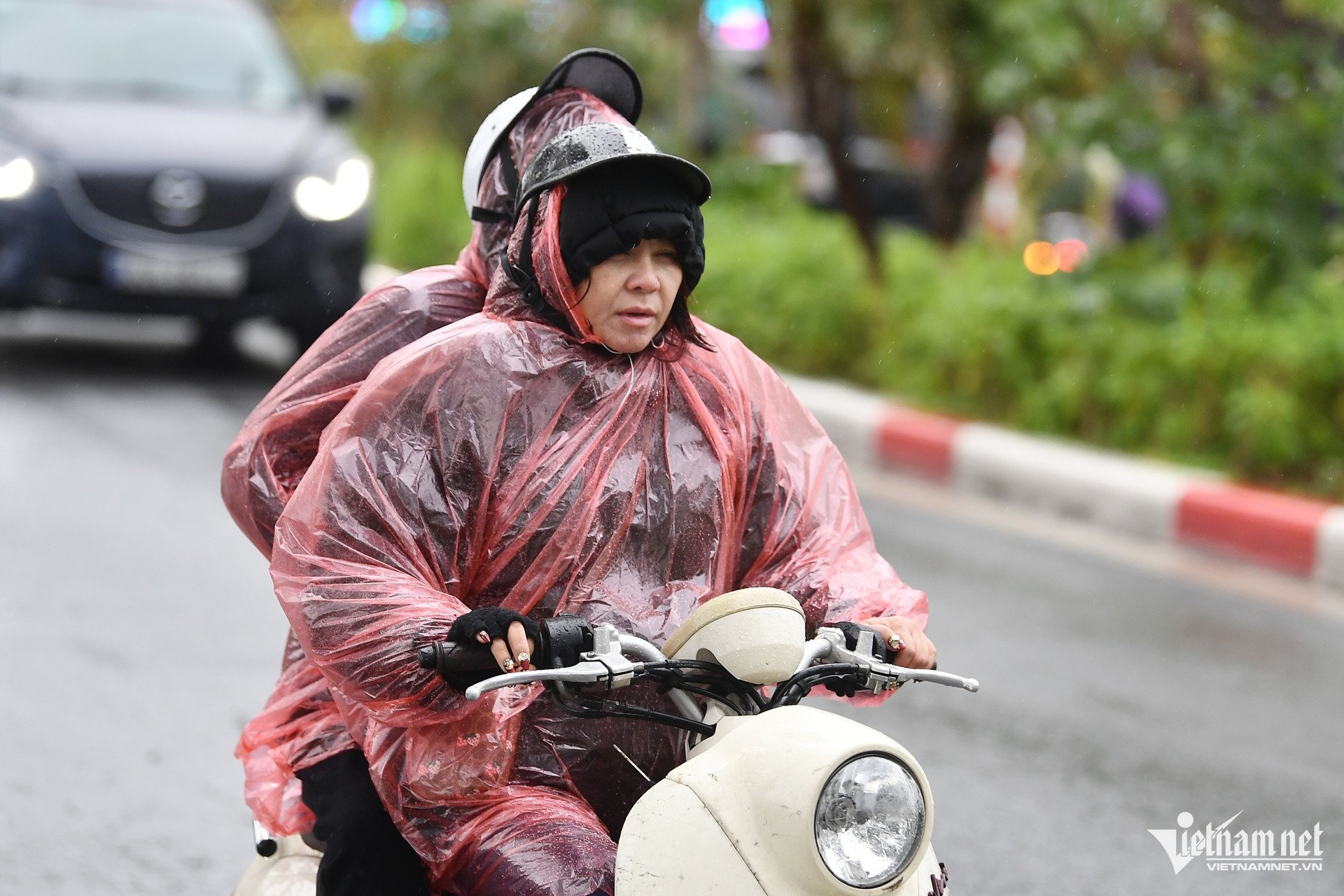
The strong cold air makes the North turn very cold, very cold; from tonight the North Central region will turn very cold, the area from Quang Binh to Hue will be very cold, some places will be very cold.
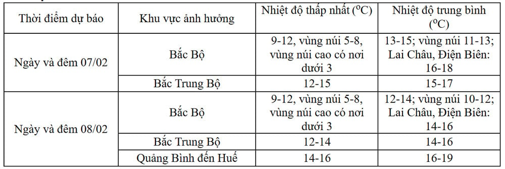
“The lowest temperature in this cold air mass in the North is generally 9-12 degrees, in mountainous areas 5-8 degrees, in high mountainous areas below 3 degrees; in the North Central region 11-14 degrees, from Quang Binh to Hue 14-16 degrees,” the meteorological agency noted.
Hanoi weather from today will be very cold, some places will be very cold. The lowest temperature in this cold air mass is commonly 10-12 degrees.
The meteorological agency also said that the widespread cold spell in the North and North Central provinces is likely to last until around February 10.
Due to the influence of the cold air strengthening combined with the strong current in the upper westerly wind zone, from today until tomorrow morning, the Northern region and Thanh Hoa will have rain; from February 7-9, from Nghe An to Khanh Hoa, there will be rain, showers, locally heavy rain and thunderstorms. During thunderstorms, there is a possibility of tornadoes, lightning and strong gusts of wind.
Notably, cold air also makes the high mountainous areas of the North susceptible to snow and ice.
It is forecasted that in February, the main winter month, the northern provinces and cities will be affected by many cold air waves and there is still a possibility of widespread severe cold in the Northern and North Central regions.
Weather at sea From the morning of February 7, in the Gulf of Tonkin, the Northeast wind is strong at level 6, sometimes at level 7, gusting to level 8-9, rough seas, waves 2-4m high; in the North East Sea (including the waters of Hoang Sa archipelago), the Northeast wind is strong at level 6, then increasing to level 7, especially in the East, sometimes at level 8, gusting to level 9-10, rough seas, waves 5-7m high. From the afternoon of February 7, the sea area from Quang Tri to Ca Mau, the area between the East Sea and the sea area west of the South East Sea (including the sea area west of Truong Sa archipelago) will have northeast winds gradually increasing to level 6, sometimes level 7, gusting to level 8-9, rough seas, waves 4.0-6.0m high. From the night of February 7, the sea area east of the South China Sea (including the sea area east of Truong Sa archipelago) will have northeast winds gradually increasing to level 6, gusting to level 7-8, rough seas, and waves 4-6m high. |
Hanoi weather for the next 3 days: Peak drizzle, north wind, lowest temperature 10 degrees

Welcoming very strong cold air, the North is again immersed in cold weather
Source: https://vietnamnet.vn/khong-khi-lanh-manh-tran-ve-mien-bac-cao-diem-mua-phun-gia-ret-2369202.html
![[Photo] General Secretary To Lam receives French Ambassador to Vietnam Olivier Brochet](https://vstatic.vietnam.vn/vietnam/resource/IMAGE/2025/4/17/49224f0f12e84b66a73b17eb251f7278)

![[Photo] Promoting friendship, solidarity and cooperation between the armies and people of the two countries](https://vstatic.vietnam.vn/vietnam/resource/IMAGE/2025/4/17/0c4d087864f14092aed77252590b6bae)
![[Photo] Closing of the 4th Summit of the Partnership for Green Growth and the Global Goals](https://vstatic.vietnam.vn/vietnam/resource/IMAGE/2025/4/17/c0a0df9852c84e58be0a8b939189c85a)
![[Photo] National Assembly Chairman Tran Thanh Man meets with outstanding workers in the oil and gas industry](https://vstatic.vietnam.vn/vietnam/resource/IMAGE/2025/4/17/1d0de4026b75434ab34279624db7ee4a)
![[Photo] Nhan Dan Newspaper announces the project "Love Vietnam so much"](https://vstatic.vietnam.vn/vietnam/resource/IMAGE/2025/4/17/362f882012d3432783fc92fab1b3e980)


![[Photo] Welcoming ceremony for Chinese Defense Minister and delegation for friendship exchange](https://vstatic.vietnam.vn/vietnam/resource/IMAGE/2025/4/17/fadd533046594e5cacbb28de4c4d5655)


![[Video] Viettel officially puts into operation the largest submarine optical cable line in Vietnam](https://vstatic.vietnam.vn/vietnam/resource/IMAGE/2025/4/17/f19008c6010c4a538cc422cb791ca0a1)


Comment (0)