
According to the latest cold air forecast from the National Center for Hydro-Meteorological Forecasting, due to the influence of cold air, in the North from the night of February 2, it will be cold, in the mountainous areas of the North it will be very cold, with some places experiencing severe cold; in the North Central region from February 3, it will be cold; in the area from Quang Binh to Hue from the night of February 3, it will be cold.
Latest cold air news
According to the National Center for Hydro-Meteorological Forecasting, currently (February 2), the cold air mass is still moving south.
Latest cold air news: From the night of the 5th to the 6th of Tet, cold air will flow in, bringing scattered showers and causing the temperature in the North to drop sharply.
It is forecasted that around the evening and night of February 2, this cold air mass will affect the Northeast region, then affect the Northwest, North Central, Central Central and some places in the South Central. The wind will change to the Northeast inland, strengthening to level 3, coastal areas to level 3-4, with some places having gusts of level 6.
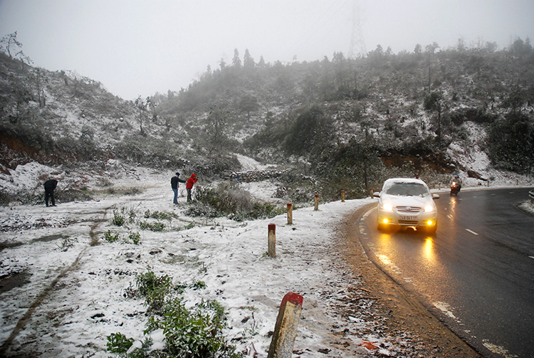
In the North from the night of February 2, it will be cold, in the mountainous areas of the North it will be very cold, with some places experiencing severe cold; in the North Central region from February 3, it will be cold; in the area from Quang Binh to Hue from the night of February 3, it will be cold. The lowest temperature during this cold air mass in the North and North Central regions is generally 11-14 degrees, in the mountainous areas of the North it is 8-10 degrees, in the high mountainous areas it is below 6 degrees in some places; in the area from Quang Binh to Hue it is generally 15-17 degrees.
Hanoi area from the night of February 2nd, the weather is cold. The lowest temperature in this cold air mass is commonly 12-14 degrees.
At sea, from the night of February 2, in the Gulf of Tonkin, the wind will change direction to strong Northeast level 6, sometimes level 7, gusting to level 8-9, rough seas, waves 2.0-3.0m high. From February 3, in the North East Sea area (including the sea area of Hoang Sa archipelago), the Northeast wind will gradually increase to level 6-7, gusting to level 8-9, rough seas, waves 3.0-5.0m high. From the night of February 3, in the sea area from Quang Tri to Binh Thuan, the area between the East Sea and the western sea area of the South East Sea area (including the sea area west of Truong Sa archipelago), the Northeast wind will gradually increase to level 6, sometimes level 7, gusting to level 8-9, rough seas, waves 2.0-4.0m high.
Due to the influence of cold air, from the evening and night of February 2-3, the Northern region will have scattered rain and showers; from early morning of February 3-4, the Northern and Central Central regions will have rain and showers, locally with moderate rain, heavy rain and thunderstorms. There is a possibility of severe cold in mountainous areas. During thunderstorms, there is a possibility of tornadoes, lightning and strong gusts of wind.
Thunderstorms accompanied by tornadoes, lightning and strong gusts of wind can affect agricultural production, cause trees to fall, damage houses, traffic works and infrastructure.
Localized heavy rains can cause flooding in low-lying areas; flash floods in small rivers and streams, and landslides on steep slopes.
Strong winds and large waves at sea are likely to affect shipping and other activities. Severe cold weather is likely to affect crops and livestock.
Source: https://danviet.vn/tin-khong-khi-lanh-moi-nhat-khong-khi-lanh-don-dap-ngay-dem-nay-co-noi-cuc-ret-duoi-6-do-c-20250202124716645.htm


Comment (0)