
Commenting on the development of the low pressure, on July 14, Head of the Weather Forecast Department, National Center for Hydro-Meteorological Forecasting Nguyen Van Huong said that on the evening of July 13, a tropical depression had formed in the sea east of the Philippines. On the morning of July 14, a tropical depression with strong winds of level 6 was active in the eastern region of the Philippines.
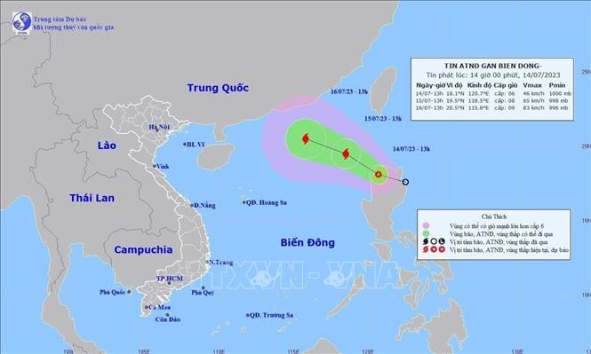
The low pressure area is likely to strengthen into a storm. Photo: VNA
According to forecasts, on the night of July 14 and 15, the tropical depression will enter the East Sea, with the potential to strengthen into a storm.
Mr. Nguyen Van Huong analyzed that there will be two scenarios for the development of the tropical depression that is likely to strengthen into a storm.
Scenario 1 (high possibility), the tropical depression is likely to strengthen into a storm, move north and make landfall in China (probability about 50 - 60%). This is the bad weather scenario that mainly occurs in the East Sea.
In the second scenario, the tropical depression that is likely to strengthen into a storm will change direction to the West and move into the mainland of our country (probability about 40 - 50%). With this development, the tropical depression that is likely to strengthen into a storm will affect the mainland around July 17 - 19 and cause heavy rain in the Northern and North Central regions.
“However, the development of the low pressure is still subject to many changes due to the impact of many weather patterns. In the next 24 hours, the tropical depression is likely to strengthen into a storm, causing strong winds of level 6-7 and heavy thunderstorms in the northern East Sea. The level of strong winds will likely increase depending on the development of the storm intensity,” Mr. Nguyen Van Huong emphasized.
In addition, the southern area of the East Sea is being strongly affected by the southwest monsoon at level 6, gusting to level 8. In the coming time, this area (including the sea area of Truong Sa as well as the sea area from Binh Thuan - Ca Mau) will have strong southwest winds at level 6 - 7, big waves, and rough seas.
Mr. Nguyen Van Huong warned that the tropical depression will greatly affect the activities of ships, boats and production activities at sea.
According to the guidance of the Standing Office of the National Steering Committee for Natural Disaster Prevention and Control, in order to proactively respond to tropical depressions, relevant provinces, cities, ministries and branches need to regularly and closely monitor the developments of tropical depressions; strictly manage means of transport going out to sea; organize counting and notify owners of means of transport, captains of ships and boats operating at sea of the location, direction of movement and developments of tropical depressions to proactively avoid, escape or not move into dangerous areas; be ready with forces and means for rescue when required./.
According to VNA
Source
![[Photo] Closing of the 4th Summit of the Partnership for Green Growth and the Global Goals](https://vstatic.vietnam.vn/vietnam/resource/IMAGE/2025/4/17/c0a0df9852c84e58be0a8b939189c85a)
![[Photo] Promoting friendship, solidarity and cooperation between the armies and people of the two countries](https://vstatic.vietnam.vn/vietnam/resource/IMAGE/2025/4/17/0c4d087864f14092aed77252590b6bae)
![[Photo] Nhan Dan Newspaper announces the project "Love Vietnam so much"](https://vstatic.vietnam.vn/vietnam/resource/IMAGE/2025/4/17/362f882012d3432783fc92fab1b3e980)
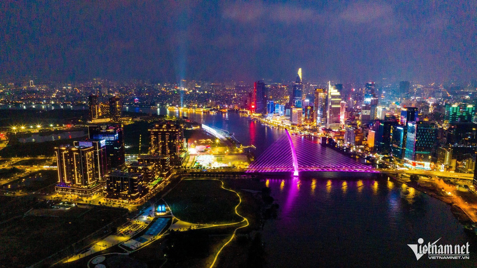
![[Photo] The beauty of Ho Chi Minh City - a modern "super city" after 50 years of liberation](https://vstatic.vietnam.vn/vietnam/resource/IMAGE/2025/4/18/81f27acd8889496990ec53efad1c5399)

![[Photo] National Assembly Chairman Tran Thanh Man meets with outstanding workers in the oil and gas industry](https://vstatic.vietnam.vn/vietnam/resource/IMAGE/2025/4/17/1d0de4026b75434ab34279624db7ee4a)


![[Photo] General Secretary To Lam receives French Ambassador to Vietnam Olivier Brochet](https://vstatic.vietnam.vn/vietnam/resource/IMAGE/2025/4/17/49224f0f12e84b66a73b17eb251f7278)


Comment (0)