

And not only the first lesson but also the history of many dynasties, many generations, poetry, music and paintings pouring out the hearts of many generations of artists have been spread along this road for thousands of years. National highway - mandarin road - royal road - southern road - the road of Vietnamese history...
Vehicles moving on National Highway 1 towards Huu Nghi international border gate, Lang Son province - Photo: HA QUAN
This Tet, many vehicles are traveling back and forth on Highway 1 from the North to the South to the Central, in a feeling of homesickness, not knowing who will stop to visit the scenery, who will look at the old signs and remember thousands of years ago, the Dai Viet Nam conquest armies, the princesses who boarded boats far from home, the groups of Vietnamese migrants who went South to reclaim land, bringing rice plants imprinted with the nation...
The border was thus opened to the South, with not a little blood and tears, but more sweat seeping into the ground so that now, from Mong Cai to Ca Mau Cape, everywhere is the beloved homeland of the Vietnamese people.

In October 2024, a 1km-long stretch of road made of ancient stones just wide enough for one person to walk on, following the mountainside, through the forest, leading to the top of Ngang Pass, was revealed in Quang Trach district, Quang Binh.
Along with Hoanh Son Quan still standing there "standing bravely with time", the stone road appears as if to recite the poem of Ba Huyen Thanh Quan 200 years ago: "Coming to Ngang Pass in the late afternoon/ Grass and trees mixed with rocks, leaves mixed with flowers/ Beneath the mountain, a few woodcutters/ Scattered by the river, a few market houses...".
Hai Van Pass, an important location on the ancient national highway, has always been an attractive tourist destination for both its landscape and historical stories. Photo: TBD
Since the Tran Dynasty (13th century), although people's travel needs were not high, mainly using waterways, the highways connecting Thang Long to other regions were exploited and built up due to administrative, military and communication requirements. To the South, the road connected from Thang Long to the border region of Nghe An.
During the Ho Dynasty, the road was continued to Hoa Chau (Hue). During the Nguyen Lords' reign (17th - 18th century), the road was gradually extended along the southward advance until it reached Ha Tien and Ca Mau: "Straighten the road with ropes, build bridges at streams, and build earth in muddy places..." (Gia Dinh Thanh Thong Chi - Trinh Hoai Duc).
Cai quan - Quan lo - Thien ly... names full of a hundred-year-old aspiration for the small, muddy, rocky path that has been through history. "The road back to the country is long and winding/ Many steep hills and mountains/ Trees and dense forests/ Van Xuyen road, Co Luy road/ The fate of mountains and rivers is still as harmonious/ Van Ly ferry, Ai Quan ferry/ The ferry of leaves and clear water, schools of fish swimming/ Co Loa citadel, Van Kiep temple/ Many months and years have not erased the mark..." (Hon Vong Phu - Le Thuong).
National Highway 1 has reached Dat Mui, Ca Mau - Photo: Quang Dinh
The conquerors went first, the settlers followed, established villages and communes, and edicts were issued from the capital to take over administration.
The new homeland has some places with scorching sun and dry land like Thuan Quang, some places have fertile rivers and streams like Gia Dinh and Ha Tien, but every place is imbued with the Vietnamese people's love for the North and for the South. "Thousands of miles away from the country/ Though the road is far/ Though the old love is far/ Still not as long as the love for people..." (The Mandarin's Road - Pham Duy).
Looking up from the fields, the highway connecting the countryside still lights up dreams of traveling back and forth on the way to find good land to start a career, establish one's career, visit one's homeland, and ancestors' graves...
At that time, most Vietnamese people only had bare feet and wooden clogs, and the main roads were just dirt and rocks, but they still had great determination to overcome the thousand-mile challenge.
The story of three old farmers from Ba Tri (Ben Tre) who packed rice and went barefoot in traditional long dresses all the way to Hue to submit a petition to the king to demand justice for the people of An Binh Dong village is still told today.
The three men's bare feet followed the long road through fields, forests, rivers and mountains in both directions, leaving behind faith and justice, leaving behind the reputation of "old man Ba Tri" as steadfast and determined for the right.
The Confucian scholars were not to be outdone. The life story of poet Nguyen Dinh Chieu tells later generations that he left Gia Dinh for Hue twice: once at the age of 12 to stay and study, and once at the age of 21 to take the Hoi examination.
The road is a thousand miles long but becomes near under the footsteps of a young man full of dreams: "A long journey / The south wind has brought spring to summer / Look again at the willow trees and locust trees / The sound of bees and cicadas is deafening / Joyfully see this country and that mountain / The water is rippling, the mountains are high and rocky / The sky is covered with brocade / On the branches, birds sing, in the pond, fish laugh..." (Luc Van Tien - Nguyen Dinh Chieu).
The death of his mother forced Nguyen Dinh Chieu to return home, missing out on his career. The pain made the journey a challenge that was not easy to overcome, even though it was still the old path: "While the wind and rain were raging/ A sad person encountered a sad scene, quite pitiful/ So many ate snow and slept in the dew/ Under the sky, sleeping on the ground, struggling on the long journey…".
Falling ill on the road, losing the light of his eyes, but the long miles imprinted in Nguyen Dinh Chieu's mind the beautiful mountains and rivers of Vietnam, giving him inspiration to write fiery and heart-wrenching verses before the scene of the country being destroyed when the French army opened fire on Gia Dinh citadel.

The highway - the thousand miles in the eyes of the ancient Vietnamese people were like that, always a beautiful landscape, even when the person looking was the king: "The most beautiful road is a letter from a distance / Hai Van passes over the Vietnamese sky / Three watches at night, the Dong Long moon is quiet / The wind is clear in the ancient times, the Hac boat is on the road" (Hai Van gate traveler - King Le Thanh Tong).
And when the French arrived, the technocratic eyes of those tasked with using every possible means to exploit the colony had a very different view.
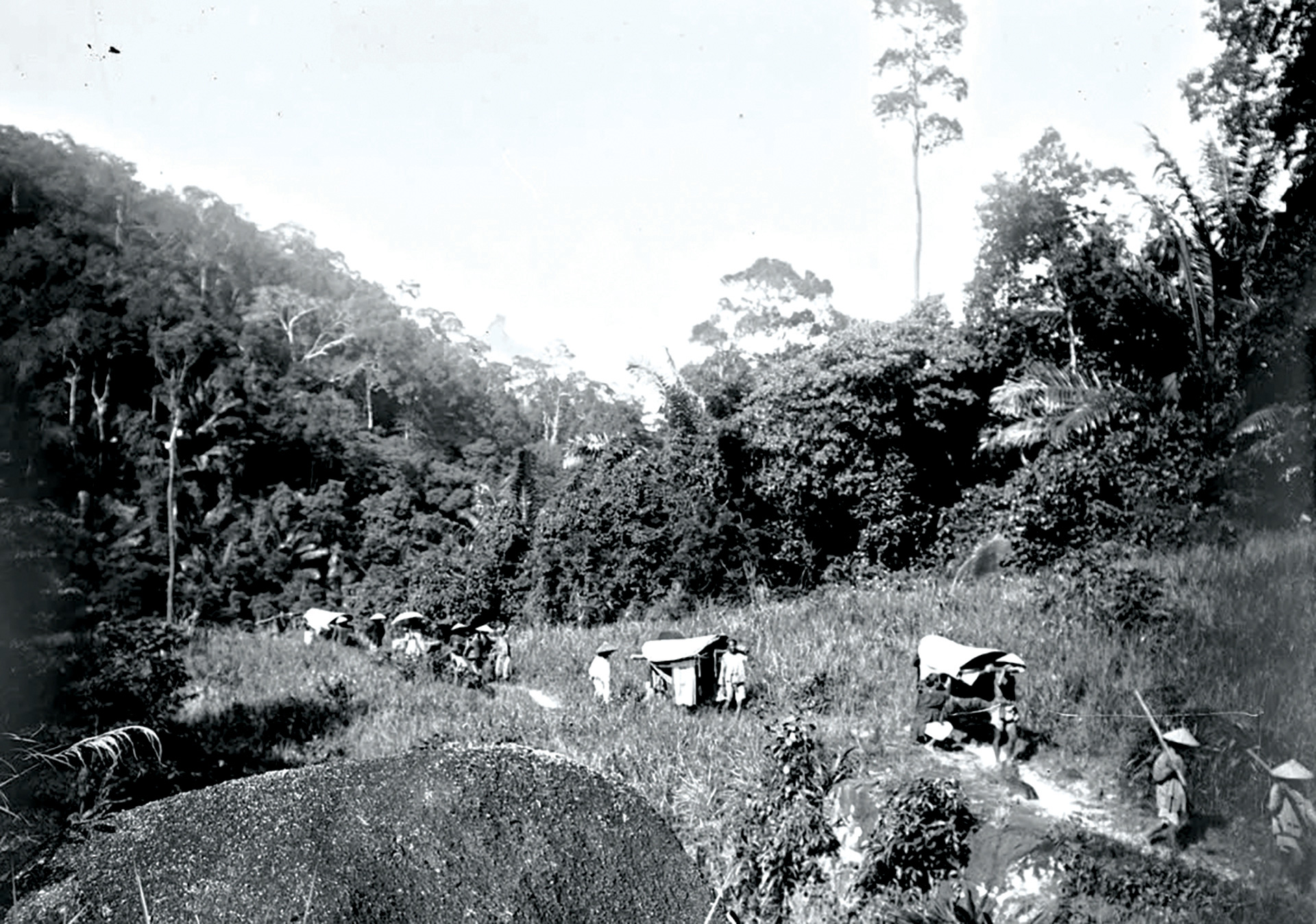
Ancient highway - Photo archive
Author Eugène Navelle wrote in the magazine Exploration and Survey in 1886: "Despite its prime importance in connecting the capital with the provinces as far as the ends of Tonkin and Cochinchina, the imperial road was impassable to vehicles.
Throughout the Central region, there are countless places where the mountains cut the coast into deep abysses, and the road then becomes a series of dangerous stone steps leading people up to the highest pass and then down to the plains. Some parts of the road follow the coast and can be flooded by the tide, sometimes the road is covered by trees, flowers and grass, and other parts are flooded with mud.
The road crosses many rivers and streams, some places have to be crossed by bamboo rafts, some places have wooden or stone bridges...".
Governor-General Paul Doumer wrote in his memoir Indochina: "In terms of roads, there is only one small, long road, almost just a trail, which people call the official road, connecting from South to North, generally quite close to the coast.
The section of the road connecting Hue with Da Nang that we saw, with its stairway up the mountain, gave an accurate picture of the general character of the road. Passengers, mainly mandarins, were carried on stretchers, and goods were carried by porters.
The trail through Hai Van Pass - the lowest point is still 500m above sea level. This road runs directly on the steepest mountainside like a ladder without even steps.
It is impossible to get a wagon train or even a mule train up there, and nearly three-quarters of the way from this pass to Hue passes through an area of only forest or sand dunes, with nothing to eat, drink, or shelter from…
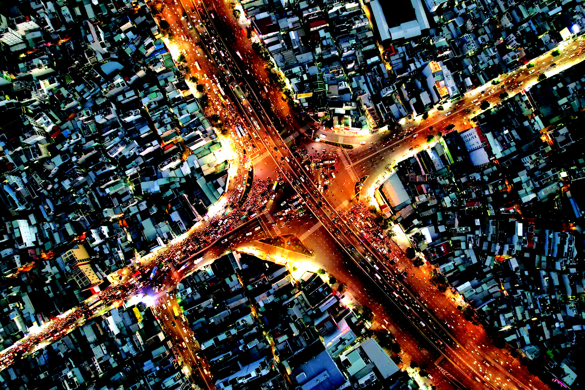
The ancient Gia Dinh citadel road (Nguyen Thi Minh Khai street) now connects to the outside of the city through the bustling Hang Xanh intersection - Photo: Q. DINH
Just 30 kilometers northeast of Saigon, one can see unexplored and inaccessible areas, abandoned to wild animals and a few hill tribes. There are no roads of any kind. Bien Hoa city on the Dong Nai river seems like the end of the world…
As a country with the longest and best waterway system, Cochinchina will not cede this role to any country in the world, but it still needs roads. The more rivers and canals there are, the more roads are needed to connect them together, creating access routes to deep areas.
The port of Da Nang was still primitive. The traffic connecting the seaport with the mainland, where products could be transported to the port, was blocked by massive mountain ranges, making it difficult to exchange.
How to develop this seaport? How to make it grow when there are no roads leading to production and consumption places, nor infrastructure for loading and unloading goods onto and off ships?
It was not until some time later, when I had decided on the plan to build the railway , that I visited the provinces of North Central Vietnam for the first time. I had a better and more assured feeling about the future of that land, and I must make efforts to soon make that future a reality, when means of transport play an important role in the prosperity of the whole country."
Since the beginning of the 20th century, the French have focused on building successive railway lines connecting the North and the South, while simultaneously building and repairing road sections following the imperial route: widening, paving, asphalting, building bridges, ferries, and river crossings...
The roads connecting the provinces were more open, not only for people and horses but also for motor vehicles. The roads began to be called National Highways.
In his note A Month in the South written in 1918, journalist Pham Quynh said: "From Hanoi to Saigon, you can go by water or by road.
But the road by car has only been open for a short time, and it is both difficult and sometimes dangerous. Because the official road to the Central region, especially from Hue, is still very bad, and there are many places separated by rivers and mountains, which is really not convenient for cars to travel.
Or there are curious people who travel by car from Hanoi to Saigon like that, just for the novelty, but it is not really a convenient way for North-South passengers.
Nowadays, cars are used to transport letters more than to transport passengers. In the future, when the railway running across Indochina is completed, then transportation from the North to the South by road will be really convenient. At present, only the sea route is better."
Just like that, through many historical periods, the national highway - the main road - the national highway has always been the top concern of managers. Building and repairing national highways is something that any government must put as one of the top tasks.
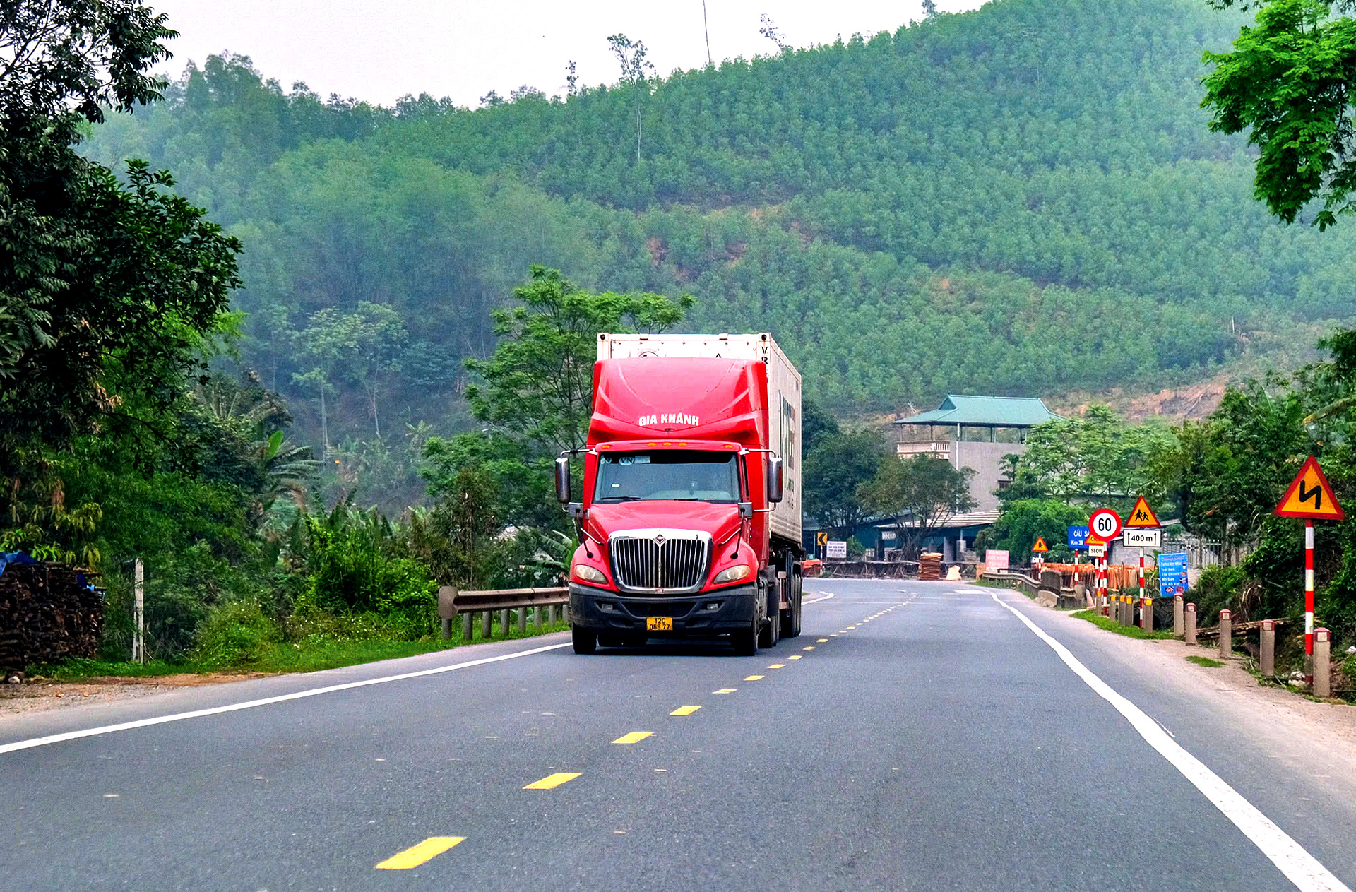
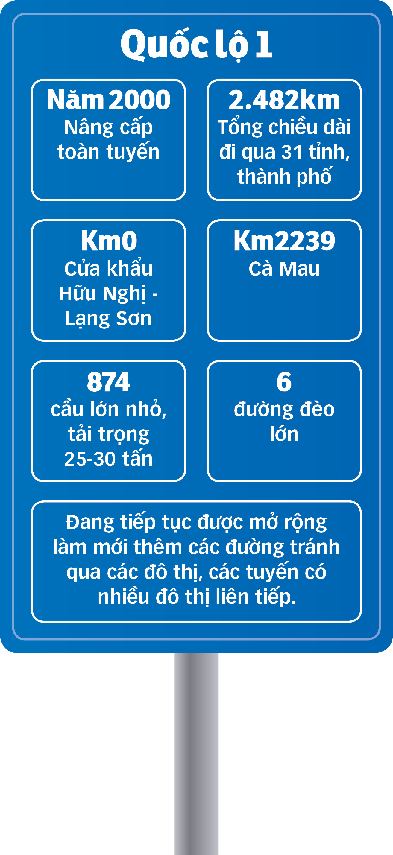
Since 2000, expanding national highways has been a major task for the central government and localities. Up to now, most of the 2,500km from Lang Son to Ca Mau passing through 31 provinces and cities of National Highway 1 - the old highway - has been a road with at least four lanes.
However, roads still cannot meet all the traffic needs of society. The modern Ho Chi Minh Road - Coastal Road - Expressway - North-South Railway and High-speed Railway (coming soon) have joined hands to shoulder the mission of bringing opportunities to everywhere.
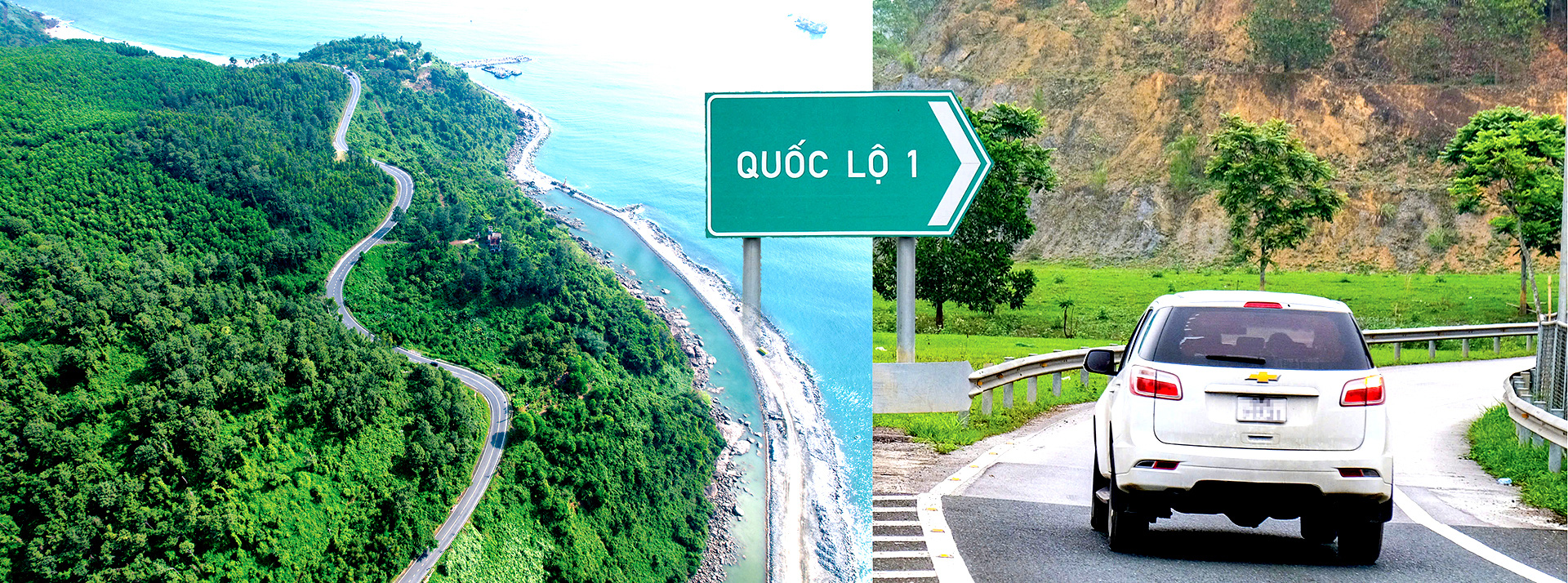
National Highway 1 from the sea to the mountains - Photo: TBD - HA QUAN

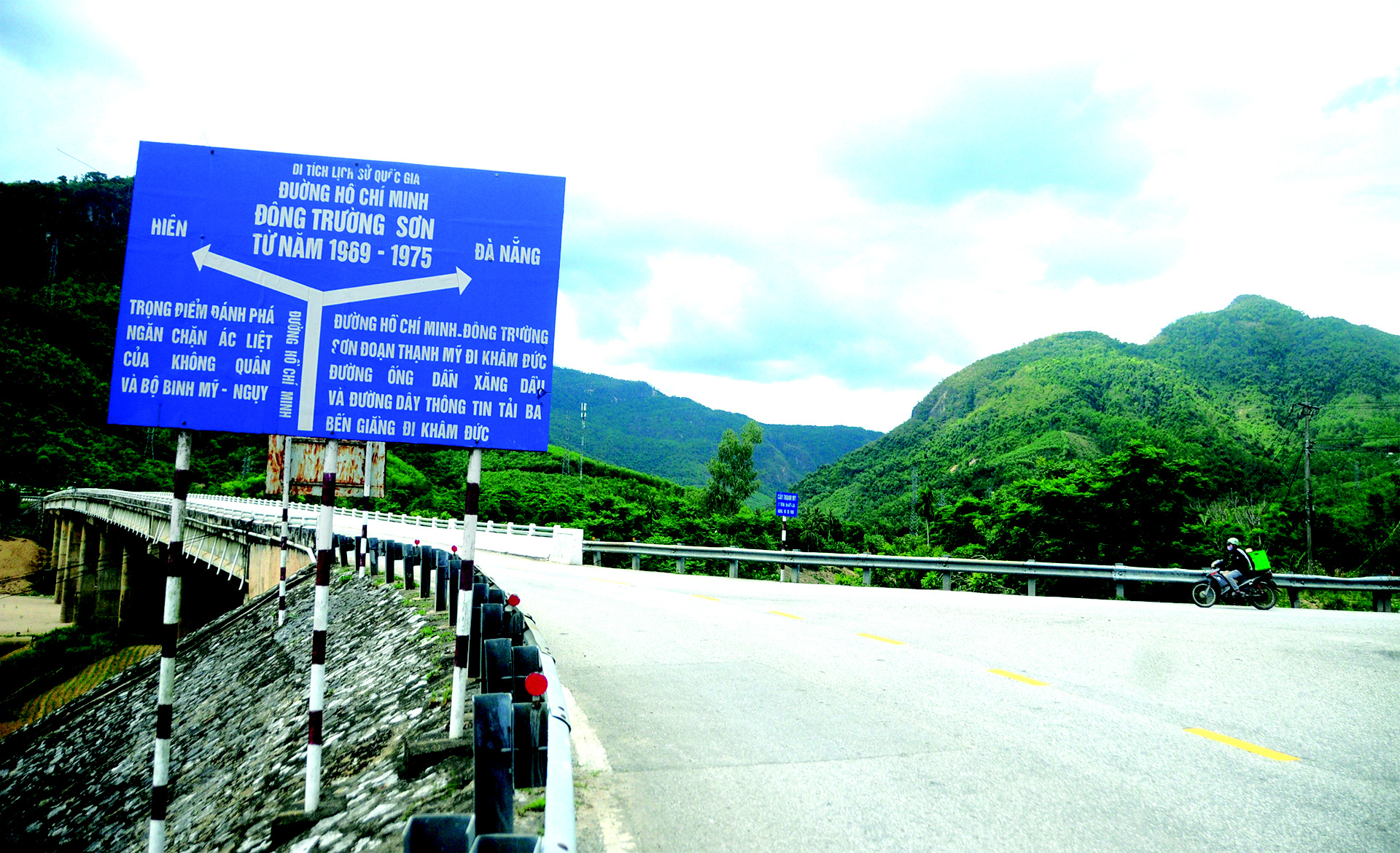
On the thousand-mile journey of the legendary Truong Son road connecting North to South, Ben Gieng in Hien district (now Nam Giang, Quang Nam) is a key location. Once a “fire coordinate” that endured hundreds of tons of bombs, the Truong Son road through Ben Gieng (now Nam Giang, Quang Nam) has now changed beyond imagination.
Ben Gieng is now mentioned by Kinh and Thuong people as a proud symbol of peace.

Although 87 years old, Mr. Nguyen Van Phao (real name Zo Ram Phao), from a village nearly 100 kilometers from Dung village, Thanh My town (Nam Giang) today, still remembers the intact shape of the Truong Son road and the old National Highway 14 passing through the center of Nam Giang district.
To bring ammunition and goods to the South, the army and people of Quang Nam devoted all their resources to protecting the backbone road leading to the day of liberation. Because it was located at the river junction, transporting goods from Da Nang, Tam Ky and the source of goods from the North, the Ben Gieng section was a crucial link.
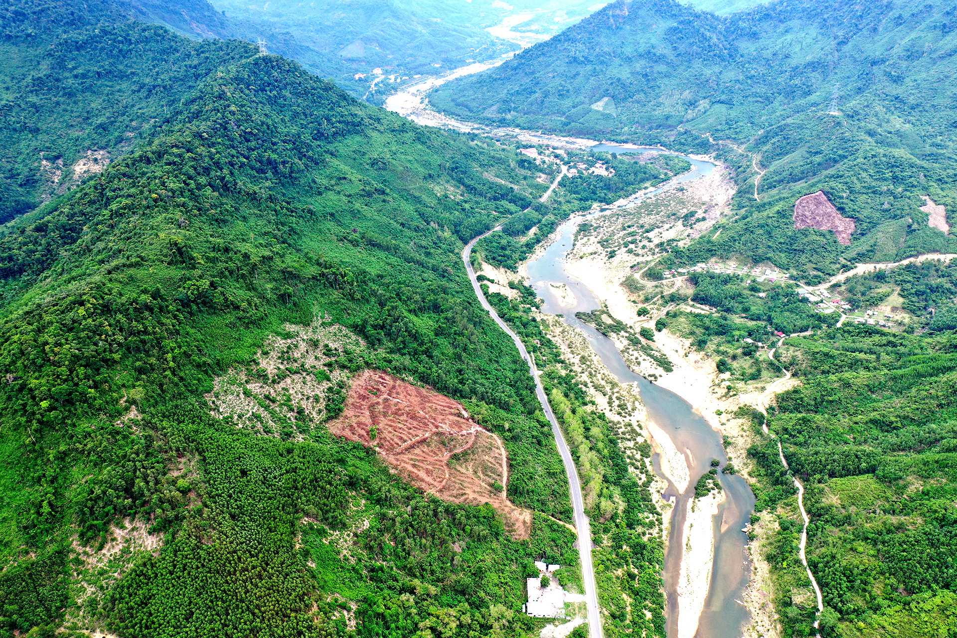
Ho Chi Minh Road cuts through the ravines through the center of Nam Giang district, Quang Nam province - Photo: TBD
"American planes dropped bombs on the wharf. The enemy attacked very fiercely, many of our people and soldiers died at Ben Giang at that time. But after the planes withdrew, we called each other to repair the bridge, leveled mountains, dug up soil and patched the road for vehicles to pass" - Mr. Phao said.
From war to peace, Mr. Phao, a union official who could not read or write well, was sent to study cultural remediation, then was successively assigned to other jobs such as district union secretary, head of the district party committee's organization committee, head of the propaganda committee...
He said he was very lucky to live until the day the Ho Chi Minh trail through the mountains and forests was expanded, and villagers from the highlands brought their shovels, pots, buffaloes and cows to the town center to do business, building the district center into a bustling town.
Ben Giang junction, the fire coordinate on Ho Chi Minh road, is now a busy road connecting North and South - Photo: TBD

Chairman of Nam Giang District People's Committee Mr. A Viet Son said that after the liberation day, the district's policy was to bring people from the highlands to the central communes to arrange and stabilize their lives.
The center of Nam Giang district is the focus of the reorganization. However, due to its remote location and unfavorable location for slash-and-burn farming and forestry, the people have not agreed despite many years of lobbying.
Ho Chi Minh Trail passes through and brightens up the Co Tu villages in Nam Giang district, Quang Nam province - Photo: TBD
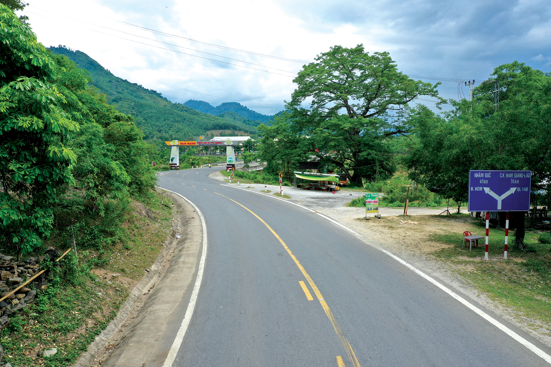
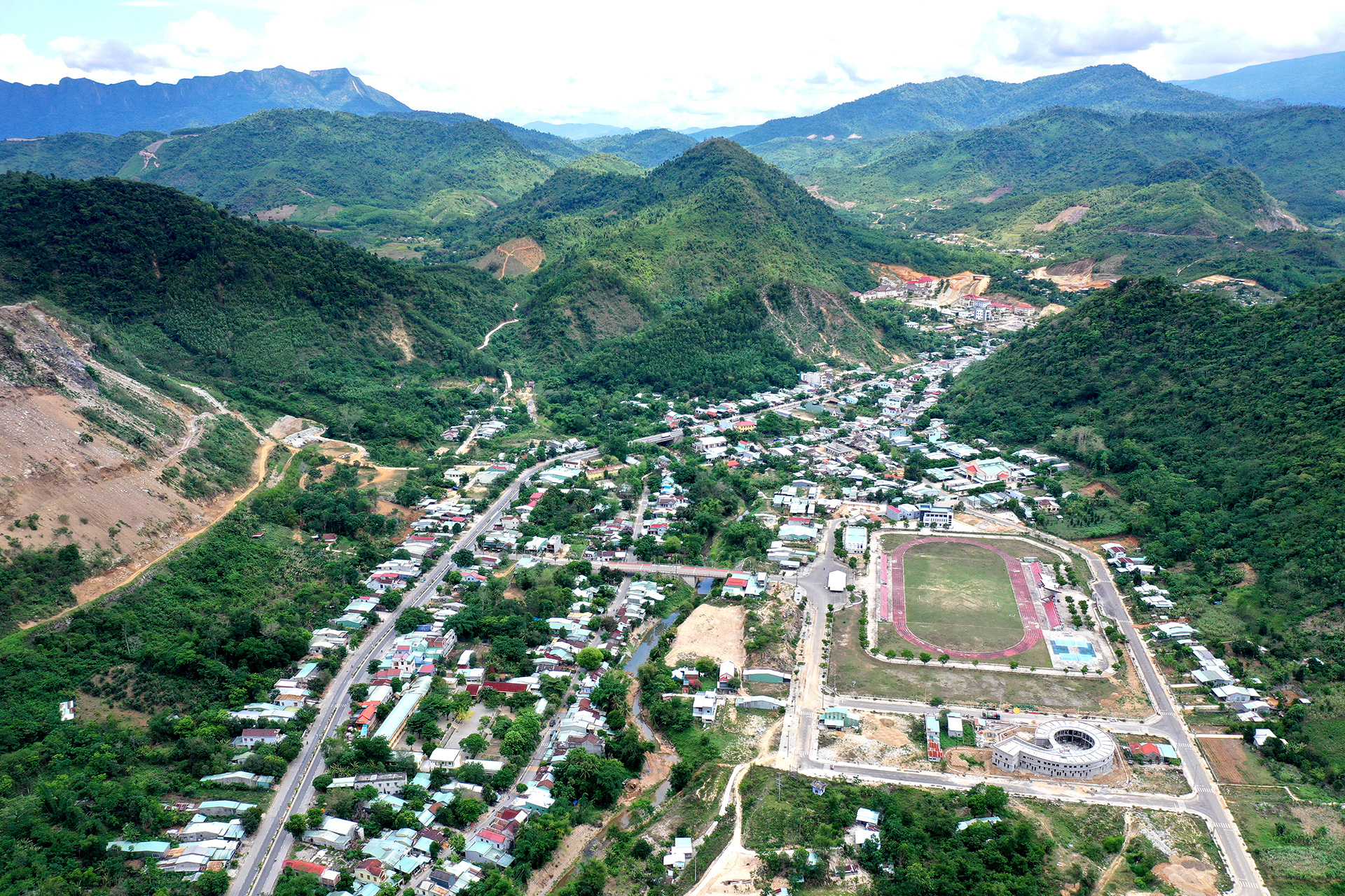
Everything changed in the 2000s when the government implemented the policy of expanding, upgrading and investing in the Ho Chi Minh route. More than 150km passed through Quang Nam, 50km in Nam Giang.
The vital mission of wartime has not faded, the road is like an electric current that awakens the villages that have been sad and gloomy for many generations. Wherever the road opens, the mountains and forests wake up. There are villages that even the "locals" who pass by now are half-believing, not sure that they are the poor and gloomy areas of the past.
"The two villages that have changed most miraculously are Pa Dau 1 and Pa Dau 2. Before there was a road, Pa Dau 2 was moved by the district to the district center, 20km away, to build a new village.
After 2000, when the Ho Chi Minh road from the north passed through Dong Giang, cutting through the old village area, people returned in droves. Now everything has changed completely. Houses are built, roads are concrete, and there is adequate lighting," said Mr. A Viet Son.
Former Head of the Propaganda Department of Nam Giang District, Mr. Nguyen Van Phao, affirmed that the Ho Chi Minh Trail through Nam Giang has many sections that do not overlap with the old Truong Son Trail. The section passing through the center of Thanh My town, about 10 km long from the beginning of the district to Ben Giang intersection, was expanded on the old National Highway 14 built during the French colonial period.
Signboard at the intersection of Ho Chi Minh Street - Photo: TBD
"It's called a national highway, but the road is cramped, with asphalt and rocks that are no different from a village road. After peace, the road was widened but still not paved. It wasn't until the Ho Chi Minh Highway was built in a large and spacious manner that Nam Giang and villages like Pa Dau, Dung village, and Muc village changed their lives," said Mr. Phao.
Mr. A Lang Truop, Chief of Office of Nam Giang District People's Committee, said that most of Thanh My residents are currently "contributors" from border communes and highland communes who were mobilized by the government to relocate and automatically moved to the district center since Ho Chi Minh road was upgraded.
"Before the road was opened, Nam Giang district had very few people. The administrative center was located at Ben Giang, surrounded by only a few houses. When Ho Chi Minh road passed through, it created gaps on both sides. The government invited people to come back to build their lives, and there were more ways to make a living. The road has created all the changes" - Mr. Truop said.

Traveling along Ho Chi Minh road, through Nam Giang villages such as Muc village, Pa Dau village, Dung village to the district center, everywhere is crowded, bustling, houses are close together, bustling activities.
Mrs. Bui Thi Minh Huong, 65 years old, owner of a coffee shop in Muc village (Thanh My town) said: "In the past, Dung and Muc villages were surrounded by dense forests. The district center only had a road built during the French colonial period, and most of the villagers lived on high mountains. Only when the Ho Chi Minh road was opened, vehicles could run in two wide lanes, and the district administrative center was moved to its current location did everything change."
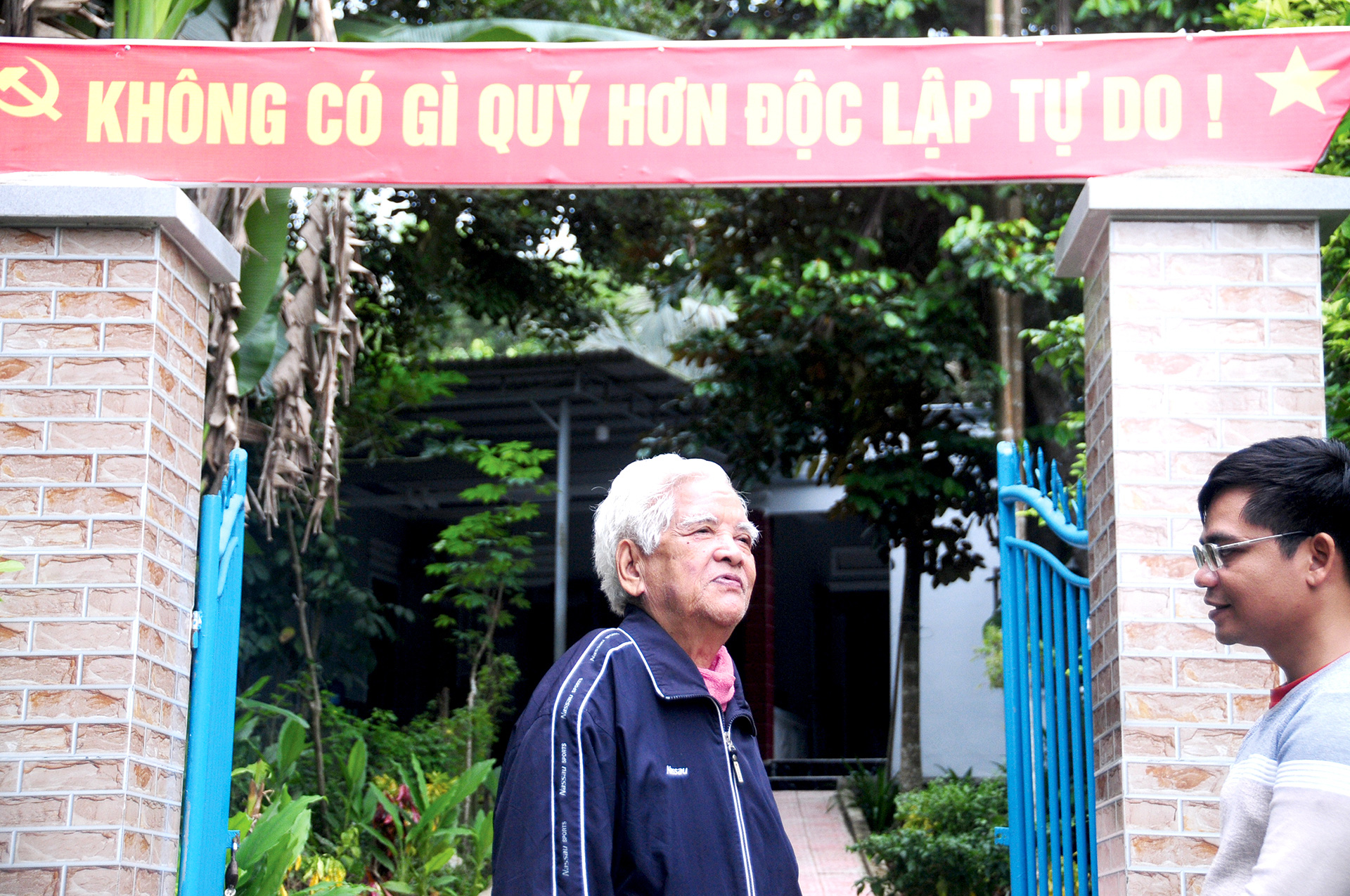
Mr. Nguyen Van Phao with beautiful memories of the day Ho Chi Minh trail was opened - Photo: TBD
Mrs. Huong’s family life is closely linked to the Ho Chi Minh trail passing through the district. She was born in Hoa Vang (Da Nang), and married a man in Nam Giang in 1982.
Before the road was built and the district center had not moved there, the couple worked in Ca Dy commune, with a salary from a remote area, and their economic situation was very difficult. When the main road was opened, the couple agreed to buy land facing the road to do business and build a comfortable life until now.
Ms. Vo Thi Hoa, K'Lai village, Ca Dy commune, a native of Hue who came to Nam Giang to make a living, also said that she never thought that one day the place where she lived would be so open and change like this.
"In the past, this place was full of forests. The old road was small and only occasionally had a car passing by. Since the big road opened, people have moved in, houses have sprung up, vehicles have stopped to eat and drink, people have started businesses, and the area has become as prosperous as it is now," said Ms. Hoa.
The Chairman of the People's Committee of Nam Giang district added: "Thanks to the road, the district's population has been rearranged, schools, hospitals, and essential facilities have been invested in. People from everywhere have come to do business, and the traffic has been bustling, leading to the development of services. The locals who used to farm just enough to eat have now learned to do business.
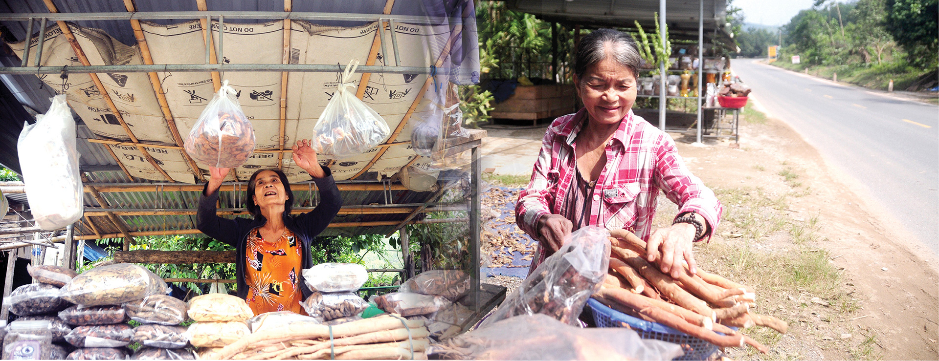
With roads, people grow forests to sell timber, acacia, and other high-value agricultural products. Vehicles go all the way to the village, making it easy for people to sell their goods. Many people even open shops. Local agricultural products and mountain specialties are displayed along Ho Chi Minh Road. Many sections of the road are as busy and bustling as a market.
Today's technology allows people to see their homeland from above. And from above, the dark forests of the past now sparkle with light.
The main road passing through makes goods and life of Nam Giang people more convenient than ever - Photo: TBD

Starting from Nui Do port, Mui Ngoc in Binh Ngoc commune, Mong Cai city, Quang Ninh province, Vietnam's coastal route runs straight through and extends to Ha Tien border gate, Kien Giang province, with a total length of about 3,041 km.
The coastal road is as soft as a silk strip, embracing the blue sea, not only bringing natural, poetic beauty but also promoting economic development, bringing opportunities for the poor, sunny and windy land to become rich and modern.

About 10 years ago in Binh Thuan, the coastal road Hoa Thang - Hoa Phu was formed, marking on the tourist map as one of the most beautiful roads in the country.
From Hoa Thang commune, Bac Binh district, the 23km long silk strip crosses the undulating white sand dunes, clinging to the blue sea to reach Phan Ri Cua town, Tuy Phong district. On both sides of the road, wild bushes, emerald green lakes, the most unique Trinh Nu sand dunes in the country, and forests of yellow cajuput flowers blooming in season on both sides of the road captivate those who love to travel.
A former leader of the People's Committee of Hoa Thang commune excitedly recalled that the completion of the Hoa Thang - Hoa Phu road changed the face of a "dry, difficult, miserable" land. From 2017 onwards, the average income per capita in the commune increased steadily.
From relying solely on agriculture, the people of Hoa Thang commune quickly seized the opportunity to do business in tourism, trade, and develop diverse industries.
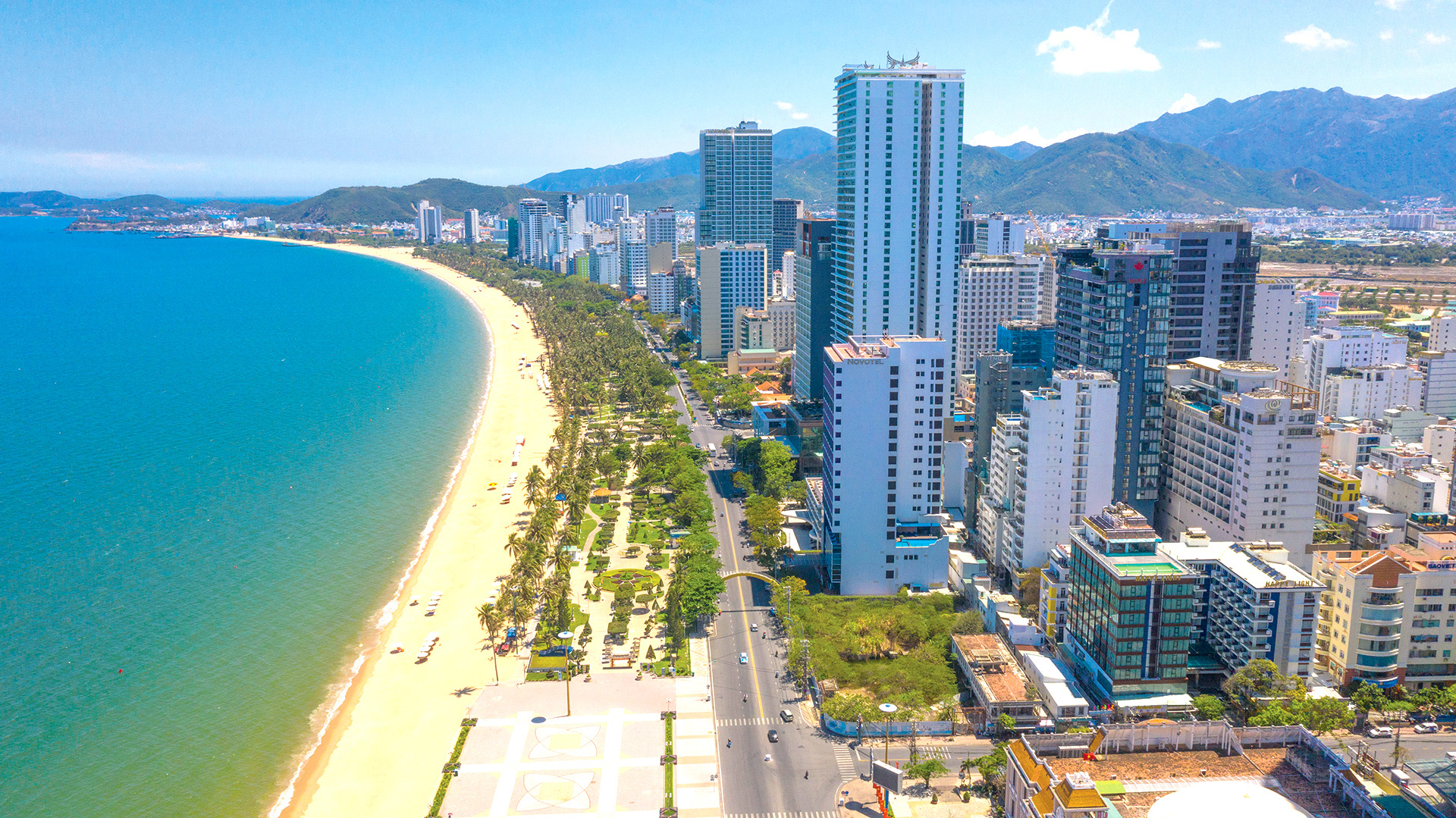
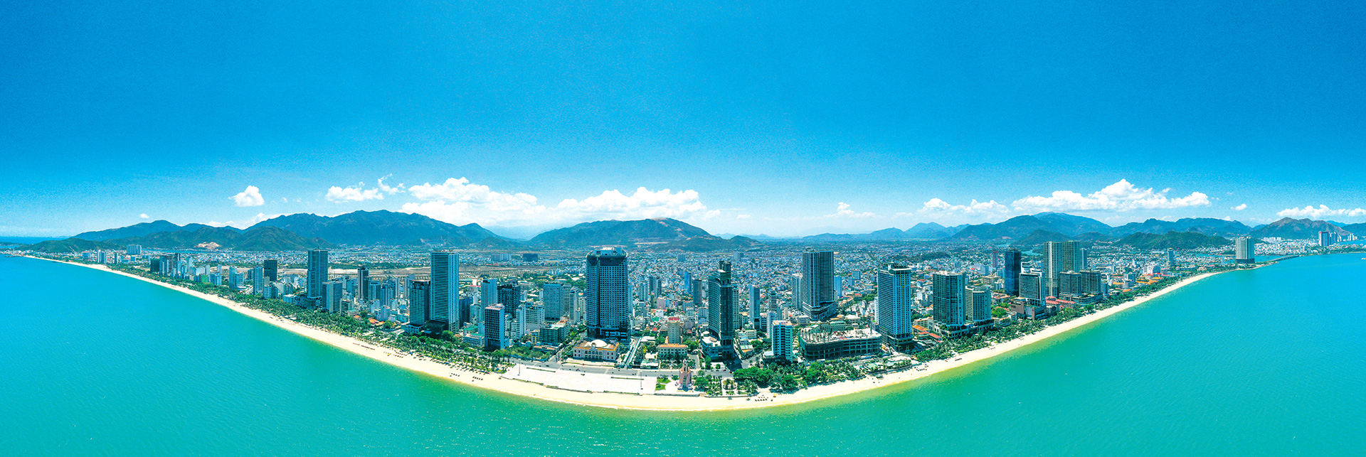
Coastal road section passing through Nha Trang - Photo: QUANG DINH
As one of the people born and raised in the Hoa Thang sand area, Mr. Nguyen Quoc Phong remembers that before this road was built, people mainly grew peanuts and melons for seeds and depended on rainwater.
To get to the district center, it takes several hours to drive a motorbike on the national highway, jostling with other vehicles, and the sun adds a layer of red dust to the road. Children in secondary school have to be sent to the district to board.
Now, Hoa Thang land suddenly becomes the most potential area of Binh Thuan province. Not only does the agricultural sector benefit, the locality also changes its economic structure, focusing on seafood processing industry and mineral exploitation.
The tourism industry has benefited the most. The main road has been opened, investors from everywhere have come to start resorts, hotels, restaurants, coastal entertainment areas... The coastal road has also become a national traffic axis, reducing the load on Highway 1, facilitating the consolidation and maintenance of national security and defense.
Riding on the momentum of victory, Binh Thuan has expanded and renewed many coastal routes: Vo Nguyen Giap, Phan Thiet - Ke Ga, Ke Ga - La Gi... connecting 200km of coastline. Wherever the road connects, investors come to develop socio-economic projects.
Since then, the value of land exploitation on both sides of the road has increased, and people's lives have changed day by day.
Connecting to the South, Provincial Road 944 is about 78 km long, connecting from Cai Mep - Thi Vai port cluster, Ba Ria - Vung Tau province to Binh Thuan province in the coastal direction, and is being rapidly expanded and upgraded.
This is an important project to promote the development of the eastern localities of Ba Ria - Vung Tau province. Later, when National Highway 55 in Binh Thuan province is also upgraded and expanded, the two largest coastal tourist centers in the South, Vung Tau and Phan Thiet, will be connected, opening up new development space.
Mr. Tran Van Binh - Vice President of Binh Thuan Province Tourism Association likened the coastal road to the most beautiful transportation system because of the scenery and terrain bestowed by nature.
The seamless coastal strip will have many new options for locals and tourists, not only in terms of transportation but also in many other amenities.
In recent years, along the Central provinces, coastal routes have been and will continue to be formed and connected to each other to reduce the load on National Highway 1.
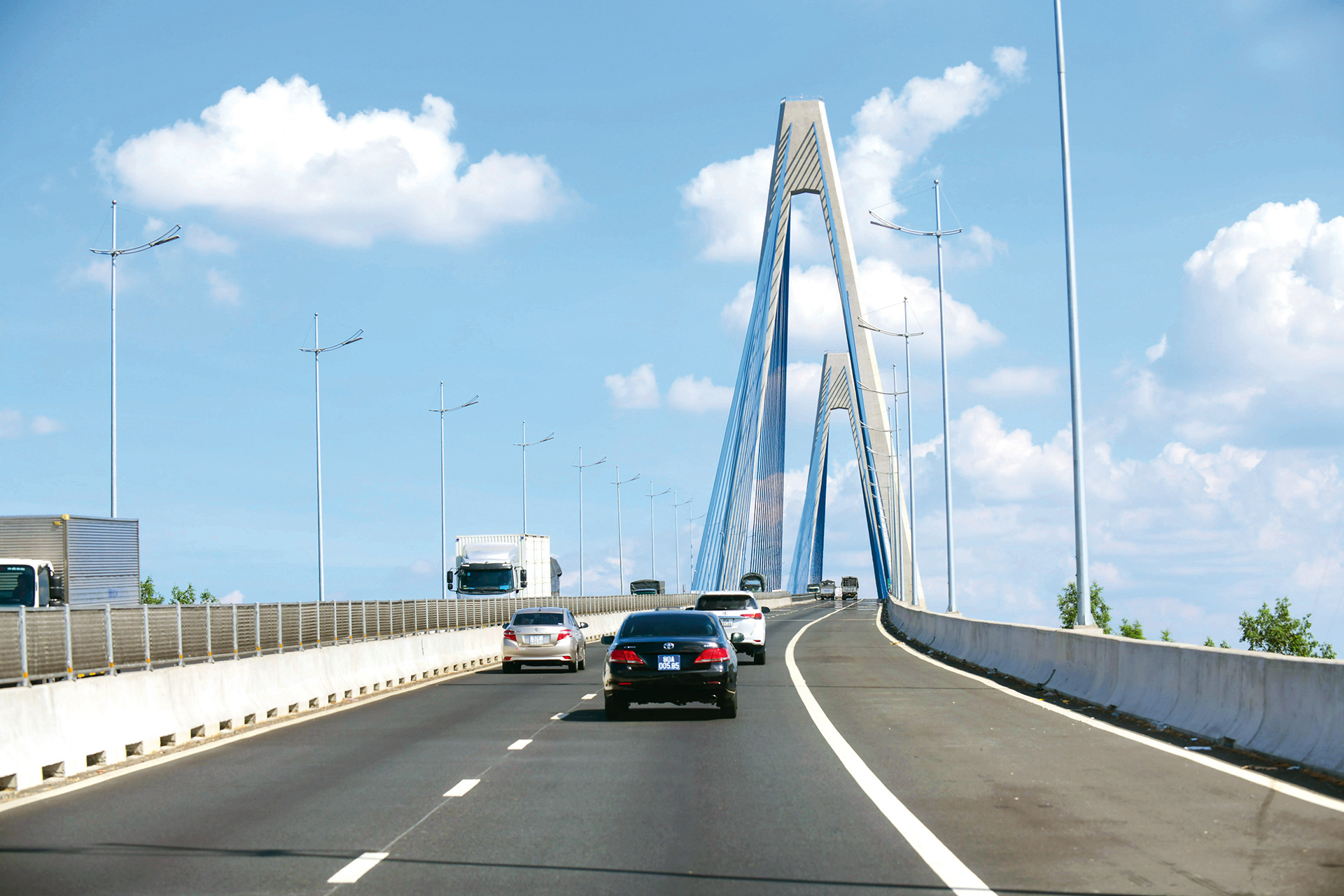
Trung Luong - My Thuan Expressway - Photo: QUANG DINH

As a bridge and road expert who has spent many years researching coastal roads, engineer Vu Duc Thang mentioned: our country has a coastline stretching over 3,000km from Mong Cai, Quang Ninh to Ha Tien, Kien Giang. The coastal road is like a balcony facing the East Sea, along the route connecting economic zones, tourism, seaports... Connecting seaports from North to South is a very important need.
Coastal roads traverse vast estuaries, requiring high-tech engineering and large capital investments. In the past, this was a major challenge, and building bridges across estuaries seemed beyond imagination. Coastal routes are therefore often pushed further inland.
Currently, we have mastered the technology of bridges and roads, the economic potential has improved a lot, the roads are getting closer and closer to the sea. In the North and Central regions, the coastal routes in many places have taken shape, creating a strong economic and tourism momentum, helping many localities develop remarkably.
Vinh Hao - Phan Thiet Expressway - Photo: QUANG DINH
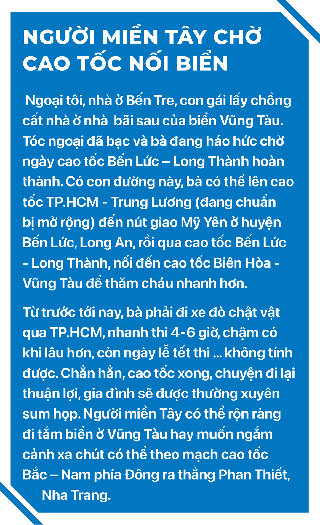
In the South, the 750km long Western coastal route, part of the planning approved by the Government in 2010, passes through 8 provinces and cities: Ho Chi Minh City, Tien Giang, Ben Tre, Tra Vinh, Soc Trang, Bac Lieu, Ca Mau, and Kien Giang.
The road was formed on the basis of maximizing the use of existing roads combined with new investment. Crossing the vast river area, this is a very large project, difficult both in terms of technology and total investment.
The Mekong Delta, home to 17.8 million people, is gradually changing its appearance over the years with a network of expressways being built and national highways being upgraded.
Transport infrastructure is the economic lifeblood, helping the "Nine Dragons" land take off. The coastal road that is being built is the next piece to complete the regional transport map.
Currently, all the goods from the West are converging to My Tho, Tien Giang. The routes to relieve resources in My Tho are all going in a big arc to Ben Luc - up to Bien Hoa - to the North. If there is a shortcut along the coast, it will save a lot of time and cost.
Meanwhile, the ancient Go Cong land was a transit and cultural exchange place between regions, located near Can Gio district, only separated by the Soai Rap river.
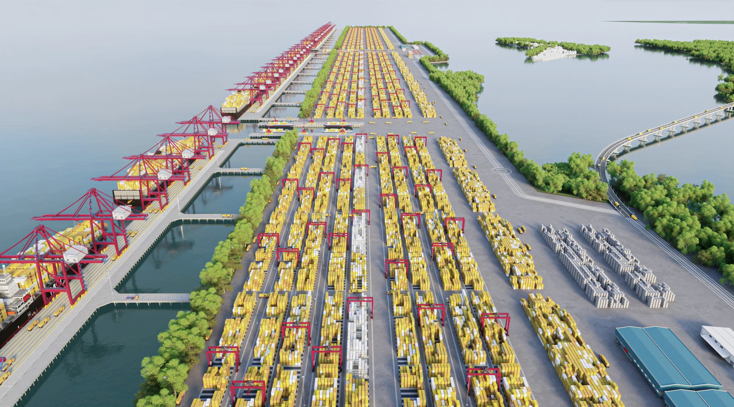
As for Can Gio - a place once described in Le Quy Don's 1776 book "Phu Bien Tap Luc" as "a bustling sea gateway where sailing boats gather". This area is facing development opportunities as Ho Chi Minh City is stepping up investment in the international transit super port here.
If the international transit port is built, Can Gio will become a big trade spot, requiring a stronger traffic connection with surrounding areas.
This is another reason why it is necessary to have a coastal road in the West, first of all, the route connecting Go Cong - Can Gio - Vung Tau. From Vung Tau, the route will connect with the coastal road in the Central region, straight to the North, forming a continuous North - South coastal axis.
"The project to adjust the general planning of Ho Chi Minh City to 2040, with a vision to 2060, has added a coastal road through Can Gio. This is an important start to form a new coastal economic corridor of Ba Ria - Vung Tau - Dong Nai - Ho Chi Minh City - Tien Giang", engineer Vu Duc Thang assessed.
After the mountains were leveled to open the Truong Son industrial road, the country's long stretch of land had another North-South expressway in the East, which was expected to run from Lang Son border gate to Ca Mau in the year of At Ty.
A complete horizontal and vertical highway not only connects regions but is also the foundation for building a prosperous nation.

The concept of expressways, or motorways dedicated to cars, first appeared in Italy and Germany in 1921-1930. In South Korea, the miracle of the Gyeongbu Expressway connecting the capital Seoul with the port city of Busan was born in the 1970s, demonstrating the determination to "just do it".
The Vietnamese began thinking about building highways in the 1990s, at the beginning of the Doi Moi period. It was not until the 2000s that concrete plans were laid out.
The first pre-highway route in Vietnam was the Phap Van - Cau Gie section at the southern gateway of Hanoi, which started construction in 1998 and was completed in 2002. After several years of operation, the route recorded many accidents, causing much controversy.
Some geologists believe that electromagnetic fields exist underground, some researchers link them to spiritual factors, and others believe that the cause lies in inadequacies in traffic organization.
Although many people think that it does not meet the criteria of a highway, the road has brought about socio-economic efficiency. Even back then, if traffic on this route had to be temporarily suspended for a few days or a week, the southern gateway of Hanoi would certainly be congested, causing huge socio-economic losses.
From the first tentative steps, two years later, the first true expressway in Vietnam was started: the Ho Chi Minh City - Trung Luong route.
Back then, from Ho Chi Minh City to the Mekong Delta provinces, vehicles had to go through a narrow, single national highway. The distance was short but the time was long. It took half a day to visit the "white rice and clear water" Can Tho region. When arriving at Ca Mau, it was very far away, and it was late at night if the My Thuan ferry and Can Tho ferry ran smoothly.
The route has a total investment of VND9,880 billion, including a 39.8km main expressway and 22km connecting roads.
This is a breakthrough, starting the construction of the North-South Expressway and the entire Vietnam expressway network that was planned in the early years of the 21st century.
However, the first modern highway encountered seemingly insurmountable difficulties and hardships.
Associate Professor, Dr. Tong Tran Tung (technical advisor to the Minister of Transport from 2007 to present), shared: investment mechanism, technical solutions, capital and experience requirements in design and construction are all big challenges.
A sudden and lightning-fast working group was established, including managers, consultants, and scientists, to visit and learn from experiences in China.
The trip lasted only three days, and the delegation inspected many locations along the Guangzhou-Shenzhen Expressway. The practical experience gained added knowledge to make decisions on policies and technical solutions for the road.
According to Mr. Tung, the most stressful issue was the controversy over the construction of the overpass over weak soil. Although the project was decided to be feasible, when it came to the technical design stage, "suddenly" there were objections that the elevated road option, which entailed the construction of dozens of kilometers of overpass, was unreasonable and led to cost increases.
"A series of extraordinary meetings, even on Sundays, were convened by the then Minister of Transport. We had to analyze, explain, and prove the technical and economic effectiveness. Finally, the Minister decided on a plan to build a flyover over weak soil," Mr. Tung shared.
Five years later, in February 2010, Vietnam's first expressway connecting Ho Chi Minh City with Long An and Tien Giang was opened to traffic, in time for the Tet holiday when "horses and carriages were like water, clothes were like wedges".
Until the road was put into use, there were still harsh criticisms of "playing it rich in the wrong place", but time has shown: the bold decisions at that time have proven effective.

In 2004, the Vietnam Expressway Corporation (VEC) was established. This was a new experiment of the Government and the transport sector on the model of a state-owned enterprise as the core in expressway development. VEC's first expressway project was the second expressway: Cau Gie - Ninh Binh.
Starting in 2008, the global economic crisis hit, and the project seemed to be unfinished and abandoned, but VEC was determined to collect every penny so that the construction of this highway would not be interrupted. And in November 2011, the route was technically opened to traffic from Cau Gie to Liem Tuyen intersection (Phu Ly, Ha Nam), and the entire route was opened to traffic in mid-2012.
"Thinking back on this, we can see that the early days of building expressways, although only short sections, were very difficult. The first two expressways at the two ends of the country required the urgent need to develop the expressway system as a driving force for development," said Mr. Nguyen An, former officer of the Department of Science and Technology, Ministry of Transport.
20 years later, standing at the intersection of Ben Luc - Long Thanh Expressway, Ho Chi Minh City Ring Road 3 and Ho Chi Minh City - Trung Luong on the last day of 2024, the faint smell of new plastic makes everyone excited, waiting for the time when the soft silk strips crossing the plains and the saltwater areas are connected. 11 years to build a 58km-long arterial road is too long.
During that time, the road was sometimes stagnant, associated with many ups and downs, many joys and sorrows, with tension and blame for the delay.
Finally, everything went smoothly when the bottleneck was removed, the construction site was bustling with the sound of machinery. The funding was sufficient, the expressway connecting the East and the Southwest regions would definitely be opened this year, there would be no more delays.
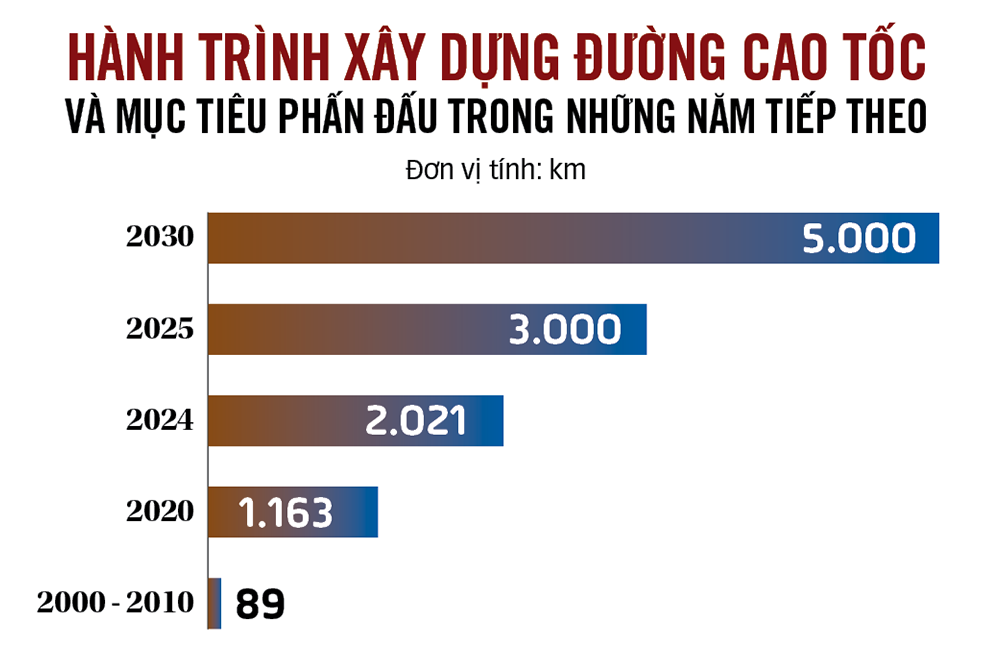
The Ben Luc - Long Thanh Expressway is a testament to the difficult period of expressways. From the start of the expressway construction until 2010, the whole country had only two routes - 89km and 10 years later there was a total of 1,163km, an average of 73km per year, much lower than other countries in the region.
The disease of slow progress appears in many places. Not only Ben Luc - Long Thanh, the Trung Luong - My Thuan expressway also made people in the West wait for 13 years.
Not only that, the planning, prioritization, and allocation of resources are not reasonable, leading to an unbalanced highway density among regions. Economically dynamic regions such as the Southeast, Southwest, and regions with important political positions such as the Central Highlands and Northwest are suffering from a desperate thirst for highways.
The National Assembly has heated up many times over this issue. Mr. Nguyen Van Giau, Chairman of the National Assembly's Foreign Affairs Committee, once mumbled: "For example, the Western Expressway, we can build it over and over again and never finish it."
In the past three years, Vietnam has added 858km of highway, equal to more than 2/3 of the total number of highways built in the previous 20 years. This is an impressive number. The achievement demonstrates the continuous efforts of all levels of government and innovative policies in the way of doing things.
The policy of decentralization and assignment of responsibility to local resources is a very important factor. This model was suggested by Quang Ninh province. When many areas still had no highways, Quang Ninh asked for a mechanism to self-invest and complete the highway projects: Hai Phong - Ha Long, Ha Long - Van Don, Van Don - Mong Cai.
From that example, the mechanism was immediately widely applied, at one point more than 500km of expressway were given to localities to take charge of implementation. Having been given the authority, many localities have made efforts day by day, the whole province has become a large construction site. Typically, Long An has completed the Ring Road 3 section very quickly, Ba Ria - Vung Tau province has accelerated the Bien Hoa - Vung Tau expressway.
In recent years, the Prime Minister has regularly inspected construction sites, and every Tet holiday, he has spent time visiting key projects in the North and South. His spirit of "only discussing work, not backtracking" promises that this year of the Snake, many new expressways will be completed.
This year's Tet holiday, many immigrant families living in the South have prepared their luggage and chosen to travel by car to their hometowns to celebrate Tet, experience the North-South expressway, and slow down a bit to watch the country change through new routes.
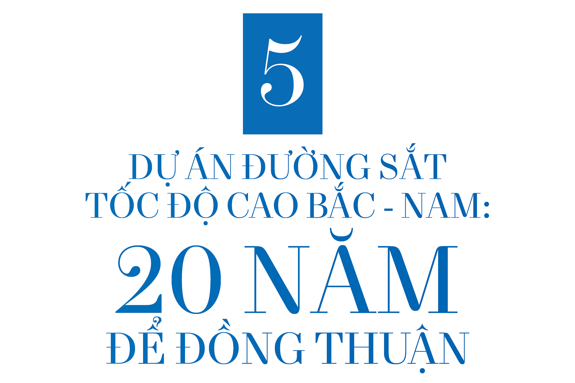
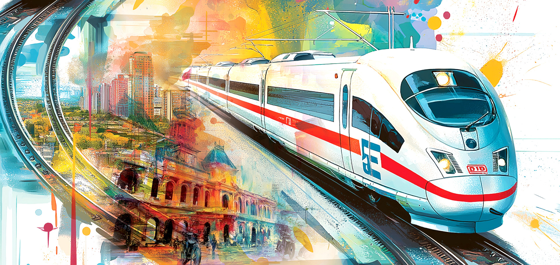
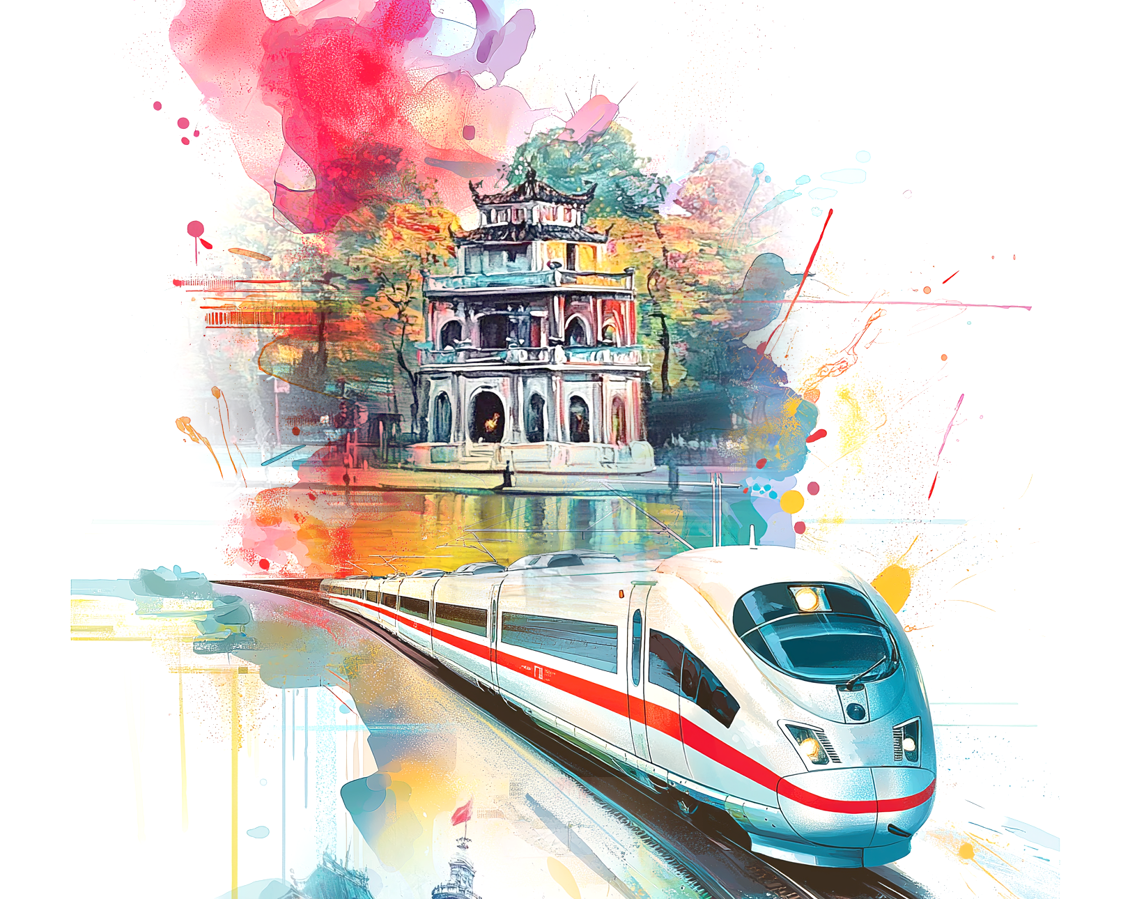
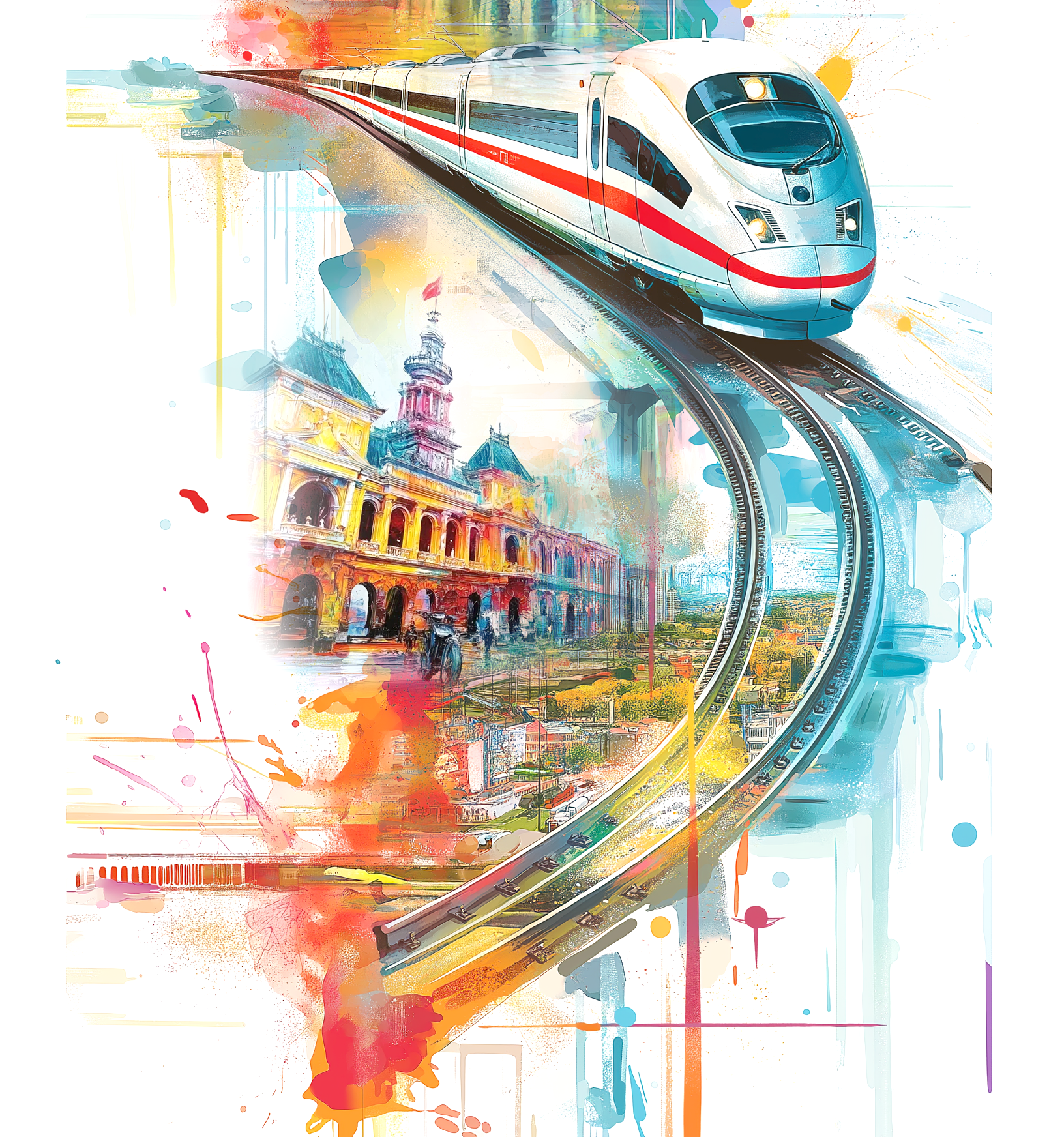
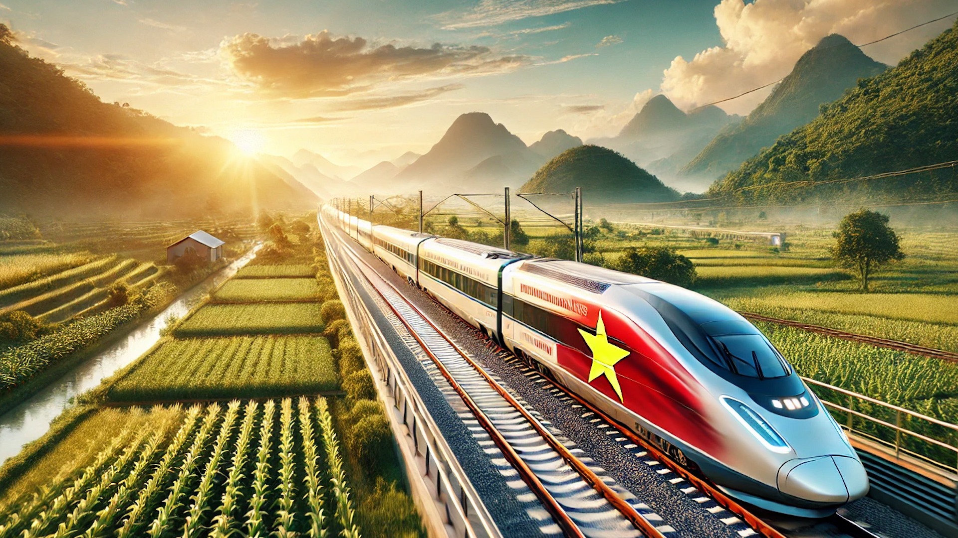
The North-South high-speed railway project was approved by the National Assembly in principle for investment on the afternoon of November 30, 2024. After 20 years of painstaking research, this very special project, of very large scale, unprecedented in Vietnam, will begin to take shape from 2025.

Former Deputy Minister of Transport Nguyen Ngoc Dong said that since 2002, the orientation for developing the North-South high-speed railway has been stated in the master plan for developing Vietnam's railways: by 2020, on the North-South axis, in addition to the existing Thong Nhat railway, it is necessary to build a double-track line for North-South high-speed passenger trains, reducing the train travel time from Hanoi to Ho Chi Minh City to less than 10 hours.
The Korea International Cooperation Agency (KOICA) was the first unit to study the two sections Hanoi - Ha Tinh and Nha Trang - Saigon in 2007 - 2008.
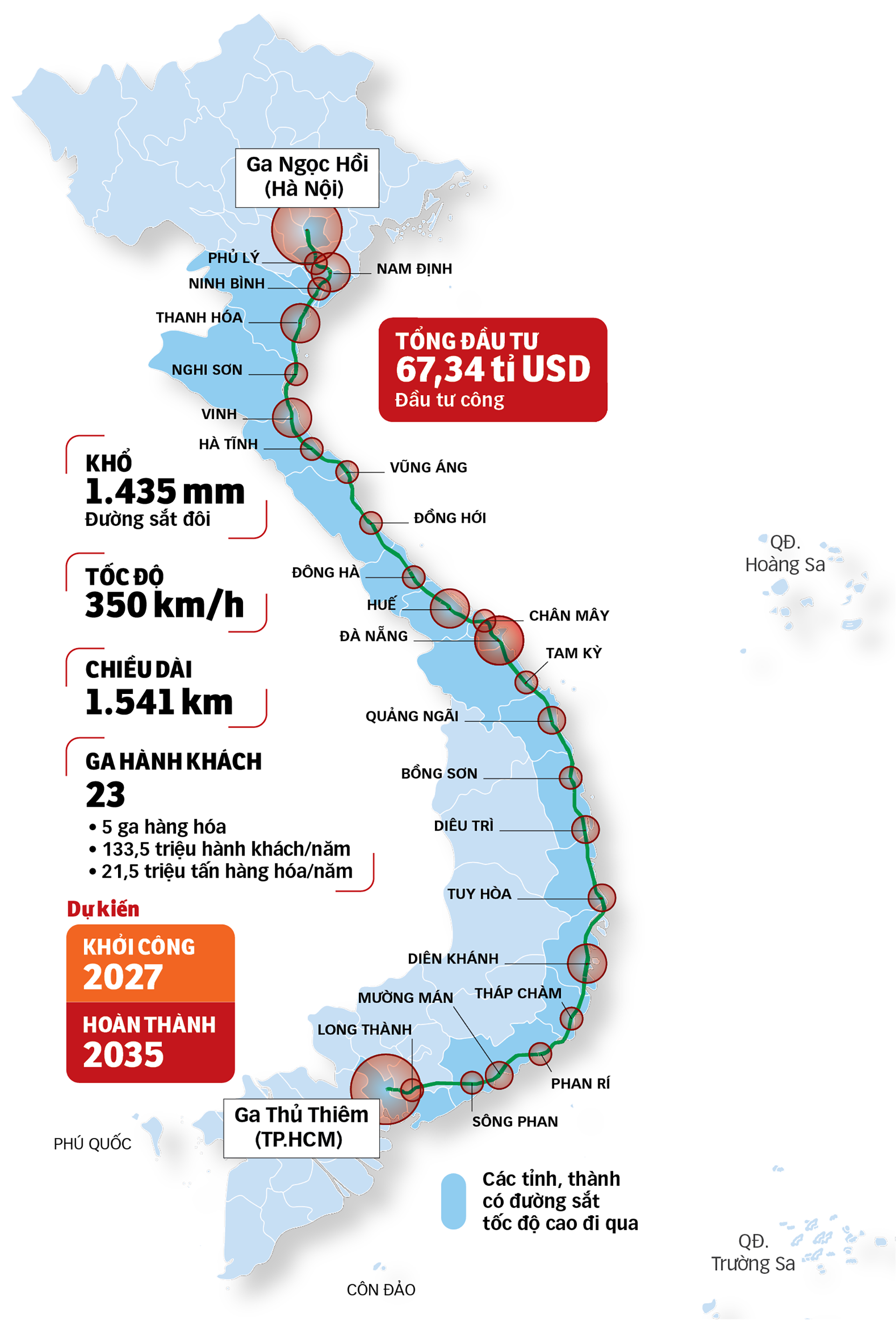
"By 2008, when KOICA handed over the product with the proposal to prioritize the construction of the two above sections as double-track, 1,435mm gauge, exclusively for passenger trains, with a design speed of 350 km/h. The Ministry of Transport accepted the results and pushed the project to the preparation stage," said Mr. Dong.
Based on KOICA's research, in the period 2008 - 2010, the Vietnam - Japan Consulting Joint Venture (VJC) was selected to research the entire North - South high-speed railway route.
In 2010, the Ministry of Transport reported to the Government to submit to the National Assembly for consideration and approval of the investment policy based on the results of the pre-feasibility study by VJC consultant: railway with a scale of 1,570 km, design speed of 350 km/h, operating speed of 300 km/h, total investment of about 55.85 billion USD.
Phase 1: by 2020, the Hanoi - Vinh and Ho Chi Minh City - Nha Trang sections will be exploited. Phase 2: by 2030, the Vinh - Da Nang section will be exploited and the entire route will be completed by 2035.
"A series of questions from citizens, experts, and National Assembly delegates expressed concerns about: investment resources, feasibility, ticket prices, ability to attract passengers, and mastery of technology. There are about 100 related questions that have been compiled into a book for the Ministry of Transport to study and explain," Mr. Nguyen Ngoc Dong revealed.
On the afternoon of June 19, 2010, with 208 delegates disagreeing, 185 delegates agreeing and 34 delegates not voting, the National Assembly did not approve the investment policy for the Hanoi - Ho Chi Minh City high-speed railway project.
"At that time, the biggest question that National Assembly delegates, including me, asked first was where would we get the money to do it?" - Mr. Nguyen Van Phuc - former Deputy Chairman of the Economic Committee of the 14th National Assembly, member of the Expert Group of the Steering Committee for the development and implementation of the Project on investment policy for high-speed railway - recounted.
At that time, Vietnam's economy was facing many difficulties. GDP in 2010 reached 174 billion USD, public debt was at 56.6% of GDP, but the total investment of the high-speed railway project of more than 55.8 billion USD accounted for 38% of GDP. "Public debt safety and budget deficit are among the main reasons why the National Assembly has not approved the project's investment policy," Mr. Phuc explained.
Mr. Tran Dinh Dan, former Head of the National Assembly Office from 2007 to 2011, reminded: At that time, National Assembly Chairman Nguyen Phu Trong was also very enthusiastic about the prospect of the North-South high-speed railway, but at that time the country's resources were difficult and the technical level was not fully accessible. Therefore, he convinced the National Assembly to discuss step by step, preparing for implementation in the following terms.

After receiving comments from the National Assembly in the 2010 session, the Ministry of Transport continued to study the Hanoi - Ho Chi Minh City high-speed railway project. This time, the Ministry assigned the Vietnam Railway Corporation to coordinate with the Japan International Cooperation Agency (JICA) to carry out the project.
In March 2013, JICA proposed a plan: if Vietnam's GDP growth rate remains at 6% per year, it would be suitable to build a high-speed railway from 2030 to 2040. JICA proposed a maximum design speed of 350 km/h, and an operating speed of 320 km/h for passenger transport only.
Of which: the Ho Chi Minh City - Nha Trang section is 366km long, with an investment cost of 9.9 billion USD, and will be operational from 2031; the Hanoi - Vinh section is 284km long, with an investment cost of 10.2 billion USD, and will be operational from 2036; the Da Nang - Hue section will be operational from 2039; the remaining sections will be operational after 2040.
JICA proposed to upgrade the Thong Nhat Railway with a single track, maximum train speed of 90km/h, train travel time from Hanoi to Ho Chi Minh City to 25 hours and 24 minutes, operating capacity of 50 trains/day and night, investment cost of 1.8 billion USD; completed in the period of 2020-2025 to meet freight transport needs.
From the results of this study, in 2015, the Ministry of Transport directed agencies to continue researching and developing a project with the goal of submitting it to the National Assembly for consideration of the investment policy for the North-South high-speed railway before 2020.
By 2017, the Ministry of Transport assigned the TEDI-TRICC-TEDI SOUTH Consulting Joint Venture to carry out the construction package and complete the pre-feasibility study report for the high-speed railway project on the North-South axis.
In February 2019, the Ministry of Transport submitted to the Prime Minister a proposal for a North-South high-speed railway with a length of 1,545km, double track, 1,435mm gauge, design speed of 350km/h, operating speed of 320km/h, mainly for passenger transport. The total investment of the project is 58.7 billion USD.
The State Appraisal Council was established to appraise the project.

The discussion about the speed and functionality of high-speed railways took place quite fiercely from mid-2019 to the first half of 2023.
First, the Ministry of Planning and Investment commented: building a railway with an operating speed of about 200km/h with a total investment of about 26 billion USD is more effective, a speed of 350km/h with a total investment of 58.7 billion USD but only carrying passengers and not goods is too redundant and wasteful.
The consulting consortium also believes that investing in a North-South high-speed railway with a speed of 250km/h, an operating speed of 225km/h, combining passenger and cargo transport with a total investment of 61 billion USD will be more effective and feasible.
"Speed and functionality are a very long story. The Ministry of Transport explained that the 350km/h speed plan is based on calculations by project research consultants from previous years and the reality of other countries: from the psychology of passengers choosing other means of transport, to the cost of building stations, bypasses between passenger and freight trips, and even the value of the goods transported compared to the value of the train...
"The arguments are getting thicker and clearer," said former Deputy Minister Nguyen Ngoc Dong.
In the context of ongoing debate, on February 28, 2023, the Politburo issued a conclusion on the orientation for the development of Vietnam's railway transport to 2030, with a vision to 2045: identifying "the North-South high-speed railway as the backbone" and requiring "the construction of a high-speed, modern, synchronous, feasible, effective national railway line with a long-term strategic vision, promoting the country's advantages and potentials, in line with the world's development trends".
The goal is to strive to complete investment policy approval by 2025 and complete the entire project before 2045.
The State Appraisal Council continues to request the Ministry of Transport to complete the scenario for the North-South high-speed railway with a double track of 1,435mm gauge for passenger and cargo transport, a design speed of 200-250km/h, and an operating speed of 200km/h.

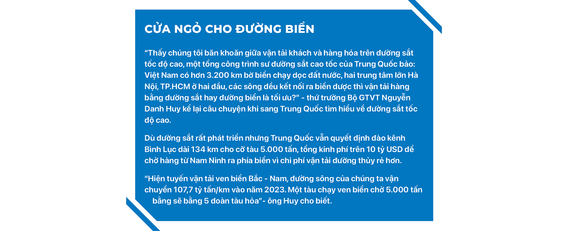
According to Deputy Minister of Transport Nguyen Danh Huy, the nearly 20-year research process on the North-South high-speed railway has left many concerns. The three issues that have raised the most concerns and questions are: resources, speed selection, and transport capacity.
In addition to synthesizing high-speed railway development experience of 22 countries and territories, the working group with the participation of relevant agencies organized field research on high-speed railway development in 6 countries: Germany, Spain, France, Japan, China, and South Korea throughout 2023.
After the field study, the Project on investment policy for the high-speed railway on the North-South axis was updated and submitted to the Government. The Politburo held a meeting to discuss and agreed to ask for the opinion of the Party Central Committee. The 13th Party Central Committee agreed on the investment policy. The project's pre-feasibility report was also updated by the Ministry of Transport. The State Appraisal Council approved the pre-feasibility report.
On the morning of November 13, 2024, Minister of Transport Nguyen Van Thang, authorized by the Prime Minister, submitted to the National Assembly the investment policy for the high-speed railway project on the North-South axis.
On the afternoon of November 30, 2024, the National Assembly officially passed a resolution on the investment policy for the North-South high-speed railway project with 92.48% approval.
According to calculations, by the time the high-speed railway is built in 2027, the size of Vietnam's economy is estimated to reach 564 billion USD, so investment resources are no longer a major obstacle.
Content: PHAM VU - THAI BA DUNG - DUC TRONG - DUC PHU - TUAN PHUNG
Presented by: AN BINH
Tuoitre.vn
Source: https://tuoitre.vn/ngan-nam-mot-duong-thien-ly-20250108212226287.htm


Comment (0)