
The Independent newspaper quoted the announcement of the US military's Joint Warning Center (JTWC) saying that super typhoon Mawar (Typhoon Betty as it is called in the Philippines) has strengthened to the equivalent of a category 5 storm - the level that causes widespread disasters while on its way to land in the Philippines.
Also according to JTWC, after strengthening, Mawar has become the world's strongest super typhoon since 2021.
As of the morning of May 27, Super Typhoon Mawar has entered the waters of the Philippines. As of 10:40 a.m., the center of the storm is estimated to be 1,170 km east-southeast of Luzon Island, Philippines. The storm is moving west at 20 km/h, with maximum sustained winds of 195 km/h near the center of the storm, gusting up to 270 km/h.
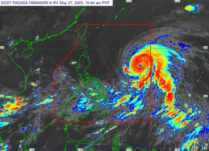
Satellite image of super typhoon Mawar entering the Philippine waters at 10:40 a.m. on May 27. (Photo: PAGAS)
Super Typhoon Mawar is still strengthening ahead of its landfall, according to the Philippine Atmospheric, Geophysical and Astronomical Services Administration (PAGAS). Several areas in the Philippines have issued warnings of thunderstorms and landslides.
PAGAS forecasts that Super Typhoon Mawar will approach Luzon Island, Philippines and then turn west-northwest into Taiwan (China). The storm may then affect Taiwan (China), South Korea and Japan.
According to the Japan Meteorological Agency (JMA), at 9:00 a.m. on May 27 (Japan time), the strongest wind near the storm's center was 180 km/h (equivalent to level 15), gusting to 250 km/h (above level 17).
JMA forecasts that in the next 3 days, storm Mawar will move west and northwest at a speed of 20-30km/h, with an intensity of level 15 and gusts of level 17.
From around May 29 to 30, storm Mawar will move more slowly, possibly changing direction to the North and then Northeast, gradually weakening to level 12-13, gusting to level 14-15.
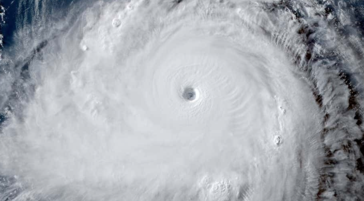
Image of super typhoon Mawar passing Guam island, continuing to move in the Pacific Ocean.
Previously, on May 24, after making landfall on Guam Island, super typhoon Mawar showed signs of weakening, but it strengthened again when it entered the waters of the Philippines.
The US National Oceanic and Atmospheric Administration (NOAA) also confirmed that this was the most destructive storm in the past 6 decades. Nearly all 52,000 households and businesses on Guam lost power after the storm swept through.
“ We are facing a mess that will take weeks to recover from ,” National Weather Service meteorologist Landon Aydlett said after Mawar swept across Guam.
Tra Khanh (Source: The Independent)
Useful
Emotion
Creative
Unique
Source


Comment (0)