
The extended Xo Viet Nghe Tinh route contributes to expanding urban space and land fund, enhancing connectivity, creating sustainable development momentum for Ha Tinh city and surrounding areas in particular, and Ha Tinh province in general.
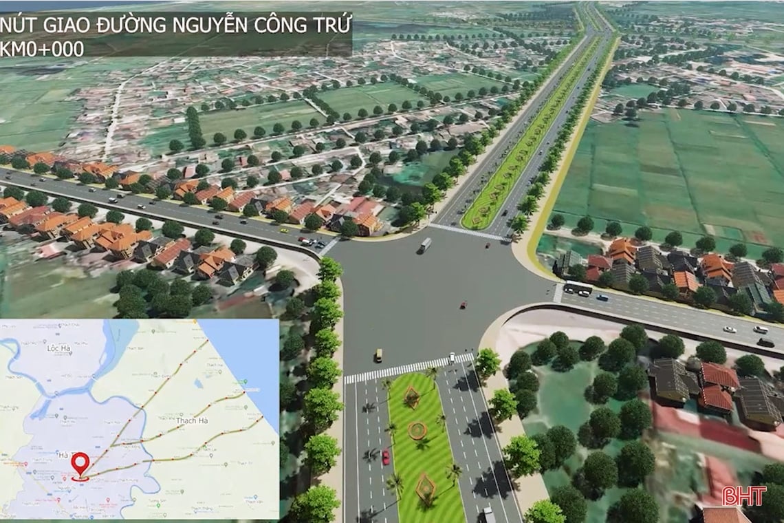
The investment project of the extended Xo Viet Nghe Tinh road is one of the contents of the Resolution on deciding on investment policies, adjusting investment policies of a number of public investment projects and supplementing the medium-term public investment plan of local budget capital for the period 2021 - 2025 (approved at the 14th Session of the 18th Provincial People's Council, taking place in mid-July 2023). Photo of the starting position of the extended Xo Viet Nghe Tinh road project through Ha Tinh city.
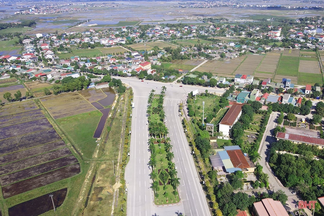
The Xo Viet Nghe Tinh route extends to the East with a length of 6.645 km, starting at the intersection with Nguyen Cong Tru (Ha Tinh City)...
... and the end point intersects with National Highway 15B in Thach Lac commune, Thach Ha district.

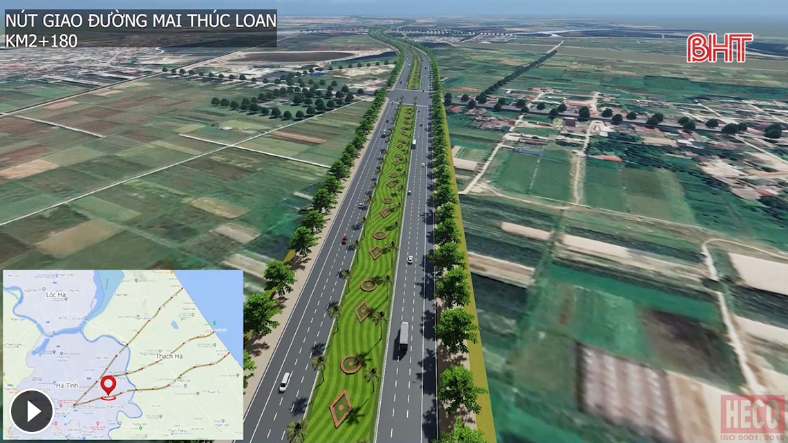
According to the design, the roadbed width is 70m, the road surface width is 21m, the sidewalk width is 10m, the green strip width on both sides of the sidewalk is 9m and the median strip width is 30m. Graphic design photo of the extended Xo Viet Nghe Tinh road.
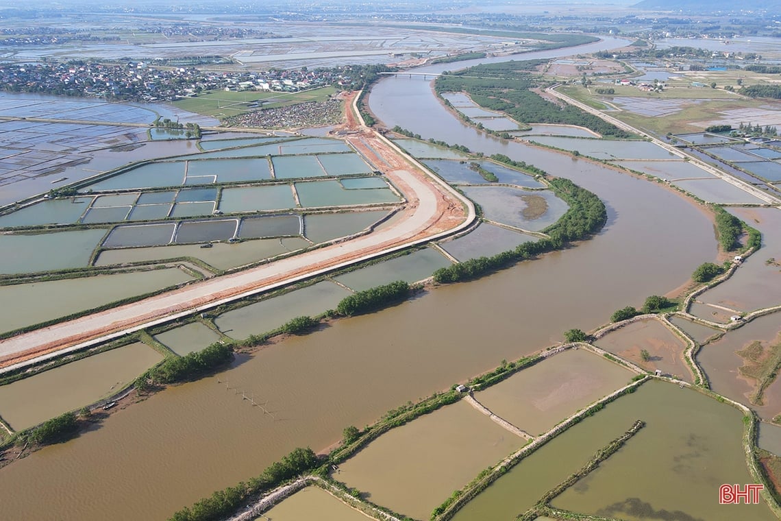
On the route, there is a large bridge over Rao Cai River made of prestressed reinforced concrete with a load capacity of HL93, with a total length of about 210m, the width of the bridge consists of 2 units - each unit is 13.5m. Photo of the construction site of the Rao Cai River overpass on the extended Xo Viet Nghe Tinh road.
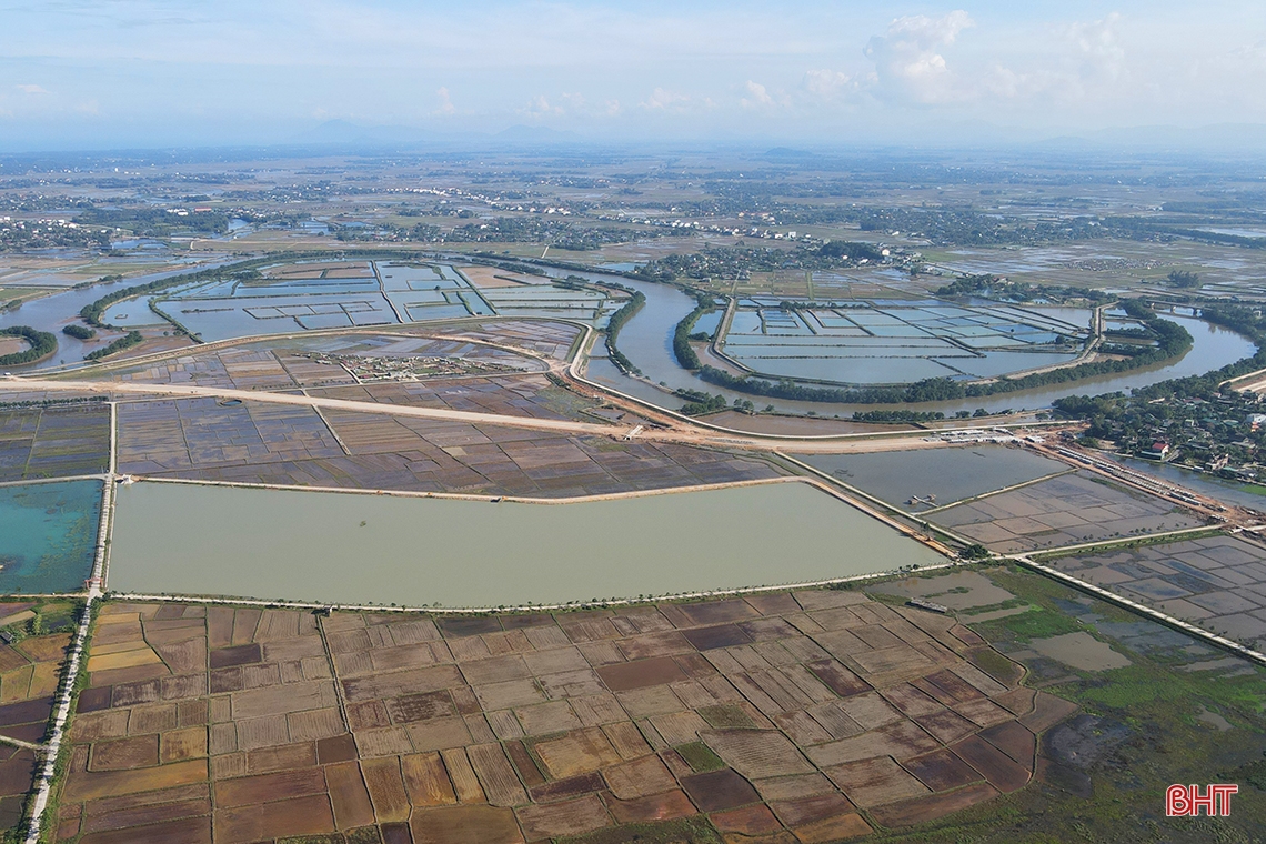
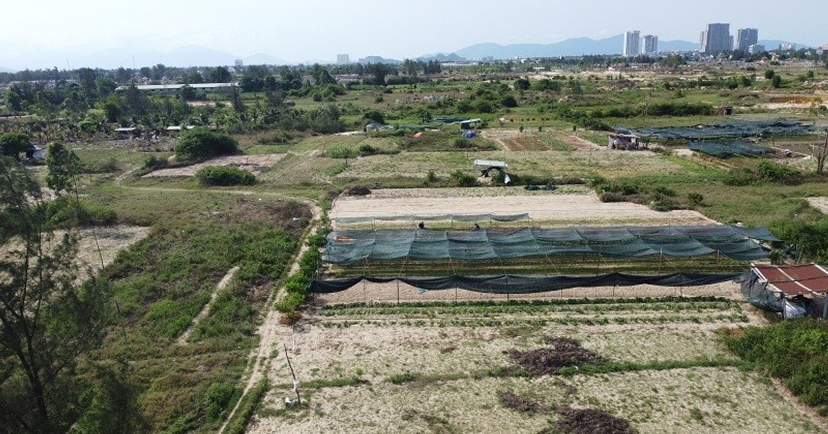
The total investment of the project is 1,498 billion VND, of which the provincial budget balances and allocates 1,248.427 billion VND from increased revenue and expenditure savings in 2021, 2022, 2023 - 2025 and 249.573 billion VND in the medium-term public investment plan of the provincial budget for the period 2026 - 2030. The project implementation period is from 2023 - 2026. Photo of the agricultural land area in Ha Tinh city where the project passes through.
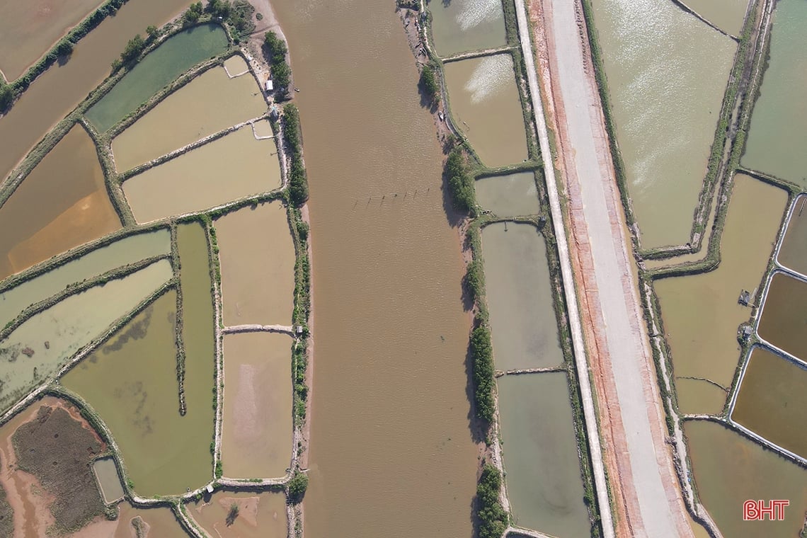
At the 17th Session of the 18th Provincial People's Council, which took place from December 6 to 8, the Provincial People's Council delegates unanimously approved the Resolution on deciding on investment policies, adjusting investment policies and supplementing the medium-term public investment plan of local budget capital for the period 2021 - 2025, including the content of adjusting the scale of the extended Xo Viet Nghe Tinh road project - adjusting the Rao Cai river overpass project. Aerial photo of the Rao Cai river overpass construction site.
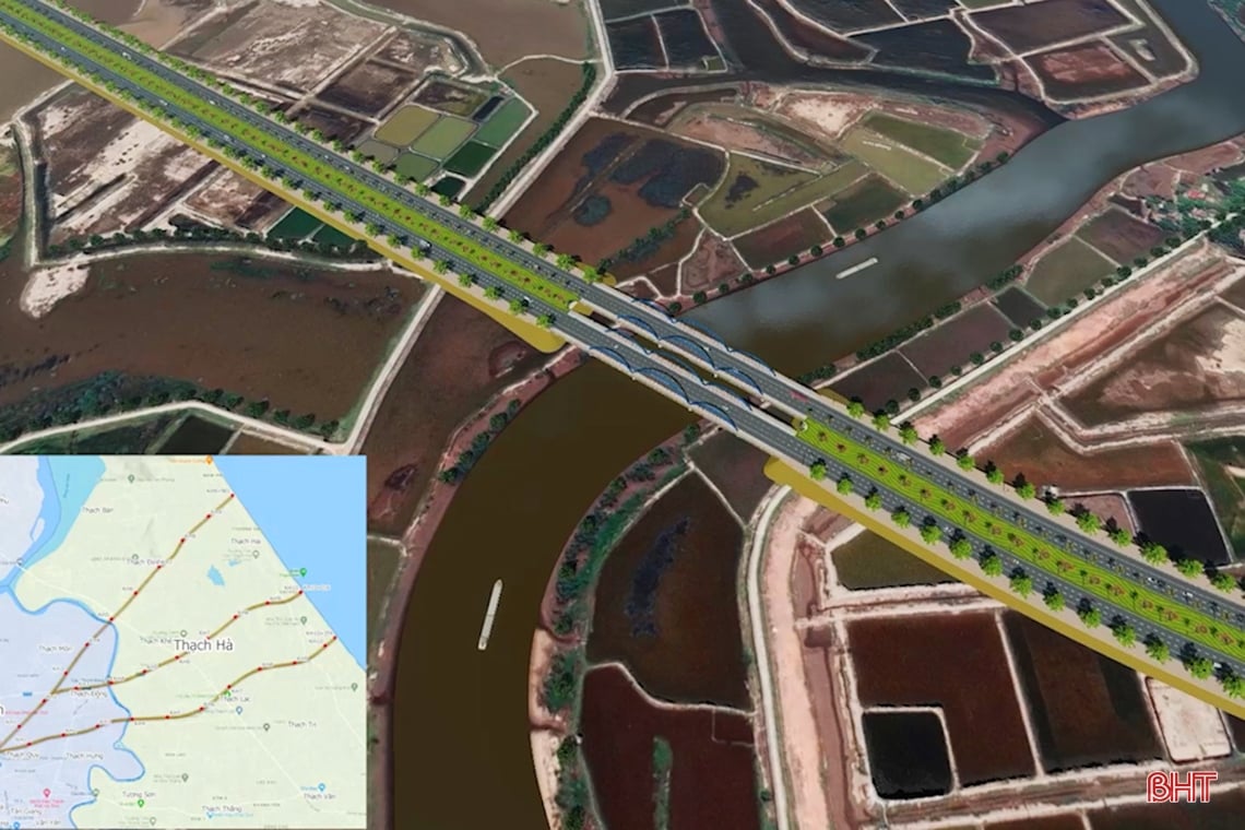
Accordingly, the Rao Cai River overpass is built (differential level crossing of the Eastern Ring Road) with prestressed reinforced concrete with HL93 load, total bridge length 341.5m, investment in a complete unit with a bridge width of 21.5m, the design of the intersection connecting to the Eastern Ring Road ensures smoothness. The adjustment is to ensure technical, aesthetic, traffic safety requirements and not exceed the total investment of the project. Initial graphic design image of the Rao Cai River overpass.
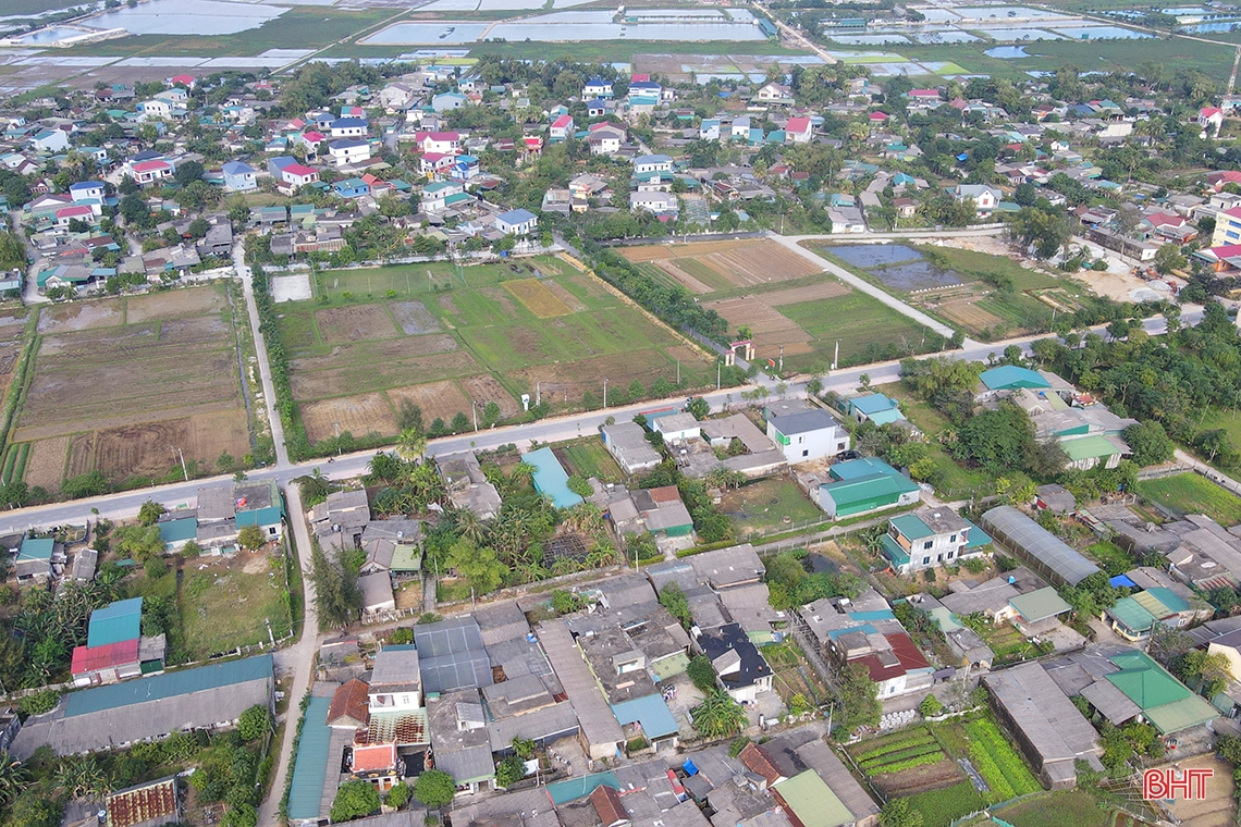
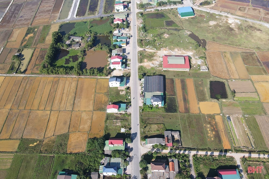
Of the 6.645 km length of the extended Xo Viet Nghe Tinh route, nearly 1 km passes through the residential area of Thach Quy ward (Ha Tinh city). Photo of the residential area of Thach Quy ward - where the project passes through.

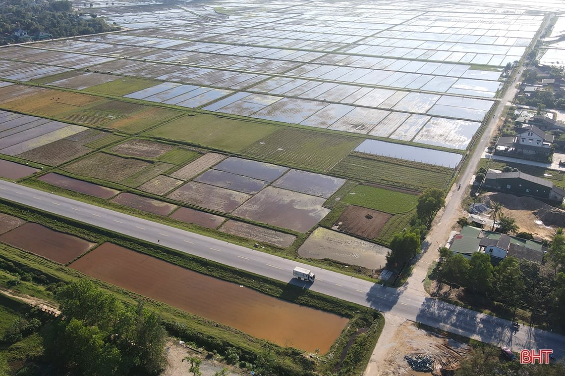
Most of the route passes through agricultural land. This will more or less facilitate the project site clearance for the two localities where the project passes through, Ha Tinh City and Thach Ha District. Photo of agricultural land in Ha Tinh City where the route passes through.
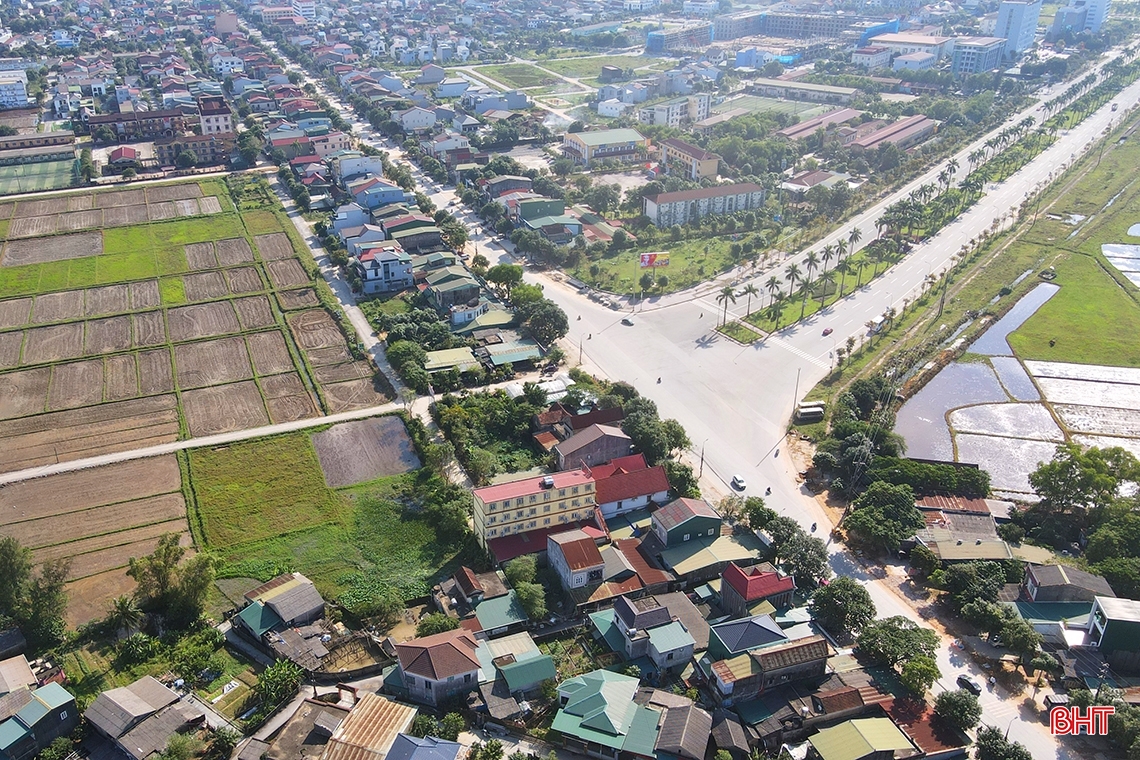
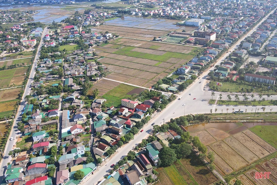
In addition to the intersection with Nguyen Cong Tru Street and National Highway 15B, along the length of the extended Xo Viet Nghe Tinh Street, there are also several other large intersections with Nguyen Trung Thien Street and Mai Thuc Loan Street of Ha Tinh City. Photo of the intersection of the extended Xo Viet Nghe Tinh Street with Mai Thuc Loan Street, Ha Tinh City.
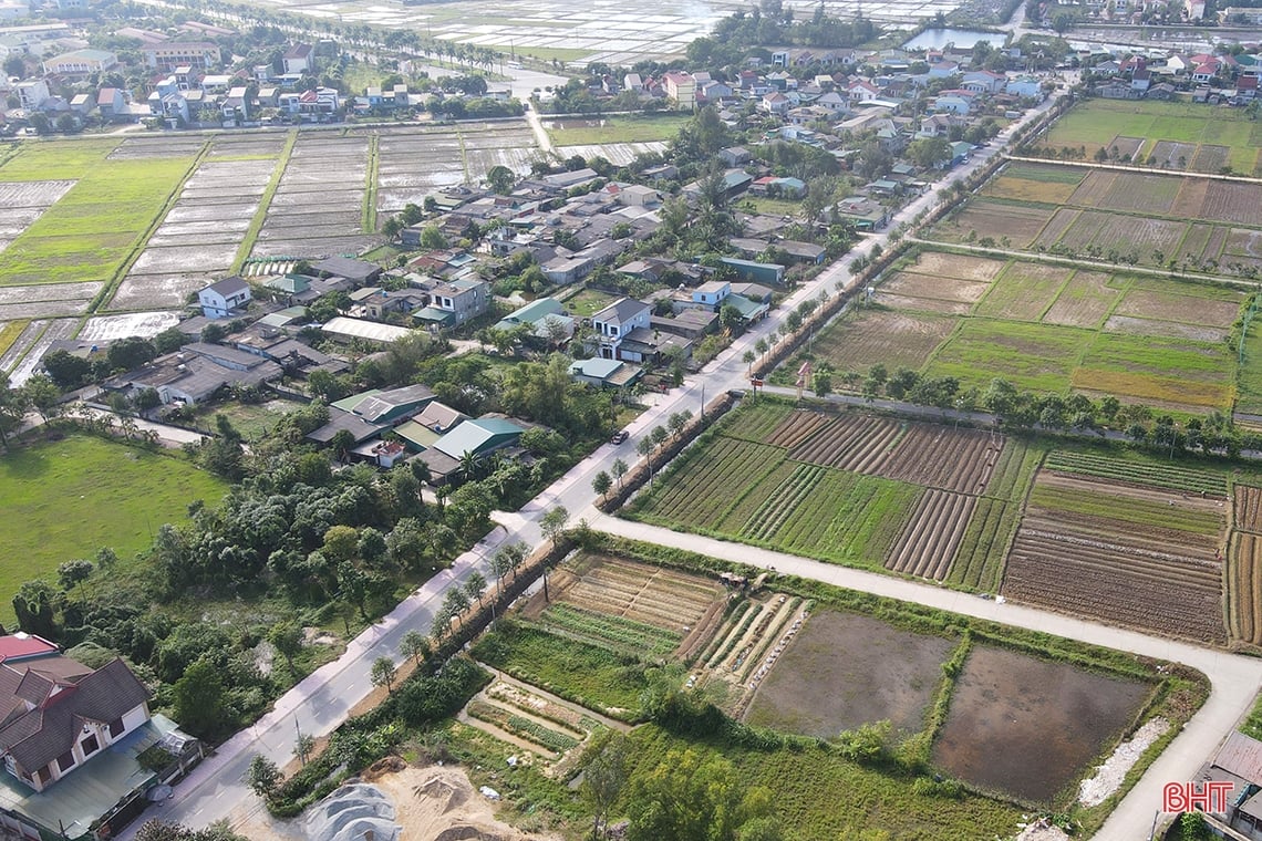
At this time, the project investor, the Ha Tinh Province Traffic Construction Investment Project Management Board, is submitting to the Ministry of Natural Resources and Environment a report assessing the project's environmental impact and preparing to submit a feasibility study report for approval. After the design is approved, the investor will design the construction drawings, select a contractor, and then implement the construction of the project. Photo of the intersection of the extended Xo Viet Nghe Tinh Street and Nguyen Trung Thien Street, Ha Tinh City.

After completion, the Xo Viet Nghe Tinh route will be the basis for forming an East-West development axis, expanding urban space, connecting urban areas, a network of public works, trade, services and connecting 9 communes in the east of Thach Ha district, connecting Ha Tinh city with the coastal strip of neighboring localities. At the same time, it will form a gateway for Ha Tinh city to develop to the sea. Photo of the intersection of the extended Xo Viet Nghe Tinh road with National Highway 15B through Thach Lac commune, Thach Ha district.
The route also contributes to completing the infrastructure according to the approved planning, ensuring traffic and transportation needs in the area, promoting production development, socio-economic development, especially economic development in the coastal area of Thach Ha district; creating conditions to attract strategic investors to implement projects in the area. Photo of the intersection of Xo Viet Nghe Tinh extended road with Nguyen Cong Tru road, Ha Tinh city.
Video: Simulation of the extended Soviet Nghe Tinh road project after completion.
Van Duc - Thang Long
Source


Comment (0)