
TPO - The peak tide of this period will appear on February 13-15 (ie January 16-18 of the lunar calendar). In particular, at Phu An station (Saigon River) and Nha Be station (Dong Dien canal), it will be around 1.47-1.52m, approximately at alert level 2.
TPO - The peak tide of this period will appear on February 13-15 (ie January 16-18 of the lunar calendar). In particular, at Phu An station (Saigon River) and Nha Be station (Dong Dien canal), it will be around 1.47-1.52m, approximately at alert level 2.
On the morning of February 12, the Southern Hydrometeorological Station said that in the past 24 hours, water levels at most stations in the downstream of the Saigon - Dong Nai river system have changed little and remained low.
At 7:00 a.m. on February 12, the highest tide peak of the day measured at Phu An station (Saigon River) was 1.28m, Nha Be station (Dong Dien canal) was 1.32m, both below Alert Level 1.
Water levels at most stations in the downstream of the Saigon - Dong Nai River are forecast to rise slowly in the coming days.
 |
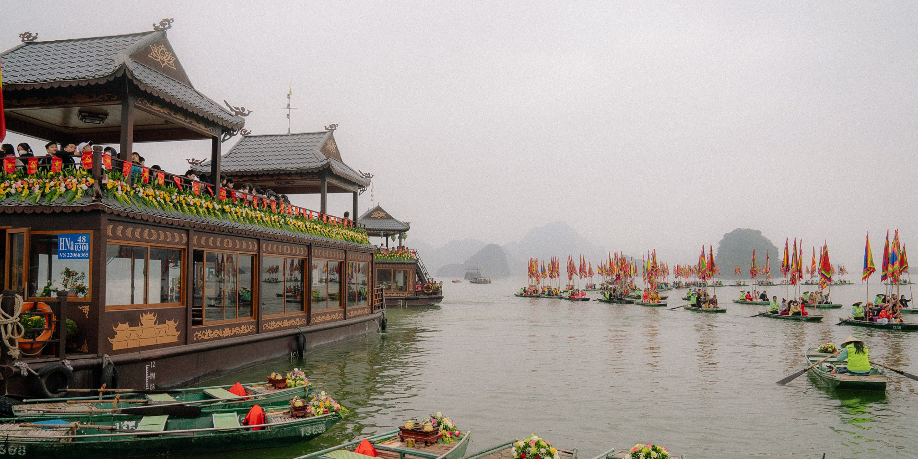
High tides on the 15th day of the first lunar month in Ho Chi Minh City may reach level 2. Illustration: Huu Huy |
The peak tide of this period will appear on February 13-15 (January 16-18), at the following levels: At Phu An station and Nha Be station, it will be around 1.47-1.52m, approximately at alert level 2.
High tide peaks from 4-6am and 5-7pm.
Bien Hoa station is about 1.7-1.8m, approximately or 0.10m below Alarm 1. Thu Dau Mot station is about 1.50-1.55m, approximately or 0.05m above Alarm 2.
Meanwhile, the National Center for Hydro-Meteorological Forecasting said that from February 11 to 20, the water level at Vung Tau station fluctuated at a high level and tended to decrease gradually. The peak tide during this period fluctuated between 390 - 400cm, with the peak tide occurring mainly between 0 and 3 a.m. and 2 to 5 p.m. every day.
The tide level in the West Sea (Rach Gia station) from February 11-20 fluctuated at a high level and tended to decrease gradually. The peak tide during this period fluctuated between 55-60cm, appearing for about 3 to 6 hours every day.
Saltwater intrusion situation in the Southwest
According to the National Center for Hydro-Meteorological Forecasting, the trend of salinity intrusion from February 11-20: Saline intrusion in the Mekong Delta increased until February 16 and then gradually decreased. The highest salinity at the stations was lower than the highest salinity in February 2024, with some stations in Ca Mau having higher salinity.
Depth of 4‰ salinity boundary at main river mouths:
Dong Vam Co River, Tay Vam Co River (saltwater intrusion range 45-55km); Cua Tieu River, Cua Dai River (saltwater intrusion range 40-45km); Ham Luong River (saltwater intrusion range 45-55km); Co Chien River (saltwater intrusion range 45-55km); Hau River (saltwater intrusion range 45-55km); Cai Lon River (saltwater intrusion range 30-40km).
Saline intrusion in the Mekong Delta in the 2024-2025 dry season will be higher than the average of many years, but not as severe as in the 2015-2016 and 2019-2020 dry seasons. Increased saline intrusion in the Mekong Delta estuary is likely to be concentrated in February-March 2025 (from February 10-16; February 27-March 4); in the Vam Co and Cai Lon rivers in March-April 2025 (from March 10-15; March 29-April 2; April 27-May 1).
The salinity intrusion situation in the Mekong Delta depends on water sources from the upper Mekong River, high tides and will fluctuate in the coming time.


Source: https://tienphong.vn/trieu-cuong-ram-thang-gieng-o-tphcm-co-the-o-muc-bao-dong-2-post1716318.tpo


Comment (0)