
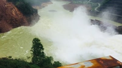
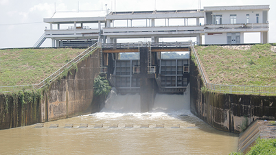
On September 22, Tri An Hydropower Company announced that it would release flood water through the spillway downstream, because the average water flow from upstream to the lake is 2,000 m3/s, reaching an elevation of 60.5m (dam safety elevation is 62m), based on the flood warning on the upstream of Tri An Lake and the water level at Bien Hoa Hydrological Station is exceeding alert level 1.
"The discharge flow will depend on the flood warning level in Bien Hoa City so that the plant can discharge at one or two gates," the announcement said.

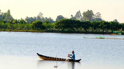
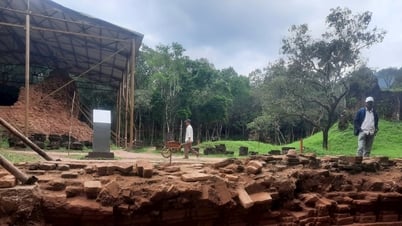
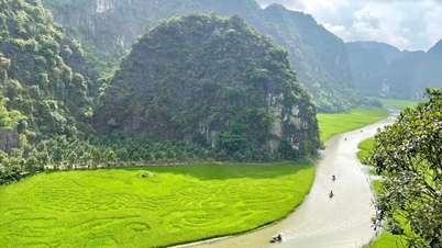
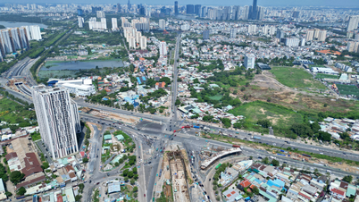
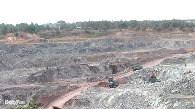
Tri An Hydroelectric Reservoir is 323 square kilometers wide, located on the Dong Nai River basin (Photo: Hoang Binh).
Tri An Hydropower Company informs the Disaster Prevention and Search and Rescue Committee at all levels and local authorities to coordinate and notify people downstream of the reservoir to prevent and avoid damage.
On the same day, the Dong Nai Province Hydrometeorological Station announced that the Dong Nai River water level was rising rapidly, between alert level 2 and alert level 3. The rising river water level has put many riverside localities in Dong Nai, Binh Duong and Ho Chi Minh City at risk of flooding and landslides.
Director of Dong Nai Province Hydrometeorological Station Nguyen Phuoc Huy said that the flood situation on Dong Nai River is complicated due to heavy rain in the upstream localities. People and relevant agencies need to closely monitor weather developments to have solutions to respond to rising river water and limit damage.
Tri An Hydroelectric Reservoir is 323km2 wide, considered the largest hydroelectric reservoir in the South, located on the Dong Nai River basin. In addition to the purpose of producing electricity for the national grid, the project also ensures water for daily life, agriculture , saltwater intrusion and flood control... for the downstream area of the Dong Nai River system.
Source: https://dantri.com.vn/xa-hoi/ho-thuy-dien-lon-nhat-mien-nam-xa-lu-canh-bao-ngap-o-tphcm-va-2-tinh-20240922150212981.htm

![[Photo] Party and State leaders attend the special art program "You are Ho Chi Minh"](https://vphoto.vietnam.vn/thumb/1200x675/vietnam/resource/IMAGE/2025/5/18/6895913f94fd4c51aa4564ab14c3f250)

![[Photo] Ready for the top competitions of Vietnamese table tennis](https://vphoto.vietnam.vn/thumb/1200x675/vietnam/resource/IMAGE/2025/5/18/9c547c497c5a4ade8f98c8e7d44f5a41)
![[Photo] Many young people patiently lined up under the hot sun to receive a special supplement from Nhan Dan Newspaper.](https://vphoto.vietnam.vn/thumb/1200x675/vietnam/resource/IMAGE/2025/5/18/6f19d322f9364f0ebb6fbfe9377842d3)


Comment (0)