
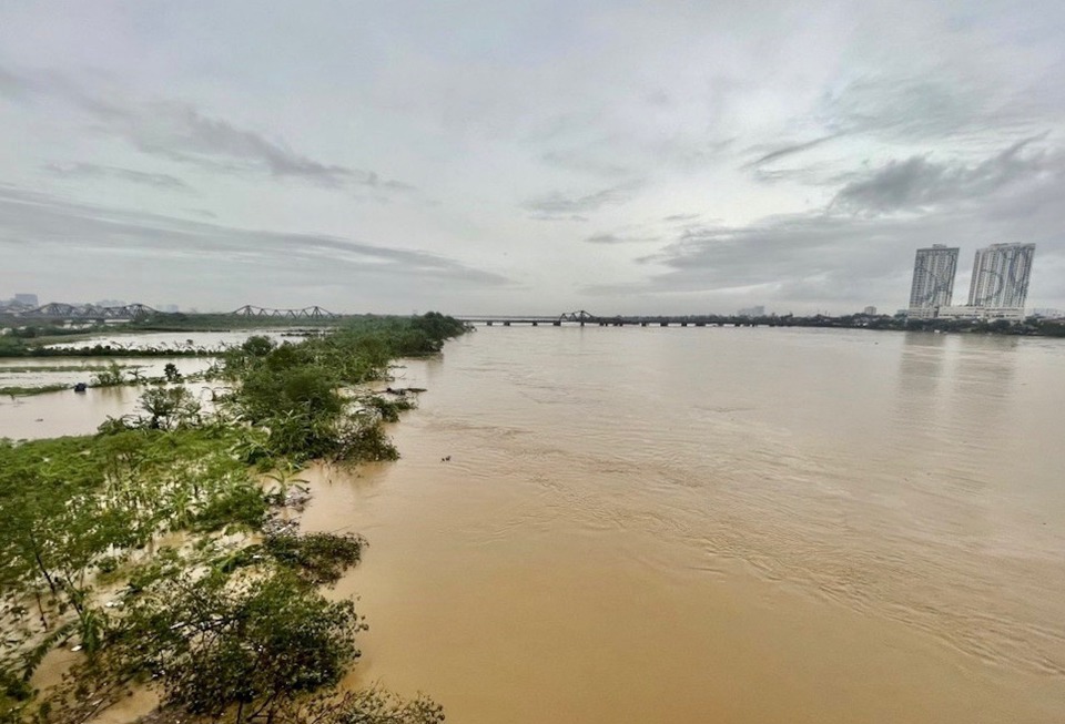
Monitoring data shows that at around 4:00 a.m. on September 11, the water level of the Duong River at Thuong Cat hydrological station (Bac Tu Liem district) was 10.05m, 0.05m above alarm level II (alarm level II is 10.0m).
Implementing regulations on flood prevention and control on the river system, the Steering Committee for Natural Disaster Prevention and Control and Search and Rescue of Hanoi City has issued a level II flood warning on the Duong River in Long Bien district and 2 districts: Dong Anh and Gia Lam.
Hanoi City requests the above districts, units in the above areas and the assigned sectors and officers to strictly implement the regulations when there is a flood warning.
At 1:00 a.m. on September 11, based on the water level at An Canh hydrological station, the Hanoi City Steering Committee for Natural Disaster Prevention and Search and Rescue also issued a level II flood warning on the Red River in the dike communes of Thuong Tin and Phu Xuyen districts.
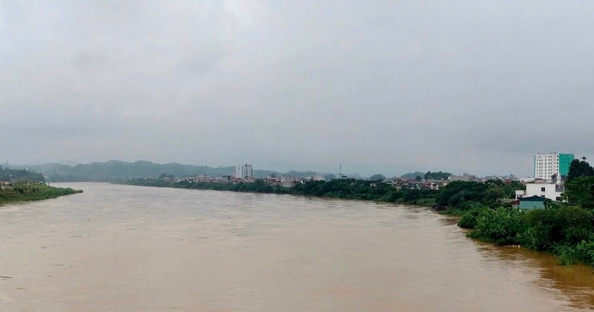
At 11:30 p.m. last night (September 10), the water level of the Red River at the Hanoi hydrological station (Long Bien bridge) exceeded 10.5 meters. Hanoi City also issued a level II flood alert in 10 districts along the river.
Previously, on September 10, the Hanoi Steering Committee for Natural Disaster Prevention and Search and Rescue also issued many warning orders, raising the flood warning level from level I to level II, from level II to level III on many rivers: Red (Son Tay station), Day (Ba Tha station), My Ha (Hoa Lac station), Cau River (Luong Phuc station)...
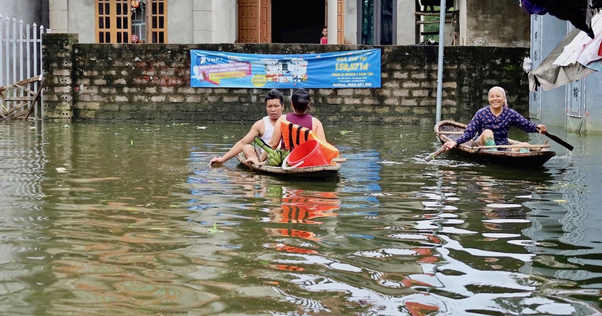
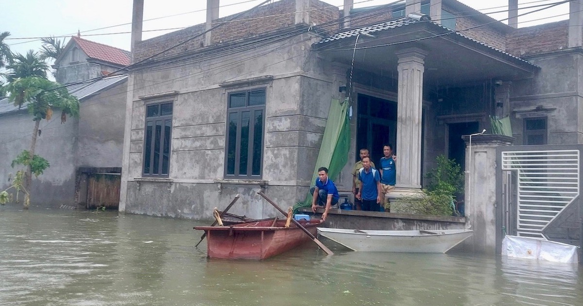
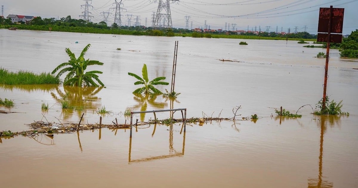
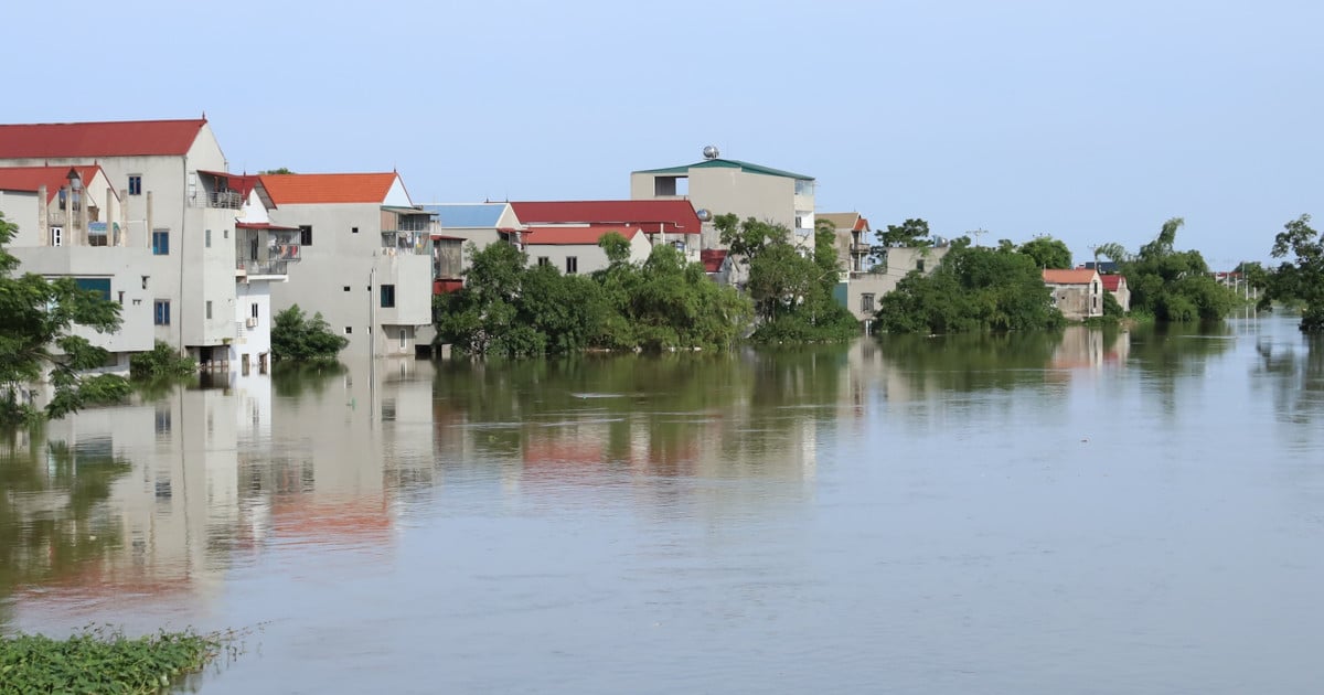
Rising water levels on many rivers are causing flooding in many riverside localities in Hanoi. As of this morning (September 11), flooding has occurred in many districts, the most severe being: Chuong My, Quoc Oai, Thach That, Soc Son, Tay Ho, Long Bien... Currently, localities are focusing their efforts on ensuring the safety of dykes on rivers.
Source: https://kinhtedothi.vn/ha-noi-nang-muc-bao-dong-lu-tren-nhieu-tuyen-song.html
![[Photo] President Luong Cuong meets with Lao Prime Minister Sonexay Siphandone](https://vstatic.vietnam.vn/vietnam/resource/IMAGE/2025/4/25/3d70fe28a71c4031b03cd141cb1ed3b1)


![[Photo] Liberation of Truong Sa archipelago - A strategic feat in liberating the South and unifying the country](https://vstatic.vietnam.vn/vietnam/resource/IMAGE/2025/4/25/d5d3f0607a6a4156807161f0f7f92362)
![[Photo] Ho Chi Minh City welcomes a sudden increase in tourists](https://vstatic.vietnam.vn/vietnam/resource/IMAGE/2025/4/25/dd8c289579e64fccb12c1a50b1f59971)


Comment (0)