According to the forecast of the National Center for Hydro-Meteorological Forecasting, on the afternoon of February 11, a low pressure area has just formed in the central and southern East Sea. It is forecasted that in the next 24 hours, this low pressure area will move slowly in a West-Northwest direction and is likely to strengthen into a tropical depression.
Latest low pressure news
At 4 p.m. on February 11, the National Center for Hydro-Meteorological Forecasting said that there was a low pressure trough with an axis of about 8 - 11 degrees North latitude connecting to the low pressure area, at 1 p.m. it was located at about 9.5 - 10.5 degrees North latitude and 112.5 - 113.5 degrees East longitude. It is forecasted that in the next 24 hours, this low pressure area will move slowly in a West-Northwest direction and is likely to strengthen into a tropical depression.
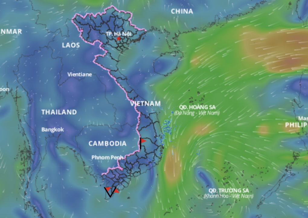
The low pressure area is likely to strengthen into a tropical depression in the next 24 hours (Photo: Vietnam Disaster Monitoring System).
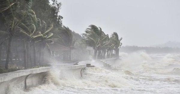
Due to the influence of the low pressure trough connecting with the low pressure area, the central and southern East Sea (including Truong Sa sea area) as well as the sea area from Binh Dinh to Ninh Thuan will have showers and thunderstorms, with a high risk of tornadoes and strong gusts of wind level 6-7.
In addition, on the night of February 11 and 12, the northeastern sea area of the North East Sea will have strong northeast winds of level 5, sometimes level 6, gusting to level 7-8. Rough seas, waves 2-4m high, posing a danger to ships operating in the area.
All vessels operating in affected sea areas should closely monitor weather developments and stay away from areas at risk of tornadoes, strong winds and large waves. Fishermen and captains should proactively seek safe anchorages and follow the instructions of authorities to ensure safety. The risk level of natural disasters due to strong winds at sea is level 1.
Authorities and people need to be vigilant and closely monitor weather forecasts to promptly respond to developments in low pressure areas.
Proactively respond to low pressure that is likely to strengthen into a tropical depression
To proactively respond to low pressure areas that are likely to strengthen into tropical depressions, the Ministry of Agriculture and Rural Development recommends that provinces and cities:
1. Closely monitor warning bulletins, forecasts and developments of low pressure areas that are likely to strengthen into tropical depressions; notify captains and owners of vehicles and vessels operating at sea to proactively prevent and have appropriate production plans, ensuring safety of people and property; maintain communication to promptly handle possible adverse situations.
2. Prepare forces and means to deploy rescue work when there is a situation.
3. Be on duty seriously and regularly report to the Ministry of Agriculture and Rural Development (through the Department of Dyke Management and Disaster Prevention and Control).
Source: https://danviet.vn/nong-ap-thap-manh-len-thanh-ap-thap-nhiet-doi-tien-vao-nuoc-ta-bien-dong-lieu-co-don-bao-trai-mua-20250211190550602.htm















Comment (0)