
Tonight (October 9), the National Center for Hydro-Meteorological Forecasting said that storm No. 4 (storm Koinu) has weakened into a tropical depression . At 7:00 p.m., the center of the tropical depression is located in the sea south of Guangdong province (China). The strongest wind near the center of the tropical depression is level 6-7 (39-61 km/h), gusting to level 9, moving in a West Southwest direction at a speed of about 10 km/h.
By 7am tomorrow (October 10), the tropical depression over Hainan Island will move southwest at a speed of about 15 km/h and weaken into a low pressure area.
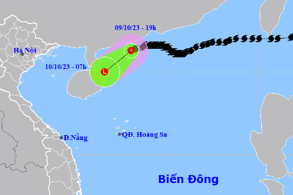
Impact of tropical depression, in the next 12 hours, the northwest sea of the North East Sea will have strong winds of level 6-7, gusts of level 9, and rough seas.
Also according to the meteorological agency, around tonight, the cold air will strengthen and affect the Northeast, then the North Central and some places in the Northwest. The Northeast wind inland will be strong at level 2-3, coastal areas at level 3-4.
The weather in the North and North Central regions is cold at night and in the morning. During this cold air mass, the lowest temperature in the North and North Central regions is generally from 21-24 degrees Celsius, in the mountainous areas of the North it is 18-21 degrees Celsius, and in the high mountainous areas it is below 16 degrees Celsius in some places.
The influence of cold air has increased, since early morning of October 10, the sea area of Bac Bo Gulf has strong northeast wind level 6, gust level 8, rough sea.
Source


Comment (0)