
From the night of February 15 to the morning of February 16, the cold air weakened to the East, combined with the strong current in the West wind zone, causing cold rain in the North and North Central regions; around February 21, a new wave will come in stronger.
According to the National Center for Hydro-Meteorological Forecasting, currently (February 15), a cold air mass is moving south from the North.
Around tonight and tomorrow morning (February 16), this cold air mass will affect the Northeast region, then some places in the Northwest and North Central regions. Northeast winds inland are strong at level 2-3.

This cold air mass strengthens the temperature of the night of February 12-13, causing the temperature in the area to continue to be cold with rain, drizzle and fog.
Specifically, the meteorological agency said that from tonight, the weather in the Northeast will be cold, with some mountainous areas experiencing severe cold. The lowest temperature in this cold air mass in the Northeast will generally be between 16-19 degrees Celsius, with some mountainous areas below 15 degrees Celsius.
As for Hanoi weather, from tonight it will be cold. The lowest temperature in this cold air mass is commonly 17-19 degrees.
Due to the influence of the weak cold air mass from the East combined with the strong current in the upper westerly wind zone from tonight to the morning of February 17, the Northern and North Central regions will have scattered rain and light rain. In the Northwest region, there will be light rain in some places, sunny in the afternoon, cold at night and morning.
At the same time, the Southern Hydrometeorological Station also forecast that the continental cold high pressure will strengthen again in the North on February 16. The equatorial low pressure trough in the south connecting with the tropical low pressure in the sea area off the South Central Coast will weaken and gradually dissipate. Above, the subtropical high pressure across the Central Coast will operate stably.
The cold air mass will strengthen and weaken slowly, and from February 21 it will strengthen again in the North.
Meteorological experts note that the cold air shifting to the East and changing its shape will cause many days of light rain, drizzle and fog, especially in the northeastern and north central provinces, which will affect people's daily activities and traffic.
In addition, from early tomorrow morning, in the North of Bac Bo Gulf, the Northeast wind will gradually increase to level 4-5, with waves 1-2m high; from tomorrow night, in the Northeastern sea area of the North East Sea, the Northeast wind will gradually increase to level 6, gusting to level 7-8, rough seas, with waves 2-4m high.

Cold air shifts to the East, the North has many days of fog and drizzle
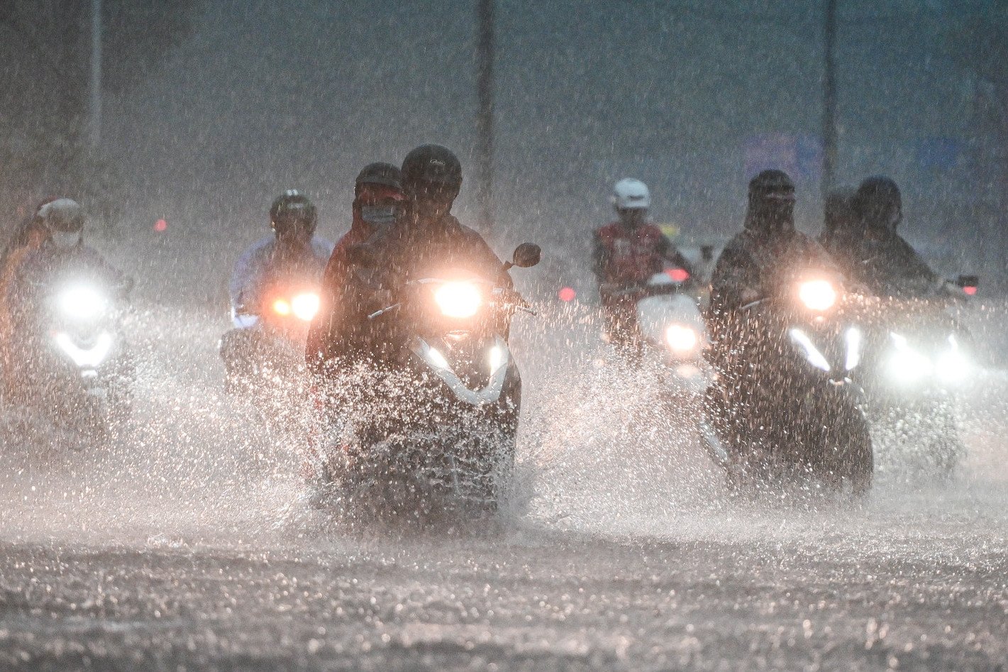
Ho Chi Minh City welcomes unusually heavy February rain in 40 years
Source: https://vietnamnet.vn/mien-bac-don-lien-tiep-hai-dot-khong-khi-lanh-mua-ret-keo-dai-2371634.html
![[Photo] More than 17,000 candidates participate in the 2025 SPT Competency Assessment Test of Hanoi National University of Education](https://vphoto.vietnam.vn/thumb/1200x675/vietnam/resource/IMAGE/2025/5/17/e538d9a1636c407cbb211b314e6303fd)
![[Photo] National conference to disseminate and implement Resolution No. 66-NQ/TW and Resolution No. 68-NQ/TW of the Politburo](https://vphoto.vietnam.vn/thumb/1200x675/vietnam/resource/IMAGE/2025/5/18/adf666b9303a4213998b395b05234b6a)


![[Photo] General Secretary To Lam visits exhibition of achievements in private economic development](https://vphoto.vietnam.vn/thumb/1200x675/vietnam/resource/IMAGE/2025/5/18/1809dc545f214a86911fe2d2d0fde2e8)


![[Photo] Prime Minister Pham Minh Chinh chairs meeting on science and technology development](https://vphoto.vietnam.vn/thumb/1200x675/vietnam/resource/IMAGE/2025/5/17/ae80dd74c384439789b12013c738a045)


Comment (0)