
Participating in this training course were 101 technical staff and line management workers who were able to use PTC1's UAVs well.

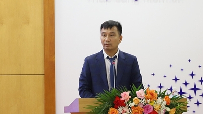
Mr. Nguyen Van Vinh, officer of PTC2 Technical Department, shares content in class
This training course aims to improve skills in using UAVs to inspect transmission lines; using flying devices combined with positioning signals from the National CORS station system to perform scanning flights and build 3D models.
On the existing 3D model, build an automatic flight path for use by other aircraft that support the RTK system to serve monthly periodic inspections using UAVs and improve skills and solve problems in the process of operating the line management software, in which artificial intelligence (AI) is applied as well as focusing on practical skills and real data processing for officers and workers operating UAV equipment to promote and accelerate the rapid and widespread application of this technology in the management and operation of the National Power Transmission Corporation (EVNNPT).

Groups practice setting up 3D diagrams
During the 4 days, PTC2 technical staff provided theoretical and practical guidance. The theoretical part included 3 contents: using UAVs to inspect power lines; power line management software system and AI software; comprehensive application of UAVs in inspection work.
The practical part includes the following contents: practicing connecting UAV with mobile and fixed RTK positioning stations (CORS); checking power lines with UAV according to the process; building automatic flight paths; on the power line management software system and on the AI software system.
During this time, PTC1's UAV operators and workers exchanged and learned more practical experiences from PTC2 in using UAVs. In particular, they exchanged experiences on the safe control distance of UAVs while UAVs can only approach objects at a maximum distance of 2 - 3 m, piloting work because if flying close to the power line, there is a high risk of collision causing incidents as well as damage to the equipment, and experience in inspection at some extremely difficult locations due to mountainous terrain, deep ravines, etc.

UAV flight practice guide
Comprehensive application of UAV to inspect power lines and make flight paths UAV to automatically inspect on 3D LiDAR model is described as follows: using LIDAR camera installed on drone to scan and build 3D map of power lines in the field.
Then, create automatic flight paths on the built 3D map and load them to other flying devices that support RTK technology to automatically fly to inspect the transmission grid with high accuracy.
This solution brings many practical benefits: saving time and labor for flying to inspect the power line compared to manual shooting method by humans; automating the process of inspecting the transmission grid by UAV and uniform data between inspection flights; being able to create flight paths on the built 3D model and change them according to data collection needs; being able to see the expected shooting angle of the flying device, making it more convenient to create flight paths.

Students install 3D to prepare for practical flight
The simulated shooting frame in the software is the same as the actual shooting frame; the device can fly and shoot with high precision (using CORS station signal); just scan 3D once and use it for the next times (management, automatic flight path creation, etc.).
EVNNPT promotes training and synchronously deploys scanning and building automatic flight paths on 3D models throughout EVNNPT to apply achievements of science , technology, engineering, automation, improve labor productivity, and reduce hardship for workers.
Continuing to effectively implement the emulation movements "Good workers - Creative workers", "Innovation - Creativity" to reduce labor, increase productivity and efficiency in operating the transmission system, creating a solid foundation for accelerating the digital transformation roadmap, contributing to EVNNPT becoming a digital enterprise of Vietnam Electricity Group by 2025.

UAV flight practice guide
Source link
![[Photo] Panorama of the Opening Ceremony of the 43rd Nhan Dan Newspaper National Table Tennis Championship](https://vphoto.vietnam.vn/thumb/1200x675/vietnam/resource/IMAGE/2025/5/19/5e22950340b941309280448198bcf1d9)

![[Photo] General Secretary To Lam attends the conference to review 10 years of implementing Directive No. 05 of the Politburo and evaluate the results of implementing Regulation No. 09 of the Central Public Security Party Committee.](https://vphoto.vietnam.vn/thumb/1200x675/vietnam/resource/IMAGE/2025/5/19/2f44458c655a4403acd7929dbbfa5039)
![[Photo] President Luong Cuong presents the 40-year Party membership badge to Chief of the Office of the President Le Khanh Hai](https://vphoto.vietnam.vn/thumb/1200x675/vietnam/resource/IMAGE/2025/5/19/a22bc55dd7bf4a2ab7e3958d32282c15)
![[Photo] Close-up of Tang Long Bridge, Thu Duc City after repairing rutting](https://vphoto.vietnam.vn/thumb/1200x675/vietnam/resource/IMAGE/2025/5/19/086736d9d11f43198f5bd8d78df9bd41)


![[Photo] Prime Minister Pham Minh Chinh inspects the progress of the National Exhibition and Fair Center project](https://vphoto.vietnam.vn/thumb/1200x675/vietnam/resource/IMAGE/2025/5/19/35189ac8807140d897ad2b7d2583fbae)


![[VIDEO] - Enhancing the value of Quang Nam OCOP products through trade connections](https://vphoto.vietnam.vn/thumb/402x226/vietnam/resource/IMAGE/2025/5/17/5be5b5fff1f14914986fad159097a677)


Comment (0)