
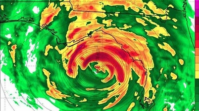
Latest news on the first storm in 2024
The tropical depression is forecast to move northwest along the eastern coast of the Philippines and is likely to strengthen into a typhoon. After that, the storm is likely to change direction to the northeast and is unlikely to affect the East Sea.
Cong Thuong Newspaper quoted the Joint Typhoon Warning Center (JTWC) of the US Navy. Specifically, on the night of May 25 (Hanoi time), this unit issued a warning that the tropical depression in the central Philippines had strengthened into a storm.
This storm is forecast to have strong winds of level 8, moving slowly in a north-northwest direction - towards the south of Manila (Philippines), then is forecast to gradually start moving outward. However, on the evening of May 25, the Japan Meteorological Agency (JMA) has not yet recognized that the tropical depression has strengthened into a storm.
According to meteorological experts, this is the first storm in the Northwest Pacific region as well as the Northern Hemisphere during this year's hurricane season.
This storm (tropical depression) is the cause of the uncomfortable heat wave in the South and reduced rain in the Central Highlands because the subtropical high pressure in the Northwest Pacific Ocean was "cut in half" by the tropical depression.
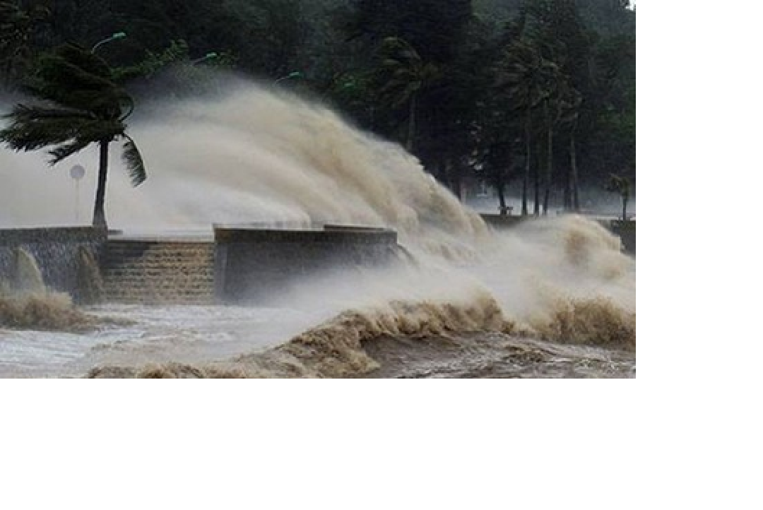
Illustration photo.
Forecast of thunderstorms, tornadoes, strong winds at sea
Currently (May 26) in the Northern Gulf of Tonkin, the eastern sea area of the central East Sea, and the southern East Sea area (including the waters of the Truong Sa archipelago) there are showers and thunderstorms.
Forecast for the day and night of May 26, the eastern sea area of the central East Sea, the southern East Sea area (including the sea area of Truong Sa archipelago) will have showers and thunderstorms. During the thunderstorms, there is a possibility of tornadoes and strong gusts of wind level 6-7, beware that wave heights may increase to over 2.0m.
Impact Forecast: All vessels operating in the above areas are at high risk of being affected by tornadoes, strong winds and large waves.
Warning of heavy rain, lightning and hail in many places
According to the National Center for Hydro-Meteorological Forecasting, last night and early this morning (May 26), in the Northern and North Central regions, there were showers and thunderstorms, locally heavy to very heavy rain with rainfall from 7:00 p.m. on May 25 to 3:00 a.m. on May 26, some places had over 50mm such as: Son Binh (Lai Chau) 53.2mm, Phu Kim (Hanoi) 169.8mm, Dan Ha (Hoa Binh) 137.6mm, Hung Vuong (Vinh Phuc) 102.4mm, Thach Lam (Thanh Hoa) 76.6mm,...
On the morning of May 26, the Northern region will have showers and thunderstorms, locally with moderate to heavy rain with rainfall of 10-30mm, in some places over 50mm.
Thunderstorms may cause tornadoes, lightning, hail and strong gusts of wind. Localized heavy rain may cause flash floods on small rivers and streams, landslides on steep slopes and flooding in low-lying areas. Beware of heavy rain in a short period of time causing flooding in urban areas.
Notably, the National Center for Hydro-Meteorological Forecasting has just issued a warning bulletin of strong winds and thunderstorms at sea. Accordingly, currently in the North of the Gulf of Tonkin, the eastern sea area of the central East Sea is experiencing showers and thunderstorms.
Today and tonight, May 26, in the northern area of the Gulf of Tonkin, the eastern sea area of the central East Sea, there will be showers and thunderstorms. During thunderstorms, there is a possibility of tornadoes and strong gusts of wind of level 6-7, beware of wave heights that may increase to over 2.0m. All vessels operating in the above areas are at high risk of being affected by tornadoes, strong gusts of wind and large waves.
Weather forecast for the next 10 days
Weather in the regions from now until May 27
- Northern region and Thanh Hoa: from the night of May 25 to the morning of May 26, there will be showers and thunderstorms, locally heavy to very heavy rain; later there will be showers and thunderstorms in some places, sunny during the day.
- Central region: in the evening and at night there will be showers and thunderstorms in some places, sunny during the day, on May 26 the western mountainous areas from Nghe An to Phu Yen will be hot, some places will be very hot; from May 27 the heat will spread to the area from Thanh Hoa to Phu Yen, some places will be very hot.
- Other areas: in the evening and at night there will be scattered showers and thunderstorms in some places, especially in the evening of May 27 in the Central Highlands and the South; sunny during the day, on May 26 in the South there will be widespread heat.
Thunderstorms may produce tornadoes, lightning, hail and strong winds.
Weather forecast from the night of May 27 to June 4
- Northern region: from the night of May 27-31, there is a possibility of rain, moderate rain and thunderstorms, locally heavy to very heavy rain. From June 1, there will be showers and thunderstorms, locally heavy rain.
- Central region: From around May 28-30, there is a possibility of widespread heat waves. From the evening and night of May 28-31, there is a possibility of showers and thunderstorms in the North Central region, with localized heavy rain.
- Central Highlands and Southern region: from the night of May 27 to June 4, in the late afternoon and evening there will be scattered showers and thunderstorms, locally heavy rain.
Thunderstorms may produce tornadoes, lightning, hail and strong winds.
Truc Chi (t/h)
Source: https://www.nguoiduatin.vn/da-co-tin-hieu-dau-tien-ve-con-bao-gan-bien-dong-suc-gio-manh-cap-8-a665362.html


![[Photo] General Secretary To Lam meets and expresses gratitude to Vietnam's Belarusian friends](https://vphoto.vietnam.vn/thumb/1200x675/vietnam/resource/IMAGE/2025/5/11/c515ee2054c54a87aa8a7cb520f2fa6e)
![[Photo] General Secretary To Lam arrives in Minsk, begins state visit to Belarus](https://vphoto.vietnam.vn/thumb/1200x675/vietnam/resource/IMAGE/2025/5/11/76602f587468437f8b5b7104495f444d)

![[Photo] General Secretary To Lam concludes visit to Russia, departs for Belarus](https://vphoto.vietnam.vn/thumb/1200x675/vietnam/resource/IMAGE/2025/5/11/0acf1081a95e4b1d9886c67fdafd95ed)


![[Photo] National Assembly Chairman Tran Thanh Man attends the Party Congress of the Committee for Culture and Social Affairs](https://vphoto.vietnam.vn/thumb/1200x675/vietnam/resource/IMAGE/2025/5/11/f5ed02beb9404bca998a08b34ef255a6)


Comment (0)