
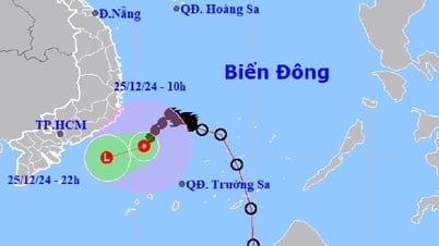
Regarding the current status of storm No. 2, according to the National Center for Hydro-Meteorological Forecasting, this morning (July 21), the tropical depression in the Hoang Sa archipelago has strengthened into a storm, storm No. 2 in 2024.
At 7:00 a.m., the eye of the storm was located at approximately 16.4 degrees North latitude; 111.4 degrees East longitude, over the waters of the Hoang Sa archipelago. The strongest wind near the eye of the storm was level 8 (62-74 km/h), gusting to level 10, moving in a West Northwest direction at a speed of 10-15 km/h.

Direction of movement of storm No. 2. Source: nchmf.
It is forecasted that by 7:00 a.m. on July 22, storm No. 2 will move northwest at a speed of 10-15 km/h, level 8 intensity, gusting to level 10.
At 7:00 a.m. on July 23, storm No. 2 moved northwest at a speed of about 10 km/h, entered the Gulf of Tonkin and gradually weakened, at level 6-7, gusting to level 9.
At 7:00 a.m. on July 24, storm No. 2 moved northwest, gradually weakening into a low pressure area.
Forecast of storm impact number 2
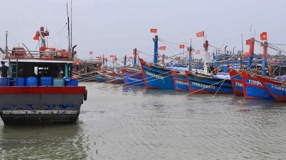
At sea : The sea area west of the North and Central East Sea (including Hoang Sa archipelago), the sea area east of Quang Tri to Quang Ngai has strong winds of level 6-7, the area near the storm's center has strong winds of level 8, gusts of level 10, rough seas.
The sea area west of the North and Central East Sea (including Hoang Sa archipelago), the sea area east of Quang Tri to Quang Ngai area has waves 2.0-4.0m high, the area near the storm center has waves 3.0-5.0m high.
Source: https://danviet.vn/nong-bien-dong-co-con-bao-so-2-tac-dong-den-thoi-tiet-mien-bac-nhung-ngay-toi-ra-sao-20240721082713488.htm

![[Photo] Prime Minister Pham Minh Chinh and Prime Minister of the Kingdom of Thailand Paetongtarn Shinawatra attend the Vietnam-Thailand Business Forum 2025](https://vphoto.vietnam.vn/thumb/1200x675/vietnam/resource/IMAGE/2025/5/16/1cdfce54d25c48a68ae6fb9204f2171a)


![[Photo] President Luong Cuong receives Prime Minister of the Kingdom of Thailand Paetongtarn Shinawatra](https://vphoto.vietnam.vn/thumb/1200x675/vietnam/resource/IMAGE/2025/5/16/52c73b27198a4e12bd6a903d1c218846)


Comment (0)