
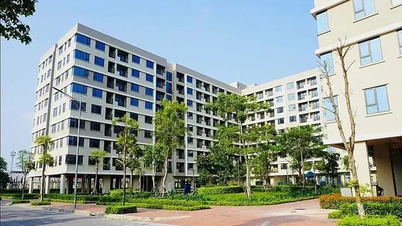
On December 10, the Hanoi People's Committee issued Decision No. 6363/QD-UBND approving the project of Local Adjustment of the Detailed Construction Planning for Renovation and Renovation of Both Sides of Pham Hung Street, scale 1/500 (from Xuan Thuy Street to Tran Duy Hung Street) at planning block N1.3 at location No. 8 Pham Hung Street, Mai Dich Ward, Cau Giay District, Hanoi City.
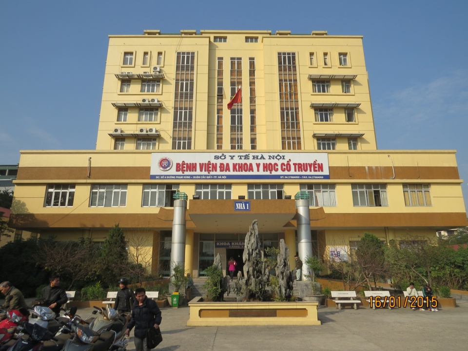
The planning research scale has a total land area of 15,160m2 (according to Decision No. 2577/QD - UBND dated May 14, 2014 of the City People's Committee on land allocation to Hanoi Traditional Medicine General Hospital at No. 8 Pham Hung Street, Mai Dich Ward, Cau Giay District).
The objective of local adjustment of the Detailed Construction Plan for Renovation and Renovation of both sides of Pham Hung Street, scale 1/500 (section from Xuan Thuy Street to Tran Duy Hung Street) at planning block N1.3 - land for investment project to upgrade Hanoi Traditional Medicine General Hospital) in the direction of reorganizing the construction site, architectural landscape space and underground construction area; ensuring land use functions and architectural planning indicators in accordance with the orientation of the Urban Zoning Plan and the related approved Detailed Plan at scale 1/500...
Land lot coded N1.3 is determined to be used as urban public works land; construction target: Hanoi Traditional Medicine General Hospital.
Architectural planning indicators: land area of about 15,262m2; construction area of about 6,105m2; construction density of about 40%; land use coefficient of about 3 times; building height: 01 ÷ 09 floors; total construction floor area of about 45,786m2. For underground works of high-rise buildings, the number of floors, area... are specifically determined according to the project approved by the competent authority.
Now, it is proposed to adjust and change (reduce) some architectural planning indicators such as: land area, construction area, construction density, total construction floor area, land use coefficient and layout solution; reorganize the landscape architectural space, specifically determine the scope and scale of the underground construction area at land lot N1.3 on the principle of: updating the land boundary according to the current status (confirmed by Mai Dich Ward People's Committee on October 19, 2024) and the granted red line; determine architectural planning indicators (construction density, building height, land use coefficient); update the land area in accordance with Decision No. 2577/QD-UBND dated May 14, 2014 of the City People's Committee and architectural planning indicators (total floor area of the above-ground construction, total floor area of 2 basements to serve the needs of parking, technical arrangement, fire prevention and fighting) ...
The Decision also clearly states the organization of spatial planning of landscape architecture and urban design; planning of technical infrastructure systems.
Source: https://kinhtedothi.vn/dieu-chinh-cuc-bo-quy-hoach-du-an-benh-vien-y-hoc-co-truyen.html

![[Photo] Party and State leaders attend the special art program "You are Ho Chi Minh"](https://vphoto.vietnam.vn/thumb/1200x675/vietnam/resource/IMAGE/2025/5/18/6895913f94fd4c51aa4564ab14c3f250)

![[Photo] Special flag-raising ceremony to celebrate the 135th birthday of President Ho Chi Minh](https://vphoto.vietnam.vn/thumb/1200x675/vietnam/resource/IMAGE/2025/5/19/1c5ec80249cc4ef3a5226e366e7e58f1)
![[Photo] Party and State leaders visit President Ho Chi Minh's Mausoleum](https://vphoto.vietnam.vn/thumb/1200x675/vietnam/resource/IMAGE/2025/5/19/d7e02f242af84752902b22a7208674ac)


Comment (0)