
Mr. Nguyen Van Huong, Head of Weather Forecasting Department, said that by 8:00 a.m. on October 25, storm Tra Mi continued to increase in intensity and heavy rain is forecast in the Central region.
On the morning of October 25, the Department of Dyke Management and Natural Disaster Prevention (Ministry of Agriculture and Rural Development) held a meeting to respond to storm Tra Mi.
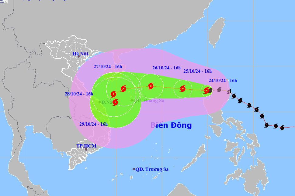
Mr. Nguyen Van Huong, Head of Weather Forecast Department (National Center for Hydro-Meteorological Forecasting) said that on the afternoon of October 24, storm Tra Mi entered the eastern sea of the North East Sea, becoming storm number 6 in 2024.
By 8am today, the storm's intensity had increased to level 10, moving west at a speed of about 5km/h.
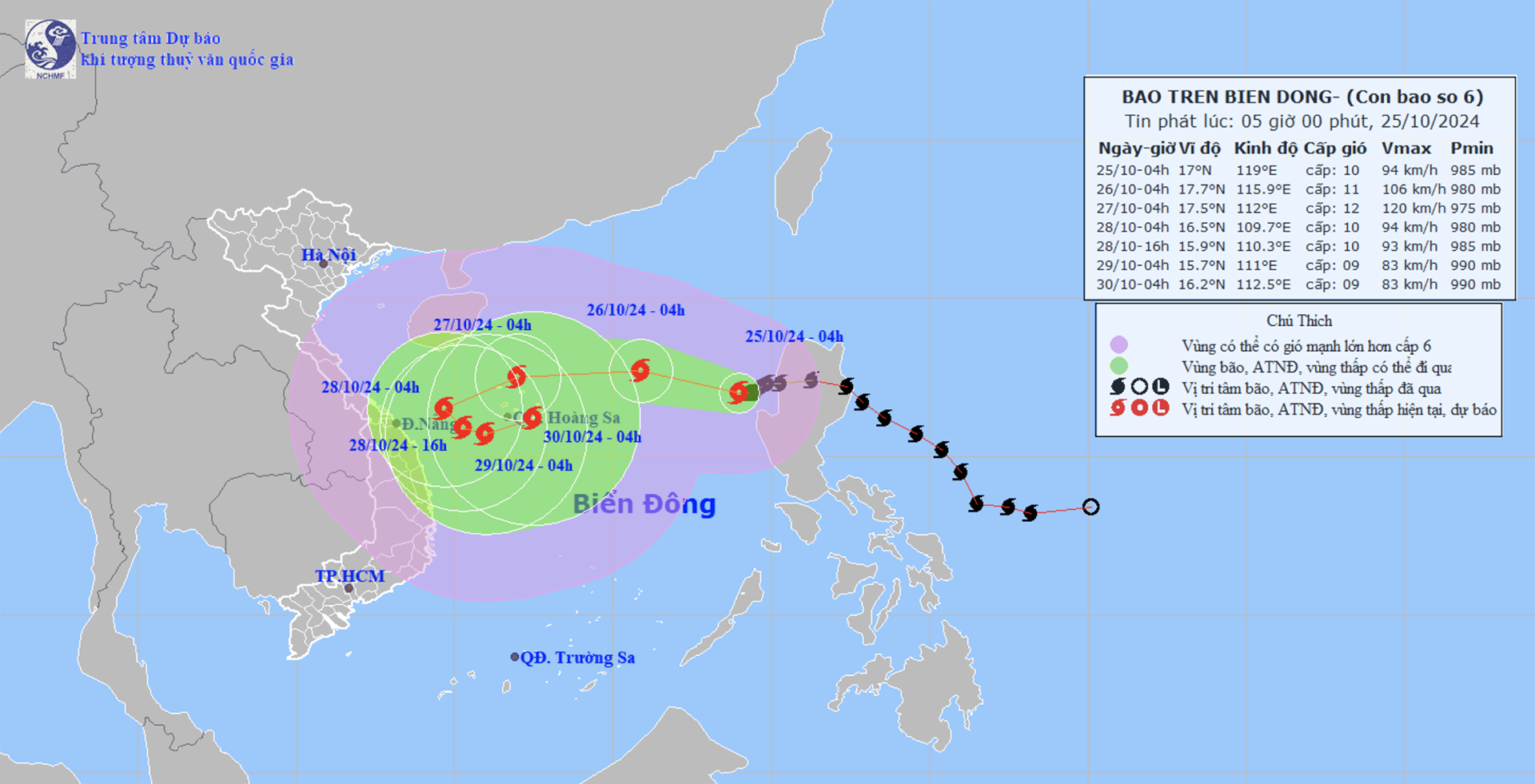
Forecast for the next 24 hours, the center of the storm is at about 17.7 degrees North latitude, 115.9 degrees East longitude; in the eastern sea of the North East Sea, 490km east of Hoang Sa archipelago; moving west-northwest, about 10-15km/h; wind force level 10-11, gust level 13.
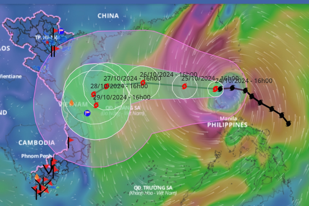
"Currently, in the East of the Philippines, there is a tropical depression, which is forecast to strengthen into a storm in the next 24-48 hours and move to the Northeast of Luzon Island, causing storm Tra Mi to interact with the double storm and weaken," said Mr. Nguyen Van Huong.

The Head of Weather Forecasting added that the circulation of storm Tra Mi is relatively wide, the convective clouds are shifted to the West, so the North and the middle of the East Sea will be affected by strong winds.
He also predicted: "From the evening and night of October 26, the storm will cause heavy rain in the Central region, with a wide area of rain from Ha Tinh to Binh Dinh and Phu Yen. Heavy rain will be concentrated in Quang Tri, Quang Nam, Kon Tum and Gia Lai, with rainfall reaching 200 - 300 mm."
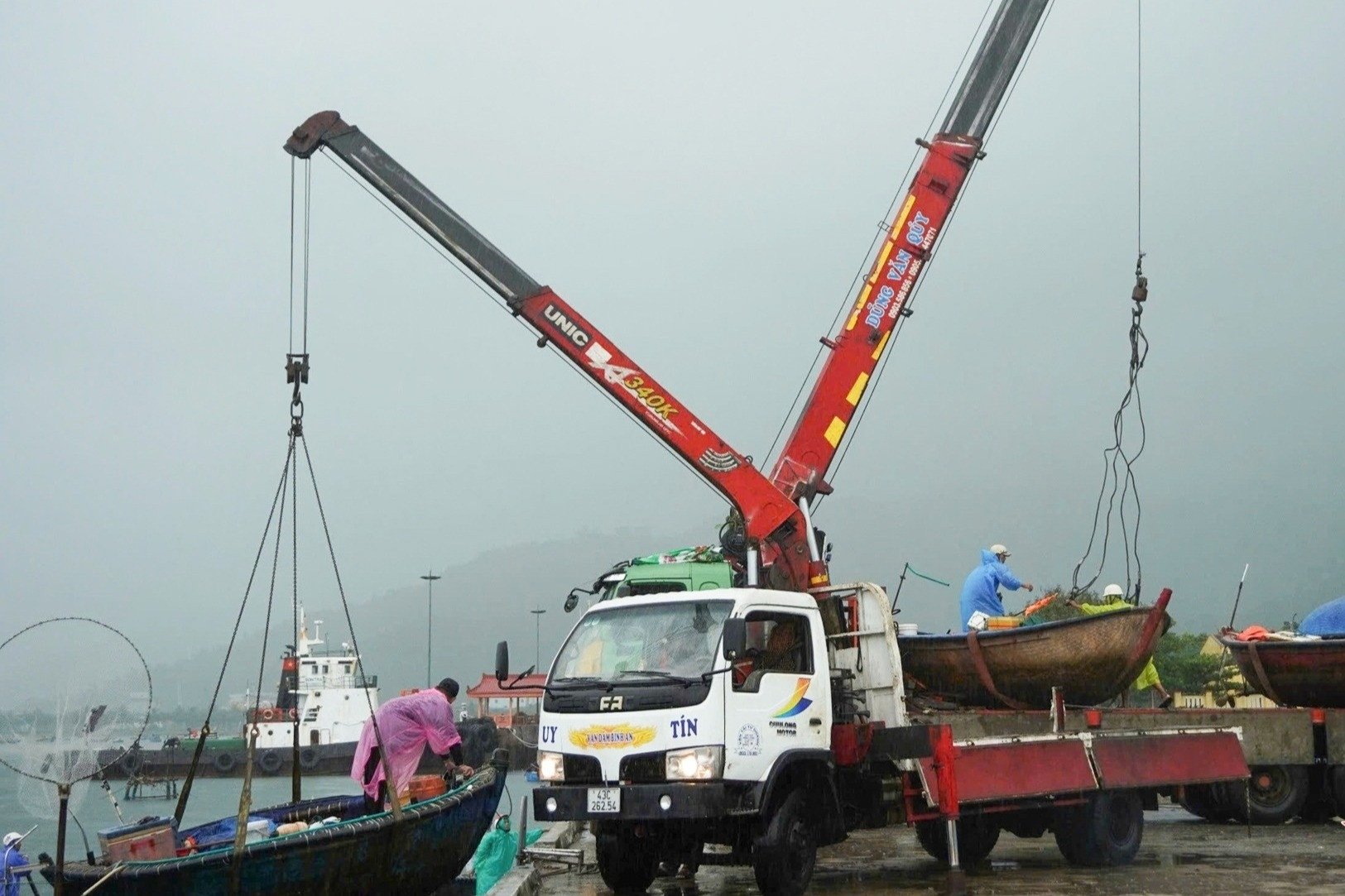
At the meeting, a representative of the Civil Defense - Natural Disaster Prevention, Search and Rescue Command (Border Guard) said that by 6:30 a.m. today, the border guard force had notified, counted, and instructed 67,212 vehicles with 307,822 people to know the developments and direction of the storm so that they could proactively move and take shelter safely.

Before the development of storm No. 6, the army mobilized 285,480 people (86,019 soldiers, 199,461 militiamen), 12,503 military vehicles of all kinds, ready to respond to this storm.
Specifically, Military Region 3 mobilized 51,075 people, 582 cars, boats, and special vehicles. Military Region 4 mobilized 135,781 people, 1,195 cars, boats, and special vehicles. Military Region 5 mobilized 55,163 people, 1,660 cars, boats, and 3 airplanes. The Air Defense - Air Force mobilized 4,600 people, 206 vehicles, and 8 airplanes. Army Corps 18 mobilized 30 people, 2 helicopters, and 4 cars.
Prime Minister requests proactive response to storm No. 6
Storm No. 6 likely to encounter cold air 'nemesis', unusual direction of movement
Central provinces urgently develop plans to respond to storm No. 6
Source: https://vietnamnet.vn/bao-tra-mi-tiep-tuc-tang-cap-chuyen-gia-du-bao-mua-lon-o-mien-trung-2335334.html
![[Photo] Magical moment of double five-colored clouds on Ba Den mountain on the day of the Buddha's relic procession](https://vphoto.vietnam.vn/thumb/1200x675/vietnam/resource/IMAGE/2025/5/9/7a710556965c413397f9e38ac9708d2f)


![[Photo] Prime Minister Pham Minh Chinh chairs a special Government meeting on the arrangement of administrative units at all levels.](https://vphoto.vietnam.vn/thumb/1200x675/vietnam/resource/IMAGE/2025/5/9/6a22e6a997424870abfb39817bb9bb6c)


Comment (0)