

3D digital model of current status of Cong Ly bridge and Nhieu Loc - Thi Nghe canal
During the working session at the end of September 2023 with Port and Marine Engineering Design Consulting Joint Stock Company (Portcoast), with the participation of leaders of Ho Chi Minh City departments and branches, Mr. Bui Xuan Cuong, Vice Chairman of the City People's Committee, requested Portcoast to coordinate and support the city's departments and branches in applying digital technology. And the project of surveying inland waterway routes to serve the management and announcement of routes is the initial result of this coordination. This is a project applying comprehensive digital transformation, 100% on a digital platform.
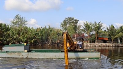
The survey product is a digital model of the current status of all 82 waterways of the city, with a total length of more than 523 km and a total underwater area of more than 5,500 hectares. In addition, the consulting unit also conducted a survey of the canal and ditch banks with a total area of slopes and both banks of more than 10,000 hectares, along with 217 bridges and culverts; 200 high/medium/low voltage power lines and 146 inland ports and wharves. The unit also designed the channels, buoy signaling systems according to the planning and current status; designed typical landscapes on both sides of the river for 82 canals and ditches.
Mr. Pham Anh Tuan, General Director of Portcoast, said that the technology and equipment used for the survey are the most modern in the world at present (such as Survey/Scan to BIM-GIS equipment). Specifically, the unit conducts depth measurement surveys using multi-beam and single-beam echo sounders using Real-Time Kinematic (RTK) technology using survey vessels, combined with unmanned USV vessels integrated with multi-beam echo sounders (underwater measurement and Lidar - on the coastal water surface).
Next is the on-land survey using a UAV system integrated with Lidar devices, a camera integrated with 5 cameras (Photogrammetry technology); surveying cross-route works (bridges, culverts), detailed items using 3D laser scanning devices (scanning range from 130m to 1km, accuracy to mm, scanning speed of 2 million points/s); high/medium/low voltage power lines using UAV integrated with Lidar devices and 3D laser scanning devices; surveying riverside roads using Mobile Mapping technology.
"This is the first time in Vietnam that digital technology has been fully applied to an inland waterway project of such a large scale. The application of technology with modern equipment shortens the survey time by only 30-40% compared to the current conventional survey method (100% 2D product), while the technology applied to this project has a much higher scale and accuracy (100% 3D product)" - Mr. Pham Anh Tuan shared.
It is known that the digital model of the entire inland waterway system of the city is built on the platform of integrating the building information model (BIM) and the geographic information system (GIS). This digital model gives us a visual way in 3D with full integration of data layers of inland waterway management information of the city: channel depth, current status of both banks, cross-route works, inland ports and wharves, inland waterway signaling system... It can be said that this is like the real world that can be used to plan related projects such as planning, urban planning along the river, embankment protection, new cross-route projects...
This digital model is decentralized in management and access at each level, making it easy to update all information changes in real time and can access information anytime, anywhere, on any digital media (computers, tablets, smartphones) serving not only the management work of management agencies but also providing information for the community and residents to easily access.
This digital technology application project completely meets the requirements of the Government and Ho Chi Minh City People's Committee on applying building information modeling (BIM) and integrating building information modeling into geographic information systems (GIS).
Below are some typical images of the comprehensive digital transformation of inland waterway survey projects to serve the management and publication of waterways:

3D digital model of Thanh Da canal depth

3D digital model of Thanh Da canal bottom

3D digital model of Thanh Da canal bottom

This is a 3D digital model of a riverbank protection embankment.

3D digital model of riverbank protection embankment.
Source link

![[Photo] Many people in Hanoi welcome Buddha's relics to Quan Su Pagoda](https://vphoto.vietnam.vn/thumb/1200x675/vietnam/resource/IMAGE/2025/5/13/3e93a7303e1d4d98b6a65e64be57e870)

![[Photo] Prime Minister Pham Minh Chinh receives Ambassador of the French Republic to Vietnam Olivier Brochet](https://vphoto.vietnam.vn/thumb/1200x675/vietnam/resource/IMAGE/2025/5/13/f5441496fa4a456abf47c8c747d2fe92)
![[Photo] President Luong Cuong attends the inauguration of the international container port in Hai Phong](https://vphoto.vietnam.vn/thumb/1200x675/vietnam/resource/IMAGE/2025/5/13/9544c01a03e241fdadb6f9708e1c0b65)


Comment (0)