
(NLDO)- The baseline used to calculate the width of Vietnam's territorial waters in the Gulf of Tonkin is the basis for determining the boundaries and scope of Vietnam's maritime zones.
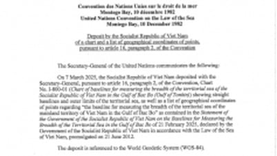
On February 21, pursuant to Resolution No. 68/NQ-UBTVQH15 dated February 14, 2025 of the Standing Committee of the National Assembly, the Government of the Socialist Republic of Vietnam issued a Declaration on the baselines used to calculate the breadth of Vietnam's territorial waters in the Gulf of Tonkin.

Diagram illustrating the baselines used to calculate the width of Vietnam's territorial waters in the Gulf of Tonkin. Source: Ministry of Foreign Affairs
The determination of baselines in the Gulf of Tonkin is to implement Vietnam's rights and obligations under the provisions of the 1982 United Nations Convention on the Law of the Sea (UNCLOS) and in accordance with the 2012 Law of the Sea of Vietnam. The baselines used to calculate the breadth of Vietnam's territorial waters in the Gulf of Tonkin are determined on the basis of the provisions of UNCLOS, in accordance with the geographical and natural characteristics of the Gulf of Tonkin and do not affect international treaties to which Vietnam participates or is a member.
The baseline used to calculate the breadth of Vietnam's territorial waters in the Gulf of Tonkin is the basis for determining the boundaries and scope of Vietnam's maritime zones according to the provisions of UNCLOS and the Agreement on the Delimitation of the Gulf of Tonkin between Vietnam and China signed in 2000, creating additional legal basis to protect and enforce Vietnam's sovereignty, sovereign rights, and jurisdiction, serving economic development, maritime management, and promoting international cooperation.
See the full text of the Declaration on baselines used to calculate the breadth of Vietnam's territorial waters in the Gulf of Tonkin here:
Source: https://nld.com.vn/viet-nam-ra-tuyen-bo-ve-duong-co-so-dung-tinh-lanh-hai-trong-vinh-bac-bo-196250221150149736.htm


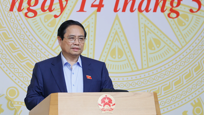
![[Photo] Prime Minister Pham Minh Chinh chairs conference on anti-smuggling, trade fraud, and counterfeit goods](https://vphoto.vietnam.vn/thumb/1200x675/vietnam/resource/IMAGE/2025/5/14/6cd67667e99e4248b7d4f587fd21e37c)


Comment (0)