
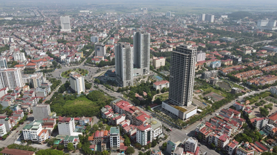
On the afternoon of October 1, heavy rains occurred across the South. Especially in Ho Chi Minh City, heavy rain combined with high tides caused flooding on many roads, greatly affecting traffic and daily activities of people.

Widespread heavy rain will continue for the next few days
The National Center for Hydro-Meteorological Forecasting said: Last night and this morning (October 2), in the area from Da Nang to Binh Thuan , the Central Highlands and the South, there were showers and thunderstorms, locally heavy to very heavy rain. The rainfall from 7:00 p.m. on October 1 to 8:00 a.m. on October 2 was over 60mm in some places such as: An Hung (Binh Dinh) 61.7mm, Phan Thiet City (Binh Thuan) 98.8mm, Kien Binh (Long An) 75.6mm, My Phuoc (Tien Giang) 67.6mm, Vien An (Soc Trang) 66.8mm, An Ninh (Kien Giang) 71.2mm...
South Central, Central Highlands and South regions forecast widespread thunderstorms
Rainfall reaching 50mm is defined as heavy rain. With this criterion, the Southern Hydrometeorological Station added some places with heavy rain such as: Tuc Truong (Dong Nai) 57.8mm, Nha Be (HCMC) 54.6mm, Thoi Binh ( Ca Mau ) 54.2mm, Nui Ba (Tay Ninh) 53.4mm.
Experts predict that heavy rain will continue to appear in the area from Da Nang to Binh Thuan, throughout the Southern provinces and the Central Highlands, lasting at least until the end of October 3, with common forecasted rainfall ranging from 40 - 100mm.
During thunderstorms, there is a possibility of tornadoes, lightning and strong gusts of wind. Localized heavy rain can cause flooding in low-lying areas and the risk of flash floods and landslides in mountainous areas.
The current heavy rains are due to the influence of a storm in the east of the Philippines that appeared on the afternoon of September 30. This storm has the international name Koinu and the local name Jenny. The appearance and activity of the storm has caused the southwest monsoon to become stronger, causing heavy rain in the southern provinces and the Central Highlands. According to experts, it is not impossible that this storm could enter the East Sea. Therefore, the bad weather will continue in the coming days, especially in the sea area from Binh Thuan to Ca Mau, Ca Mau to Kien Giang, the Gulf of Thailand and the southern East Sea (including the Truong Sa archipelago) where there are showers and strong thunderstorms.
Source link


![[Photo] Nearly 3,000 students moved by stories about soldiers](https://vphoto.vietnam.vn/thumb/1200x675/vietnam/resource/IMAGE/2025/5/17/21da57c8241e42438b423eaa37215e0e)


![[Infographic] Numbers about the 2025 High School Graduation Exam in Dong Thap Province](https://vphoto.vietnam.vn/thumb/402x226/vietnam/resource/IMAGE/2025/5/17/c6e481df97c94ff28d740cc2f26ebbdc)


Comment (0)