
The recently approved adjustment of the Hanoi Capital Master Plan has provided orientation and roadmap for the spatial development of Hanoi Capital.
Prime Minister Pham Minh Chinh signed Decision No. 1668/QD-TTg approving the adjustment of the Hanoi Capital Master Plan to 2045, with a vision to 2065.
Accordingly, the planning scope and boundary is the entire administrative boundary of Hanoi Capital, with 30 district-level administrative units, including 12 districts, 17 counties and 1 town.
The planning scale is about 3,359.84 km2. The planning period is in the short term until 2030; the long term until 2045; and the vision until 2065.
Building smart cities is the driving force for regional development.
The plan sets out a vision for 2065, with Hanoi Capital being “Cultured - Civilized - Modern”; being the center and driving force for the development of the Red River Delta, the key economic region of the North and the whole country; being a globally connected city with a high standard of living and quality of life; with comprehensive, unique and harmonious economic, cultural and social development; having a level of development on par with the capitals of developed countries in the region and the world.
By 2030, Hanoi aims to be a modern urban area, a center to support and promote regional connectivity, a comprehensive service center of the country, and an attractive international economic and cultural destination.
The goal by 2045 is to become a cultural capital, a smart, ecological city, a center of finance, services, science and technology and human resource training, a center for organizing political, economic, cultural, scientific and technological events of Asia and the world. A green and ecological city with the Red River as a symbol of development.
In terms of urban characteristics, Hanoi is the national political and administrative center; a "Cultured - Civilized - Modern" city; a place to concentrate, preserve and promote the quintessence of tangible and intangible cultural values; a world-class capital with the integration of unique traditional cultural and historical values.
This is also a major center of economy, culture, education and training, science and technology and international integration; a smart, modern, green, clean, beautiful, secure, safe and happy urban area; developing rapidly and sustainably, with a spreading power to promote the development of the Red River Delta, the key economic region of the North and the whole country.
Has an important position in the national urban development strategy; is one of the economic - transaction - tourism and trade centers of Southeast Asia and Asia - Pacific region.
Metropolitan, multipolar, polycentric with 5 metropolitan areas
The population development forecast by 2030 is expected to be 12 million people (of which about 10.5 million are permanent residents); the urbanization rate will reach 65% - 70%. By 2045, it will be 14.6 million people (of which about 13 million are permanent residents); the urbanization rate will reach over 75%.
Regarding land use, by 2030, construction land will be about 148,000 - 150,000 hectares, of which urban construction land will be about 89,000 - 90,000 hectares (accounting for 26 - 27% of the total area of the city), and rural construction land will be about 59,000 - 60,000 hectares.
By 2045, construction land will be about 198,000 - 200,000 hectares, of which urban construction land will be about 124,000 - 125,000 hectares (accounting for 37 - 38% of the total city area), and rural construction land will be about 74,000 - 75,000 hectares.
The planning defines the urban development structure as a multi-polar, multi-center urban area, with 5 urban areas including: The urban area south of the Red River, including the historical inner city area, the expanded historical inner city area, the urban expansion area to the West and South - Dan Phuong, Hoai Duc, Ha Dong, Thanh Tri and part of Thanh Oai, Thuong Tin.
The Eastern urban area includes Long Bien district and Gia Lam district.
The Northern urban area includes Dong Anh, Me Linh and Soc Son districts (expected to form a Northern city).
The Western urban area includes Son Tay town, Ba Vi district, Phuc Tho, Quoc Oai, Thach That, Chuong My, in which there is a plan to form a Western city in the future, upgrading the urban type of Son Tay city.
The Southern urban area includes Thanh Oai, My Duc, Ung Hoa, Thuong Tin, and Phu Xuyen districts, taking into account future research into the Southern city.
The satellite and ecological urban systems are separated by green corridors and green wedges, connected by a belt and radial transport system.
Spatial frame structure according to the ring and radial traffic axes
Connecting the central urban area, urban areas and satellite cities through belts (belt 1, belt 2, belt 2.5, belt 3, belt 3.5, belt 4, belt 5, Northwest expressway...).
Radial axes include National Highway 1A, National Highway 1B; National Highway 2; National Highway 3; National Highway 5; National Highway 6; National Highway 32; Ha Dong - Xuan Mai axis; Thang Long Boulevard; Tay Thang Long road axis; Ho Tay - Ba Vi road axis; Le Van Luong - To Huu - Nguyen Thanh Binh road; Southern economic axis; Nhat Tan - Noi Bai axis (Vo Nguyen Giap road...).
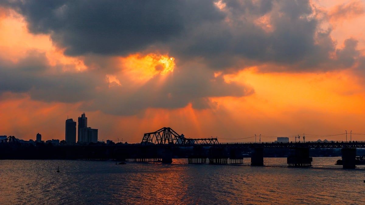
Five important spatial axes are oriented, including the Red River axis, combined with the Duong River, to be developed as the central green space of the central urban area, a creative cultural space, an economic and social development axis, and a symbolic highlight space of the capital Hanoi. The city will develop urban areas, ecological parks on both sides of the river, water management, exploitation of landscape values, river ports, and tourism on both sides of the river.
West Lake - Ba Vi axis, synchronously combining the space of Thang Long Avenue and National Highway 6; building a cultural connection axis of Thang Long - Xu Doai, connecting the center of the capital with the western city and connecting neighboring provinces in the west, northwest, mountainous and midland regions in the north.
The West Lake - Co Loa axis is the axis connecting the historical urban heritage; synchronously combining the connecting space of West Lake - Tu Lien Bridge - Co Loa. The city will arrange cultural works, exhibitions, symbolic works along this axis, combined with traditional villages, water landscapes and the Co Loa Citadel relic site to become a unique historical and cultural space in the northern urban area.
Nhat Tan - Noi Bai axis is an economic development axis, smart and modern urban area (synchronously combined with the space of Bac Thang Long - Noi Bai axis), connecting with the Northern, Northwestern and Northeastern provinces, the economic corridor of Lao Cai - Hanoi - Hai Phong - Quang Ninh, the trans-Asian road, connected with Noi Bai international gateway airport and the northern city.
The newly developed South Hanoi axis is linked to the My Dinh - Ba Sao - Bai Dinh cultural axis; connecting the Thang Long - Hoa Lu heritage, connecting with the Huong Son - Tam Chuc relic area, the second airport of the capital region and Phu Xuyen urban area, synchronized with the National Highways 1A, 1B, Ho Chi Minh Road, connecting the Northwest Expressway and the Southern provinces, creating new development space and momentum.
One of the contents of the Plan is the orientation of spatial development for the capital Hanoi with overall space, regional space; orientation of rural development, green space, green corridor, green belt, green wedge; orientation of landscape architecture - overall urban design; orientation of underground space planning; orientation of land use planning by stages; orientation of socio-economic infrastructure development and orientation of technical infrastructure planning.
Deployment according to a specific time schedule, with appropriate support policies and mechanisms
The project determines the implementation of the planning according to the roadmap associated with strategic investment programs and projects, synchronous development between functions, scale, infrastructure and socio-economic development programs, strict implementation plan according to specific time roadmap, associated with the ability to mobilize resources and have appropriate support policies and mechanisms.
The planning implementation period is divided into stages 2025-2030; 2030-2035; 2035-2045; 2045-2050 and vision to 2065.
Accordingly, in the period of 2025 - 2030, the system of legal bases and unified planning layers will be completed to create a foundation for development according to the plan. Complete the construction of the framework infrastructure network including the traffic routes of Ring Road 4, Ring Road 5, Ring Road 4.5 (North-South axis); upgrade the radial axes connecting the regions. Complete the development of the expanded urban areas in the West (Ha Dong, Hoai Duc, Dan Phuong, Thuong Tin) according to the TOD model and Hoa Lac urban area. Synchronously deploy the urban railway system, renovate the inner-city river and lake system, renovate, embellish and reconstruct old urban areas.
In the period of 2030 - 2035, the urban chain north of the Red River (Gia Lam, Long Bien, Dong Anh, Me Linh) will be developed and completed with synchronous, modern, and smart urban infrastructure, combined with modern public transport, creating new development centers of the capital. Developing the Red River axis and bridges across the Red River will create a mark and symbol of the capital Hanoi.
In the period of 2035 - 2045, develop, expand and complete satellite cities such as Son Tay and Phu Xuyen to form gateway cities, attracting new development needs to the capital Hanoi. Connect with the regional urban network to create a unified development space. Develop and expand the public transport network to satellite cities and neighboring localities to connect development space. Build a second airport in the South according to the planning associated with the airport urban model, international logistics services and important logistics hub.
The period 2045 - 2050 and vision to 2065 will develop and perfect urban space, harmoniously combining urban and rural space, new development and urban renovation and embellishment, forming an urban area with identity, ecology, and modern infrastructure.
Source: https://kinhtedothi.vn/thu-tuong-duyet-dieu-chinh-quy-hoach-chung-thu-do-den-nam-2045-tam-nhin-2065.html

![[Photo] Prime Minister Pham Minh Chinh and Prime Minister of the Kingdom of Thailand Paetongtarn Shinawatra attend the Vietnam-Thailand Business Forum 2025](https://vphoto.vietnam.vn/thumb/1200x675/vietnam/resource/IMAGE/2025/5/16/1cdfce54d25c48a68ae6fb9204f2171a)


![[Photo] President Luong Cuong receives Prime Minister of the Kingdom of Thailand Paetongtarn Shinawatra](https://vphoto.vietnam.vn/thumb/1200x675/vietnam/resource/IMAGE/2025/5/16/52c73b27198a4e12bd6a903d1c218846)


Comment (0)