
According to the National Center for Hydro-Meteorological Forecasting, due to the influence of storm circulation No. 3 (storm Yagi), Bach Long Vi island has strong winds of level 6, gusting to level 8.
At 4:00 p.m. on September 6, the center of storm No. 3 was at approximately 19.9 degrees North latitude; 110.8 degrees East longitude, on the mainland northeast of Hainan Island (China); approximately 420km East Southeast of Quang Ninh. The strongest wind near the center of the storm was level 16 (184-201km/h), gusting to level 17, moving in a West Northwest direction at a speed of 15-20km/h.
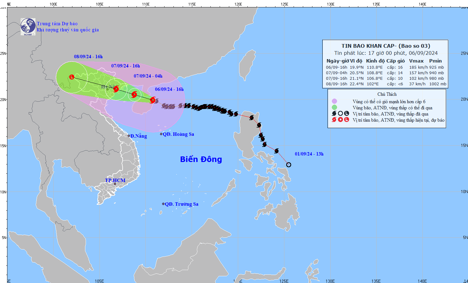
Forecast of storm developments in the next 24 to 48 hours as follows:
Today, in the Northeast region and the area from Thanh Hoa to Thua Thien Hue, the Central Highlands and the South, there will be showers and thunderstorms, with some places having heavy rain. The rainfall from 7am to 3pm is over 40mm in some places such as: Ha Trung (Thanh Hoa) 58mm, Tan Giang (Ha Tinh) 47.6mm, Ia Pnôn (Gia Lai) 58.8mm, Cu Kbang (Dak Lak) 47.4mm, Tam Giang Tay (Ca Mau) 93mm,...
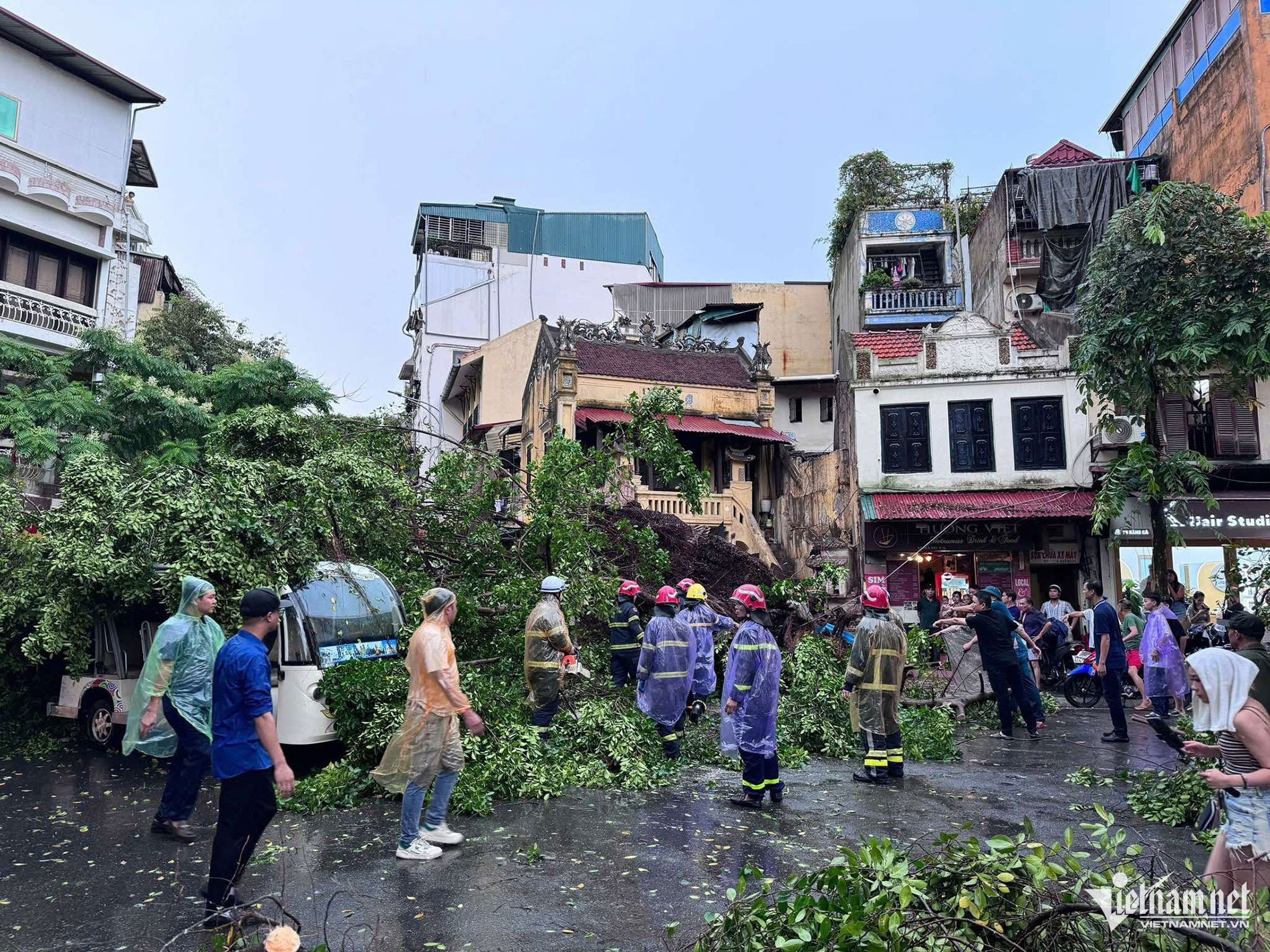
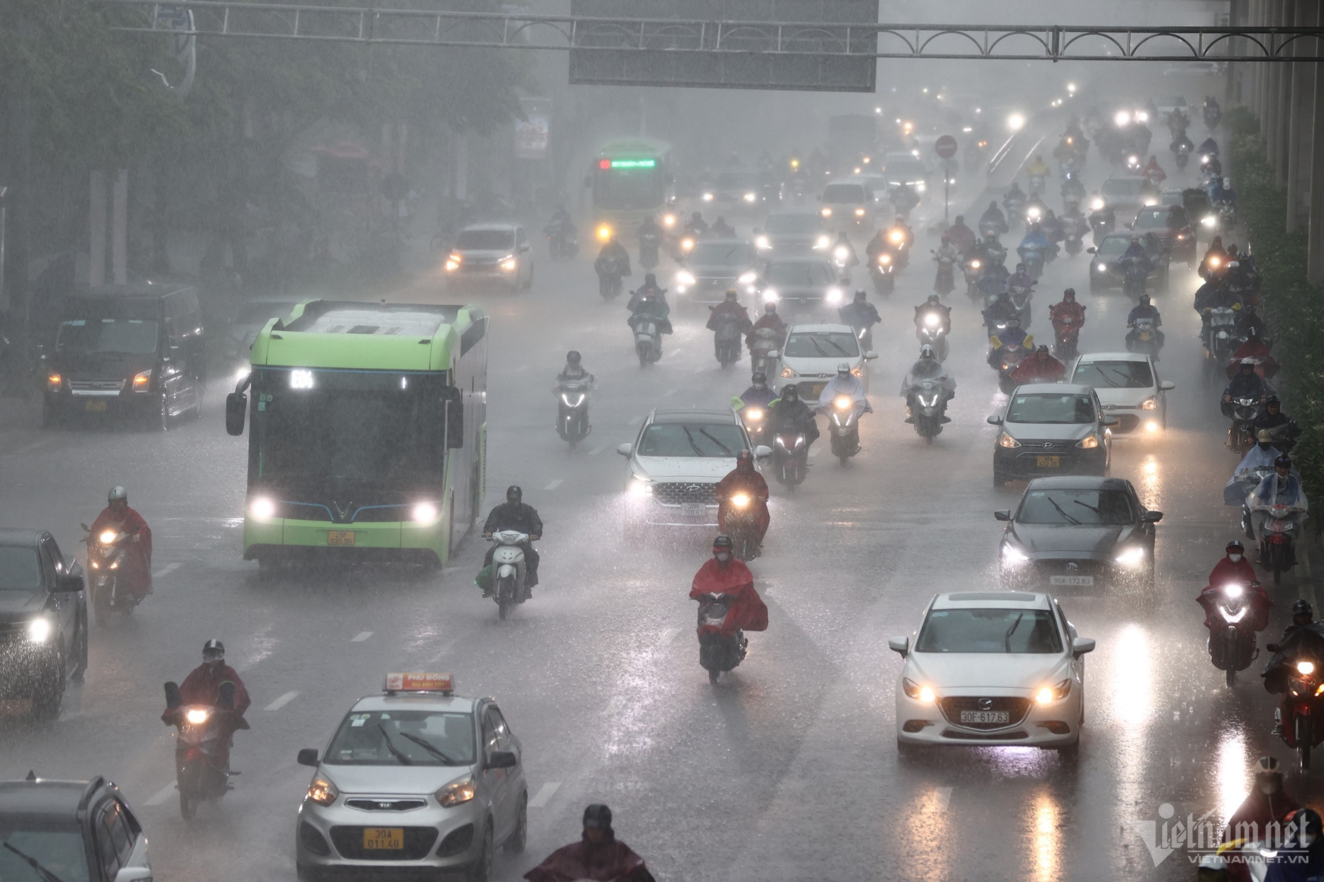
From 2:30 p.m. this afternoon, many areas in Hanoi began to experience heavy rain and thunderstorms, with gusty winds due to the influence of storm Yagi's distant circulation.
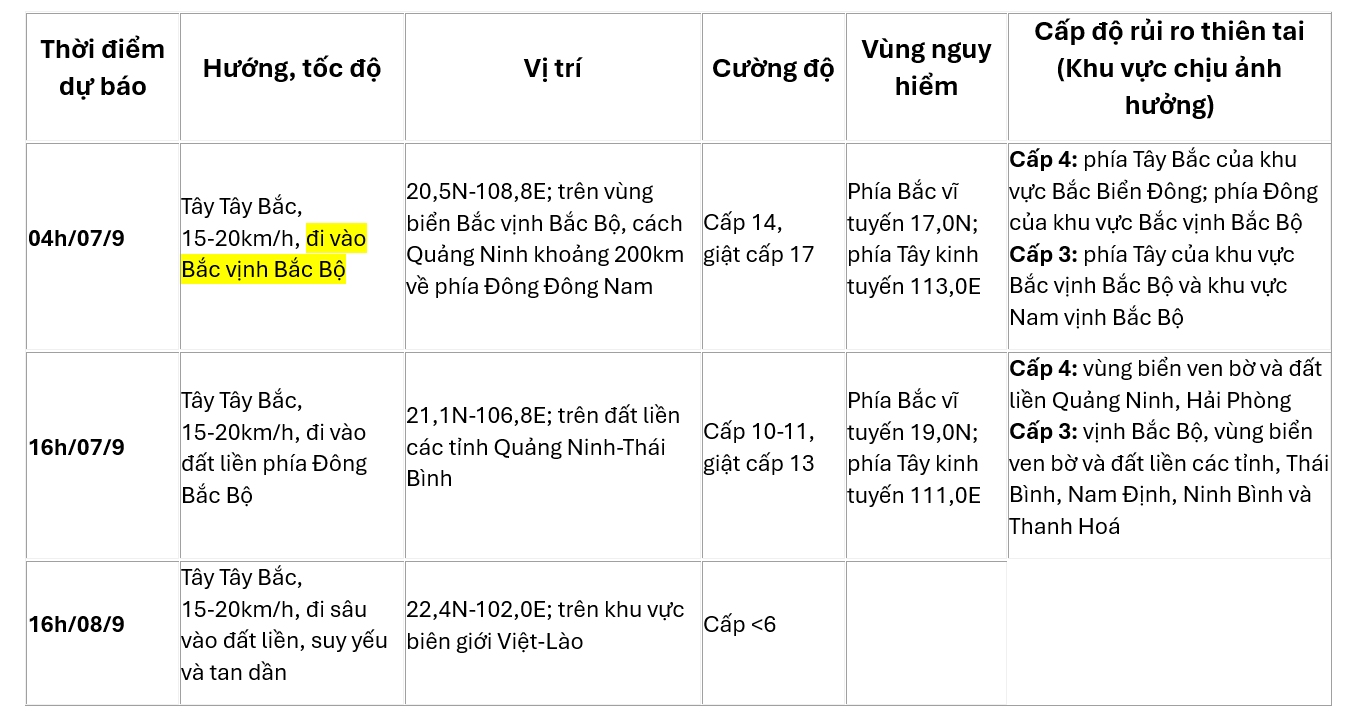
Heavy rain is forecasted in the next 24-48 hours, in the Northeast and Thanh Hoa, from the night of September 6 to the end of the night of September 7, there will be heavy to very heavy rain with common rainfall of 100-300mm, locally over 450mm.
Strong wind warning due to storm number 3:
At sea: The northwestern sea area of the North East Sea on the night of September 6 still has strong winds of level 10-12, near the storm center of level 14-16, gusting over level 17; the sea is very rough. On September 7, the wind gradually decreases.
The Gulf of Tonkin (including Bach Long Vi island district) has strong winds of level 6-7. From the evening and night of September 6, the Gulf of Tonkin (including Bach Long Vi island district and Co To) will have winds gradually increasing to level 8-9, then increasing to level 10-11, near the storm's eye level 12-14, gusting to level 17; the sea is very rough.
On land: From the night of September 6 and early morning of September 7, coastal areas from Quang Ninh to Thanh Hoa will have strong winds of level 6-7, then increasing to level 8-9, areas near the storm center will have strong winds of level 10-12, gusting to level 14; areas deep inland in the Northeast will have strong winds of level 6-8, gusting to level 9-11 (the strongest winds will be from morning to evening of September 7).
Source: https://vietnamnet.vn/sieu-bao-so-3-yagi-van-dien-cuong-voi-cap-16-cach-quang-ninh-khoang-415km-2319168.html
![[Photo] General Secretary To Lam arrives in Minsk, begins state visit to Belarus](https://vphoto.vietnam.vn/thumb/1200x675/vietnam/resource/IMAGE/2025/5/11/76602f587468437f8b5b7104495f444d)

![[Photo] General Secretary To Lam meets and expresses gratitude to Vietnam's Belarusian friends](https://vphoto.vietnam.vn/thumb/1200x675/vietnam/resource/IMAGE/2025/5/11/c515ee2054c54a87aa8a7cb520f2fa6e)


![[Photo] General Secretary To Lam concludes visit to Russia, departs for Belarus](https://vphoto.vietnam.vn/thumb/1200x675/vietnam/resource/IMAGE/2025/5/11/0acf1081a95e4b1d9886c67fdafd95ed)


![[Photo] National Assembly Chairman Tran Thanh Man attends the Party Congress of the Committee for Culture and Social Affairs](https://vphoto.vietnam.vn/thumb/1200x675/vietnam/resource/IMAGE/2025/5/11/f5ed02beb9404bca998a08b34ef255a6)


Comment (0)