
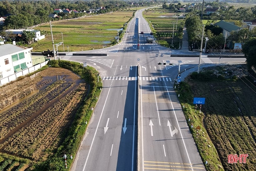
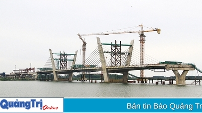
The conversion of the Ha Tinh coastal route into the Ha Tinh coastal national highway contributes to the effective management and maintenance, ensuring smooth traffic, maintaining the exploitation capacity and long-term life of the route.
Ha Tinh coastal route,
According to information from the Ha Tinh Department of Transport: The Provincial People's Committee has just sent a document to the Ministry of Transport and the Vietnam Road Administration regarding the proposal to convert the Ha Tinh coastal road (provincial road DT.547) into the Ha Tinh coastal national highway.
The coastal route Xuan Hoi - Thach Khe - Vung Ang (DT.547 - Ha Tinh coastal road) is being constructed according to the detailed planning of Vietnam's coastal roads, approved by the Prime Minister in Decision No. 129/QD-TTg dated January 18, 2010. This is one of the vertical traffic routes of Ha Tinh, which is extremely important for the socio -economic development and ensuring national defense and security of the province.
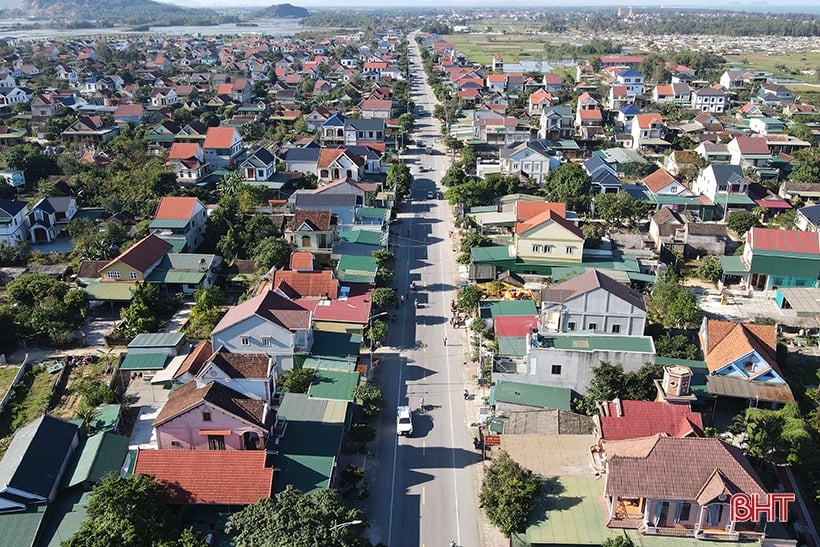
Ha Tinh coastal road contributes to promoting economic development in localities where the road passes through.
Since its completion and operation, the Ha Tinh coastal route has not only shared traffic volume for National Highway 1, but also facilitated travel and trade, thereby contributing to the effective exploitation and use of marine resources and coastal areas of Ha Tinh.
The route also helps connect the economic regions of South Nghe An - North Ha Tinh, South Ha Tinh - North Quang Binh, playing a driving role in building key economic zones of 3 provinces: Nghe An, Ha Tinh, Quang Binh, forming a chain of economic zones with connections to promote regional strengths.
In recent times, the management and maintenance of traffic infrastructure, including the coastal route Xuan Hoi - Thach Khe - Vung Ang, has been directed by Ha Tinh to be implemented by agencies and units.
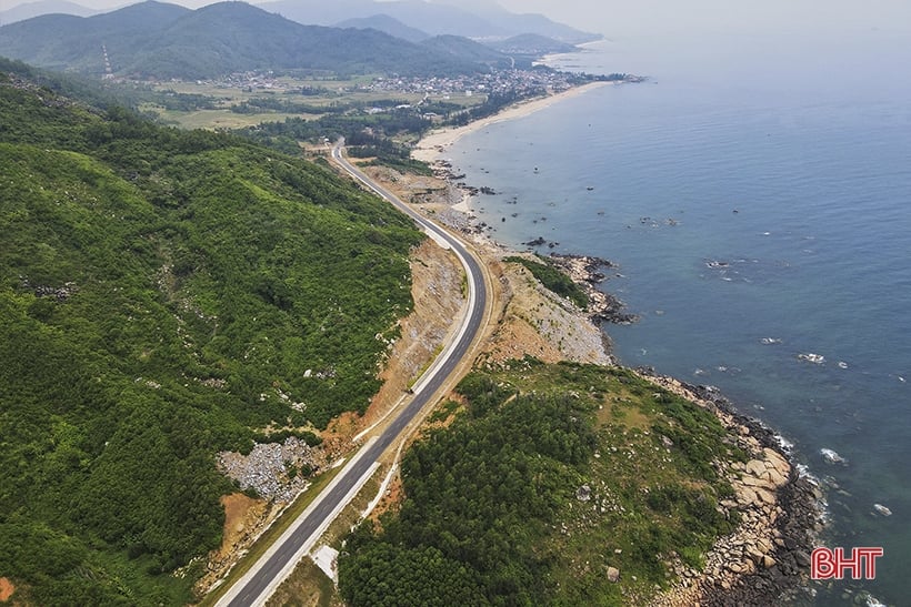
Ha Tinh coastal route has all the elements to become Ha Tinh coastal national highway.
However, due to the long length of the route, it is heavily affected by rain, storms and floods every year, requiring a large amount of funding for maintenance and repair, while the provincial budget is still facing many difficulties, so the balance and allocation of resources is still limited and cannot meet the actual needs. Some traffic infrastructure items are at risk of degradation and damage, affecting traffic safety, the ability to exploit and the life of road works.
In order to effectively manage and maintain, ensure smooth and safe traffic, maintain the exploitation capacity and long-term life of the coastal route, based on the provisions of Point a, Clause 1, Article 39 of the 2008 Road Traffic Law, Decision No. 129/QD-TTg dated January 18, 2010 of the Prime Minister on approving the detailed planning of Vietnam's coastal roads, the People's Committee of Ha Tinh province requests the Ministry of Transport and the Vietnam Road Administration to consider and approve the conversion of the coastal route of Ha Tinh province into the Ha Tinh coastal national highway and entrust the Department of Transport with management, maintenance and exploitation.
The coastal route Xuan Hoi – Thach Khe – Vung Ang (Ha Tinh coastal route) is 120 km long, starting from Cua Hoi bridge (Nghi Xuan district) to the intersection with National Highway 12C at Vung Ang port (Ky Anh town). The traffic route passes through 6 localities of Ha Tinh, including the districts: Nghi Xuan, Loc Ha, Thach Ha, Cam Xuyen, Ky Anh and Ky Anh town. Of the 120 km of the Ha Tinh coastal route, 33 km overlap with some sections that have been invested in by projects in 3 localities (Loc Ha, Thach Ha and Ky Anh town), while 87 km are newly built in 2 phases (the investor in phase 1 is the Ha Tinh Department of Transport, and in phase 2 is the Provincial Traffic Project Management Board) with a total investment of more than 2,000 billion VND. The route is designed according to the standards of a grade 3 plain road, with a maximum speed of 80 km/h. The section from Dan Truong commune (Nghi Xuan) to Cua Nhuong bridge (Cam Xuyen) has a 12m wide roadbed, 11m road surface and 2 layers of asphalt concrete. The section from Cua Nhuong bridge to Ky Ninh commune (Ky Anh town) also has a 12m wide roadbed but the width of the motor vehicle lane is only 7m, the width of the rudimentary lane (reinforced shoulder) is 4m and the dirt shoulder is 1m. |
Precious Stone
Source
![[Photo] Ready for the top competitions of Vietnamese table tennis](https://vphoto.vietnam.vn/thumb/1200x675/vietnam/resource/IMAGE/2025/5/18/9c547c497c5a4ade8f98c8e7d44f5a41)

![[Photo] General Secretary To Lam visits exhibition of achievements in private economic development](https://vphoto.vietnam.vn/thumb/1200x675/vietnam/resource/IMAGE/2025/5/18/1809dc545f214a86911fe2d2d0fde2e8)


![[Photo] National conference to disseminate and implement Resolution No. 66-NQ/TW and Resolution No. 68-NQ/TW of the Politburo](https://vphoto.vietnam.vn/thumb/1200x675/vietnam/resource/IMAGE/2025/5/18/adf666b9303a4213998b395b05234b6a)


Comment (0)