
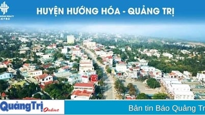
Quang Tri is a province with a narrow, short, steep terrain; a 75km long coastline, a dense river system and a complex climate. Therefore, Quang Tri is one of the provinces that is often affected by natural disasters with high frequency and severity. On average, each year the province suffers about 2 storms along with floods, inundation, drought, saltwater intrusion, flash floods and landslides due to climate change (CC).
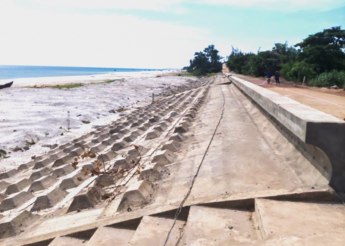
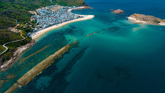
The sea dike system in Vinh Thai commune, Vinh Linh district was built to help prevent coastal erosion - Photo: TN
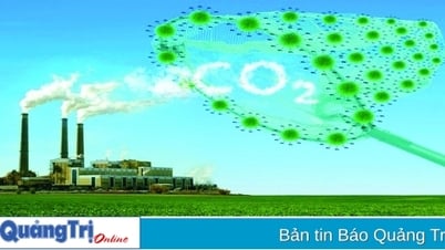
According to monitoring data in recent years, extreme climate phenomena are occurring in a complex, unpredictable and irregular manner, with greater intensity and higher frequency. This has led to natural disasters becoming increasingly stronger in intensity and frequency, causing great damage to the property of the State and the People in the province. The impacts of climate change are increasingly affecting all areas of social life.
Typically, the situation of high temperature and drought has caused some river, lake and underground water sources that provide raw water for daily life to gradually become scarce, reserves to decrease, and water shortages for daily life and production to occur in many places in the province...
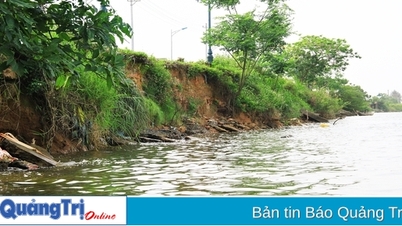
Along with that, there have been many unusual floods and heavy rains leading to flooding in low-lying areas in the plains, causing serious subsidence and landslides in mountainous areas and riverside areas in the province. Coastal erosion is also serious. According to statistics, the coastline of Quang Tri province has up to 3,000 m of eroded length, mainly concentrated in the coastal section through Thai Lai, Tan Mach, Thu Luat, Tan Hoa villages in Vinh Thai commune, Vinh Linh district, affecting the dike system, residential land, houses, and production land.
In order to proactively respond to the adverse impacts caused by climate change, the People's Committee of Quang Tri province issued Plan No. 58/KH-UBND, dated March 17, 2021, which identifies 3 groups of tasks and solutions, focusing on 7 priority groups and areas to enhance resilience and adaptive capacity of communities, economic sectors and ecosystems to minimize vulnerability and risks to the impacts of climate change; promote the integration of climate change adaptation into the system of strategies, planning and socio-economic development plans of the province...
To realize the above tasks and solutions, the People's Committee of Quang Tri province determined that it is necessary to manage and sustainably use forest resources in association with biodiversity protection and improving ecosystem services. Invest in developing infrastructure for residential areas, coastal resettlement areas and Con Co island based on natural disaster risk zoning and climate change scenarios. Prioritize the construction of green buildings and urban green trees, upgrade drainage systems, prevent flooding due to heavy rain and floods for urban areas such as Dong Ha city, Quang Tri town, etc.
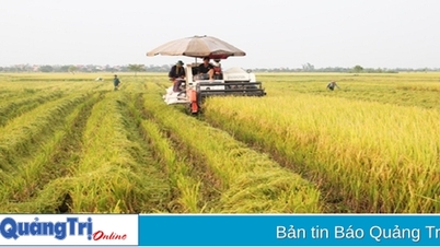
Strive to effectively manage the province's water, land and environmental quality resources by 2050. Continue to develop smart, modern agriculture that effectively adapts to climate change and has high added value. Implement plans to regulate and allocate water resources; improve the effectiveness of water resource management in a unified and integrated manner to meet the water needs of sectors and localities in the province.
Supervise the exploitation, use and protection of water resources; prevent, combat and overcome consequences and harms caused by water according to the provisions of law. Organize response and remediation of water pollution incidents; investigate and assess the carrying capacity of rivers, lakes... Rationally and effectively exploit unused land areas, alluvial land along rivers and seas for forest development, green tree development in urban areas and industrial zones.
Increase investment in upgrading infrastructure, equipment, facilities, and measuring works for hydrometeorology and disaster prevention; add hydrometeorological monitoring stations, especially in areas where high tides often occur, flash floods, landslides, and inundation often occur; assess and zonate in detail the risks of hydrometeorological disasters; assess and update climate and water resources reports.
Implement timely and effective disaster prevention solutions, minimize risks from the impacts of climate change, focusing on areas at high risk of being affected by storms, floods, flash floods, inundation, landslides, droughts. Prevent, avoid, stop, and limit the impacts of saltwater intrusion, riverbank erosion, coastal erosion, and rising sea levels. Build and upgrade disaster prevention and control works in areas where storms, floods, inundation, flash floods, and landslides frequently occur.
Strengthen, upgrade and complete the river and sea dyke systems and irrigation works to proactively prevent and combat floods and storms, prioritizing the safety of lakes, dams, river and sea dykes. Build and upgrade storm shelters for ships and boats according to planning, linked with logistics services and fisheries information, including the Con Co island area.
Focus on planning, investment, relocation, and rearrangement of residential areas in areas frequently affected by extreme climate, especially those at high risk of storms, floods, riverbank and coastal erosion, or at risk of flash floods, landslides, and land subsidence. Strengthen measures to ensure safety for people, especially vulnerable groups in areas frequently affected by extreme climate and natural disasters. Build disaster-proof houses, community centers, etc.
Improve the capacity of search and rescue forces, ensure security, social order and safety; proactively prevent natural disasters, ensure the safety of people's lives and property against the impacts of natural disasters caused by climate change.
Tan Nguyen
Source: https://baoquangtri.vn/giam-tac-dong-ton-that-va-thiet-hai-do-bien-doi-khi-hau-189523.htm

![[Photo] President Luong Cuong presents the decision to appoint Deputy Head of the Office of the President](https://vphoto.vietnam.vn/thumb/1200x675/vietnam/resource/IMAGE/2025/5/8/501f8ee192f3476ab9f7579c57b423ad)

![[Photo] General Secretary concludes visit to Azerbaijan, departs for visit to Russian Federation](https://vphoto.vietnam.vn/thumb/1200x675/vietnam/resource/IMAGE/2025/5/8/7a135ad280314b66917ad278ce0e26fa)

![[Photo] National Assembly Chairman Tran Thanh Man chairs the meeting of the Subcommittee on Documents of the First National Assembly Party Congress](https://vphoto.vietnam.vn/thumb/1200x675/vietnam/resource/IMAGE/2025/5/8/72b19a73d94a4affab411fd8c87f4f8d)


![[Photo] General Secretary To Lam receives leaders of typical Azerbaijani businesses](https://vphoto.vietnam.vn/thumb/1200x675/vietnam/resource/IMAGE/2025/5/8/998af6f177a044b4be0bfbc4858c7fd9)


![[Photo] Prime Minister Pham Minh Chinh talks on the phone with Singaporean Prime Minister Lawrence Wong](https://vphoto.vietnam.vn/thumb/402x226/vietnam/resource/IMAGE/2025/5/8/e2eab082d9bc4fc4a360b28fa0ab94de)


Comment (0)