
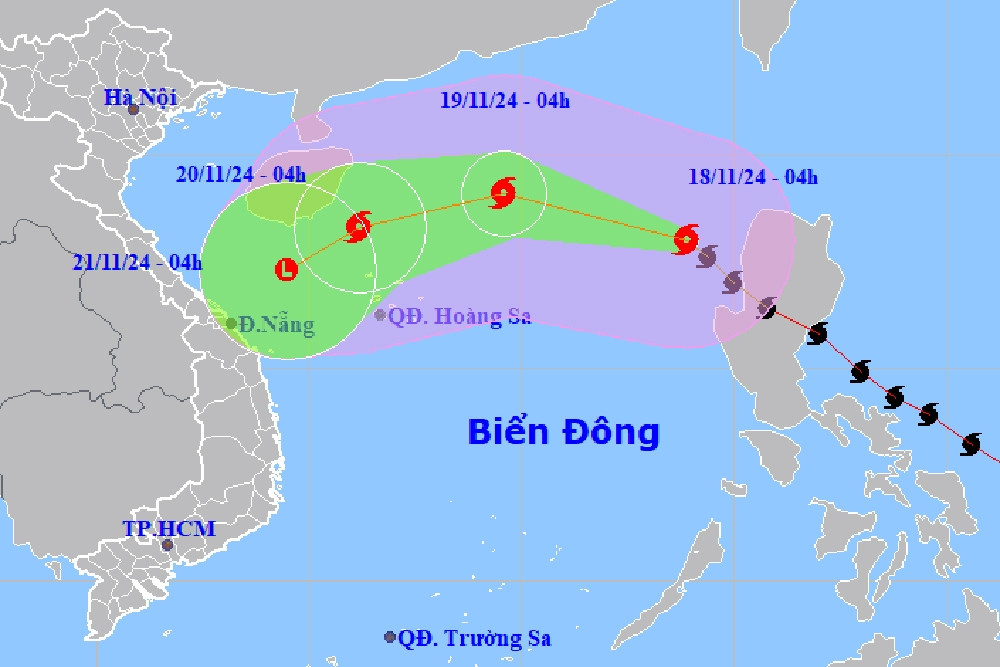
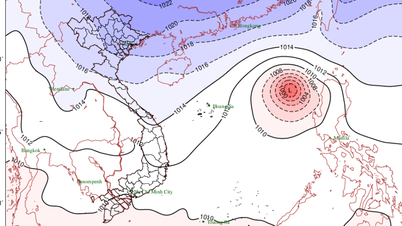
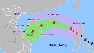
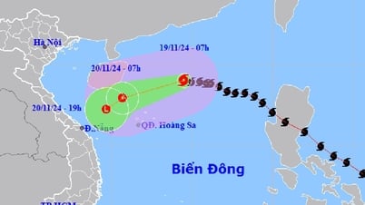
Storm No. 9 is about 220km north of Hoang Sa archipelago with winds reduced to level 8, gusting to level 10. In the coming hours, the storm will weaken rapidly and become a low pressure area tomorrow afternoon (November 20).
Specifically, at 4:00 p.m. this afternoon (November 19), the center of storm No. 9 was located in the North East Sea, about 220km north of Hoang Sa archipelago. The strongest wind near the center of the storm was level 8 (62-74km/h), gusting to level 10. Moving in the West Southwest direction, at a speed of about 20km/h.
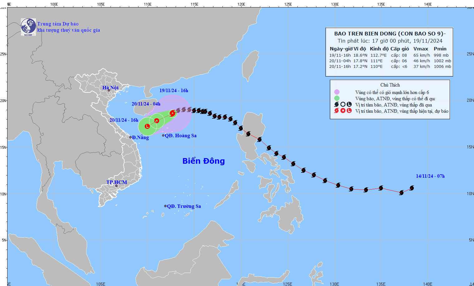
In the coming hours, the storm will continue to move west-southwest at a speed of 15-20km/h and gradually weaken into a tropical depression. By 4am tomorrow morning, the center of the tropical depression will be in the west of the North East Sea; about 180km northwest of Hoang Sa archipelago, with winds decreasing to level 6, gusting to level 8.
About 12 hours later, the tropical depression moved southwest at about 10km/h, gradually weakening into a low pressure area in the sea off the Central Central Coast.
Due to the impact of the storm, the western sea area of the North East Sea (including the sea area north of Hoang Sa archipelago) has strong winds of level 6-7, the area near the storm's center has winds of level 8, gusts of level 10, waves 3-5m high; very rough seas.
Vessels operating in the above mentioned dangerous areas are susceptible to the effects of strong winds and large waves.
Storm No. 9 enters the East Sea, meets cold air weakening in the Central Central Coast

La Nina develops unexpectedly, coldest air in the second half of December
Source: https://vietnamnet.vn/bao-so-9-giat-cap-10-suy-yeu-nhanh-thanh-vung-ap-thap-trong-chieu-mai-2343631.html


![[Photo] Prime Minister Pham Minh Chinh chairs Government Standing Committee meeting on Gia Binh airport project](https://vphoto.vietnam.vn/thumb/1200x675/vietnam/resource/IMAGE/2025/5/10/6d3bef55258d417b9bca53fbefd4aeee)


![[Photo] General Secretary To Lam holds a brief meeting with Russian President Vladimir Putin](https://vphoto.vietnam.vn/thumb/1200x675/vietnam/resource/IMAGE/2025/5/10/bfaa3ffbc920467893367c80b68984c6)


Comment (0)