
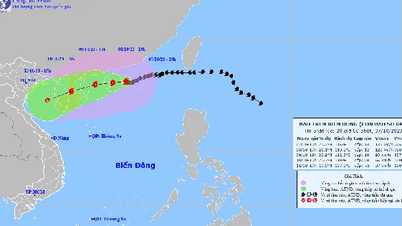
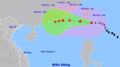
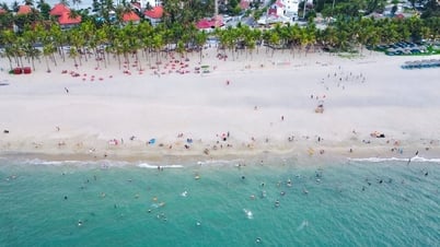
The National Center for Hydro-Meteorological Forecasting said that at 7:00 a.m. today, October 9, the center of storm No. 4 was at about 21.6 degrees north latitude; 113.2 degrees east longitude, in the sea south of Guangdong province (China). The storm is level 9 (75 - 88 km/h), gusting to level 12, moving slowly westward at a speed of about 5 km/h.

Map of the path of storm number 4
In the next 24 hours, storm No. 4 will move rapidly in the west-southwest direction, traveling 15 km per hour and weakening further.
At 7:00 a.m. on October 10, the center of the storm was at about 20 degrees north latitude; 110.8 degrees east longitude, in the northeastern area of Hainan Island. The storm was at level 6-7, gusting to level 9. After making landfall on Hainan Island, storm No. 4 weakened into a tropical depression and a low-lying area.
Compared to the forecast 1 day ago, storm number 4 has decreased by 3 levels and cannot enter the Gulf of Tonkin.
Due to the influence of storm No. 4, in the next 24 hours, the northwest sea area of the northern East Sea will have strong winds of level 6 - 7, the area near the storm center will have strong winds of level 8 - 9, gusting to level 12; very rough seas.
In addition, due to the influence of the cold air strengthening, from early morning on October 10, the sea area of Bac Bo Gulf has strong northeast wind level 6, gust level 8, rough sea.
In the northern East Sea, waves are 2-3 m high, and near the storm center, waves are 3-5 m high. Since the morning of October 10, in the Gulf of Tonkin, waves are 2-3 m high. All ships operating in these areas are affected by strong winds and large waves.
Source link

![[Photo] National conference to disseminate and implement Resolution No. 66-NQ/TW and Resolution No. 68-NQ/TW of the Politburo](https://vphoto.vietnam.vn/thumb/1200x675/vietnam/resource/IMAGE/2025/5/18/adf666b9303a4213998b395b05234b6a)
![[Photo] More than 17,000 candidates participate in the 2025 SPT Competency Assessment Test of Hanoi National University of Education](https://vphoto.vietnam.vn/thumb/1200x675/vietnam/resource/IMAGE/2025/5/17/e538d9a1636c407cbb211b314e6303fd)
![[Photo] Prime Minister Pham Minh Chinh chairs meeting on science and technology development](https://vphoto.vietnam.vn/thumb/1200x675/vietnam/resource/IMAGE/2025/5/17/ae80dd74c384439789b12013c738a045)


![[Photo] Readers line up to visit the photo exhibition and receive a special publication commemorating the 135th birthday of President Ho Chi Minh at Nhan Dan Newspaper](https://vphoto.vietnam.vn/thumb/1200x675/vietnam/resource/IMAGE/2025/5/17/85b3197fc6bd43e6a9ee4db15101005b)


Comment (0)