(Dan Tri) – According to Dan Tri reporters, the rain has stopped in the coastal area of Thuan An, Hue City. However, the main road leading to the seaport in Hue was deeply flooded due to storm No. 6, forcing many households to evacuate urgently.
At noon on October 27, according to Dan Tri reporters, the wind in coastal areas of Quang Binh, Quang Tri, Thua Thien Hue, Da Nang and Quang Nam has decreased.
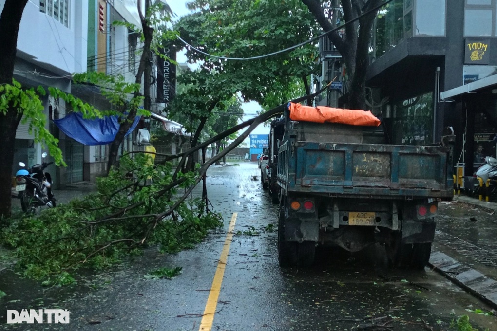
In Da Nang, it is raining heavily, some trees have fallen, causing traffic jams. To ensure the safety of people and vehicles, Da Nang City Traffic Police in coordination with Phu Loc District Police and Hai Van Road Tunnel Management Company continue to implement road closures, not allowing vehicles to pass through Hai Van Pass to ensure safety.

12:03, October 27, 2024
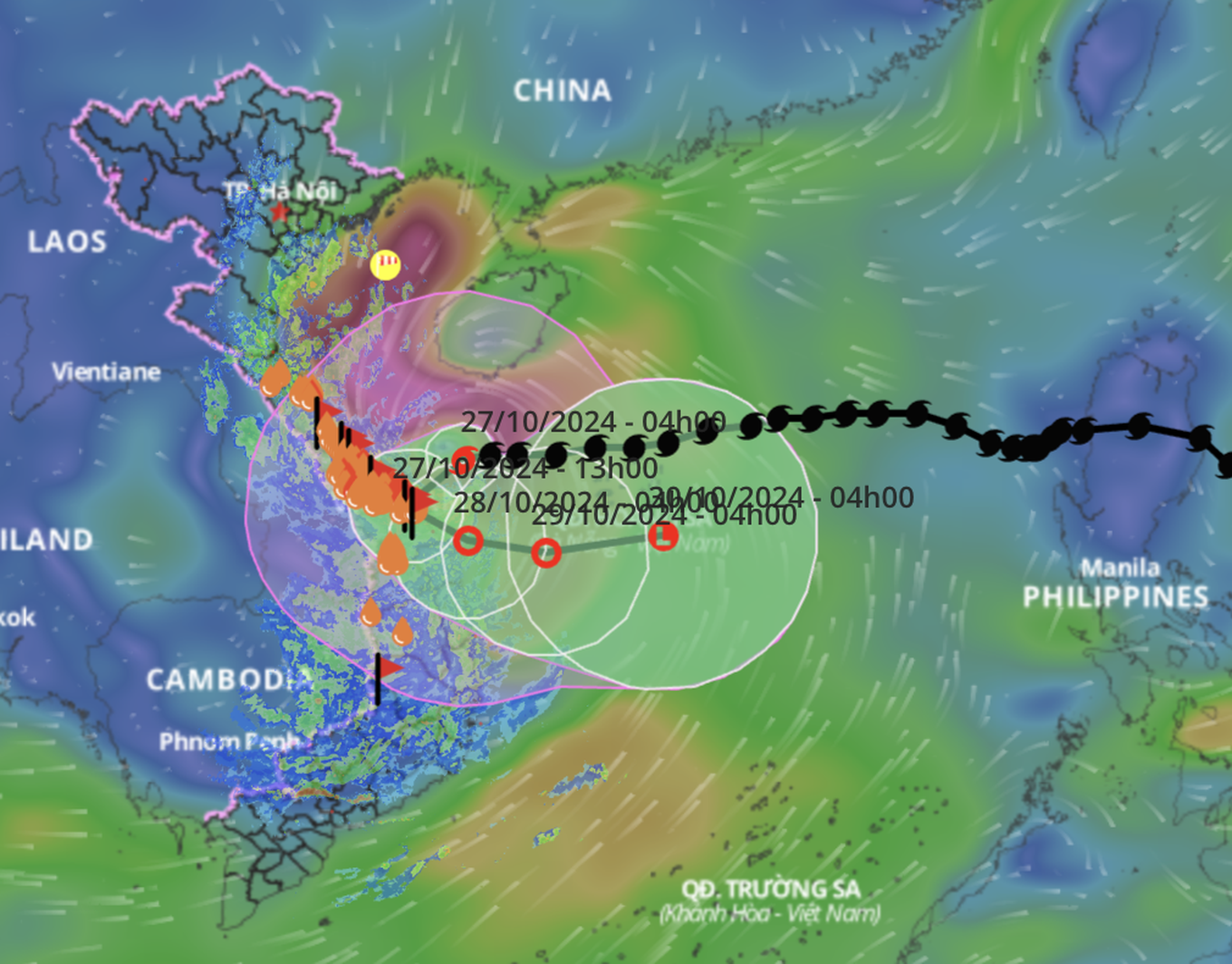
According to the National Center for Hydro-Meteorological Forecasting, at noon on October 27, storm Tra Mi (storm number 6) entered the sea area of Thua Thien Hue - Da Nang.
The strongest wind near the storm center is level 9, gusting to level 12. The storm moves southwest at a speed of 15-20km/h.
Due to the impact of the storm, the sea areas of the provinces from Quang Binh to Quang Ngai (including Con Co Island, Cu Lao Cham, Ly Son) have strong winds of level 6-7, near the storm center of level 8-9, gusting to level 11; waves 3-5m high; very rough seas.
It is forecasted that coastal areas from Quang Binh to Quang Nam provinces may experience water levels rising 0.4-0.6m.
Ships operating in coastal areas from Quang Binh to Quang Ngai are likely to be affected by storms, whirlwinds, strong winds, and large waves.
Warning of high risk of landslides of sea dikes and embankments along the coast of provinces from Quang Tri to Quang Nam due to the impact of big waves and rising water.
At the meeting to respond to storm No. 6 (Tra Mi storm) on the morning of October 27, Mr. Mai Van Khiem, Director of the National Center for Hydro-Meteorological Forecasting, said that this morning, gusts of wind of level 8 were recorded on Con Co island, Cu Lao Cham. On the mainland, in Quang Tri and Thua Thien Hue, gusts of wind of level 6 were recorded.
Regarding rain, from the afternoon of October 26 to the morning of October 27, the average rainfall in the Central Central region was 50-130mm, some places over 350mm.
Storm No. 6 is located in the Quang Tri - Quang Nam sea area, about 75km from Da Nang.
This afternoon, storm No. 6 is expected to make landfall in the area from South Quang Tri to North Quang Nam. The area with strong winds of level 8-9, gusting to level 11, is mainly concentrated from Quang Nam - Quang Tri.
Mr. Khiem commented that Tra Mi storm is different from normal storms, so when it makes landfall, it will return to the East Sea. Therefore, on land, there will be strong winds and prolonged heavy rain.
Regarding rainfall, it is forecasted that from the morning of October 27 to the end of October 29, from Quang Binh to Quang Nam, there will be 200-400mm of rain, with some places having over 600mm.
Heavy rains may cause flooding on rivers in Quang Tri - Quang Ngai, at alert level 1 to alert level 3.
“We estimate that from Quang Binh to Quang Ngai, there are over 30 districts and urban areas with a total of 365 communes at risk of flooding,” said Mr. Khiem.
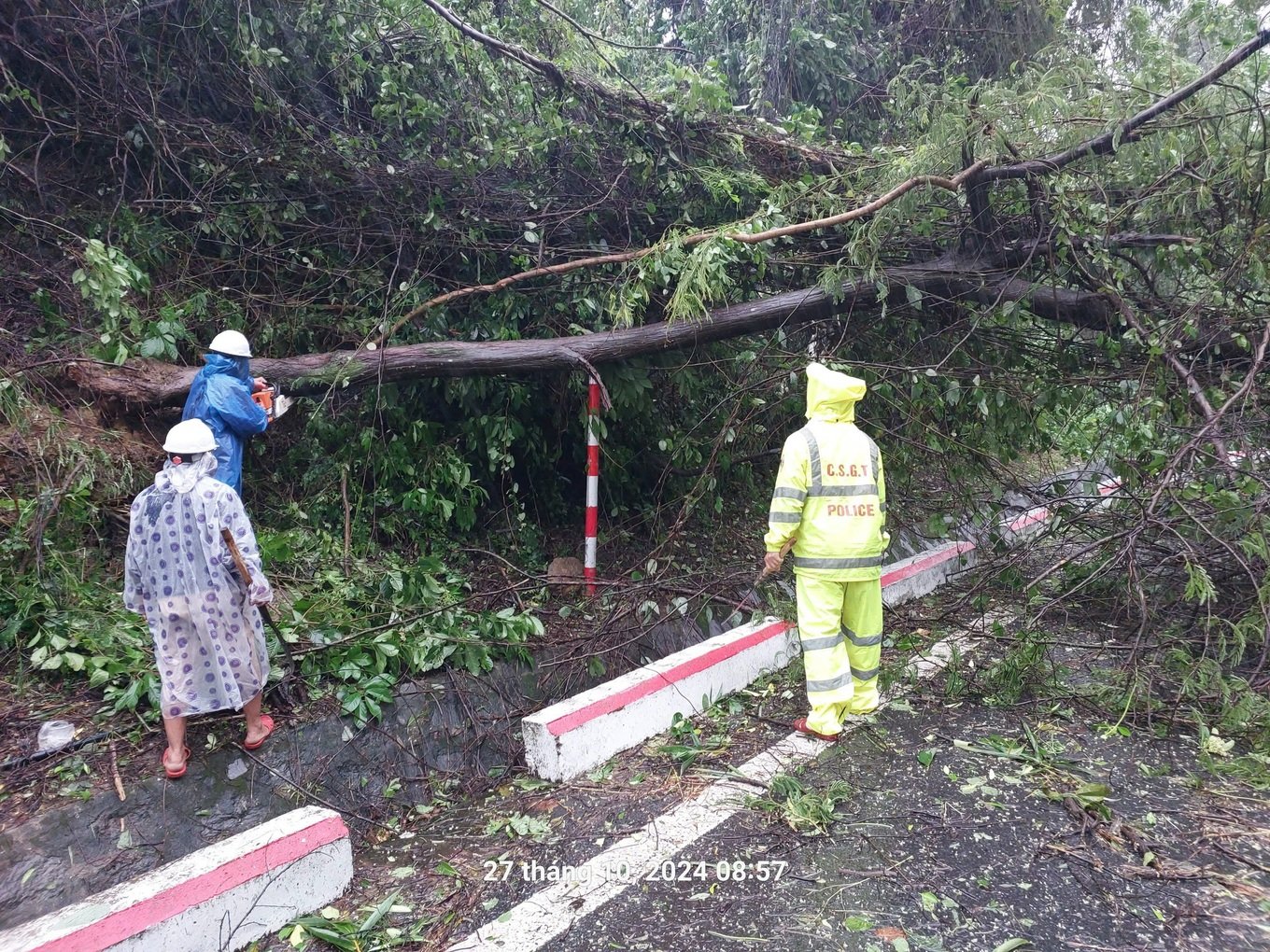
According to Dan Tri reporters, some sections of National Highway 1A in the direction of Lang Co - Hue are currently partially blocked due to fallen trees along the road.
The route in Hai Van tunnel was also blocked on the morning of October 27, but has now been reopened.

A representative of the Steering Committee for Natural Disaster Prevention, Search and Rescue and Civil Defense of Da Nang City said that the city's functional forces have evacuated 1,677 households/6,205 people living in motels, temporary houses, and non-permanent houses in areas at risk of landslides and flash floods to safe places.
The Border Guard force coordinated with local authorities and Vo Thi Sau Primary School, Thuan Phuoc Ward, Hai Chau District, to arrange and evacuate nearly 100 people in the area living in motels and temporary houses to take shelter from the storm at the school.

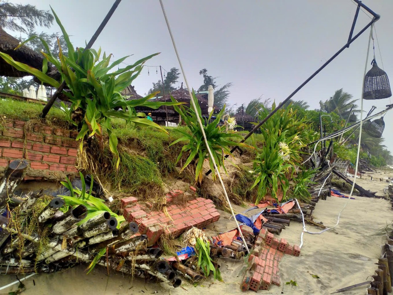
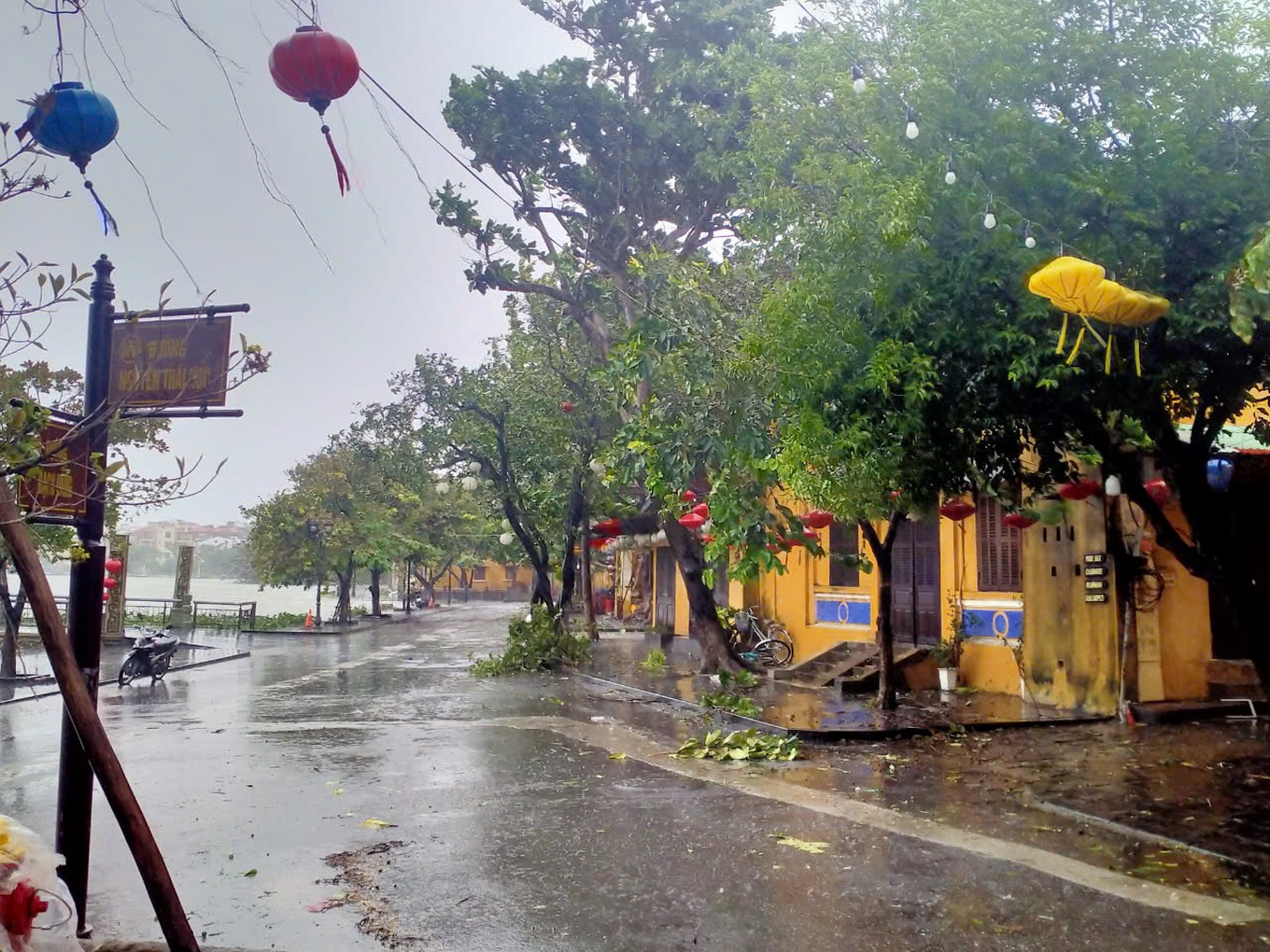
According to the reporter, at Cua Dai beach, Hoi An, the waves crossed the dike and hit the shore, causing a short landslide of 20m. Meanwhile, the coastal area of Hoi An had big waves, rough seas, and winds of level 6-7.
A coastal restaurant in An Bang, Cam An ward, Hoi An city suffered a landslide. Talking to reporters, the restaurant owner said that at around 7am on October 27, waves over 2m high hit the shore, causing the embankment to collapse.
To cope with storm Tra Mi, Hoi An city has established many rapid response teams to participate in storm and flood prevention in wards and communes. At the same time, Hoi An authorities also called on people to stay at home and not go out unnecessarily this afternoon and evening.
At a meeting to respond to storm No. 6 (Tra Mi storm) on the morning of October 27, Deputy Prime Minister Tran Hong Ha said that Tra Mi storm is the first storm to make landfall in the Central region in 2024.
The Deputy Prime Minister assessed that storm Tra Mi has a very special mechanism of operation when it enters the mainland and then turns out to sea, so the impact of strong winds on land lasts for a long time and there is heavy rainfall.
Therefore, the National Center for Hydro-Meteorological Forecasting and local meteorological stations need to make accurate forecasts about the time of storm landfall and high tides to focus on handling vulnerable sea dike areas.
The Deputy Prime Minister asked the Ministry of National Defense to support localities in using drones to survey densely populated areas and areas with geological fault maps to promptly detect landslide-prone areas and move people to safety.
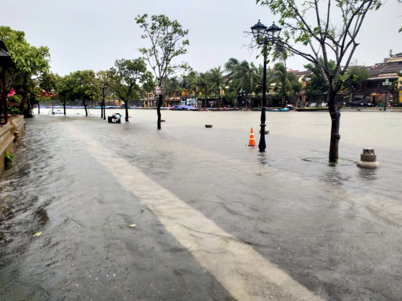
According to Dan Tri reporters, the rain has stopped in the coastal area of Thuan An, Hue City. However, the main road leading to the estuary is deeply flooded, forcing many households to evacuate urgently.
To help people, Hue City has mobilized many forces to support people evacuating from flooded areas.

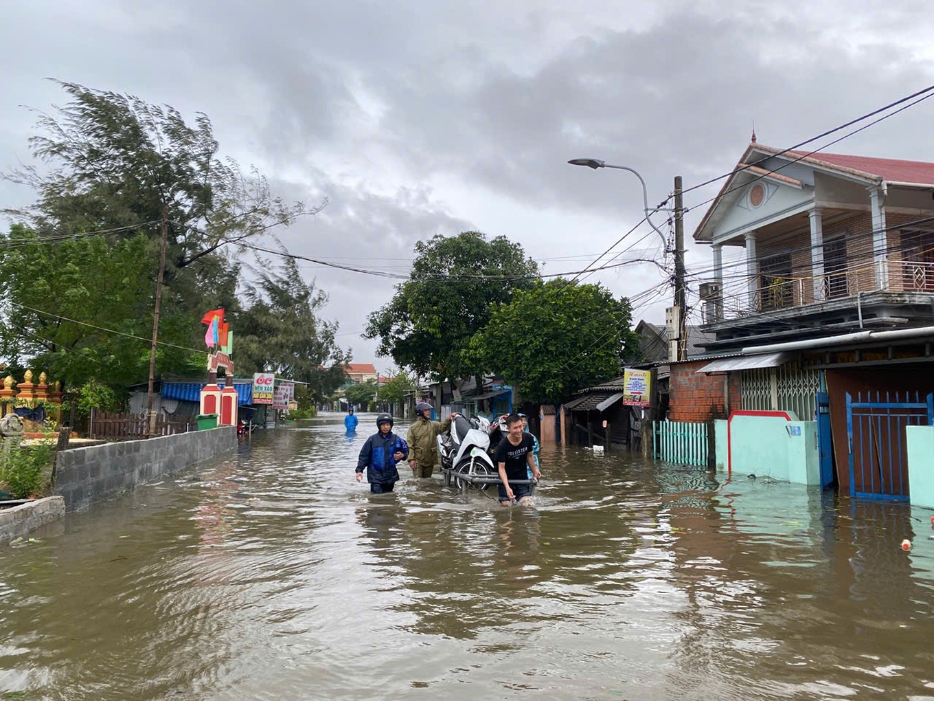
Strong winds and strong waves caused seawater to overflow the shore at Thuan An beach, Hue city and Phu Thuan commune, Phu Vang district (Thua Thien Hue province). Seawater even overflowed onto Highway 49 into Tam Giang lagoon.
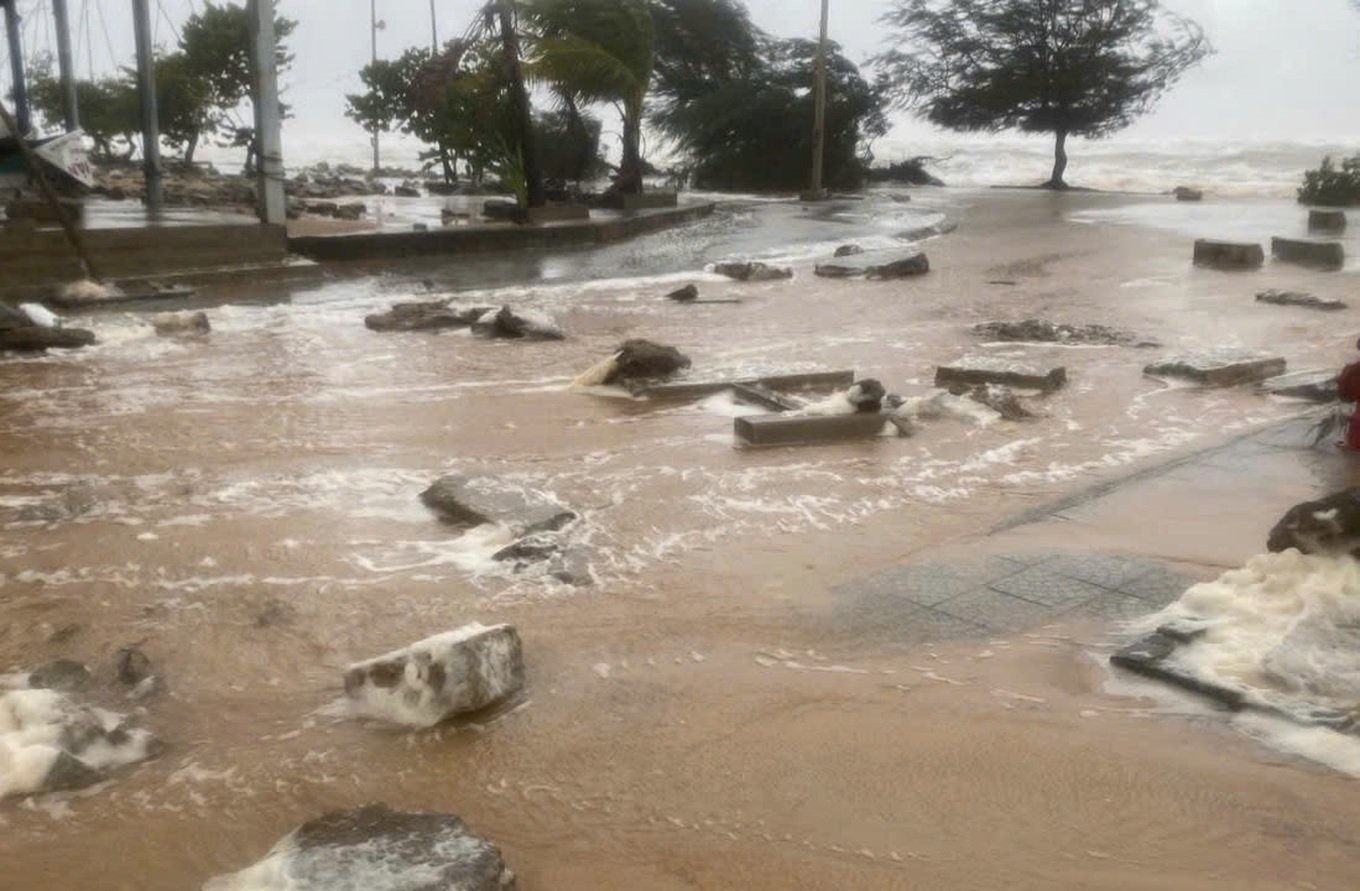
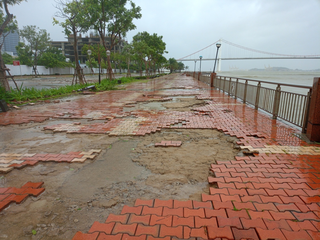
Due to the impact of storm Tra Mi, the waves on the Han River in Da Nang City were quite large. The large waves knocked down the pavement along the Han River, near the Thuan Phuoc Bridge, in Hai Chau District. To ensure the safety of the people, the authorities have barricaded the area and prohibited vehicles from passing through.
According to Dan Tri reporters, many lamp posts on the sidewalk along the Han River have fallen, and the sidewalk tiles have also been washed away by the waves onto the road.
Due to the impact of storm Tra Mi, by 9:30 a.m. on October 27, in Quang Tri province, many places had heavy to very heavy rain and strong gusts of wind. Water levels in rivers and streams in mountainous districts of this province were rising, some underground water overflowed and caused local isolation.
On Con Co island district, there was heavy rain and wind of level 8, gusting to level 9, and waves of 3-4m high. To ensure the safety of people and authorities on the island, local authorities asked everyone to stay at home and stay at shelters.
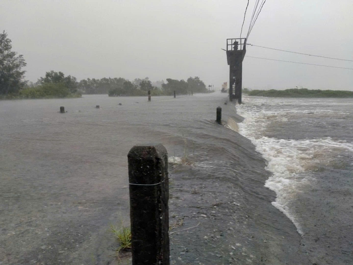
Due to the impact of storm No. 6, there was heavy rain in Quang Tri province, some roads and spillways in Trieu Phuoc and Trieu Dai communes, Trieu Phong district (Quang Tri) were deeply flooded.
Heavy rain also caused water levels in rivers and streams in mountainous districts of the province to rise, overflowing in Dakrong district at km0+307 on National Highway 15D, causing local isolation.

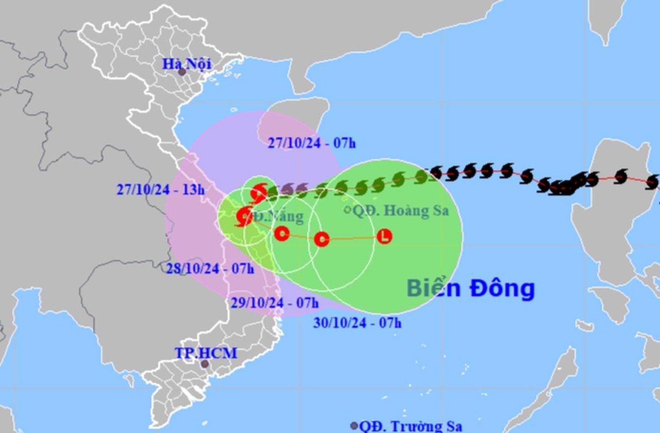
Mr. Mai Van Khiem, Director of the National Center for Hydro-Meteorological Forecasting, said that at 9:00 a.m. on October 27, the center of storm Tra Mi (storm No. 6) was about 65km northeast of Da Nang.
The strongest wind is level 9, gusting to level 11. In the next 3 hours, the storm will move in the West Southwest direction, at a speed of about 10-15km/h.
This afternoon, the storm is forecast to move from southern Quang Tri to northern Quang Nam. Areas near the storm's center are likely to have strong winds of level 8-9, gusting to level 11.
From this afternoon to tonight, the storm will weaken into a tropical depression and move out to the East Sea.
According to the hydro-meteorological agency, due to the influence of storm No. 6's circulation, Con Co Island (Quang Tri) has strong winds of level 8, gusting to level 9; Cu Lao Cham Island (Quang Nam) has strong winds of level 8, gusting to level 10; Ly Son Island (Quang Ngai) has level 6, gusting to level 7; Nam Dong (Thua Thien Hue) has strong winds of level 7; Thua Thien Hue has strong winds of level 6, gusting to level 8; Ba Na (Da Nang) has strong winds of level 6, gusting to level 13.
The area from Quang Binh to Da Nang has had heavy rain, with common rainfall of 50-150mm, and locally heavy rain over 250mm.
Due to the impact of the storm in the western sea area of the North East Sea, strong winds of level 6-7, sometimes level 8, gusting to level 10, waves 2-4m high; rough seas.
The sea area of provinces from Quang Binh to Quang Ngai (including Con Co Island, Cu Lao Cham, Ly Son) has strong winds of level 6-7, the area near the storm's eye has winds of level 8-10, gusts of level 12, waves 3-5m high; very rough seas.
From the morning of October 27, coastal areas from Quang Binh to Quang Nam provinces are likely to experience storm surges of 0.4-0.6m high.
Ships/boats operating in the above-mentioned dangerous areas (especially in the Hoang Sa island district area), coastal areas from Quang Binh to Quang Ngai are all likely to be affected by storms, whirlwinds, strong winds, and big waves.
Warning of high risk of landslides of sea dikes and embankments along the coast of provinces from Quang Tri to Quang Nam due to the impact of big waves and storm surges.
The development of storm number 6 is still very complicated and may change.
To prevent and combat storm No. 6 (storm Tra Mi), the Da Nang Military Command mobilized 4 BTR-152 armored vehicles of Armored Battalion 699 under the General Staff Department to be ready to respond to emergency situations.
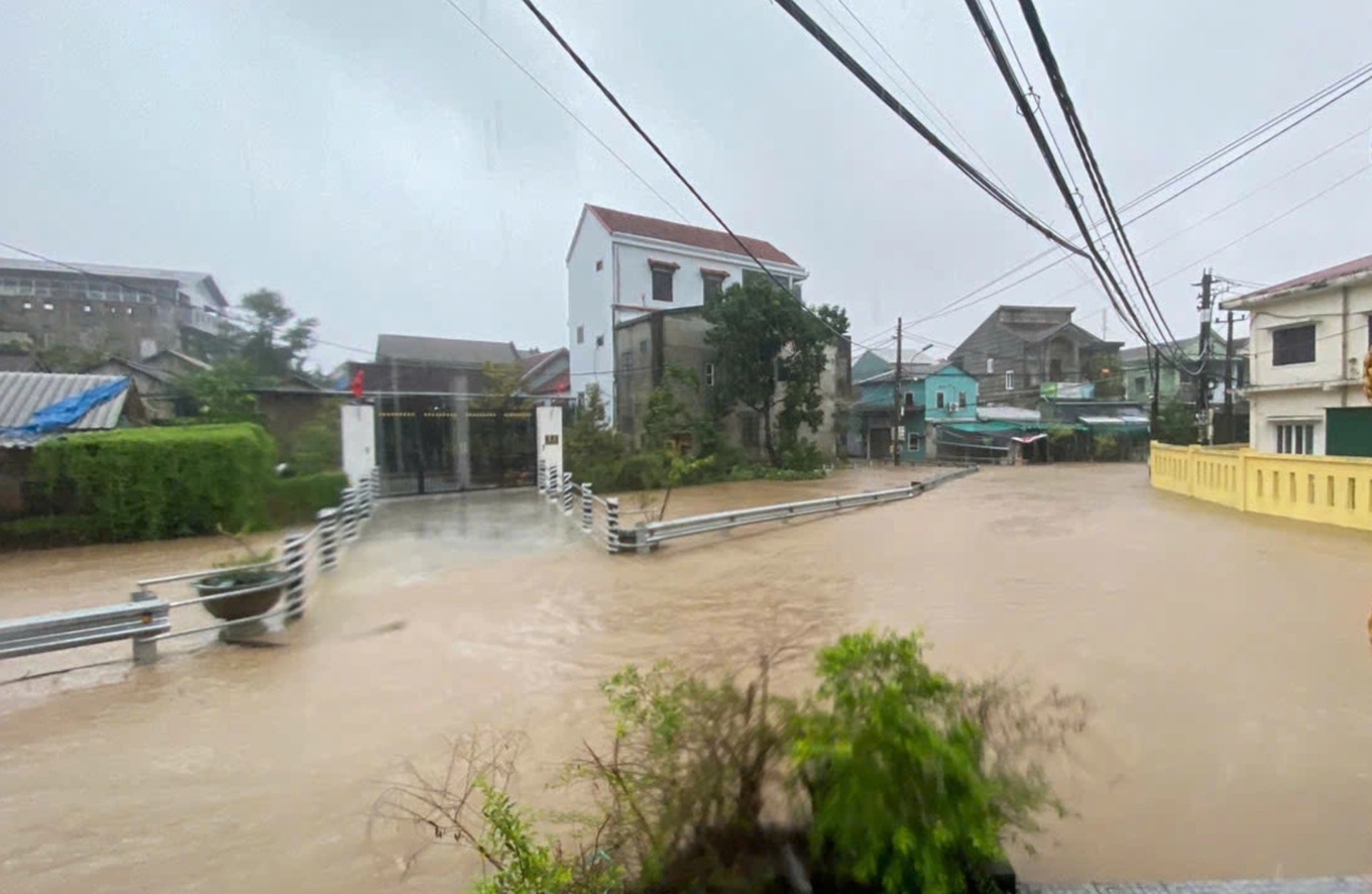
This morning, due to the influence of storm Tra Mi, many areas in Thua Thien Hue province had heavy rain, causing flooding in some localities, including some places in Hue city.
At around 8:40 this morning, at Sam Son city beach, Thanh Hoa province, there was light rain and strong wind. Along the embankment at the end of D beach of this city, many high waves appeared, many tourists invited each other to the beach to take pictures.

At 8:30 a.m., the streets of Hoi An, Quang Nam were deserted, with only a few people occasionally shopping for necessities. The wind began to blow strongly, accompanied by light rain. The traditional markets were still open, but few people were on the streets.
Ms. Pham Thi My Huong - Chairwoman of Tan Hiep Commune People's Committee (Cu Lao Cham Island), Hoi An City - said that at 9:00 a.m. on October 27, the storm made landfall with winds of level 7-8, gusts of level 10, very high waves, flooding the island's coastal roads. The authorities asked people to close their doors and stay off the streets to ensure safety.

According to the National Center for Hydro-Meteorological Forecasting, at 6:00 a.m. on October 27, the center of storm Tra Mi (storm No. 6) was at about 16.8 degrees North latitude; 108.9 degrees East longitude, about 110km East Northeast of Da Nang.
The strongest wind is level 9-10, gusting to level 12. In the next 3 hours, the storm will move southwest at a speed of about 15km/h.
It is forecasted that this morning, storm Tra Mi will make landfall in the Central Central provinces (Quang Tri, Thua Thien Hue, Da Nang, Quang Nam, Quang Ngai).
By noon today, the storm center is on land along the coast of the Central Central provinces.
The storm then changed direction to the Southeast, moving towards the sea area of Quang Nam - Quang Ngai provinces and gradually weakened into a tropical depression.
In Thua Thien Hue, on the morning of October 27, the Provincial Steering Committee for Natural Disaster Prevention and Search and Rescue also issued a notice restricting people from going out when strong winds occur due to storm Tra Mi.
According to the disaster prevention agency, due to the influence of storm No. 6, in Thua Thien Hue province, there are strong winds of level 8, gusting to level 9; rainfall from 7:00 p.m. on October 26 to 6:00 a.m. on October 27 is generally 100-150mm, some places are higher such as: Bach Ma 268mm, Nam Dong 144mm, causing risks to people's lives and property.
The Steering Committee for Natural Disaster Prevention, Control and Search and Rescue of Thua Thien Hue province requires people to stay off the streets from 7am on October 27 (except for forces on duty and special cases) until further notice from the authorities.
According to Dan Tri reporters, from early morning on October 27, heavy rains with strong gusts of wind began to appear in Da Nang city and some localities of Thua Thien Hue.
On the same morning, the Hue Monuments Conservation Center announced that it would temporarily stop receiving visitors at locations in the Hue Monuments Complex until further notice.
To respond to storm No. 6, Thua Thien Hue province has planned to evacuate 16,349 households/52,186 people in vulnerable areas.
Thua Thien Hue mobilizes people to proactively stock up on essential goods for 7-10 consecutive days to prepare for natural disasters, floods and storms; arranges 100 tons of rice and 100 tons of instant noodles to support people when necessary.
According to the Steering Committee for Natural Disaster Prevention and Search and Rescue of Thua Thien Hue province, up to now, all 1,884 vessels with 10,685 workers of the province have safely anchored ashore.
In Da Nang, on the morning of October 27, strong winds began to appear and the sky was very gloomy. The beaches began to have gusts of wind, which is a sign that storm No. 6 (storm Tra Mi) is approaching the mainland. People in the city are also asked to limit going out from 10am today.

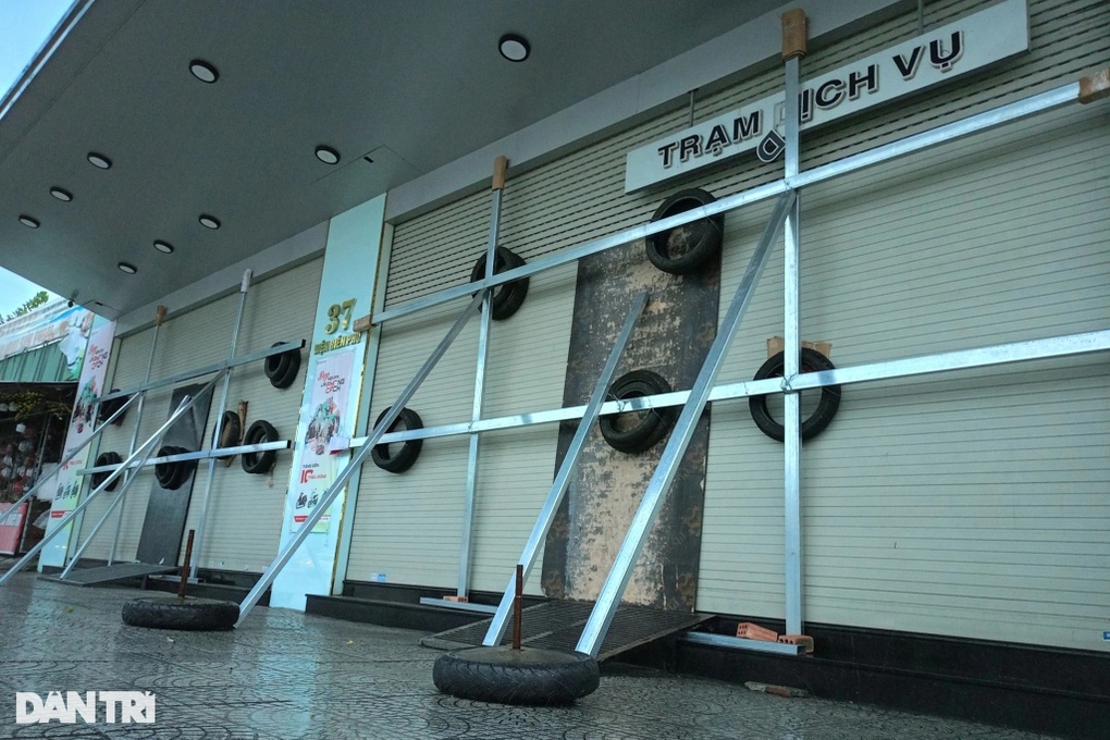
Also according to records this morning, Da Nang city had light rain and light wind, people quickly tied up their houses and shops to prepare to cope with storm Tra Mi.



Dantri.com.vn
Source: https://dantri.com.vn/xa-hoi/bao-tra-mi-khien-nuoc-bien-dang-cao-tran-vao-bo-o-thua-thien-hue-20241027080707249.htm





![[Photo] Prime Minister Pham Minh Chinh meets with US business representatives](https://vphoto.vietnam.vn/thumb/1200x675/vietnam/resource/IMAGE/2025/5/13/5bf2bff8977041adab2baf9944e547b5)






















Comment (0)