Using radar satellite images to quickly assess storm damage and flood areas in Hanoi
Việt Nam•30/10/2024
Typhoon Yagi made landfall in Vietnam on September 7, 2024, with its eye passing through Quang Ninh province and Hai Phong city. This is a strong storm, with many records being set. Typhoon Yagi caused great damage to the areas it passed through, especially Quang Ninh province and Hai Phong city. The damage included damage to infrastructure systems (electricity, telecommunications networks, transportation), houses and especially coastal aquaculture areas. Radar data was processed by scientists at the Vietnam Space Center to get an initial look to quickly assess the damage in coastal aquaculture areas affected by the storm.
Radar satellite imagery demonstrates superiority in providing disaster-related information thanks to its ability to penetrate clouds, helping to strengthen disaster monitoring capabilities.
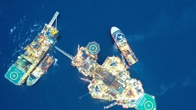
Aquaculture areas devastated by Typhoon Yagi in the northern area of Cat Ba Island. Photo: Internet.
Scientists at the Vietnam Space Center (Vietnam Academy of Science and Technology) are processing radar satellite images to quickly assess damage in coastal aquaculture areas affected by Typhoon Yagi and flood areas near Hanoi. In an interview with the Government E-newspaper, Dr. Vu Anh Tuan, Deputy General Director of the Vietnam Space Center, said that in recent days, scientists at the Vietnam Space Center have used image data from synthetic aperture radar (SAR) satellites to get an initial look to quickly assess damage in coastal aquaculture areas affected by Typhoon Yagi in Quang Ninh and Hai Phong. The collected data includes two Sentinel-1 images (European SAR satellite, C-band, 10m spatial resolution) taken on August 29, 2024 (before the storm) and on September 10, 2024 (when the storm just passed). Using fast image processing tools on VV polarization, enhancing image quality and sensory assessment, coastal aquaculture areas have been severely damaged. In addition, to survey and assess the flooded areas of Hanoi, the Vietnam Space Center has asked the Japanese side to support satellite photography and initially obtained results. In particular, the image of the ASNARO-2 radar remote sensing satellite (X-band, 2m resolution, similar to Vietnam's future LOTUSat-1 satellite) was taken at 5:33 p.m. on September 12, 2024, in the Hanoi area and surrounding areas. The photo shows locations such as Noi Bai airport at the top of the photo, West Lake below, and Thang Long bridge, Nhat Tan bridge across the Red River. In particular, the photo clearly shows the flooded area around the Ca Lo river near Noi Bai airport.
These results are only initial results based on the rapid processing of SAR images by the staff of the Vietnam Space Center. This also shows the superiority of SAR images in providing information related to natural disasters thanks to the ability to capture through clouds (during this time optical satellite images cannot observe the ground). According to Dr. Vu Anh Tuan, to make a more accurate assessment, more processing time is needed and coordination with field verification information is needed. However, in the urgent situation of responding to storms, all information obtained is extremely valuable. In the coming time, the Vietnam Space Center will continue to coordinate with foreign partners to exploit SAR satellite images and process them quickly to provide information that contributes to proactively responding to storm circulation. In particular, we are focusing on completing the LOTUSat-1 satellite, Vietnam's first radar technology satellite, so that it can be launched into orbit in 2025. "When we have Vietnam's own radar satellite, we will be more timely and proactive when taking pictures of areas of interest," said Dr. Vu Anh Tuan. The LOTUSat-1 satellite belongs to the project "Prevention of natural disasters and climate change using Earth observation satellites". The satellite weighs 600 kg, using the latest radar technology with many advantages such as detecting objects measuring 1m on the ground, the ability to observe both day and night. The LOTUSat-1 satellite will take pictures and provide accurate information to respond to and minimize the impact of natural disasters, climate change, resource management and environmental monitoring. Unlike optical satellites, radar satellites can take pictures in all weather conditions, especially in cloudy, foggy, and low-light conditions./.


![[Photo] National Assembly Chairman Tran Thanh Man chairs the meeting of the Subcommittee on Documents of the First National Assembly Party Congress](https://vphoto.vietnam.vn/thumb/1200x675/vietnam/resource/IMAGE/2025/5/8/72b19a73d94a4affab411fd8c87f4f8d)

![[Photo] President Luong Cuong presents the decision to appoint Deputy Head of the Office of the President](https://vphoto.vietnam.vn/thumb/1200x675/vietnam/resource/IMAGE/2025/5/8/501f8ee192f3476ab9f7579c57b423ad)
![[Photo] General Secretary concludes visit to Azerbaijan, departs for visit to Russian Federation](https://vphoto.vietnam.vn/thumb/1200x675/vietnam/resource/IMAGE/2025/5/8/7a135ad280314b66917ad278ce0e26fa)


![[Photo] General Secretary To Lam receives leaders of typical Azerbaijani businesses](https://vphoto.vietnam.vn/thumb/1200x675/vietnam/resource/IMAGE/2025/5/8/998af6f177a044b4be0bfbc4858c7fd9)


![[Photo] Prime Minister Pham Minh Chinh talks on the phone with Singaporean Prime Minister Lawrence Wong](https://vphoto.vietnam.vn/thumb/402x226/vietnam/resource/IMAGE/2025/5/8/e2eab082d9bc4fc4a360b28fa0ab94de)


Comment (0)