
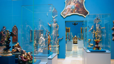
Ha Tinh Museum has just received documentary images of transportation, logistics, and bridge and road construction activities on the Truong Son route ( Ho Chi Minh trail) from Khe intersection through Dong Loc intersection to Lac Thien intersection at the end of 1968.
Ha Tinh Electronic Newspaper respectfully introduces some documentary images to readers:
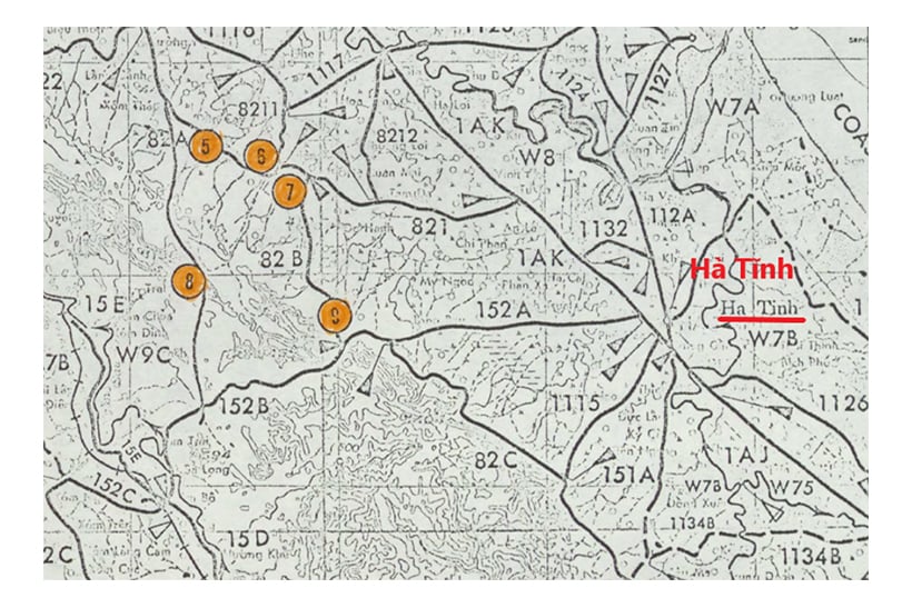
Map of US military aerial photo locations of the Truong Son - Ho Chi Minh trail from Lac Thien Junction through Dong Loc Junction to Khe Giao Junction.
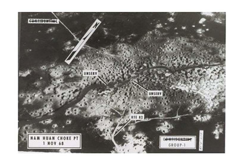
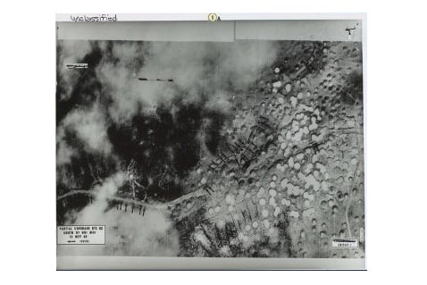
Photo of the area of Highway 15A (Route 82 designated by the US military on the US military map) through Nam Huan (Thuong Loc commune, Can Loc) plowed and destroyed by US bombs (photo taken on November 1, 1968). Now the area near Bang Bridge on Highway 15. Aerial photo shows damaged bridges, bypasses and main roads.
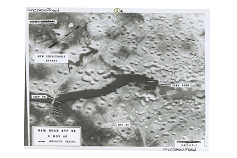
The area of Highway 15A through Nam Huan (Thuong Loc commune, Can Loc) was repaired by the army's engineering force, Youth Volunteers and local people for convoys to go to the front line (photo taken on November 7, 1968). The aerial photo shows a bypass (9 o'clock angle) and a newly built bridge over the river. The main Highway 82 has been repaired, and a tunnel over the river has been built. At the time of taking the photo, there were 8 trucks (marked by arrows) passing through the key point, heading south to Dong Loc intersection.
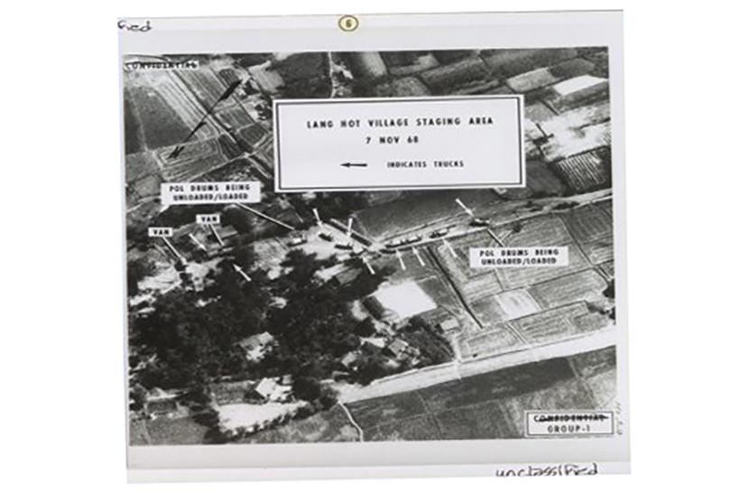
Photo of the assembly area for transport convoys to the South in the Hot village area (just north of the Nui Moi bypass - Dong Loc town, Can Loc district) (photo taken on November 7, 1968). The photo shows many transport trucks loading or unloading fuel drums.
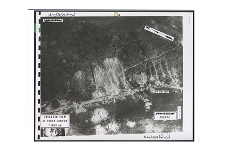
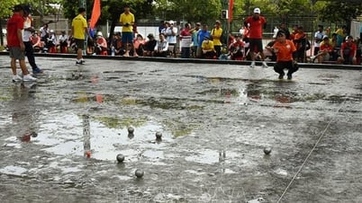
Close-up photo of a convoy of 32 trucks heading to the South stuck at the Nui Moi bypass (Dong Loc town, Can Loc district) because Highway 15 and Dong Loc T-junction were under repair (photo taken on November 7, 1968).
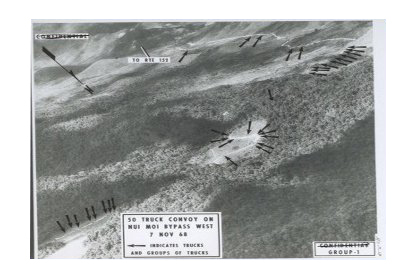
Photo of a convoy of 50 trucks heading to the South passing through the Dong Loc intersection bypass area due to the repair of Highway 15 and Dong Loc intersection (photo taken on November 7, 1968). This area is about 10km southwest of Dong Loc intersection.
Close-up photo of a convoy of trucks moving to the South along Route 15 through Khe Giao (photo taken on November 12, 1968).
Photo of key area of Ha Linh commune, Huong Khe district (taken on December 20, 1968)
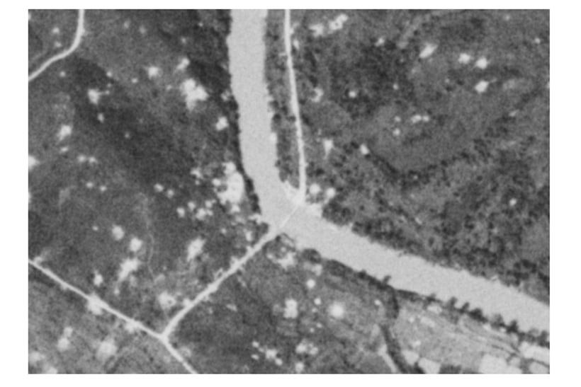
Photo of Dia Loi Ferry Terminal key area (taken on December 20, 1968)
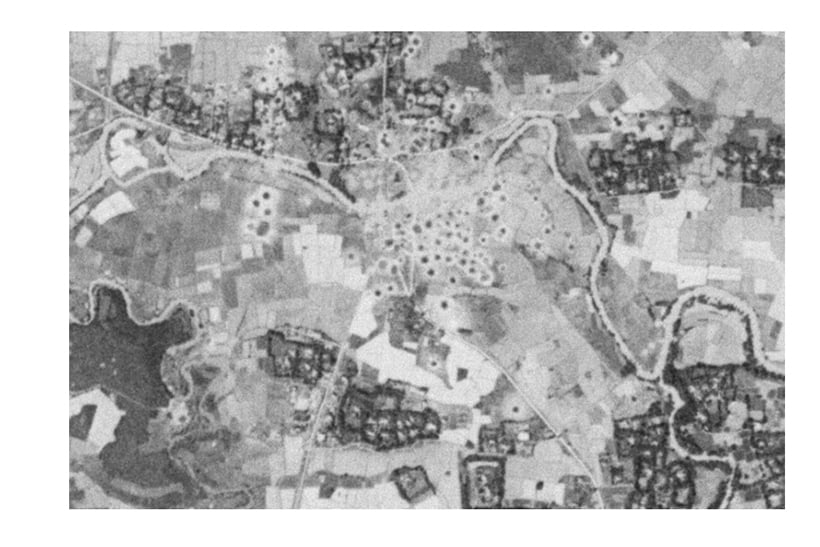
Photo of the key area of Cau Nhe (photo taken on December 20, 1968)
With the sharing, support and information provided by the leaders of the Vietnam Fatherland Front Committee of Ha Tinh province, in early November 2023, Ha Tinh Museum received more than 20 image files about transportation, logistics and bridge and road construction activities on the Truong Son route (Ho Chi Minh road) from Khe Giao intersection through Dong Loc intersection to Lac Thien intersection at the end of 1968. These are rare documentary images on this route during the fierce resistance years.
Photo source: Construction of Logistics in Northern Vietnam, November 1968, by the US Department of Defense and extracted from satellite images taken by the US military, stored at the US National Archives, exploited by Mr. Lam Hong Tien (Dong Da district, Hanoi) and the Vietnam Fatherland Front Committee of Ha Tinh province in 2023.
Currently, we are coordinating with relevant units to fully verify the information of the images, and soon complete the photo captions for printing and display to serve the needs of the people to come and view and learn information.
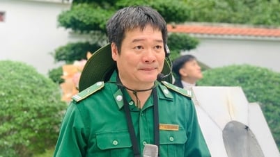
Mr. Dau Khoa Toan - Director of Ha Tinh Museum
PV
Source
![[Photo] General Secretary To Lam attends the conference to review 10 years of implementing Directive No. 05 of the Politburo and evaluate the results of implementing Regulation No. 09 of the Central Public Security Party Committee.](https://vphoto.vietnam.vn/thumb/1200x675/vietnam/resource/IMAGE/2025/5/19/2f44458c655a4403acd7929dbbfa5039)
![[Photo] President Luong Cuong presents the 40-year Party membership badge to Chief of the Office of the President Le Khanh Hai](https://vphoto.vietnam.vn/thumb/1200x675/vietnam/resource/IMAGE/2025/5/19/a22bc55dd7bf4a2ab7e3958d32282c15)

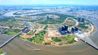
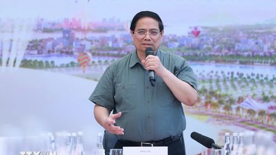
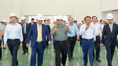
![[Photo] Prime Minister Pham Minh Chinh inspects the progress of the National Exhibition and Fair Center project](https://vphoto.vietnam.vn/thumb/1200x675/vietnam/resource/IMAGE/2025/5/19/35189ac8807140d897ad2b7d2583fbae)


![[VIDEO] - Enhancing the value of Quang Nam OCOP products through trade connections](https://vphoto.vietnam.vn/thumb/402x226/vietnam/resource/IMAGE/2025/5/17/5be5b5fff1f14914986fad159097a677)


Comment (0)