
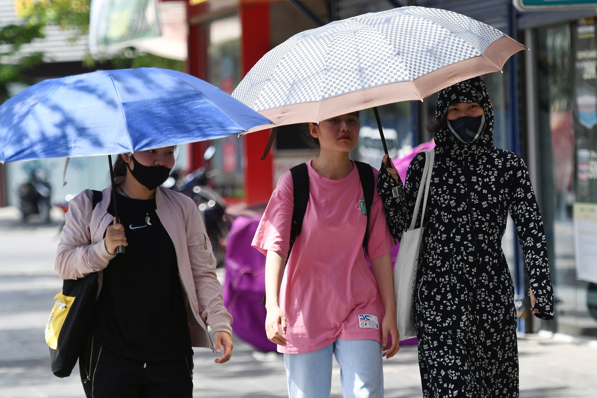
According to the National Center for Hydro-Meteorological Forecasting, due to the influence of the low pressure area in the West and the Foehn wind effect, the midland and delta regions of the North and Hoa Binh have been hot for nearly a week in a row with the highest temperature ranging from 36-39 degrees, some places over 39 degrees.
Specifically, today (June 19), in the Northern Delta, Hoa Binh and Central regions, there is hot weather, some places are extremely hot with temperatures at 1pm in some places above 38 degrees such as: Lang (Hanoi) 38.5 degrees, Tinh Gia (Thanh Hoa) 38.9 degrees, Do Luong (Nghe An) 38.6 degrees, Huong Khe (Ha Tinh) 38.4 degrees, ...; relative humidity at 1pm is commonly 45-55%.
On June 20-21, the Northern Delta, Hoa Binh and from Thanh Hoa to Thua Thien Hue will continue to experience hot and extremely hot weather, with some places experiencing extremely hot weather with the highest temperature ranging from 36-39 degrees Celsius, some places above 39 degrees Celsius; the lowest relative humidity is 40-45%.

In the mountainous and midland areas of the North and from Da Nang to Ninh Thuan, the heat will decrease with the highest temperature from 35-38 degrees, some places over 38 degrees; the lowest relative humidity is commonly 50-60%.
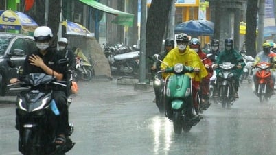
It is forecasted that from the night of June 22-23, the Northern region will experience scattered showers and thunderstorms (concentrated in the evening and at night), so from June 23, the heat will tend to decrease gradually.
This is the forecast temperature in the weather tent, the actual temperature outside is 2-4 degrees hotter depending on the surface conditions such as concrete road, asphalt road...
For the Central region, hot and extremely hot weather, with some areas being particularly hot, will continue for the next few days. Until June 22, from Thanh Hoa to Thua Thien Hue, it will still be hot and extremely hot; from around June 23-24, the heat will tend to decrease gradually, from the evening of June 24, there will be a possibility of scattered showers and thunderstorms (rain concentrated in the evening).
From Da Nang to Binh Thuan, on June 22, the North will have hot weather; from the night of June 21 to 24, there is a possibility of scattered showers and thunderstorms (rain will be concentrated in the late afternoon and evening).
Pay special attention to areas where, after many days of "fiery" heat, when thunderstorms appear, be very cautious about the possibility of tornadoes, lightning, hail and strong gusts of wind. Localized heavy rain can cause flash floods on small rivers and streams, landslides on steep slopes and flooding in low-lying areas. Beware of heavy rain in a short period of time causing flooding in urban areas.
In addition, the Central Highlands and the South will still have sunshine in the coming days, with some places experiencing hot weather, but in the late afternoon and evening there may be scattered showers and thunderstorms, with some areas experiencing heavy rain; from the evening of June 21 to 25, there will be scattered showers and thunderstorms, with some areas experiencing heavy rain.
Possibility of low pressure in the East Sea
In the weather forecast for Ho Chi Minh City in the next 10 days (June 18-28), the Southern Hydrometeorological Station assessed that the weather conditions will affect the region. Specifically, in the next 24 hours, the low pressure trough with an axis at about 24-27 degrees North latitude connecting with the hot low pressure area in the West will develop and gradually expand to the East. Above, the subtropical high pressure over the South Central region will continue to maintain. The Southwest monsoon will operate at a moderate intensity.
From the next 2-10 days, the low pressure trough with its axis at about 24-27 degrees North latitude will connect with the hot low pressure area in the West and gradually fill up.
Notably, from around June 23, a low pressure trough with an axis over the Northern region will gradually become stronger, with the possibility of a tropical cyclone in the Northern East Sea.
According to this meteorological station, with the above weather patterns, the Ho Chi Minh City area will continuously experience rain with a probability of 65-75%.
In addition, during the day and tonight, in the central and southern East Sea (including the waters of the Truong Sa archipelago), the waters from Ca Mau to Kien Giang and the Gulf of Thailand, there will be showers and strong thunderstorms. During thunderstorms, there is a possibility of tornadoes and strong gusts of wind of level 6-7, beware of wave heights sometimes increasing to over 2m.
The sea area from Binh Thuan to Ca Mau has showers and strong thunderstorms, strong southwest wind level 5, sometimes level 6, gusting to level 7-8; rough sea; waves from 1.5-2.5m high.
All vessels operating in the above areas are at high risk of being affected by tornadoes, strong winds and large waves.
Source: https://vietnamnet.vn/mien-bac-nang-nong-dinh-diem-kha-nang-co-xoay-thuan-nhet-doi-o-bien-dong-2293077.html
![[Photo] National Assembly Chairman Tran Thanh Man chairs the meeting of the Subcommittee on Documents of the First National Assembly Party Congress](https://vphoto.vietnam.vn/thumb/1200x675/vietnam/resource/IMAGE/2025/5/8/72b19a73d94a4affab411fd8c87f4f8d)
![[Photo] Prime Minister Pham Minh Chinh meets with the Policy Advisory Council on Private Economic Development](https://vphoto.vietnam.vn/thumb/1200x675/vietnam/resource/IMAGE/2025/5/8/387da60b85cc489ab2aed8442fc3b14a)
![[Photo] General Secretary To Lam begins official visit to Russia and attends the 80th Anniversary of Victory over Fascism](https://vphoto.vietnam.vn/thumb/1200x675/vietnam/resource/IMAGE/2025/5/8/5d2566d7f67d4a1e9b88bc677831ec9d)
![[Photo] General Secretary concludes visit to Azerbaijan, departs for visit to Russian Federation](https://vphoto.vietnam.vn/thumb/1200x675/vietnam/resource/IMAGE/2025/5/8/7a135ad280314b66917ad278ce0e26fa)

![[Photo] President Luong Cuong presents the decision to appoint Deputy Head of the Office of the President](https://vphoto.vietnam.vn/thumb/1200x675/vietnam/resource/IMAGE/2025/5/8/501f8ee192f3476ab9f7579c57b423ad)


![[Photo] Prime Minister Pham Minh Chinh talks on the phone with Singaporean Prime Minister Lawrence Wong](https://vphoto.vietnam.vn/thumb/402x226/vietnam/resource/IMAGE/2025/5/8/e2eab082d9bc4fc4a360b28fa0ab94de)


Comment (0)