Wednesday, June 28, 2023, 19:16 (GMT+7)
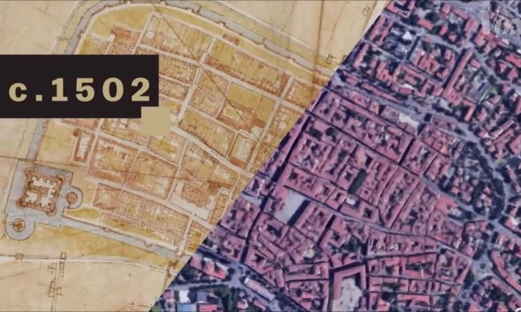
Around 1502, Leonardo created a "precise" floor plan of the city of Imola, showing the buildings as if viewed from a satellite.
Video : Vox
Source link
 VnExpress•28/06/2023
Around 1502, Leonardo created a "precise" floor plan of the city of Imola, showing the buildings as if viewed from a satellite.
Video : Vox


Comment (0)