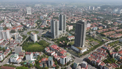
Hung Yen is located in the center of the Northern Delta, in the northern key economic region. Its administrative boundaries are bordered by 5 provinces and cities: * North borders Bac Ninh province * Northwest borders Hanoi city * East borders Hai Duong province. * South borders Thai Binh province * Southwest borders Ha Nam province. The spatial and territorial distribution of the province has geographical coordinates: * From 20o36' to 21o01' North latitude * From 105o53' to 106o17' East longitude. Total natural area is 930.2 km2, accounting for 6.2% of the area of the Northern Delta. Hung Yen is a plain province without forests, mountains and seas. It consists of 10 districts, towns and cities with 161 communes, wards and towns. Hung Yen city is the political , economic and cultural center of the province.
In the province, there is a system of important road traffic routes such as: National Highway 5, 39, 38, 38B, Hanoi - Hai Phong Expressway; the route connecting Hanoi - Hai Phong Expressway with Cau Gie - Ninh Binh, provincial roads: DT.376, DT.378, DT.379, DT.382, DT.382B, DT.386, DT.387... and Hanoi - Hai Duong - Hai Phong railway, connecting Hung Yen with the northern provinces, especially with Hanoi, Hai Phong and Quang Ninh; There is a system of Red River, Luoc River creating a fairly convenient traffic network for the exchange of goods and travel.


![[Photo] Readers line up to visit the photo exhibition and receive a special publication commemorating the 135th birthday of President Ho Chi Minh at Nhan Dan Newspaper](https://vphoto.vietnam.vn/thumb/1200x675/vietnam/resource/IMAGE/2025/5/17/85b3197fc6bd43e6a9ee4db15101005b)
![[Photo] Prime Minister Pham Minh Chinh chairs meeting on science and technology development](https://vphoto.vietnam.vn/thumb/1200x675/vietnam/resource/IMAGE/2025/5/17/ae80dd74c384439789b12013c738a045)


![[Photo] More than 17,000 candidates participate in the 2025 SPT Competency Assessment Test of Hanoi National University of Education](https://vphoto.vietnam.vn/thumb/1200x675/vietnam/resource/IMAGE/2025/5/17/e538d9a1636c407cbb211b314e6303fd)





![[Photo] Nearly 3,000 students moved by stories about soldiers](https://vphoto.vietnam.vn/thumb/1200x675/vietnam/resource/IMAGE/2025/5/17/21da57c8241e42438b423eaa37215e0e)













Comment (0)