
Russia's new generation Kondor-FKA-M radar satellite will be able to take images of the Earth's surface with a resolution of up to 0.5 meters, said Alexei Rabochiy, chief designer of the NPO Mashinostroyenia Rocket and Space Corporation.

“The most interesting modernization is the change in the radar geometry... This fundamentally changes the main characteristics of radar surveys. The increased electronic scanning angles along two planes make it possible to achieve detailed surveys with resolutions of up to 0.5 meters,” he said.
Rabochiy added that the radar energy and disposable power characteristics of this space platform will also improve on the new generation spacecraft. This will significantly improve the acquired radar imaging characteristics.
The Kondor-FKA-M natural resource-search satellite is expected to be launched into orbit in 2025.
Earlier, Mr. Alexander Leonov, General Director and designer of NPO Mashinostroyeniya design bureau, said that the specific time has not been revealed yet because the Russian space corporation Roscosmos is constantly cutting the budget, but the satellite development continues.
On May 27, the first Kondor-FKA radar satellite will be launched on a Soyuz-2.1a rocket from the Vostochny Cosmodrome. The system will consist of two satellites, with the second satellite scheduled for launch in the summer of 2024.
Source link
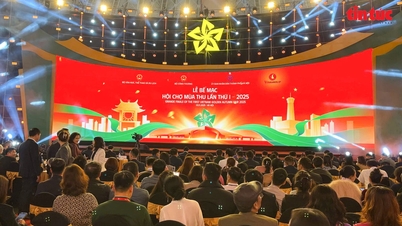
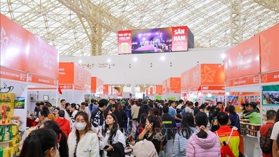
![[Photo] Fall Fair 2025 and impressive records](https://vphoto.vietnam.vn/thumb/1200x675/vietnam/resource/IMAGE/2025/11/03/1762180761230_ndo_br_tk-hcmt-15-jpg.webp)
![[Photo] Prime Minister Pham Minh Chinh receives the Chairman of the Japan-Vietnam Friendship Association in the Kansai region](https://vphoto.vietnam.vn/thumb/1200x675/vietnam/resource/IMAGE/2025/11/03/1762176259003_ndo_br_dsc-9224-jpg.webp)
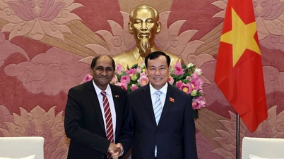
![[Photo] General Secretary To Lam receives Singaporean Ambassador Jaya Ratnam](https://vphoto.vietnam.vn/thumb/1200x675/vietnam/resource/IMAGE/2025/11/03/1762171461424_a1-bnd-5309-9100-jpg.webp)
![[Photo] Lam Dong: Close-up of illegal lake with broken wall](https://vphoto.vietnam.vn/thumb/1200x675/vietnam/resource/IMAGE/2025/11/03/1762166057849_a5018a8dcbd5478b1ec4-jpg.webp)


Comment (0)