
 |
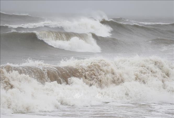
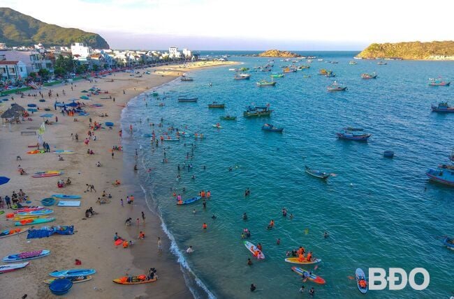
| Illustration photo: VNA |
Heat wave in the North and Central regions to last until August
The ENSO phenomenon (including El Nino and La Nina phenomena - the phenomenon of unusual warming or cooling of the surface sea water layer in the central equatorial region and the Eastern Pacific) is likely to maintain a neutral state with a probability of 70 - 90%.
The average temperature across the country is generally at a level similar to the average of many years; in the Northwest region, it is 0.5 - 1 degree Celsius higher than the average of many years in the same period. In June, the average temperature is generally 0.5 - 1 degree Celsius higher than the average of many years in the same period.
In May, heat waves are likely to appear nationwide, from June, heat waves will decrease in the Central Highlands and the South. Heat waves in the North and Central regions will last until around August, from September 2025, heat waves will gradually decrease, the intensity of heat waves will be equivalent to the average of many years in the same period.
From May to July, moderate to heavy rains are likely to occur in the Northern, North Central, Central Highlands and Southern regions. Total rainfall from May to July nationwide is generally approximately equal to the average of many years, with the Central Highlands and Southern regions in May generally being 5-20% higher than the average of many years during the same period.
In the Mekong River basin, in May, total rainfall was generally 5-15% higher than the average for the same period in many years. In June and July, total rainfall in most basins was approximately the same as the average for many years.
"Storms, tropical depressions and the southwest monsoon are likely to cause strong winds and large waves that affect the activities of ships. Across the country, there is a possibility of dangerous weather phenomena such as thunderstorms, tornadoes, lightning, hail and strong gusts of wind, especially during cold spells during the transitional season that can negatively affect production activities and public health," Mr. Hoang Phuc Lam noted.
Many sea areas have high waves - many high tides appear
Regarding hydrology and water resources, Mr. Hoang Phuc Lam said that from May to July, the flow on rivers in the Northern region is likely to be 10-50% lower than the average of many years, especially the flow downstream of the Red River in Hanoi is likely to be approximately the average of many years in May and June, and in July it is about 20-30% lower than the average of many years. The flow to large reservoirs on the Da River will fluctuate according to the regulation of the upper hydropower plants, the flow to Lai Chau, Son La, and Hoa Binh lakes is 15-40% lower than the average of many years, the flow to Tuyen Quang and Thac Ba lakes is 5-16% lower than the average of many years. From May to July, floods are likely to occur on small rivers in the upper reaches of the Red - Thai Binh river system.
In the North Central region, from the second half of April to July, the water level in the upstream areas of rivers in Thanh Hoa, Nghe An, and Ha Tinh is likely to experience some small floods and strong fluctuations. The water level in the middle areas of rivers will fluctuate according to reservoir regulation, and the water level in the downstream areas will change according to the tide. The flow on the rivers will increase from May. The flow from May to July on rivers in Thanh Hoa will be 7-10% lower; the downstream areas of rivers in Nghe An will be 30-50% lower than the average of many years; the water level in rivers in Ha Tinh including Ngan Pho River will be 30-70% lower, Ngan Sau River will be 10-32% lower.
In the Central Central region, from the second half of April to June, the water level of the upper reaches of rivers from Quang Binh to Quang Ngai is likely to fluctuate 1-2 times, while the lower reaches will change slowly. In July, the water level on the rivers will change slowly with a downward trend. The flow on the rivers from May to July will be 35-75% lower than the average of the same period in many years; the Ta Trach River, Thu Bon River (Quang Nam) and Tra Khuc River (Quang Ngai) will be approximately equal to 20-45% higher.
In the South Central region, from the second half of April to July, water levels on rivers from Binh Dinh to Binh Thuan changed slowly. The flow on rivers was generally lower than the average of many years, especially on the An Lao River (Binh Dinh) higher than the average of many years.
In the Central Highlands, from the second half of April to July, water levels on rivers generally fluctuate according to the operation of hydroelectric reservoirs and tend to increase gradually from the second half of April. There is a possibility of 1-3 small floods on rivers. The flow on rivers in the Northern Central Highlands is generally 21-53% lower than the average of many years in the same period, rivers in the Southern Central Highlands are approximately equal to 10-50% higher than the average of many years, especially the downstream area of the Srepok River is 10-15% lower.
On the Dong Nai River (Southern region), from mid-April to May, the water level will change slowly. From June to July, the water level is likely to experience 1-2 fluctuations.
From late April to May, the total flow of the Mekong River to the Mekong Delta is 5-10% higher than the average of many years and from June to July it is likely to be 5-15% higher than the average of many years. The salinity intrusion in the Mekong River mouths tends to decrease gradually; on the Vam Co and Cai Lon rivers, salinity intrusion is likely to increase from April 27 to May 1 and will decrease from mid-May. From June to July, it is the flood season on the Mekong and Cuu Long rivers. The water level in the upstream of the Mekong River fluctuates with the tide and is 0.1-0.3m lower than the average of many years.
Regarding the oceanographic situation, according to Mr. Hoang Phuc Lam, from the end of June, the strong southwest monsoon can cause high waves in the sea area from Binh Dinh to Ninh Thuan, the South East Sea area can reach 2-4m, sometimes over 4m, in the Gulf of Thailand, the common wave height fluctuates from 1-2.5m.
From late April to July, the coastal area of the Southeast region will experience 5 high tides, the first from April 27 to April 30, the second from May 12 to 15, the third from May 26 to 29, the fourth from June 12 to 14 and the fifth from June 25 to 27. The highest water level at Vung Tau station can reach 4.2m from 1-4am on April 29, low-lying areas, riverside areas and areas outside the dike in the coastal area of the Southeast region are likely to be flooded. High high tides during this period not only cause flooding in low-lying areas, coastal areas and river mouths but also increase saltwater intrusion in the fields.
According to VNA
Source: https://baoapbac.vn/xa-hoi/202504/tu-thang-5-7-bao-va-ap-thap-nhiet-doi-co-kha-nang-hoat-dong-tren-khu-vuc-bien-dong-1039968/
![[Photo] Vietnam shines at Paris International Fair 2025 with cultural and culinary colors](https://vstatic.vietnam.vn/vietnam/resource/IMAGE/2025/5/4/74b16c2a197a42eb97597414009d4eb8)
![[Photo] General Secretary To Lam receives Sri Lankan President Anura Kumara Dissanayaka](https://vstatic.vietnam.vn/vietnam/resource/IMAGE/2025/5/4/75feee4ea0c14825819a8b7ad25518d8)


![[Video]. Building OCOP products based on local strengths](https://vstatic.vietnam.vn/vietnam/resource/IMAGE/2025/5/3/61677e8b3a364110b271e7b15ed91b3f)


Comment (0)