
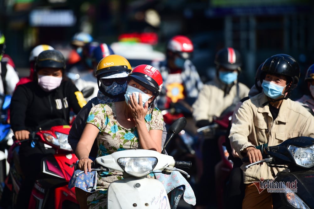
The weather in Ho Chi Minh City started to be hot in the central area right from the first days of March and there were many more periods after that. At the same time, in March, the area also experienced some localized heavy rains.
Mr. Le Dinh Quyet, Head of Forecasting Department, Southern Hydrometeorological Station, has just commented on the prominent trends and weather in March. In the first 10 days of the month, the continental cold high pressure (cold air) continued to weaken and move to the East. The low pressure area in the West, which dominates the Northern provinces, continued to develop and gradually expand to the East.
Around March 4-5, the cold air will strengthen again and become quite strong, lasting until around March 9-10, then weakening and moving east. There is a possibility that around March 9-10, a low pressure area will appear in the East Sea, causing thunderstorms and dangerous weather at sea.
With the above weather patterns, Mr. Quyet said that Ho Chi Minh City will have hot weather in the city center from March 1-4; there will be rain in some places with the possibility of moderate rain, local heavy rain from March 4-7 and March 9-10.
By mid-March, the general trend in the first half of the week is that the cold air weakens and shifts east; the low pressure area over the East Sea is likely to persist for a few days. In the second half of the week, the cold air weakens, the hot low pressure in the west develops and expands eastward.
At this time, the weather in Ho Chi Minh City is generally showers and thunderstorms in some places, hot in the Eastern region and some places in the southwestern border area of the West in the second half of the week.
According to Mr. Quyet, the low pressure in the west tends to become stronger in the last week of the month. The cold air is weak, shifting east and almost unable to diffuse down to the Southern region. In the last few days of the month, the equatorial low pressure trough is likely to slightly lift its axis to the north.
Ho Chi Minh City weather this week is mostly sunny with a few days of widely heat in the city center. Showers and thunderstorms with heavy rainfall due to local heat convection are likely to appear in a few days.
According to the Southern Meteorological Station, temperatures in March increased significantly compared to the previous month. Heat waves and widely heat waves appear in many waves with the absolute highest temperature reaching 37 and above 37 degrees in the city center.
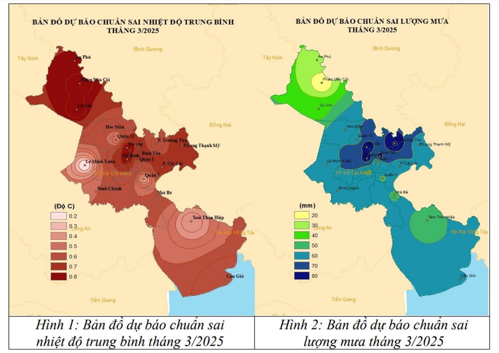
The number of hot days is generally between 7-12 days, at a level slightly below the average of many years. The average temperature of March is generally higher than the average of many years but not much, including the average temperature, the highest temperature and the lowest temperature.
The average temperature is 28-29 degrees; the highest is commonly 33-36 degrees, some days 36-37 degrees; the lowest is 22-25 degrees. In particular, some widely heat waves with the highest temperature of 35-37 degrees last for several days.
Experts note that the widespread heat waves at the beginning of the season in the region will have negative effects on the health of outdoor workers.
In addition, although it is the dry season, in the first half of the month, there will be some days of rain in some places, mainly caused by easterly wind disturbances. In the second half of the month, the eastern region and the southwestern border area will have rain due to local thermal convection, so showers and thunderstorms will appear in the late afternoon. During thunderstorms, be on guard against thunderstorms, tornadoes, lightning, hail, and gusts of wind that can be dangerous to people and cause property damage.

Hanoi continues to increase temperature to 28 degrees, then welcomes strong cold air

The North suddenly has continuous sunshine right after the cold rain, Hanoi temperature rises to 28 degrees
Source: https://vietnamnet.vn/tphcm-xuat-hien-nhieu-ngay-nang-nong-dien-rong-dot-ngot-mua-to-cuc-bo-2376168.html


![[OCOP REVIEW] Bay Quyen sticky rice cake: A hometown specialty that has reached new heights thanks to its brand reputation](https://vphoto.vietnam.vn/thumb/402x226/vietnam/resource/IMAGE/2025/7/3/1a7e35c028bf46199ee1ec6b3ba0069e)


Comment (0)