
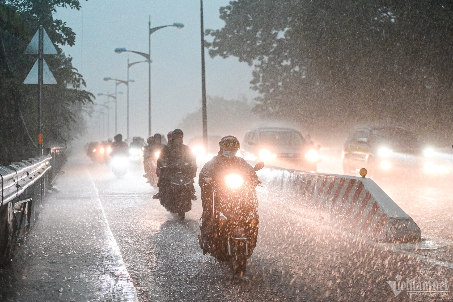
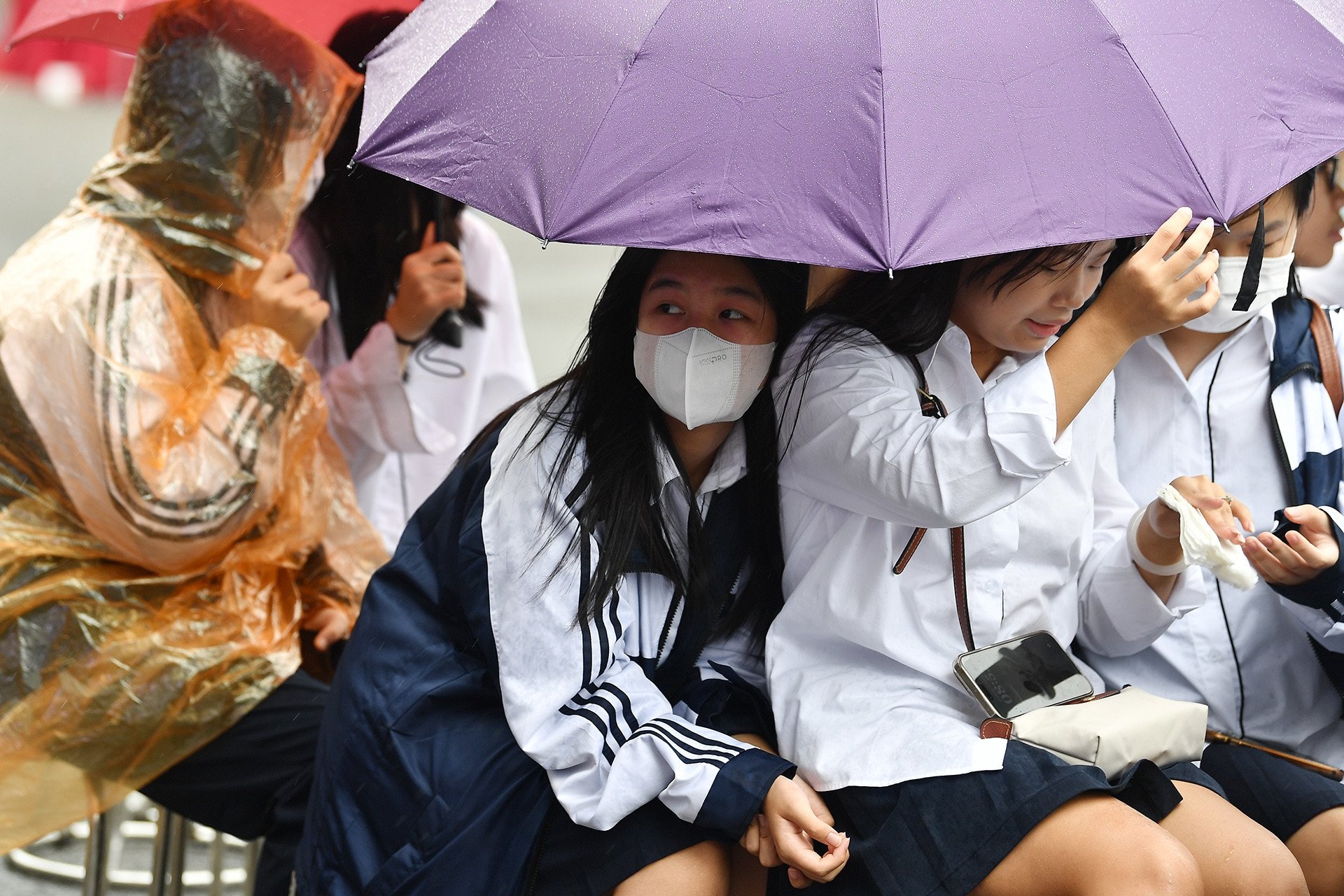
Thunderstorms and lightning have occurred continuously in Ho Chi Minh City and the Southeast provinces since early this morning. Currently, many places in the Southern region continue to have thunderstorms and heavy rain in waves.
The National Center for Hydro-Meteorological Network (NCN) said this afternoon (October 28) that thunderstorms with lightning are developing strongly in the Southern region. The areas of An Giang, Binh Thuan, Dong Thap, Lam Dong, Ben Tre, Tra Vinh,... are experiencing continuous thunder and lightning.
According to the noon bulletin of the Southern Hydrometeorological Station, in the past 3 hours, satellite images, lightning location data and weather radar images show that convective clouds continue to develop and cause rain in the following provinces: Tay Ninh (Trang Bang, Go Dau), Binh Duong (Dau Tieng, Ben Cat), Kien Giang (Hon Dat, Giang Thanh, Tan Hiep); An Giang, Can Tho City, Soc Trang, Dong Thap, Vinh Long, Tien Giang, Long An, Ben Tre, Ho Chi Minh City, Dong Nai.
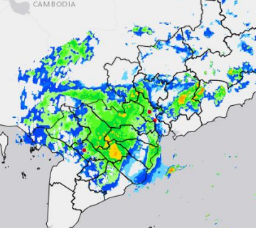
It is forecasted that in the next 4 hours, these convective clouds will continue to cause rain, showers and thunderstorms in the above areas, and may also spread to neighboring areas such as Ba Ria - Vung Tau, Binh Phuoc and other areas of Taiwan. During thunderstorms, there is a possibility of tornadoes, lightning, hail and strong gusts of wind.
In Ho Chi Minh City alone, monitoring satellite cloud images, weather radar images and lightning positioning shows that thunderstorms are developing and causing rain with thunderstorms and lightning in Can Gio, Nha Be district, Binh Chanh, districts 8, 7, Binh Tan, district 6, Thu Duc city, districts 11, 1, Tan Phu, 10, Tan Binh, Binh Thanh, 12, Go Vap, Hoc Mon district, Cu Chi.
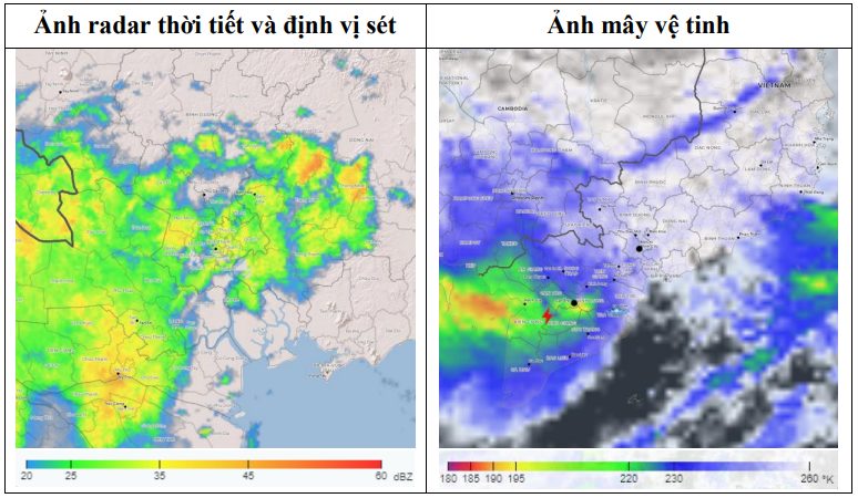
In the next 0-3 hours, thunderstorms will continue to develop, causing showers, accompanied by thunderstorms and lightning in the above districts, then expanding to other neighboring areas. Rainfall is generally from 6-30mm, in some places over 39mm. During thunderstorms, beware of tornadoes, hail and strong gusts of wind around level 5-7 (8-17m/s), heavy rain causing localized flooding.
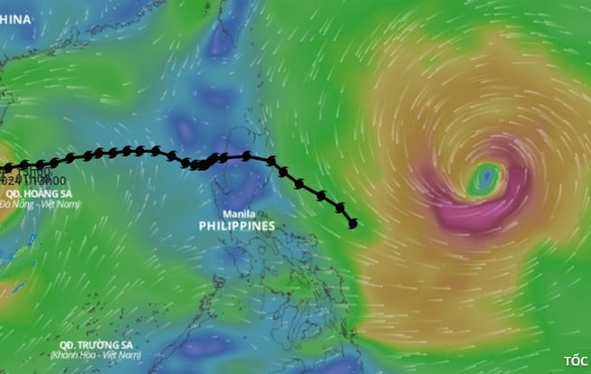
The meteorological station said that the stormy weather in the area was caused by the influence of the circulation of storm No. 6 weakening into a tropical depression and the cold air strengthening; the storm in the eastern Philippines is intensifying, causing the southwest monsoon to become more active; at the same time, the tropical convergence zone over the Central region is causing thunderstorms to develop strongly.
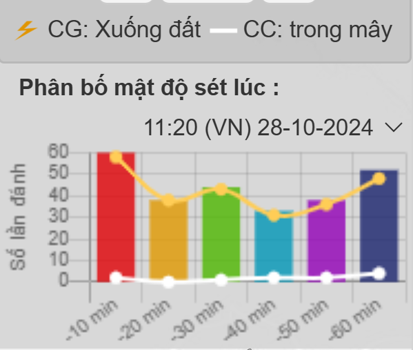
Currently, thunderstorms and lightning are developing strongly in some provinces in the West and East. The peak in some areas recorded up to 50 lightning strikes in a period of 10 minutes, equivalent to an average of nearly 5 lightning strikes in 1 minute. Of these, about 4 lightning strikes hit the ground and 1 lightning strike between the thunderstorm clouds.
Storm No. 6 weakens, causing heavy rain and flooding, storm Kong-rey is strengthening
Heavy rain in Ho Chi Minh City and the Southeast due to the influence of storm No. 6
Hanoi weather for the next 3 days: Cold air spreads throughout the region, cold rain
Source: https://vietnamnet.vn/tphcm-mua-lon-tung-dot-nhieu-noi-o-nam-bo-hung-sam-set-lien-hoi-2336356.html
![[Photo] General Secretary To Lam begins official visit to Russia and attends the 80th Anniversary of Victory over Fascism](https://vphoto.vietnam.vn/thumb/1200x675/vietnam/resource/IMAGE/2025/5/8/5d2566d7f67d4a1e9b88bc677831ec9d)
![[Photo] Prime Minister Pham Minh Chinh meets with the Policy Advisory Council on Private Economic Development](https://vphoto.vietnam.vn/thumb/1200x675/vietnam/resource/IMAGE/2025/5/8/387da60b85cc489ab2aed8442fc3b14a)
![[Photo] General Secretary concludes visit to Azerbaijan, departs for visit to Russian Federation](https://vphoto.vietnam.vn/thumb/1200x675/vietnam/resource/IMAGE/2025/5/8/7a135ad280314b66917ad278ce0e26fa)
![[Photo] President Luong Cuong presents the decision to appoint Deputy Head of the Office of the President](https://vphoto.vietnam.vn/thumb/1200x675/vietnam/resource/IMAGE/2025/5/8/501f8ee192f3476ab9f7579c57b423ad)
![[Photo] National Assembly Chairman Tran Thanh Man chairs the meeting of the Subcommittee on Documents of the First National Assembly Party Congress](https://vphoto.vietnam.vn/thumb/1200x675/vietnam/resource/IMAGE/2025/5/8/72b19a73d94a4affab411fd8c87f4f8d)


![[Photo] Prime Minister Pham Minh Chinh talks on the phone with Singaporean Prime Minister Lawrence Wong](https://vphoto.vietnam.vn/thumb/402x226/vietnam/resource/IMAGE/2025/5/8/e2eab082d9bc4fc4a360b28fa0ab94de)


Comment (0)